
Order Total (1 Item Items):
Shipping Destination:

Giles Darkes (60 results)
Skip to main search results
Search filters
Product Type
- All Product Types
- Books (54)
- Magazines & Periodicals (No further results match this refinement)
- Comics (No further results match this refinement)
- Sheet Music (No further results match this refinement)
- Art, Prints & Posters (No further results match this refinement)
- Photographs (No further results match this refinement)
- Maps (6)
- Manuscripts & Paper Collectibles (No further results match this refinement)
Condition Learn more
- New (36)
- As New, Fine or Near Fine (8)
- Very Good or Good (8)
- Fair or Poor (No further results match this refinement)
- As Described (8)
Binding
- All Bindings
- Hardcover (No further results match this refinement)
- Softcover (15)
Collectible Attributes
- First Edition (3)
- Signed (No further results match this refinement)
- Dust Jacket (No further results match this refinement)
- Seller-Supplied Images (15)
- Not Print on Demand (58)
Language (2)
Free Shipping
Seller Location
Seller Rating
-
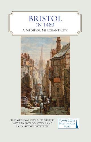
Bristol in 1480 : A Medieval Merchant City
Language: English
Published by The Historic Towns Trust, 2020
ISBN 10: 0993469876 ISBN 13: 9780993469879
Condition: As New. Unread book in perfect condition.
-

A Map Of Tudor London Revised ed
Language: English
Published by The Historic Towns Trust, 2022
ISBN 10: 1838071946 ISBN 13: 9781838071943
Condition: As New. Unread book in perfect condition.
-

A map of Tudor London : England's greatest city in 1520 / by Caroline Barron, Vanessa Harding and Nick Holder ; cartography by Giles Darkes
Language: English
Published by [Oxford] : British Historic Towns Atlas, 2018
ISBN 10: 0993469833 ISBN 13: 9780993469831
Edition Unstated. Fine map, slightly edge-bumped. Remains well-preserved overall. Physical description; 1 map : color ; 87 x 128 cm, folded to 24 x 14 cm. Notes; Scale approximately 1:2500. Based on a map first researched and produced by Col Henry Johns, 1989. Subjects; London (England). History. 16th century. Maps. London (England). Historical geography. Maps. City of London (England). Maps. Early maps. Facsimiles. 1 Kg.
-
Bristol in 1480 : A Medieval Merchant City
Language: English
Published by The Historic Towns Trust, 2020
ISBN 10: 0993469876 ISBN 13: 9780993469879
Condition: New.
-
Bristol in 1480 (Folded)
Language: English
Published by The Historic Towns Trust, 2021
ISBN 10: 0993469876 ISBN 13: 9780993469879
Folded. Condition: new. Folded. A full colour map, where the city in about 1480 is shown against a background of a detailed Ordnance Survey of the early 20th century.In 1480, a high-ranking official called William Worcestre revisited his native city of Bristol and wrote a detailed description of all the streets and their buildings and the activities that went on there. Worcestre's description, combined with archaeological information and historical research, has allowed the recreation in map form of the city at that time. It was a prosperous and growing city, already trading extensively with Europe and poised to start a new trade with the Americas. Its merchant houses, churches and largely vanished city walls show a town that was easily one of the top five in England in the late Middle Ages.The map's cover has a short introduction to the city in 1480 and an explanation of who William Worcestre was. On the reverse is an illustrated and comprehensive gazetteer of Bristol's main sites of medieval interest.Produced in association with the University of Bristol. A full colour map, where the city in about 1480 is shown against a background of a detailed Ordnance Survey of the early 20th century. Produced in association with the University of Bristol. Shipping may be from multiple locations in the US or from the UK, depending on stock availability.
-

An Historical Atlas of Oxfordshire
Language: English
Published by Oxfordshire Record Society 01/c /07 D, 2010
ISBN 10: 0902509632 ISBN 13: 9780902509634
Condition: Very Good. Shipped within 24 hours from our UK warehouse. Clean, undamaged book with no damage to pages and minimal wear to the cover. Spine still tight, in very good condition. Remember if you are not happy, you are covered by our 100% money back guarantee.
-
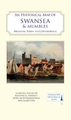
An Historical Map of Swansea and Mumbles
Language: English
Published by The Historic Towns Trust, 2023
ISBN 10: 183807192X ISBN 13: 9781838071929
Seller: PBShop.store UK, Fairford, GLOS, United Kingdom
Seller rating 5 out of 5 stars

UNK. Condition: New. New Book. Shipped from UK. Established seller since 2000.
-

An Historical Map of Canterbury from medieval times to 1907
Language: English
Published by The Historic Towns Trust, 2021
ISBN 10: 0993469884 ISBN 13: 9780993469886
Seller: PBShop.store UK, Fairford, GLOS, United Kingdom
Seller rating 5 out of 5 stars
UNK. Condition: New. New Book. Shipped from UK. Established seller since 2000.
-
Bristol in 1480
Language: English
Published by The Historic Towns Trust, 2021
ISBN 10: 0993469876 ISBN 13: 9780993469879
Seller: PBShop.store UK, Fairford, GLOS, United Kingdom
Seller rating 5 out of 5 stars
UNK. Condition: New. New Book. Shipped from UK. Established seller since 2000.
-
A Map Of Tudor London Revised ed
Language: English
Published by The Historic Towns Trust, 2022
ISBN 10: 1838071946 ISBN 13: 9781838071943
Condition: New.
-

An Historical Map of York
Language: English
Published by The Historic Towns Trust, 2018
ISBN 10: 0993469841 ISBN 13: 9780993469848
Seller: PBShop.store UK, Fairford, GLOS, United Kingdom
Seller rating 5 out of 5 stars
UNK. Condition: New. New Book. Shipped from UK. Established seller since 2000.
-

An Historical Map of Coventry
Language: English
Published by The Historic Towns Trust, 2020
ISBN 10: 0993469868 ISBN 13: 9780993469862
Seller: PBShop.store UK, Fairford, GLOS, United Kingdom
Seller rating 5 out of 5 stars
UNK. Condition: New. New Book. Shipped from UK. Established seller since 2000.
-

A map of Tudor London : England's greatest city in 1520 / by Caroline Barron, Vanessa Harding and Nick Holder ; cartography by Giles Darkes
Language: English
Published by [Oxford] : British Historic Towns Atlas, 2018
ISBN 10: 0993469833 ISBN 13: 9780993469831
Edition Unstated. Fine map, slightly edge-bumped. Remains well-preserved overall. Physical description; 1 map : color ; 87 x 128 cm, folded to 24 x 14 cm. Notes; Scale approximately 1:2500. Based on a map first researched and produced by Col Henry Johns, 1989. Subjects; London (England). History. 16th century. Maps. London (England). Historical geography. Maps. City of London (England). Maps. Early maps. Facsimiles. 1 Kg.
-

Condition: As New. Unread book in perfect condition.
-
Condition: As New. Unread book in perfect condition.
-

An Historical Map of Oxford: From Medieval to Victorian Times NEW EDITION
Language: English
Published by Historic Towns Trust, 2021
ISBN 10: 0993469892 ISBN 13: 9780993469893
Map
Map. Condition: Brand New. 2nd edition. 2 pages. 8.94x5.28x0.51 inches. In Stock.
-
A Map of Tudor London
Language: English
Published by The Historic Towns Trust, 2022
ISBN 10: 1838071946 ISBN 13: 9781838071943
Condition: New.
-
An Historical Map of Coventry: From Medieval to Industrial City
Language: English
Published by The Historic Towns Trust, 2021
ISBN 10: 0993469868 ISBN 13: 9780993469862
Map
Map. Condition: Brand New. 2 pages. 8.90x5.28x0.39 inches. In Stock.
-

Condition: New.
-
Condition: New.
-

Cartography: an introduction
Language: English
Published by British Cartographic Society, United Kingdom, London, 2017
ISBN 10: 0904482251 ISBN 13: 9780904482256
Seller: WorldofBooks, Goring-By-Sea, WS, United Kingdom
Seller rating 5 out of 5 stars
Paperback. Condition: Very Good. The book has been read, but is in excellent condition. Pages are intact and not marred by notes or highlighting. The spine remains undamaged.
-
A Map of Tudor London: The City and Southwark in 1520. Second edition
Language: English
Published by The Historic Towns Trust, 2022
ISBN 10: 1838071946 ISBN 13: 9781838071943
Map
Map. Condition: Brand New. revised edition. 2 pages. 8.98x5.24x0.91 inches. In Stock.
-
A Map of Tudor London
Language: English
Published by The Historic Towns Trust, 2022
ISBN 10: 1838071946 ISBN 13: 9781838071943
Condition: New. Revised edition NO-PA16APR2015-KAP.
-

A map of Tudor London : England's greatest city in 1520
Published by Oxford : British Historic Towns Atlas
First Edition
1st edition. Series: Town & city historical maps. Physical description: 1 map : colour ; 87 x 128 cm, folded to 24 x 14 cm. Subjects: London History 2018; Maps; Geography; Tudor England. 3 Kg.
-
Bristol in 1480: A Medieval Merchant City
Language: English
Published by The Historic Towns Trust, 2020
ISBN 10: 0993469876 ISBN 13: 9780993469879
Seller: THE SAINT BOOKSTORE, Southport, United Kingdom
Seller rating 5 out of 5 stars
Sheet map, folded. Condition: New. New copy - Usually dispatched within 3 working days.
-
Bristol in 1480 : A Medieval Merchant City
Language: English
Published by The Historic Towns Trust, 2020
ISBN 10: 0993469876 ISBN 13: 9780993469879
Seller: GreatBookPricesUK, Woodford Green, United Kingdom
Seller rating 5 out of 5 stars
Condition: New.
-
A Map of Tudor London: The City and Southwark in 1520. Second edition
Language: English
Published by The Historic Towns Trust, 2022
ISBN 10: 1838071946 ISBN 13: 9781838071943
Condition: new.
-
A Map of Tudor London
Language: English
Published by The Historic Towns Trust, 2022
ISBN 10: 1838071946 ISBN 13: 9781838071943
Condition: New.
-
A Map Of Tudor London Revised ed
Language: English
Published by The Historic Towns Trust, 2022
ISBN 10: 1838071946 ISBN 13: 9781838071943
Seller: GreatBookPricesUK, Woodford Green, United Kingdom
Seller rating 5 out of 5 stars
Condition: New.
-
Cartography: An Introduction
Language: English
Published by British Cartographic Society, 2017
ISBN 10: 0904482251 ISBN 13: 9780904482256
paperback. Condition: Very Good. Connecting readers with great books since 1972! Used books may not include companion materials, and may have some shelf wear or limited writing. We ship orders daily and Customer Service is our top priority!