
Order Total (1 Item Items):
Shipping Destination:

Geospatial Technology Earth Observation (38 results)
Skip to main search results
Search filters
Product Type
- All Product Types
- Books (38)
- Magazines & Periodicals (No further results match this refinement)
- Comics (No further results match this refinement)
- Sheet Music (No further results match this refinement)
- Art, Prints & Posters (No further results match this refinement)
- Photographs (No further results match this refinement)
- Maps (No further results match this refinement)
- Manuscripts & Paper Collectibles (No further results match this refinement)
Condition Learn more
- New (35)
- As New, Fine or Near Fine (3)
- Very Good or Good (No further results match this refinement)
- Fair or Poor (No further results match this refinement)
- As Described (No further results match this refinement)
Binding
Collectible Attributes
- First Edition (No further results match this refinement)
- Signed (No further results match this refinement)
- Dust Jacket (No further results match this refinement)
- Seller-Supplied Images (19)
- Not Print on Demand (24)
Language (1)
Free Shipping
Seller Location
Seller Rating
-
Condition: New. Brand New Original US Edition. Customer service! Satisfaction Guaranteed.
-
Condition: Brand New. New. US edition. Expediting shipping for all USA and Europe orders excluding PO Box. Excellent Customer Service.
-
Condition: New. This is a Brand-new US Edition. This Item may be shipped from US or any other country as we have multiple locations worldwide.
-
Condition: New. Brand New Original US Edition. Customer service! Satisfaction Guaranteed.
-

Earth Observation Data & Geospatial Technology for Landslide Modelling: Mapping of Landslide Vulnerability, Susceptibility and 3 Dimensional Modelling of Debris Flow
Language: English
Published by LAP LAMBERT Academic Publishing, 2016
ISBN 10: 3659957194 ISBN 13: 9783659957192
Paperback. Condition: Brand New. 68 pages. 8.66x5.91x0.16 inches. In Stock.
-
Condition: New. pp. 572.
-
Condition: New. pp. 572 25 Illus. (Col.).
-
Condition: New. pp. 572.
-

Earth Observation Data & Geospatial Technology for Landslide Modelling | Mapping of Landslide Vulnerability, Susceptibility and 3 Dimensional Modelling of Debris Flow
Language: English
Published by LAP LAMBERT Academic Publishing, 2016
ISBN 10: 3659957194 ISBN 13: 9783659957192
Taschenbuch. Condition: Neu. Earth Observation Data & Geospatial Technology for Landslide Modelling | Mapping of Landslide Vulnerability, Susceptibility and 3 Dimensional Modelling of Debris Flow | Subhajit Bandopadhyay | Taschenbuch | 68 S. | Englisch | 2016 | LAP LAMBERT Academic Publishing | EAN 9783659957192 | Verantwortliche Person f�r die EU: preigu GmbH & Co. KG, Lengericher Landstr. 19, 49078 Osnabr�ck, mail[at]preigu[dot]de | Anbieter: preigu.
-

Geospatial Technology for Earth Observation
Seller: Ria Christie Collections, Uxbridge, United Kingdom
Seller rating 5 out of 5 stars

� 136.79
� 11.98 shipping
Ships from United Kingdom to U.S.A.Quantity: Over 20 available
Add to basketCondition: New. In.
-
Geospatial Technology for Earth Observation
Seller: Ria Christie Collections, Uxbridge, United Kingdom
Seller rating 5 out of 5 stars
� 136.79
� 11.98 shipping
Ships from United Kingdom to U.S.A.Quantity: Over 20 available
Add to basketCondition: New. In.
-

Condition: New.
-
Condition: New.
-

Geospatial Technology for Earth Observation Data
Seller: GreatBookPricesUK, Woodford Green, United Kingdom
Seller rating 5 out of 5 stars
� 136.78
� 15 shipping
Ships from United Kingdom to U.S.A.Quantity: Over 20 available
Add to basketCondition: New.
-
Condition: New. pp. 556.
-
Taschenbuch. Condition: Neu. Geospatial Technology for Earth Observation | Deren Li (u. a.) | Taschenbuch | xiii | Englisch | 2014 | Springer US | EAN 9781489981097 | Verantwortliche Person f�r die EU: Springer Verlag GmbH, Tiergartenstr. 17, 69121 Heidelberg, juergen[dot]hartmann[at]springer[dot]com | Anbieter: preigu.
-

Geospatial Technology for Earth Observation
Language: English
Published by Springer US, Copernicus, 2009
ISBN 10: 1441900497 ISBN 13: 9781441900494
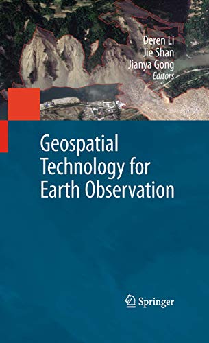
Buch. Condition: Neu. Druck auf Anfrage Neuware - Printed after ordering - Earth Observation interacts with space, remote sensing, communication, and information technologies, and plays an increasingly significant role in Earth related scientific studies, resource management, homeland security, topographic mapping, and development of a healthy, sustainable environment and community. Geospatial Technology for Earth Observation provides an in-depth and broad collection of recent progress in Earth observation. Contributed by leading experts in this field, the book covers satellite, airborne and ground remote sensing systems and system integration, sensor orientation, remote sensing physics, image classification and analysis, information extraction, geospatial service, and various application topics, including cadastral mapping, land use change evaluation, water environment monitoring, flood mapping, and decision making support.Geospatial Technology for Earth Observation serves as a valuable training source for researchers, developers, and practitioners in geospatial science and technology industry. It is also suitable as a reference book for upper level college students and graduate students in geospatial technology, geosciences, resource management, and informatics.
-

Geospatial Technology for Earth Observation
Language: English
Published by Springer US, Springer US, 2014
ISBN 10: 1489981098 ISBN 13: 9781489981097
Taschenbuch. Condition: Neu. Druck auf Anfrage Neuware - Printed after ordering - Earth Observation interacts with space, remote sensing, communication, and information technologies, and plays an increasingly significant role in Earth related scientific studies, resource management, homeland security, topographic mapping, and development of a healthy, sustainable environment and community. Geospatial Technology for Earth Observation provides an in-depth and broad collection of recent progress in Earth observation. Contributed by leading experts in this field, the book covers satellite, airborne and ground remote sensing systems and system integration, sensor orientation, remote sensing physics, image classification and analysis, information extraction, geospatial service, and various application topics, including cadastral mapping, land use change evaluation, water environment monitoring, flood mapping, and decision making support.Geospatial Technology for Earth Observation serves as a valuable training source for researchers, developers, and practitioners in geospatial science and technology industry. It is also suitable as a reference book for upper level college students and graduate students in geospatial technology, geosciences, resource management, and informatics.
-
 International Edition
Hardcover. Condition: New. Brand New ! Fast Delivery "International Edition " and ship within 24-48 hours. Deliver by FedEx and Dhl, & Aramex, UPS, & USPS and we do accept APO and PO BOX Addresses. Order can be delivered worldwide within 4-6 Working days .and we do have flat rate for up to 2LB. Extra shipping charges will be requested This Item May be shipped from India, United states & United Kingdom. Depending on your location and availability.
-
Geospatial Technology for Earth Observation Data
Language: English
Published by Springer-Verlag New York Inc, 2009
ISBN 10: 1441900497 ISBN 13: 9781441900494
Hardcover. Condition: Brand New. 1st edition. 558 pages. 9.76x6.65x2.05 inches. In Stock.
-

Hardcover. Condition: New. ISBN:9781441900494.
-

Geospatial Technology for Earth Observation Data
Seller: GreatBookPricesUK, Woodford Green, United Kingdom
Seller rating 5 out of 5 stars
� 211.99
� 15 shipping
Ships from United Kingdom to U.S.A.Quantity: Over 20 available
Add to basketCondition: As New. Unread book in perfect condition.
-
Hardcover. Condition: Like New. LIKE NEW. SHIPS FROM MULTIPLE LOCATIONS. book.
-

Condition: As New. Unread book in perfect condition.
-

Earth Observation Data & Geospatial Technology for Landslide Modelling
Language: English
Published by LAP LAMBERT Academic Publishing Sep 2016, 2016
ISBN 10: 3659957194 ISBN 13: 9783659957192
Seller: BuchWeltWeit Ludwig Meier e.K., Bergisch Gladbach, Germany
Seller rating 5 out of 5 stars
Taschenbuch. Condition: Neu. This item is printed on demand - it takes 3-4 days longer - Neuware -Landslide modeling and its risk analysis is a crucial task for disaster management. It has higher significance in the post-disaster resilience planning and development, especially for Himalayan mountainous terrain. In this study, earth observation data and advanced geospatial technology were used for landslide susceptibility mapping and subsequent risk analysis from Gourikund to Kedarnath region, Rudraprayag District, Uttarakhand India. Numerical simulation technique was used to frame out the run-out zone of debris flow through RAMMS (Rapid Mass Movement) modeling. 68 pp. Englisch.
-

Earth Observation Data & Geospatial Technology for Landslide Modelling
Language: English
Published by LAP LAMBERT Academic Publishing, 2016
ISBN 10: 3659957194 ISBN 13: 9783659957192
Condition: New. Dieser Artikel ist ein Print on Demand Artikel und wird nach Ihrer Bestellung fuer Sie gedruckt. Autor/Autorin: Bandopadhyay SubhajitSubhajit Bandopadhyay is currently working as a Research Assistant at Indian Institute of Technology Bombay. He has a two-year multidisciplinary research experience in Remote Sensing and GIS, with publications in.
-

Earth Observation Data & Geospatial Technology for Landslide Modelling : Mapping of Landslide Vulnerability, Susceptibility and 3 Dimensional Modelling of Debris Flow
Language: English
Published by LAP LAMBERT Academic Publishing, 2016
ISBN 10: 3659957194 ISBN 13: 9783659957192
Taschenbuch. Condition: Neu. nach der Bestellung gedruckt Neuware - Printed after ordering - Landslide modeling and its risk analysis is a crucial task for disaster management. It has higher significance in the post-disaster resilience planning and development, especially for Himalayan mountainous terrain. In this study, earth observation data and advanced geospatial technology were used for landslide susceptibility mapping and subsequent risk analysis from Gourikund to Kedarnath region, Rudraprayag District, Uttarakhand India. Numerical simulation technique was used to frame out the run-out zone of debris flow through RAMMS (Rapid Mass Movement) modeling.
-

Earth Observation Data & Geospatial Technology for Landslide Modelling
Language: English
Published by LAP LAMBERT Academic Publishing Sep 2016, 2016
ISBN 10: 3659957194 ISBN 13: 9783659957192
Seller: buchversandmimpf2000, Emtmannsberg, BAYE, Germany
Seller rating 5 out of 5 stars
Taschenbuch. Condition: Neu. This item is printed on demand - Print on Demand Titel. Neuware -Landslide modeling and its risk analysis is a crucial task for disaster management. It has higher significance in the post-disaster resilience planning and development, especially for Himalayan mountainous terrain. In this study, earth observation data and advanced geospatial technology were used for landslide susceptibility mapping and subsequent risk analysis from Gourikund to Kedarnath region, Rudraprayag District, Uttarakhand India. Numerical simulation technique was used to frame out the run-out zone of debris flow through RAMMS (Rapid Mass Movement) modeling.VDM Verlag, Dudweiler Landstra�e 99, 66123 Saarbr�cken 68 pp. Englisch.
-
Condition: new. Questo � un articolo print on demand.
-

Geospatial Technology for Earth Observation
Language: English
Published by Springer US Nov 2014, 2014
ISBN 10: 1489981098 ISBN 13: 9781489981097
Seller: BuchWeltWeit Ludwig Meier e.K., Bergisch Gladbach, Germany
Seller rating 5 out of 5 stars
Taschenbuch. Condition: Neu. This item is printed on demand - it takes 3-4 days longer - Neuware -Earth Observation interacts with space, remote sensing, communication, and information technologies, and plays an increasingly significant role in Earth related scientific studies, resource management, homeland security, topographic mapping, and development of a healthy, sustainable environment and community. Geospatial Technology for Earth Observation provides an in-depth and broad collection of recent progress in Earth observation. Contributed by leading experts in this field, the book covers satellite, airborne and ground remote sensing systems and system integration, sensor orientation, remote sensing physics, image classification and analysis, information extraction, geospatial service, and various application topics, including cadastral mapping, land use change evaluation, water environment monitoring, flood mapping, and decision making support.Geospatial Technology for Earth Observation serves as a valuable training source for researchers, developers, and practitioners in geospatial science and technology industry. It is also suitable as a reference book for upper level college students and graduate students in geospatial technology, geosciences, resource management, and informatics. 572 pp. Englisch.


