
Order Total (1 Item Items):
Shipping Destination:

Beyond Mapping Concepts Algorithms (19 results)
Skip to main search results
Search filters
Product Type
- All Product Types
- Books (19)
- Magazines & Periodicals (No further results match this refinement)
- Comics (No further results match this refinement)
- Sheet Music (No further results match this refinement)
- Art, Prints & Posters (No further results match this refinement)
- Photographs (No further results match this refinement)
- Maps (No further results match this refinement)
- Manuscripts & Paper Collectibles (No further results match this refinement)
Condition Learn more
- New (10)
- As New, Fine or Near Fine (3)
- Very Good or Good (6)
- Fair or Poor (No further results match this refinement)
- As Described (No further results match this refinement)
Binding
- All Bindings
- Hardcover (No further results match this refinement)
- Softcover (19)
Collectible Attributes
- First Edition (1)
- Signed (No further results match this refinement)
- Dust Jacket (1)
- Seller-Supplied Images (5)
- Not Print on Demand (17)
Language (1)
Free Shipping
Seller Location
Seller Rating
-
Condition: Very Good. Pages intact with possible writing/highlighting. Binding strong with minor wear. Dust jackets/supplements may not be included. Stock photo provided. Product includes identifying sticker. Better World Books: Buy Books. Do Good.
-
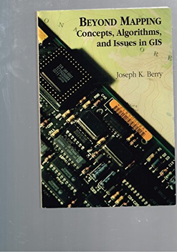
Beyond Mapping: Concepts, Algorithms, and Issues in Gis
Language: English
Published by New York, New York, U.S.A.: Halsted Pr, 1996
ISBN 10: 0962506362 ISBN 13: 9780962506369
Soft cover. Condition: Near Fine. soft cover in near fine condition.
-
Condition: Good. This is an ex-library book and may have the usual library/used-book markings inside.This book has soft covers. In good all round condition. Please note the Image in this listing is a stock photo and may not match the covers of the actual item,500grams, ISBN:9781899761753.
-
paperback. Condition: Very Good. Used - Very Good.
-
BEYOND MAPPING: Concepts, Algorithms, and Issues in Gis
Language: English
Published by GIS World, Fort Collins, Co, 1993
ISBN 10: 0962506362 ISBN 13: 9780962506369
First Edition
Paperback. Condition: New. First Edition, 2nd Printing, 1995. BRAND NEW COPY. Geographic Information Systems (GIS) technology and its relationships with traditional map processing. Resource in environmental planning. Anthology of columns published 1989-1993, GIS magazine. 35 chapters in 10 parts: Topic 1, Maps as Data & Data Structure Implications; 2, Measuring Effective Distant & Connectivity; 3, Roving Windows: Assement of Neighborhood Characteristics; 4, What GIS Is & Isn't: Spatial Data Mapping, Management, Modeling & More; 5, Assessing Variability, Shape & Pattern of Map Features; 6, Overlaying Maps & Characteristics; 7, Overlaying Maps & Summarizing the Results; 8, Scoping GIS: What to Consider; 9, Slope, Distance & Connectivity: Their Algorithms; and 10, Cartographis & Spatial Modeling, followed by Epilogue, and Appendix: A Tutorial Map Analysis Package.
-
Beyond Mapping : Concepts, Algorithms, and Issues in Gis
Seller: Phatpocket Limited, Waltham Abbey, HERTS, United Kingdom
Seller rating 5 out of 5 stars

Condition: Good. Your purchase helps support Sri Lankan Children's Charity 'The Rainbow Centre'. Ex-library, so some stamps and wear, but in good overall condition. Our donations to The Rainbow Centre have helped provide an education and a safe haven to hundreds of children who live in appalling conditions.
-

Beyond Mapping: Concepts, Algorithms, and Issues in GIS
Seller: Phatpocket Limited, Waltham Abbey, HERTS, United Kingdom
Seller rating 5 out of 5 stars
Condition: Good. Your purchase helps support Sri Lankan Children's Charity 'The Rainbow Centre'. Ex-library, so some stamps and wear, but in good overall condition. Our donations to The Rainbow Centre have helped provide an education and a safe haven to hundreds of children who live in appalling conditions.
-
Condition: new.
-

Condition: As New. Unread book in perfect condition.
-

Condition: New.
-
Beyond Mapping: Concepts, Algorithms, and Issues in GIS
Seller: Ria Christie Collections, Uxbridge, United Kingdom
Seller rating 5 out of 5 stars
� 93.40
� 11.98 shipping
Ships from United Kingdom to U.S.A.Quantity: Over 20 available
Add to basketCondition: New. In.
-

Beyond Mapping : Concepts, Algorithms, and Issues in Gis
Seller: GreatBookPricesUK, Woodford Green, United Kingdom
Seller rating 5 out of 5 stars
Condition: New.
-

Beyond Mapping : Concepts, Algorithms, and Issues in Gis
Seller: GreatBookPricesUK, Woodford Green, United Kingdom
Seller rating 5 out of 5 stars
Condition: As New. Unread book in perfect condition.
-
Beyond Mapping: Concepts, Algorithms, and Issues in GIS
Language: English
Published by John Wiley & Sons Inc, 1996
ISBN 10: 0470236760 ISBN 13: 9780470236765
Seller: THE SAINT BOOKSTORE, Southport, United Kingdom
Seller rating 5 out of 5 stars
� 101.38
� 15.23 shipping
Ships from United Kingdom to U.S.A.Quantity: Over 20 available
Add to basketPaperback / softback. Condition: New. New copy - Usually dispatched within 4 working days.
-
Beyond Mapping: Concepts, Algorithms, and Issues in Gis
Language: English
Published by John Wiley & Sons Inc, 1996
ISBN 10: 0470236760 ISBN 13: 9780470236765
Paperback. Condition: Brand New. 1st edition. 246 pages. 9.25x6.50x0.75 inches. In Stock.
-
Beyond Mapping: Concepts, Algorithms, and Issues in GIS
Language: English
Published by The Geoinformation Group, 1996
ISBN 10: 1899761756 ISBN 13: 9781899761753
paperback. Condition: Very Good. Very Good. Dust Jacket may NOT BE INCLUDED.CDs may be missing. SHIPS FROM MULTIPLE LOCATIONS. book.
-

Taschenbuch. Condition: Neu. Neuware - This book discusses maps as data with data structure implications; roving windows; spatial data modeling and management; assessing variability, shape, and pattern of map features; overlaying maps; cost-benefit analysis; algorithms involved in slope, distance, and connectivity; and cartographic and spatial modeling. A disk containing four-color graphics, including charts and maps, is also available. Provides a GIS glossary. Includes a list of recommended readings for each topic. Compiles international GIS instructions and presents contact details and information on each.
-
Beyond Mapping: Concepts, Algorithms, and Issues in GIS
Language: English
Published by John Wiley & Sons Inc, 1996
ISBN 10: 0470236760 ISBN 13: 9780470236765
Seller: THE SAINT BOOKSTORE, Southport, United Kingdom
Seller rating 5 out of 5 stars
� 109.37
� 15.23 shipping
Ships from United Kingdom to U.S.A.Quantity: Over 20 available
Add to basketPaperback / softback. Condition: New. This item is printed on demand. New copy - Usually dispatched within 5-9 working days 448.
-
Beyond Mapping: Concepts, Algorithms, and Issues in Gis
Language: English
Published by John Wiley & Sons Inc, 1996
ISBN 10: 0470236760 ISBN 13: 9780470236765
Paperback. Condition: Brand New. 1st edition. 246 pages. 9.25x6.50x0.75 inches. In Stock. This item is printed on demand.