Abert J W (35 results)

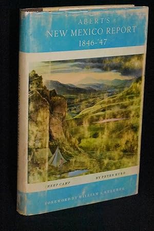
Published by Horn & Wallace, Albuquerque 1962
- Hardcover
Seller: 4 THE WORLD RESOURCE DISTRIBUTORS, Springfield, MO, U.S.A.4 THE WORLD RESOURCE DISTRIBUTORS
Contact seller5-star sellerHardcover. Condition: Good. Ex-Library; 8vo 8" - 9" tall.
 More images
Language: English
Published by Horn & Wallace, Publishers, Albuquerque, NM 1962
- Hardcover
- First Edition
Seller: Books by White/Walnut Valley Books, Winfield, KS, U.S.A.Books by White/Walnut Valley Books
Contact seller5-star sellerCondition: Used - Very good
£ 27.87
£ 3.60 shippingShips within U.S.A.Quantity: 1 available
Hardcover. Condition: Very Good. Dust Jacket Condition: Good +. 1st Edition. Horn & Wallace, Publishers, Albuquerque, NM. 1962. First Edition. Book is tight, square, and unmarked. Book Condition: Very Good; toning to front endpapers from newspaper clippings; shelfwear to tail and board bottom edges. DJ: Good + ; NOT Price Clippe…d ($7.50); rubbing to panels; light wear at tips; chipping at head and tail. Marbled paper over boards with brown overlay on the spine; gilt lettering on the spine. Maps as endpapers. Internally clean. Interior hinges are sound and not split. 182 pp 8vo. This book is an exact replication of the original. LT James Abert was a member of the Corps of Topographical Engineers sent with GEN Stephen Kearney on his expedition to conquer New Mexico for the United States. His instructions were to write a detailed report on New Mexico and its inhabitants. His investigations resulted in a document that has continued to be important historical source material on early New Mexican history and the military occupation of the state. A clean very respectable copy in a Brodart mylar jacket.
Published by J. Howell
- Hardcover
Seller: ThriftBooks-Dallas, Dallas, TX, U.S.A.ThriftBooks-Dallas
Contact seller5-star sellerHardcover. Condition: Good. No Jacket. Missing dust jacket; Pages can have notes/highlighting. Spine may show signs of wear. ~ ThriftBooks: Read More, Spend Less.
Published by J. Howell 1966
- Hardcover
Seller: Eureka Books, Eureka, CA, U.S.A.Eureka Books
Contact seller5-star sellerHardcover. A very good hardcover. Clear plastic dust jacket with several tears.
 More images
Published by John Howell Books 1961
- Hardcover
Seller: Tiber Books, Cockeysville, MD, U.S.A.Tiber Books
Contact seller4-star sellerHardcover. Condition: Good. . . . . Folio, hardcover. No dj. Good condition. Old moisture marking to bottom edge of covers and textblock. Contents free of writing or marking. Binding square and tight. 115 pp. text, illustrations. Foldout maps at rear. 19th, American, Century, Exploration, History, Southwest, Western.
 More images
Published by John Howell - Books 1966
- Hardcover
Seller: Midway Book Store (ABAA), St. Paul, MN, U.S.A.Midway Book Store (ABAA)
Contact seller5-star sellerCondition: Used - Near fine
£ 19.51
£ 6.06 shippingShips within U.S.A.Quantity: 1 available
Hardcover. Condition: near fine. Folio. 103pp. With illustrations in color from his Sketchbook. Limited to 3000 copies. Two folded bound maps in rear. In a light chipped mylar wrapper jacket.

- Hardcover
Seller: Orrin Schwab Books, Providence, UT, U.S.A.Orrin Schwab Books
Contact seller4-star sellerCondition: Used - Good
£ 39.01
£ 3.41 shippingShips within U.S.A.Quantity: 1 available
Hardcover. Condition: Good+. Large oversized hardback covers show slight shelf wear and rubbing to the spine edges and corners. Corners slightly bumped. Slight discoloration to the edges of the covers.; 116 pages.
Published by JOHN HOWELL 1966
- Hardcover
Seller: Books From California, Simi Valley, CA, U.S.A.Books From California
Contact seller4-star sellerHardcover. Condition: Good.
Published by Lawton and Alfred Kennedy for John Howell-Books, San Francisco, CA 1966
- Hardcover
Seller: Oak Knoll Books, ABAA, ILAB, NEW CASTLE, DE, U.S.A.Oak Knoll Books, ABAA, ILAB
Contact seller5-star selleroriginal beige decorated cloth. folio. original beige decorated cloth. (xii) 116 pages, 14 colored plates, 2 plans, 2 folding maps, text illustrations. Handsome reprint of Abert's diary published by Congress in 1848, one of the earliest American publications relating to the newly acquired Territory of New Mexico, with the first…printing of Abert's watercolor sketchbook. Field 4. Howes All. Pilling 3 (Cheyenne vocabulary). Plaines & Rockies 120. Radar 3344. Raines, p. 1: "Canadian Valley of Texas was part of the region traversed and described." Rittenhouse 2: "A basic Santa Fe Trail document." From the private reference library of Dorothy Sloan with a commemorative bookplate loosely inserted. Americana (illustrator).
Published by San Francisco, Calif.: John Howell Books, [n.d.]
- Manuscript
Seller: Wittenborn Art Books, San Francisco, CA, U.S.A.Wittenborn Art Books
Contact seller4-star sellerCondition: Good. Prospectus. 8vo. One folded sheet. [This is a prospectus, not a book]. Designed and printed by Lawton and Alfred Kennedy. Edited by John Galvin.
Language: English
Published by John Howell Books, San Francisco, California 1966
- Hardcover
Seller: Sea Chest Books, Tucumcari, NM, U.S.A.Sea Chest Books
Contact seller5-star sellerCondition: Used - Near fine
£ 73.34
£ 5.30 shippingShips within U.S.A.Quantity: 1 available
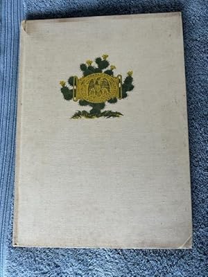
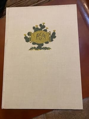
Hardcover. Condition: Near Fine. Limited Edition. Hardcover folio of 14 inches tall in near fine condition. Limited edition of 3,000 copies. Cream colored cloth with an upper central motif of the seal of 'The Corps of Topographical Engineers' in yellow, framed behind an irregular border in green of a prickly pear cactus. Clear v…inyl Dust Jacket.The text is from Abert's original travel diary kept on this expedition, and the illustrations, watercolors, in color are from his original sketchbook. Included as appendices are Abert's original notes concerning animals, birds and plants, and another concerning notes on minerals and fossils. Two large folding maps in fine condition are included at the end. Also included are a glossary of Spanish and Native terms and a letter directing Abert to continue with the First United States Survey of New Mexico.Also included are a list of references and Index. A valuable first person written and observed source from the first United States survey of New Mexico. Southwest, New Mexico, Topographical Survey, Maps, Journal, Drawings and Watercolors, Limited Edition. Abert, J.W. (illustrator).
Published by John Howell Books, San Francisco, CA 1966
- Hardcover
- First Edition
Seller: Cat House Books LLC, Pensacola, FL, U.S.A.Cat House Books LLC
Contact seller5-star sellerCondition: Used - Very good
£ 42.91
£ 7.20 shippingShips within U.S.A.Quantity: 1 available
Cloth. Condition: Very Good. No Jacket. First Edition. Edited by John Galvin and has his bold signature on the title page. Contains illustrations from Abert's sketchbook. Limited to 3000 copies. Fold-out maps. Glassine DJ,chipped. Rittenhouse considered this "One of the largest and most lavish books about the Santa Fe Trail.It i…ncludes his travel diary from Fort Leavenworth to Santa Fe and return. Contains many comments on the SFT found in no other published Abert report." Designed and printed by Lawton and Alfred Kennedy. Copies signed by Galvin are scarce. Signed By Editor.
Published by john howell 1966
- Hardcover
- First Edition
Seller: booklahoma, Arvada, CO, U.S.A.booklahoma
Contact seller5-star sellerCondition: Used - Near fine
£ 50.71
£ 2.65 shippingShips within U.S.A.Quantity: 1 available
Hardcover. Condition: Near Fine. Dust Jacket Condition: Very Good. 1st Edition. limited edition of 3000 copies. clean and tight throughout and cover has been well protected by brodart wrap (original to the book).
Language: English
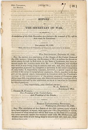
Published by Ritchie & Heiss, printers, [Washington, D.C.] 1845
- First Edition
Seller: Kaaterskill Books, ABAA/ILAB, East Jewett, NY, U.S.A.Kaaterskill Books, ABAA/ILAB
Contact seller5-star sellerRemoved. First edition. 13 pp. Illus. with 1 b/w drawing. 8vo. 29th Congress, 1st session. Senate. Doc. no. 26. Rfats were a contlinual problem for navigation. OCLC locates onlt 4 hard copies: Tulane, Historic New Orleans, LSU, NSU Louisiana. Inked numeral on title else a very good copy.
Language: English
Published by John Howell 1966
- Hardcover
Seller: Sparrow Reads, Edgewood, NM, U.S.A.Sparrow Reads
Contact seller5-star sellerCondition: Used - As new
£ 148.17
£ 3.41 shippingShips within U.S.A.Quantity: 1 available
Hardcover. Condition: As New. Pristine new condition. Rockwell Kent (illustrator).
 More images
Published by John Howell, San Francisco 1966
- Hardcover
Seller: 32.1 Rare Books + Ephemera, IOBA, ESA, Princeton, NJ, U.S.A.32.1 Rare Books + Ephemera, IOBA, ESA
Contact seller4-star sellerHardcover. Folio. Limited edition [1 of 3,000. Illustrated. Maps. Profusely illustrated in color, this is the diary of Lt. J.W. Abert who mapped New Mexico for the United States Army. Fold-out maps included. Ivory cloth hardcover; topographical engineers insignia on front board; gilt text on spine; Very Good with some light hand…ling in white cloth and acetate jacket.

Published by John Howell, San Francisco 1966
- Hardcover
- First Edition
Seller: Between the Covers-Rare Books, Inc. ABAA, Gloucester City, NJ, U.S.A.Between the Covers-Rare Books, Inc. ABAA
Contact seller5-star sellerHardcover. Condition: Fine. Dust Jacket Condition: Very Good. First edition. Edited by John Galvin. Illustrated from color illustrations and black and white folding maps. Fine in a lightly worn, very good dust jacket with a few edge chips and a small split along the spine. One of 3000 copies printed.
Published by John Howell-Books, San Francisco 1966
- Hardcover
Seller: Hackenberg Booksellers ABAA, El Cerrito, CA, U.S.A.Hackenberg Booksellers ABAA
Contact seller5-star sellerEdited by John Galvin. 116p., fold-out maps, colored illus., large quarto, original cloth.
Published by John Howell, San Francisco
- Hardcover
Seller: Spafford Books (ABAC / ILAB), Regina, SK, CanadaSpafford Books (ABAC / ILAB)
Contact seller5-star sellerCondition: Used
£ 55.17
£ 17.42 shippingShips from Canada to U.S.A.Quantity: 1 available
1966. (Folio) Very good plus. 116pp. Frontispiece, illus., maps. Mylar wrap slightly torn. Fold-out maps. Illustrations in colour from the author's sketchbooks. Limited to 3000 copies.
Published by Wendell and Van Benthuysen, Washington, D.C. 1848
- Hardcover
- First Edition
Seller: Saucony Book Shop, Kutztown, PA, U.S.A.Saucony Book Shop
Contact seller5-star sellerOriginal Cloth. Condition: Good. Not Issued. First Edition. House Exec. Doc. No. 41, 30th Congress, 1st Session. Howes E 145 (1st issue). Original brown cloth, lettered in gilt. Lacks both flyleaves and title page, opens directly onto Secretary of War W. L. Marcy's letter dated 9 Feb. 1848 (p. 3), thus 3-614 pp., collated and co…mplete except as noted with (64) lithographic plates including (26) in Emory's report, (14) botanical illustrations accompanying Engelmann's report, and (24) in Abert's report, plus (3) battle plan maps also in Emory between pp. 108-120. House edition (i.e. first issue), far more scarce than the (second issue) Senate edition (which was only 416 pp.), with possibly the first known rendering of Santa Fe on the plate opposite p. 419. Lacking the (2) folding maps and the large folding map which may not yet have been available upon issue (see Howes E 145 note). Considerable wear, but mostly intact. Cloth is somewhat soiled and spotted, with exposure at corners, chipped at tail of spine with some separation along joints and approx. 1" of minor loss along lower front joint, small vintage paper label mounted on upper spine (though not otherwise marked as an institutional copy). Signed on front pastedown and along top edge of p. 3 by former owner H. W. Clapham, a page in the U.S. House of Representatives, Washington, D.C., 1848-49. Front hinge shows some evidence of amateur repair, but the binding is still intact, all leaves and plates present and firmly anchored excepting pp. 71-74 (which, along with 3 adjacent plates, are partially detached but fully intact). Text block edges somewhat dulled by age, interior with light scattered foxing, engraved plates mostly clean also with light foxing. Scarce edition. CONTENTS: 1) Notes of a Military Reconnoissance from Fort Leavenworth, in Missouri, to San Diego, in California, Including Part of the Arkansas, Del Norte, and Gila Rivers / 2) Report of Lieut. J. W. Abert, of his Examination of New Mexico, in the Years 1846-47 / 3) Report of Lieut. Col. P. St. George Cooke of his March from Santa Fe, New Mexico, to San Diego, Upper California / 4) Journal of Captain A. R. Johnston, First Dragoons. Size: 8vo - over 7¾" - 9¾" tall. Book.
 More images
Published by George S. Appleton, Philadelphia 1849
- Hardcover
Seller: Lloyd Zimmer, Books and Maps, Chanute, KS, U.S.A.Lloyd Zimmer, Books and Maps
Contact seller5-star sellerCloth - Hard Cover. Condition: Fair. No Dust Jacket. First Edition, Thus. 614 pages. Ex. Doc. No. 41 complied by W. L. Marcy, Secretary of War and incorporating portions of Emory's "Notes of a Military Reconnoissance." (pp 5-416); Report of Lieut. J. W. Abert, Examination of New Mexico in the Years 1846-'47" (pp 417-548); "Repor…t of Lieut. Col. P. St. George Cooke of his March From Santa Fe, New Mexico to San Diego, Upper California" (pp 549-614). Although the title page calls for three large maps and over one-hundred engravings, there are 67 plates present, of which three are maps. There are no folding maps present in this volume. 43 of the plates are bound within the Emery report, and 24 are in the Abert report. Ex-Library with older library stickers on spine, and minimal internal markings. Paper spine label is worn, though lettering remains good. Hinges are broke, though volume appears previously reglued beneath spine covers and entire volume remains solid and tight. Small book plates, inked and penciled names on front end leaves. Blind stamp on title page. Foxing throughout, sometimes quite heavy. Most plate are affected at least a little by foxing, and some significantly so. Good working copy of this somewhat scarce configuration of these reports.
Published by Wendell and Van Benthuysen, Printers, Washington, D. C. 1848
- Hardcover
Seller: G. F. Wilkinson Books, member IOBA, GRASS VALLEY, CA, U.S.A.G. F. Wilkinson Books, member IOBA
Contact seller4-star sellerHardcover. Condition: Poor. Joint split with spine laid down, chipped at edges; rubbing to edges and bumped corners; front endpaper torn; owner signature second endpaper, two bookplates, one for Frederick Wm. Zimmerman, one for Alfred I. Exberg. Hinge starting lower 2 inches at title page, but cord binding holding firm. First fo…lding map of New Mexico with tape repairs to back; degrees of foxing in general to text pages and plates from mild to moderate, occasionaly heavy, yet many pages and plates remain relatively clean. ; Original brown cloth, and paper spine label; 4 sketches; 26 plates; 10 of 12 botanical plates called for, also lacking 2 botanical plates called for in appendix. Abert's report with 23 of 24 plates, lacking Pueblo de Santa Ana; 2 folding maps. Conforms to Wagner-Camp 148: 5. ; 8vo 8" - 9" tall; 614 pages.
Published by WashDC: Wendell and Van Benthuysen, Printers 1848
- Hardcover
- First Edition
Seller: Ethnographics, Georgetown, TX, U.S.A.Ethnographics
Contact seller3-star sellerCondition: Used - Very good
£ 390.11
£ 2.27 shippingShips within U.S.A.Quantity: 1 available
Hardcover. Condition: Very Good. No Jacket. 1st Edition. 1stedn; THIRTIETH CONGRESS, FIRST SESSION - EX. DOC. NO. 41; lg8vo blue cloth bds, gilt spine titles; rebacked with orig ptdwraps preserved, pp433ff has nibbling and water staining to extreme bottom page corners but not affecting text, ow VG/ndj: 11+614pp, many tables, bw…plates and intext illus; First edition, House of Representatives issues of the report, containing the reports of Lieutenant Abert, Colonel Cooke, and Captain Johnson as well as that of Emory; the Senate issue only contained the Emory report; with [this copy only contains 1 of 2 folding maps, The large foldout map of the Territory of New Mexico is MISSING but the large foldout sketch of the march and wagon road of Lt. Colonel Cooke is PRESENT and attached toward the rear of the book. At the start of the Mexican War, Emory was selected to join General Stephen Watts Kearny and the Army of the West (1846) to take New Mexico and California. Along the way he kept a detailed journal of the march down the Rio Grande and across to the Gila River, and down it to its mouth on the Colorado River, then to the Pacific Coast. It became an important guide book for the road to Southern California. This report described terrain and rivers, cities and forts and made observations about Native Americans, Mexicans, primarily in future New Mexico Territory, Arizona Territory and Southern California. It was and is considered one of the important chronicles and descriptions of the historic Southwest, particularly noted for its maps. [wikipedia];Zamorano Eighty 33: "Emory's report contains numerous folding maps of the areas described, and 64 lithograph plates of views and of botanical and natural history subjects. It is source material for the Southwest and the Mexican border. A library of Western Americana is incomplete without it." Howes E145: "That the House edition has priority is indicated by the fact that many copies were seemingly issued before the large map was available.". Thirtieth Congress - Senate Executive No. 7, 30th Congress First Session. (Cowan page 195; (Cowan p.195; Graff 1249; Howes E145; Wagner-Camp 148:2; Zamorano Eighty 33) First edition. In 1844, Emory served in an expedition that produced a new map of Texan claims westward to the Rio Grande. He came to public attention as the author of the Notes of a Military Reconnaissance from Fort Leavenworth in Missouri to San Diego, California, published by the Thirtieth United States Congress in 1848. This report described terrain and rivers, cities and forts and made observations about Indians, Mexicans, primarily in New Mexico Territory, Arizona Territory and Southern California. It was and is considered one of the important chronicles and descriptions of the historic Southwest, particularly noted for its maps. Emory was a reliable and conscientious cartographer. There is a story of testament as to Emory s dedication to accuracy that says John Bartlett his supervisor in the Corps of Topographical Engineers made him sign off on a misplaced boundary marker, creating a sweet revenge for Emory who replaced him as Head of the International Boundary Commission in 1855. So accurate were his maps that when topographical engineers were surveying possible routes for the transcontinental railroad the most Southern route did not need to be surveyed thanks to the outstanding work by William H. Emory.
 More images
Published by Bureau of Topographical Engineers, Washington 1848
- Hardcover
- First Edition
Seller: Glenn Books, ABAA, ILAB, Prairie Village, KS, U.S.A.Glenn Books, ABAA, ILAB
Contact seller5-star sellerGreen Cloth. Condition: Minor Corner and Edge Wear. No Jacket. First Edition. This is a Senate document from the 30th Congress, 1st Session, Executive No, 23. 132 pages of text material, followed by twenty-four full-page lithographic plates and a large folding map. Plates show very minor brown spotting, confined mainly to the pe…riphery. The large folding map has two small closed tears and small areas of paper defect at left margin secondary to binding and folding process. The plates were probably drawn by Abert, lithography by C.B. Graham. The report details Abert's trek from Fort Leavenworth, along the Santa Fe Trail to northern New Mexico, and his return along the Trail. Several pages of Cheyenne vocabulary are included in the report. See Howes A11, Streeter Sale 168, Graff 5, Sabin 57, Wagner-Camp 143 Size: Octavo.
 More images
Published by Wendell and Van Benthuysen, Printers, Washington 1848
- Hardcover
- First Edition
Seller: Frey Fine Books, Rougemont, NC, U.S.A.Frey Fine Books
Contact seller5-star sellerCondition: Used - Very good
£ 1,950.55
£ 5.26 shippingShips within U.S.A.Quantity: 1 available
Cloth. Condition: Very Good +. 1st edition. 1st edition. A Very Good + copy. 8vo., 614 pp., illustrated with 64 engraved plates and Two large folding maps attached: "Map of Territory of New Mexico" by Kearney's Report ("under instruction from Emory") 1846-47 and "Sketch of part of the march & wagon road of Lt. Colonel Cooke from… Santa Fe to the Pacific Ocean 1846-47"by Cooke's Report. Laid in, is a very large (7 foot long) map, titled: "Military Reconnaissance of the Arkansas, Rio Del Norte and Rio Gila. by W. H. Emory". Bound in the original brown cloth with paper title label on the spine. A very clean copy, with plates vibrant, with rich blacks and no spotting or soiling. Maps are also very clean, with very little (if any) breaks along the folds. Lower front tip bumped. Some browning to the paste downs. A Superior copy. Howes E-145. Thirtieth Congress- First Session. Ex. Doc. No. 41. Includes the reports of J.W. Abert and Philip St. George Cooke. Together they summarize the activity of the U.S. Army to the west of Santa Fe after the capture of New Mexico by the Army of the West. This work is considered one of the important chronicles and descriptions of the historic Southwest.
 More images
Published by Government Printing Office, 1848]., [Washington 1848
- Hardcover
- First Edition
Seller: BUCKINGHAM BOOKS, ABAA, ILAB, IOBA, GREENCASTLE, PA, U.S.A.BUCKINGHAM BOOKS, ABAA, ILAB, IOBA
Contact seller5-star seller[NEW MEXICO]. First edition. 8vo. Senate Executive Document No. 23, 30th Congress, 1st Session. Red cloth, 132 pp., [blank], plus 24 full-page, lithograph plates and a large folding map. Raines page 1 says, "The Canadian valley of Texas was part of the region traversed and described." The report provides much of life among the I…ndians, plus examination of the country from Fort Leavenworth to Santa Fe with descriptions of flora and fauna, Mexican customs, Mexican ruins, and several pages of Indian nouns and verbs. Rittenhouse 2 says ". describes his trip from Fort Leavenworth over the SFT via Bent's Fort, his survey of the northern part of New Mexico, and his return trip over the Trail." Very fragile front wrapper detached, but present. Wear to spine ends corners, and extremities, margins of some interior pages are lightly chipped not affecting the print, a very old water stain to the top page edges not affecting the print, some light foxing throughout, interior pages are clean, and large folding map is very good with minor to light wear at a few fold creases. A solid good copy housed in a cloth clamshell case with a red leather spine label and titles stamped in gilt.
Published by U.S. Government Printing Office, Depart of War 1848
- Hardcover
- First Edition
Seller: Sequitur Books, Boonsboro, MD, U.S.A.Sequitur Books
Contact seller5-star sellerHardcover. Condition: Good. First Edition. 1st edition, Senate issue. Housed in a custom made morocco leather backed slipcase. Bound by Jacques Desmonts, James Macdonald, Norwalk Conn. 24.5 cm. Bound in original printed wrappers. Wraps are worn, and nearly detached. Loss to bottom corner of front and rear wrap. Contemporary sign…ature on front wraps. 132 pages: 24 plates, folded map; 24 cm. Large folding lithographic "Map of the Territory of New Mexico." Pages are clean and unmarked. Includes plates of Santa Fe, Fort Marcy, San Felipe, and Native Americans. Howes A-11; Sabin 57; Wagner-Camp 143; Streeter I.168; Graff 5, Rittenhouse 2. One of the earliest U.S. government sponsored explorations of the Southwest. James Abert left Ft. Leavenworth in Kansas along the Santa Fe trail in order to map the newly won territory. He made his way via Bent's Fort and returned to back His map was the most detailed up to that point. Abert had served in Gen. Stephen W. Kearny's Army of the West in the Mexican American War and had been part of Fremont's earlier California expedition. 30th Cong., 1st sess. Senate. Ex. doc., no. 23.
 More images
Published by Wendell and Van Benthuysen., Washington 1848
- Hardcover
- First Edition
Seller: Ziern-Hanon Galleries, Frontenac, MO, U.S.A.Ziern-Hanon Galleries
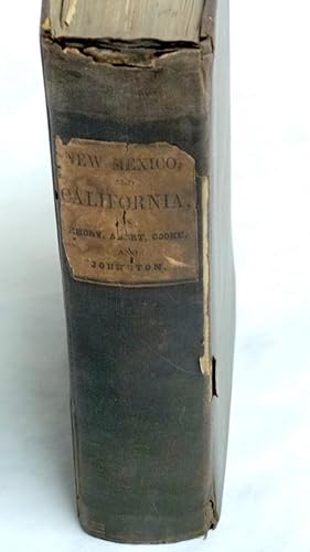
Contact seller1-star sellerFull Cloth. Condition: Good. First Edition. FIRST EDITION. House of Representatives Edition which proceeds the Senate edition. Title page mistakenly lists Emory as "Lieut. Col.". Original dark brown cloth with paper label title "New Mexico, and California, by Emory, Abert, Cooke, and Johnston". Contains some scuffs and nicks. Ri…ght spine edge is loose. Pages are age-toned and stiff with a few foxed. Includes wonderful pen and ink drawings in fine condition. Two fold out maps and three maps of battles in California with the Mexicans. Large fold-out map with 5" tear from inner margin affecting the map, "The Territory of New Mexico, 1846-47"; 67 plates. Page 454 misprinted as 754. 614pp. Overall GOOD minus condition. Extreemely scarce first edition. Damp staining to bottom corner throughout. Previous owner's notes on first page from 1929. Includes the reports of J.W. Abert and Philip St. George Cooke. Together they summarize the activity of the U.S. Army to the west of Santa Fe after the capture of New Mexico by the Army of the West. The first folding map is Philip St. George Cooke's "Sketch of Part of the march & Wagon road of Lt. Colonel Cooke, from Santa Fe to the Pacific Ocean, 1846-7." This shows the route of the Mormon Battalion from Santa Fe to the Gila River. The other, "Map of the Territory of New Mexico," was compiled by Lieutenants Abert and Peck after the conquest of New Mexico. Both are important contributions to western cartography. Abert's report includes material on the Indians of New Mexico and their languages. The Abert report also includes all of his views of New Mexico, the best group of early New Mexico views published. Wagner-Camp is in error in its collation of this edition, mistakenly calling for only forty plates, plus those of the Abert report. William Hemsley Emory (September 7, 1811 -- December 1, 1887) was an United States Army officer and surveyor of Texas. Emory was born in Queen Anne's County, Maryland, on his family's "Poplar Grove" estate. He attended the United States Military Academy at West Point, New York, and graduated in 1831. Assigned as a second lieutenant, he served in the Corps of Engineers until he resigned from the service in 1836 to pursue civil engineering, but he returned to the service in 1838.During that same year, he married a great-grandaughter of Benjamin Franklin, Matilda Wilkins Bache of Philadelphia. The couple would have three children. During his second stint in the army, he was successively promoted from lieutenant to captain and finally to major. He specialized in mapping the United States border, including the Texas-Mexico border, the United States-Canadian border(18441866) and the Gadsen Purchase (1854 -- 1857). In 1844, Emory served in an expedition that produced a new map of Texan claims westward to the Rio Grande River. He came to public attention as the author of the Notes of a Military Reconnaissance from Fort Leavenworth in Missouri to San Diego, California, published by the Thirtieth United States Congress in 1848. This report described terrain and rivers, cities and forts and made observations about Indians, Mexicans, primarily in New Mexico Territory, Arizona Territory and Southern California. It was and is considered one of the important chronicles and descriptions of the historic Southwest, particularly noted for its maps. Emory was a reliable and conscientous cartographer. Size: 8vo - over 7¾" - 9¾" tall. Hardcover.
- Hardcover
Seller: G.S. MacManus Co., ABAA, Bryn Mawr, PA, U.S.A.G.S. MacManus Co., ABAA
Contact seller5-star sellerABERT, Lt. J.W. Western America in 1846-1847. The Original Travel Diary of.Who Mapped New Mexico for the United States Army. Edited by John Galvin. [San Francisco]: John Howell Books, 1966. Folio. Many illus. in full color by the author. two large fold-out maps. 116pp. Fine in orig. cloth.
- Hardcover
Seller: GoldBooks, Denver, CO, U.S.A.GoldBooks
Contact seller5-star sellerHardcover. Condition: new. New Copy. Customer Service Guaranteed.


