

Order Total (1 Item Items):
Shipping Destination:

Tourist Map Kaniel (2 results)
Skip to main search results
Search filters
Product Type
- All Product Types
- Books (1)
- Magazines & Periodicals (No further results match this refinement)
- Comics (No further results match this refinement)
- Sheet Music (No further results match this refinement)
- Art, Prints & Posters (No further results match this refinement)
- Photographs (No further results match this refinement)
- Maps (1)
- Manuscripts & Paper Collectibles (No further results match this refinement)
Condition Learn more
- New (No further results match this refinement)
- As New, Fine or Near Fine (No further results match this refinement)
- Very Good or Good (No further results match this refinement)
- Fair or Poor (No further results match this refinement)
- As Described (2)
Binding
- All Bindings
- Hardcover (No further results match this refinement)
- Softcover (1)
Collectible Attributes
- First Edition (No further results match this refinement)
- Signed (No further results match this refinement)
- Dust Jacket (No further results match this refinement)
- Seller-Supplied Images (2)
- Not Print on Demand (2)
Language (1)
Price
- Any Price
- Under £ 20 (No further results match this refinement)
- £ 20 to £ 35 (No further results match this refinement)
- Over £ 35
Free Shipping
- Free Shipping to U.S.A. (No further results match this refinement)
Seller Location
Seller Rating
-
Welcome to Egypt U. A. R.
Published by State Tourist Administration; Institut Graphique Egyptien., Cairo., 1959
Seller: Asia Bookroom ANZAAB/ILAB, Canberra, ACT, Australia
Association Member: ANZAAB ILAB
Seller rating 5 out of 5 stars

Folding pictorial colour map, 47.5 x 43.8 cms; 51.7 x 47.7 cms (sheet) folding into plain title wrappers 21 x 12 text in panels on verso, in very good, bright condition. Brightly coloured tourist map of Egypt and the Middle East, with pictographs of various tombs, temples, oases, and wildlife, roads and railways. Information for the tourist about Egypt and Syria including a brief history, hotels, transport, health and currency are printed on the verso.
-

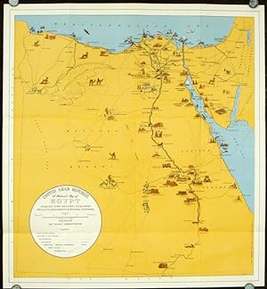
United Arab Republic. A Pictorial Map of Egypt Showing some Regional Resources, Products, Monuments and Natural Features.
Publication Date: 1959
Seller: Geographicus Rare Antique Maps, Brooklyn, NY, U.S.A.
Association Member: ABAA ESA ILAB
Seller rating 4 out of 5 stars

Map
Good. Exhibits wear along original fold lines. Verso repairs to fold separations. Exhibits some soiling. Text on verso. Size 16 x 18 Inches. Egypt is world-renowned for its ancient heritage and this 1959 Khalil Kamel pictorial tourist map published during the United Arab Republic emphasizes that strength. Ancient sites, illustrated in profile, line the banks of the Nile River, with the Pyramids at Giza, the Luxor Temple, the Ramesseum, Karnak, and the Temple of Dakka among them. Sites also line both banks of the Red Sea, many of which are economic, including mines, oil fields, and refineries. Major roads and railroads are illustrated as well. Palestine is labeled along the right border, even though Israel had existed since 1948. This map appeared just one year after the founding of the UAR and can be best understood as a statement of optimism for a prosperous pan-Arab future. The United Arab Republic The United Arab Republic (UAR), founded in 1958, was a political union between Egypt (which included the occupied Gaza Strip) and Syria. Led by Egyptian President Gamal Abdel Nassar, the union lasted until 1961, when a coup d'état in Syria led to its secession. Egypt continued to be known as the UAR until 1971. Publication History and Census This map was created by Khalil Kamel and published by the Tourist Administration of the United Arab Republic in 1959. Six examples are catalogued in the OCLC and are part of the institutional collections at the Library of Congress, Harvard College, Pennsylvania State University, Western Illinois University, the University of Minnesota-Minneapolis, and Vrije Universiteit Amsterdam.

