
Order Total (1 Item Items):
Shipping Destination:

The Balkans (26 results)
Skip to main search results
Search filters
Product Type
- All Product Types
- Books (11)
- Magazines & Periodicals (3)
- Comics (No further results match this refinement)
- Sheet Music (No further results match this refinement)
- Art, Prints & Posters (No further results match this refinement)
- Photographs (No further results match this refinement)
- Maps (12)
- Manuscripts & Paper Collectibles (No further results match this refinement)
Condition Learn more
- New (2)
- As New, Fine or Near Fine (1)
- Very Good or Good (8)
- Fair or Poor (No further results match this refinement)
- As Described (15)
Binding
Collectible Attributes
- First Edition (4)
- Signed (No further results match this refinement)
- Dust Jacket (1)
- Seller-Supplied Images (18)
- Not Print on Demand (26)
Language (2)
Free Shipping
- Free Shipping to U.S.A. (No further results match this refinement)
Seller Location
Seller Rating
-

National Geographic
Language: English
Published by Official Journal of the National Geographic Society, Washington, D.C., 1995
Magazine / Periodical
Encuadernaci�n de tapa blanda. Condition: Aceptable. Dust Jacket Condition: Aceptable. The Cover:Skill of a Neandertal woman, found in Krapina Cave in tne Balkans, has survived for 130,000 years. Photograph by Kenneth Garrett (illustrator). National Geographic Monthly Magazine VOL, 189, NO.1 January 1996: NEANDERTALS Archaeology proves these ancient humans to be inteliigent hunters and compassionate beings. By Rick Gore Photographs by Kenneth Garrett Paintings by Richard Schkecht. THE EDMUND FITZGERALD High-tec dives in Lake Superior retrieve a ship�s bell-and memories of a lost crew. By Thomas L. Farnquist. Photographs by Emory Kristof and Jeffrey Cree. UTAH As it celebrates its centennial, Utah still promises wide spaces and family-centered living. By Donovan Webster. Photographs by Joel Sartore. ARCTIC OCEAN TRAVERSE An interenational team completes a periotous transocean crossing via the North Pole. By Will Steger Photographs by Gordon Wiltsie. FEAST OF THE TARPON Clouds of baitfish schooling in hte Caribbean atract these voracious predators. Article and photographs by David Doubilet. UNDER OUR SKIN Churning heat at earth�s center drives our dynamic planet and sparks debate among scientists. By Keay Davidson and A.R.Williams Illustrations by Chuck Carter and Allen Carroll. PUFFINS Insquisitive and social, these beguiling seabirs are well adapted to the harsh North Atlantic. By Kenneth Taylor Photographs by Frans Lanting.
-
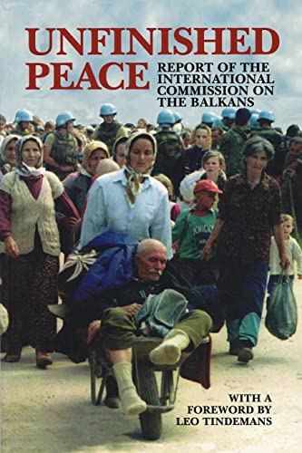
Unfinished Peace (Carnegie Endowment for International Peace): Report of the International Commission on the Balkans
Language: English
Published by Carnegie Endowment for Internati, 1996
ISBN 10: 087003118X ISBN 13: 9780870031182
paperback. Condition: Good. Our good condition books are generally good for reading but not for gifting or collecting. They could have imperfections such as creasing, fanning, inscriptions, margin notes, yellowing, staining on edge or cover or pages, bumps, scuffs, etc etc (sometimes multiple of these). It's a wide category that encompasses anything that isn't almost-new down to anything that is slightly better than poor. We would NOT recommend gifting Good books - these should be considered reading copies. Our books are dispatched from a Yorkshire former cotton mill. We list via barcode/ISBN so please note that the images are stock images and may not be the exact copy you receive, furthermore the details about edition and year might not be accurate as many publishers reuse the same ISBN for multiple editions and as we simply scan a barcode or enter an ISBN we do not check the validity of the edition data when listing. If you're looking for an exact edition please don't order (at least not without checking with us first, although we don't always have time to check). We aim to dispatch prompty, the service used will depend on order value and book size. We can ship to most countries, see our shipping policies. Payment is via Abe only.
-

Thirteen Days in Unexplored Montenegro : A journey through the remote, mountainous interior of Montenegro. An article printed in 1899, written by May McClellan Desprez : 13 pages, illustrated.
Published by Harper's Monthly Magazine, London, 1899
Magazine / Periodical
Booklet - Unbound Pages. Condition: Very Good. 13 pages, illustrated. An authentic standalone article, extracted from a larger volume. Not a reprint or reproduction, but an original work in its own right. Preserved in a modern card cover, prepared for practicality - an unassuming but serviceable presentation that favours function over finery. Size: 16 x 24 cms. Category: Harper's Monthly Magazine; Cosmo Books : 29 years on ABE, 47 years taking care of customers. A bookseller you can rely on.
-

The Balkans in Arms: A Militant Democracy Takes Shape. Written by Albert Sonnichsen, 1912.
Published by The American Review of Reviews, New York, 1912
Booklet - Unbound Pages. Condition: Very Good. 6 pages. An original article from the The American Review of Reviews, 1912. An authentic standalone article, extracted from a larger volume. Not a reprint or reproduction, but an original work in its own right. Preserved in a modern card cover, prepared for practicality - an unassuming but serviceable presentation that favours function over finery. Size: 18 x 24 cms. Category: Review of Reviews; Cosmo Books : 29 years on ABE, 47 years taking care of customers. A bookseller you can rely on.
-

-

First Edition. Hardcover, very good with light wear. Book.
-

Black Flag Issue 217 For Anarchist Resistance / May Day in Prague / The case of the Krasnodar Three / Turkey, Ocalan and the Kurds / Bad behaviour in Greece / No Easy Answers Looking at the Balkans War /The story of LA's Bus Riders Union / The origins of welfare as a means of social control
Published by Black Flag Collective
Magazine / Periodical
Soft cover. Condition: Very Good. 40 pages. Illustrated. May Day in Prague / The case of the Krasnodar Three / Turkey, Ocalan and the Kurds / Bad behaviour in Greece / No Easy Answers Looking at the Balkans War /The story of LA's Bus Riders Union / The origins of welfare as a means of social control (SL#130).
-

fight against terrorism and crisis management in the Western Balkans. Edited by Iztok Prezelj.
Language: English
Published by Amsterdam, Netherlands ; Washington, DC, IOS Press, c., 2008
ISBN 10: 1586038230 ISBN 13: 9781586038236
Seller: Universit�tsbuchhandlung Herta Hold GmbH, Berlin, Germany
Association Member: GIAQ ILAB VDA
Seller rating 4 out of 5 stars

First Edition
1st ed. 1 online resource (236 p.). Hardcover. Versand aus Deutschland / We dispatch from Germany via Air Mail. Einband besto�en, daher M�ngelexemplar gestempelt, sonst sehr guter Zustand. Imperfect copy due to slightly bumped cover, apart from this in very good condition. Stamped. NATO science for peace and security series. Sprache: Englisch.
-

-

Soft cover. Condition: Very Good. 16 pages. "Norway Fights Again" / "Allotments In Wartime" / "Trade With The Balkans" / "Letters From Home" / "Function Of Export Credits" / "Norwegian National 'Cradle' Bombed" / "Allied Defenders C.-In-C. The Home Fleet" (SL#86).
-
ROUTE THROUGH THE BALKANS - an Original Antique Hand-coloured Engraving, printed circa 1850
Language: English
Publication Date: 1850
Seller: K Books Ltd ABA ILAB, York, YORKS, United Kingdom
Association Member: ABA ILAB PBFA
Seller rating 5 out of 5 stars

No Binding. Condition: Very Good. An original antique hand-coloured engraving, printed circa 1850. Colouring not contemporary, but delicately and expertly done. Mounted (matted) and ready to frame. Very good condition. A view of the rocky mountainous route.
-
The Balkans - An Original Hand Coloured View.
Language: English
Publication Date: 1850
Seller: K Books Ltd ABA ILAB, York, YORKS, United Kingdom
Association Member: ABA ILAB PBFA
Seller rating 5 out of 5 stars
No Binding. Condition: Very Good. A fine original hand coloured engraving. Not contemporary colouring, but delicately and expertly executed. Mounted and ready to frame. Very good condition. Original and hand-coloured. Attractive and decorative . Circa 1850. This shows the Balkans, with some boats in the foreground.
-
The States & Provinces of the Balkan Peninsula shewing the Boundaries as determined by the Treaty of Berlin.
Language: English
Published by London: Edward Stanford, 1885
Seller: Meridian Rare Books ABA PBFA, London, United Kingdom
Association Member: ABA ILAB PBFA
Seller rating 5 out of 5 stars
Map First Edition
Hardcover. Condition: Very Good. 1st Edition. A large folding coloured map, approx. 26 x 22", laid down and sectionalised on linen, text summarising the Treaty of Berlin to lower right corner, folding into original cloth boards with lettering piece, VG. The 1878 Treaty of Berlin, made in the wake of the Russo-Turkish war of 1877-8, recognised the independence of the principalities of Romania, Serbia, and Montenegro, which are shown on this map, as well as Bulgaria, Rumelia (Rumili) and Macedonia.
-
[R.W. Seton-Watson, Authority on the Balkans] Part of an autograph letters signed to an unnamed correspondent.
Published by No place or date
Seller: Richard M. Ford Ltd, London, United Kingdom
Seller rating 5 out of 5 stars
Authority on the Balkans, etc. (DNB). Fragment of a letter, c.6" x 2", laid down on slightly larger card from album, good condition. Text: "By the time I leave, I hope we shall have our Serbian expedition virtually ready. The great trouble is to find a means of transit: it is hoped to get out all the way by ship. I will write again: this has to catch the post.".
-

Sound Trip
Seller: Celler Versandantiquariat, Eicklingen, Germany
Association Member: GIAQ
Seller rating 5 out of 5 stars
Reise Know How, Bielefeld, 2008. CD mit Begeleittext in Papph�lle--- - gutes Exemplar - 110 Gramm.
-

1812 Provinces Illyriennes, Servie et Bosnie
Seller: New World Cartographic, Chicago, IL, U.S.A.
Seller rating 4 out of 5 stars
Map
By: Conrad Malte-BrunDate: 1812 (Published) ParisDimensions: 9 x 11.76 inches (22.9 x 29.9 cm)This finely engraved map depicts a portion of the territories in Europe controlled by the Austrian and Ottoman Empires just as the Russo-Turkish War was ending. The map is from the atlas published in Paris entitled Atlas Supplementaire du Precis de la Geographie Universelle de M. Malte-Brun.The lower left quadrant is embellished with an attractive vignette featuring the beloved, beautiful and well-known Kravica waterfalls in Bosnia-Herzegovina.Condition: This map is in A condition.Inventory #113481200 W. 35th Street #425 Chicago, IL 60609 | P: (312) 496 - 3622.
-

Turkey and Greece.
Publication Date: 1845
Seller: Geographicus Rare Antique Maps, Brooklyn, NY, U.S.A.
Association Member: ABAA ESA ILAB
Seller rating 4 out of 5 stars
Map
Very good. Minor foxing at places. Blank on verso. Size 10 x 8 Inches. This is a beautiful example of Thomas Ewing's 1845 map of the European parts of Turkey. Centered on the Aegean Sea, this map covers from Moldavia to Thessaly and from the Adriatic to the Black Sea. Drawn when the Ottoman Empire controlled much of the region, it covers what is today Greece, Turkey, Macedonia, Albania, Bosnia, Serbia, Croatia, Bulgaria, Montenegro, and Moldova. Throughout, the map identifies various cities, towns, rivers, mountain passes and an assortment of additional topographical details. This map depicts the waning years of Ottoman hegemony in the region. The Greek Independence movement attained sovereignty for the Peloponnese in 1821. The other Grecian and Balkan states, including Serbia, Croatia, Moldavia, Wallachia, Albania, and Macedonia, remained at least nominally under Ottoman control until 1878. This map was published in 1845 by Oliver and Boyd as part of Ewing's New General Atlas .
-

Turkey in Europe.
Publication Date: 1855
Seller: Geographicus Rare Antique Maps, Brooklyn, NY, U.S.A.
Association Member: ABAA ESA ILAB
Seller rating 4 out of 5 stars
Map First Edition
1st Edition. Very good condition. Blank on verso. Size 13.5 x 16 Inches. An excellent 1855 first edition example of Colton's map of European Turkey. Like most of Colton's Europe maps, this map was derived from an earlier wall map of the world produced by Colton and D. Griffing Johnson. This map, made when the Ottoman empire controlled much of the region, covers what are today parts of Greece, Turkey, Macedonia, Albania, Bosnia, Serbia, Croatia, Bulgaria, Montenegro, and Moldova. An inset map in the lower left quadrant details the Bosporus and Istanbul (Constantinople). Another inset map, in the lower right, focuses on the island of Candia or Crete. This map depicts the waning years of Ottoman hegemony in the region, with the Greek Independence movement achieving Peloponnesian sovereignty in 1821. The Ionian Republic, under the protection of Great Britain, was also free of Ottoman control. The other Grecian and Balkan states, including Serbia, Croatia, Moldavia, Wallachia, Albania, and Macedonia, remained at least nominally under Ottoman control until 1878. This map also identifies various cities, towns, rivers, rapids, mountain passes, and an assortment of additional topographical details. Map is hand colored in pink, green, yellow and blue pastels to define national and regional boundaries. Surrounded by Colton's typical spiral motif border. Dated and copyrighted to J. H. Colton, 1855. Published from Colton's 172 William Street Office in New York City. Issued as page no. 22 in volume 2 of Colton's 1856 Atlas of the World. References: Rumsey 0149.089 (1856 edition). Phillips (Atlases) 816.
-

Map of Turkey in Europe with Ionian Islands.
Publication Date: 1850
Seller: Geographicus Rare Antique Maps, Brooklyn, NY, U.S.A.
Association Member: ABAA ESA ILAB
Seller rating 4 out of 5 stars
Map
Very good. Overall age toning. Minor spotting at places. Size 12.5 x 10.5 Inches. A fine example of Thomas Cowperthwait and S. A. Mitchell's 1854 map of Greece and the Balkans under the Ottoman empire. Centered on the Aegean Sea, this map covers from Moldova to Crete and from the Adriatic to the Black Sea. This map depicts the waning years of Ottoman hegemony in the region, with the Greek Independence movement attaining independence in Peloponnese in 1821. The Ionian Republic, under the protection of Great Britain, was also free of Ottoman control. The other Grecian and Balkan states, including Serbia, Croatia, Moldavia, Wallachia, Albania, and Macedonia, remained at least nominally under Ottoman control until 1878. The whole is engraved in Mitchell's distinctive style with green border work and vivid pastels. Political and topographical features are noted and color coded with elevation rendered by hachure. This map was prepared by S. A. Mitchell for publication by the Philadelphia firm of Thomas Cowperthwait & Co. as plate no. 62 in the 1854 edition of Mitchell's New General Atlas . Dated and copyrighted, 'entered according to act of Congress in the year 1850 by Thomas Cowperthwait & Co. in the Clerk's office of the eastern District of Pennsylvania. References: Rumsey 0537.060 (1846 edition). Phillips (Atlases) 814.
-

North Part of Turkey in Europe Comprehending Ancient Illyricum, and Dacia, Moesia, etc.
Publication Date: 1817
Seller: Geographicus Rare Antique Maps, Brooklyn, NY, U.S.A.
Association Member: ABAA ESA ILAB
Seller rating 4 out of 5 stars
Map
Very good. Minor wear along original centerfold. Original platemark visible. Overall toning and foxing at places. Size 20 x 24 Inches. This is an attractive 1817 map of the Balkans by the Edinburgh cartographer John Thomson. It depicts the region from modern day Slovenia east to the Black Sea and from Moldova south to include Bulgaria. The map also notes the ancient Roman regions of Illyricum, Dacia and Moesia. Throughout, the map notes both contemporary and ancient place names. Also notes rivers, mountains and other topographical features. Following the Battle of Corinth in 146 BC, the Greek peninsula came under Roman rule. The period from 31 BC and AD 180 in Greek history is described as the era of the Pax Romana. This was a period of peace and security when many Greek cities flourished, leading to cultural and economic progress. The classical period in Greek history, which lasted from the 5th century B.C. through the 4th century B.C. greatly influenced the Roman Empire's politics, art, architecture, philosophy and literature. After the fall of the Western Roman Empire, Greece became the center of the Eastern Roman or Byzantium Empire. Thomson's work, including this map, represents some of the finest cartographic art of the 19th century. His maps are known for their stunning color, awe-inspiring size, and magnificent detail. This map was prepared by John Thomson for inclusion in the 1817 edition of his New General Atlas .
-

Europe after the Congress of Vienna.
Publication Date: 1817
Seller: Geographicus Rare Antique Maps, Brooklyn, NY, U.S.A.
Association Member: ABAA ESA ILAB
Seller rating 4 out of 5 stars
Map
Very good. Minor wear along original centerfold. Minor toning and spotting. Narrow top margin. Size 21 x 25.5 Inches. This is an attractive 1817 map of Greece, the Balkans and Ukraine by the Edinburgh cartographer John Thomson. It depicts the region from Greece north to include the southern portions of Ukraine, including Crimea. Includes the whole or part of the modern day nations of Greece, Albania, Macedonia, Bulgaria, Romania, Moldova, Serbia and Hungary. Rivers, mountains and other topographical features are noted. As the title suggest, this map was issued to depict the territories as set by the Congress of Vienna in 1815. The regions are color coded with an explanation of the colors included in the lower right quadrant of the map. Following the defeat of Napoleonic France, the conference in Vienna set to resize the main powers so they could balance each other off and remain at peace. Europe under a new peaceful balance of power was centered on the five most important powers (also referred to as the five 'Great Powers') of the United Kingdom, France, Russia, Prussia and the Austrian empire. Alas, the 'peace' was but an illusion and Europe was anything but calm. Old rivalries would fester and soon nationalism, liberalism, revolution (industrial and otherwise) would once again be on the rise across Europe. This map is a part of a Thomson's larger 4 map set of Europe. Thomson's work, including this map, represents some of the finest cartographic art of the 19th century. His maps are known for their stunning color, awe-inspiring size, and magnificent detail. This map was prepared by John Thomson for inclusion in the 1817 edition of his New General Atlas . References: Rumsey 1007.036.
-

Turkey in Europe and Hungary; from the best authorities.
Publication Date: 1795
Seller: Geographicus Rare Antique Maps, Brooklyn, NY, U.S.A.
Association Member: ABAA ESA ILAB
Seller rating 4 out of 5 stars
Map
Good. Discoloration along the centerfold. Wear along the centerfold at margins. Slight foxing at upper-left margin. Size 12.5 x 14 Inches. This is Matthew Carey and William Barker's c. 1795 map of Ottoman Europe, Hungary, and nearby territories in southeastern Europe, made for Carey's General Atlas . It depicts the region as it was just prior to a major rearrangement that would see Ottoman rule over the European portion of its empire collapse. A Closer Look Coverage includes Hungary, the Balkans, Greece, and territories that today compose Bulgaria, Romania, Moldova, and Ukraine. Waterways, mountains, cities, administrative borders, and regions appear in extensive detail. Scales are provided in Hungarian miles and British statute miles. Bulgaria and Romania are reversed from their actual locations, a curious error which remained in later editions. The Decline of Ottoman Europe Often remembered as the 'sick man of Europe,' the Ottoman Empire went through a long period of unrest and dissolution from the late 18th through the early 20th century. In fact, there were several important reform efforts that might have forestalled the empire's disintegration, but they were hindered by opposition from entrenched interests. The Ottoman's main problem was dealing with an increasingly powerful Russia to its north while also managing potential threats from Austria and other nearby powers, especially as Russia and Austria were allied for much of the 18th century. Although on the defensive, the Ottomans were able to do so for the first half of the 18th century, but the disastrous Russo-Turkish War of 1768 - 1774 led to the loss of Crimea, and another war against Russia from 1787 until 1792 led to further losses along the Black Sea. The Ottomans also had to contend with rising discontent among subject populations, including a 1769 - 1772 revolt in Egypt and periodic Greek uprisings, harbingers of greater troubles to come. By the 1830s, Ottoman rule over most of the territory seen here would be seriously threatened or eliminated entirely. Publication History and Census This map was engraved by William Barker for the 1795 or 1796 edition of Carey's General Atlas (sometimes subtitled American Edition of Guthrie's Geography improved ). Its distribution is difficult to firmly establish, both due to uncertainty over its date and because the OCLC catalog listing includes digitized copies along with physical examples. The map is listed among the holdings of the American Antiquarian Society, while the entire atlas is held by a handful of universities and research institutions in the United States and Europe. References: Rumsey 2862.014 (1796 edition). OCLC 793032211, 53047069.
-

Fluviorum in Europa principis Danubii cum Adiacentibus Regnis nec non totius Graeciae et Archipelagi Novissima Tabula.
Publication Date: 1710
Seller: Geographicus Rare Antique Maps, Brooklyn, NY, U.S.A.
Association Member: ABAA ESA ILAB
Seller rating 4 out of 5 stars
Map
Very good. Closed centerfold split to the right of the cartouche, stabilized on verso. Soiling lower corners due to handling. Small pencil annotation near center. Size 20.5 x 23.5 Inches. An example of Johann Baptist Homann's c. 1710 map of southeastern Europe, with a special focus on the Danube River. A Closer Look Coverage embraces from Bohemia to Malta in the west and from the Dnieper (Dnipro) River to Crete and Rhodes in the east. Settlements are labeled throughout, with the larger towns and cities illustrated by buildings. Several of these are recorded for purely academic interest, such as Delphi, which had been destroyed and abandoned for centuries. Waterways, hills and mountains, islands, coastal features, and administrative boundaries are also illustrated. The Danube and its tributaries are traced in bold lines across the map. The ancient Roman Via Militaris is also noted, running between Belgrade ( Singidunum ) and Seliuree (Silivri, formerly Selymbria or Selybria) near Constantinople. The combination of Latin, Italian, German, and Polish placenames gives a sense of Homann's source material, as well as the prevailing political powers in different regions. A curious inset map on the left covers the Upper Danube, originating in the Black Forest and flowing through Swabia. The title cartouche includes several references to Greek mythology, including Pegasus at the top and Istros at the right, symbolizing the Danube River. The figures at left are uncertain, but they could be Heracles slaying the Lernaean Hydra or Cadmus defeating a similar water dragon. The figures to the far left of the cartouche are likely naiads (freshwater nymphs). Historical Context Between 1707 and 1710, Greece and the wider Balkans were under the control of the Ottoman Empire, which was experiencing both internal challenges and external threats during this period. While Ottoman rule remained dominant, the region was marked by unrest and tensions stemming from heavy taxation, corruption, and the empire's efforts to suppress dissent. In Greece, particularly in the Peloponnese, this period followed the end of the Morean War (1684 - 1699), during which the Venetians had temporarily taken control of the region. However, the Treaty of Karlowitz (1699) had returned the Peloponnese to Ottoman control, and by 1707, the Ottomans were re-establishing their authority, often harshly, leading to resentment among the Greek population. Resistance to Ottoman rule simmered in the northern Balkans, with Christian populations in Serbia, Bulgaria, and Wallachia looking to Austria or Russia for support. However, these powers were preoccupied with other conflicts, such as the Great Northern War and R�k�czi's War of Independence in Hungary. Publication History and Census This map was prepared by Johann Baptist Homann. Although examples in institutional catalogs are assigned dates ranging from 1702 into the 1730s (with later issues by Homann Heirs into the late 1750s), the present work was prepared between 1707 and 1710 for inclusion in the 1710 edition of his Neuer Atlas . Although later issues of the map are superficially similar to the present map, there are numerous updates and changes, including Homann's Privilege, explanatory notes, and a representation of the Danube River transposed on the Black Sea in later issues. Also, the face of the mythological figure holding a lyre and bow on the left side of the cartouche is noticeably different between the present map and later issues, indicating a new plate rather than modifications to an existing plate. Of note, this example has an old color cartouche, which is very rare in Homann maps, as he generally preferred to leave the cartouche uncolored (most examples with colored cartouches represent modern color).
-
![Seller image for [Detailed (Map) of Ottoman Europe]. for sale by Geographicus Rare Antique Maps](https://pictures.abebooks.com/inventory/md/md32068516299.jpg)
[Detailed (Map) of Ottoman Europe].
Publication Date: 1906
Seller: Geographicus Rare Antique Maps, Brooklyn, NY, U.S.A.
Association Member: ABAA ESA ILAB
Seller rating 4 out of 5 stars
Map
Average. Wear along original folds. Some loss at junction of folds. Light soiling. Several tears around edges professionally repaired. Size 25 x 34.75 Inches. A scarce map of Ottoman Europe, produced by military officer al-Hac Nasir al-Dagistani and published in 1906 by Mahmud Bey Matbaasi. It displays the remaining European portion of the Ottoman Empire, which was severely imperiled at the time, and most of which would break away in two wars in the Balkans that directly preceded World War I (1914 - 1918). A Closer Look Covering the Balkans from the Adriatic to the Black Sea, this map highlights the remnant European portions of Ottoman Europe in the early 20th century, before the two Balkan Wars. Administrative borders are illustrated and labeled, as are mountains, waterways, major roads, railways, cities, and other features. An inset at the bottom-left displays the Bosporus, while a legend at the right explains the symbols used throughout. Multiple tables provide information on telegraph and postal codes, distances between major cities, and demographics of the empire's vilayets. An inset of Crete appears at bottom. Despite a movement to do so, the island did not join Greece upon the latter's independence in the early 19th-century. However, repeated revolts against Ottoman rule and foreign intervention forced the Sultan to accept Crete's near de facto independence. Nevertheless, momentum for union with Greece continued, driven by communal violence between Muslims and Christians and the weakening of Ottoman rule overall. In 1906, the year of this map's publication, the island's High Commissioner was deposed. In 1908 Crete joined Greece. Historical Context The Collapse of Ottoman Europe Ottoman control over the Balkans, Greece, and other nearby territories was already in jeopardy in the early 19th-century, and by the end of the 19th-century, many of these territories had achieved independence. Those regions that had not (Albania, Macedonia, portions of modern Greece, and Bulgaria) were underonly nomina l control from Istanbul. Despite the Young Turk Revolution in 1908 and the onset of drastic reforms, the difficulties faced by the Ottomans only increased in subsequent years, and the empire lost nearly all of its European territory by the end of 1913. The destabilization of the region provided opportunities for rival foreign powers to interfere and compete with each other, setting the stage for the First World War. Late Ottoman Cartography As with other elements of Ottoman administrative and intellectual life, in 19th century, the threat of powerful neighbors prompted a comprehensive reexamination of cartographic methods. Along with the Tanzimat reforms in the mid-19th century, came an effort to train cartographers in the latest European surveying methods. Print technology also improved with the development of commercial lithographic printing by the end of the century (the present map is, notably, a chromolithograph). Still, several factors, including limited funding for military and non-military cartographers, somewhat hindered the development of late Ottoman cartography. Chromolithography Chromolithography, sometimes called oleography, is a color lithographic technique developed in the mid-19th century. The process uses multiple lithographic stones, one for each color, to yield a rich composite effect. Generally, a chromolithograph begins with a black basecoat upon which subsequent colors are layered. Some chromolithographs used 30 or more separate lithographic stones to achieve the desired effect. Chromolithograph color can be blended for even more dramatic results. The process became extremely popular in the late 19th and early 20th centuries when it emerged as the dominant method of color printing. The vivid color chromolithography made it exceptionally effective for advertising and propaganda. Publication History and Census This map was drawn by Dagistani al-Hac Nasrullah al-Hac Nasir Efendi (alternatively and more simpl.
-

Map of the Country between Odessa and Constantinople, embracing the Present Seat of War between the Russians and Turks.
Publication Date: 1854
Seller: Geographicus Rare Antique Maps, Brooklyn, NY, U.S.A.
Association Member: ABAA ESA ILAB
Seller rating 4 out of 5 stars
Map
Very good. Mounted on linen. Light wear and toning along original fold lines. Blank on verso. Size 31.75 x 20.75 Inches. This is an 1854 James Wyld map of the eastern Balkans and the Black Sea coast during the Crimean War. The map depicts the region from Salonica to Odessa, and from the Dnister (Dniester) River to the island of Lesbos (I. Mytilini) in the Aegean Sea. Published in the middle of the conflict, Wyld presents the theater of war, highlighting the two regions first occupied by the Russian Empire (Wallachia and Moldavia) and allowing his viewers a better understanding of the news they were receiving from their armies in the Balkans. Geographic Context Highly detailed, myriad cities, towns, and villages are labeled throughout, including Odessa, Adrianople, Salonica, Gallipoli, and Constantinople. Topography is also noted, with chains of hills and mountains indicated by hachure and rivers and streams meandering their way to the sea. Three different grades of roads are marked from 'great roads' to 'carriage roads' and finally to 'cross roads'. Ancient roads are also noted. Forts and batteries, Greek monasteries, and inns are also marked. Various colors are used to highlight regional boundaries, with Moldavia, Austria, Bessarabia, Walachia, Bulgaria, and Rumili among those identified. A brilliant blue sets apart the regional seas, as well as the Bosporus (Bosphorus) and the Strait of the Dardanelles in two inset maps situated in the lower right corner. A plan of the town of Schoumla is situated along the right border. This city, located along two mountain passes through the Balkan Mountains, was an important site in the Crimean War, which was raging at the time of this map's publication. Per the map, only five practicable passes over the Balkan Mountains existed at this time, and the two routes through Schoumla led directly to Constantinople, the capital of the Ottoman Empire. The Crimean War The Crimean War, with an alliance of the Ottoman Empire, Britain, France, and Sardinia on one side of the conflict and the Russian Empire on the other, lasted from October 1853 until February 1856. The root cause of the war has never been fully understood, but the stated impetus for hostilities was the rights of Christians in the Holy Land, with the Catholics being supported by the French and the Greek Orthodox Church gaining the support of the Russians. Other factors also included the gradual decline of the Ottoman Empire and British and French concerns about Russian gains in the region at the cost of the Ottomans. Further Historical Context Hostilities erupted in July 1853 when Russia invaded two Ottoman suzerainties known collectively as the Danubian Principalities, labeled here as Wallachia and Moldavia. The Ottomans immediately responded and fought a defensive campaign that eventually halted the Russian advance at Silistra, which the Russians besieged. Alarmed by the possibility of an Ottoman collapse, the British and French jumped to their aid, sending troops and supplies to Gallipoli. They did not arrive at Silistra until after the Russians had withdrawn. Further Conflict Now, public opinion at home, where discontent at the seemingly wasted effort and expense of sending armies to the Balkans, exerted an influence on the alliance. This outcry led to the planning and execution of an invasion of the Crimean Peninsula in September and a siege of the Russian naval port of Sevastopol, their primary naval base in the Black Sea, which lasted for eleven months. Russia finally sued for peace in March 1856 and in the Treaty of Paris the ended the war Russia lost its Black Sea ports, Wallachia and Moldavia gained a modicum of independence, and Christians in the Holy Land were given a degree of equality. Publication History and Census This map was created and published by James Wyld in 1854. The OCLC records examples as being part of the collections at Yale University, Harvard University, and the British Library. References: OCLC 948645527.
-

Stumme Physikalische Schul-Wandkarten der Lander Europas. Balkan-Halbinsel.
Publication Date: 1884
Seller: Geographicus Rare Antique Maps, Brooklyn, NY, U.S.A.
Association Member: ABAA ESA ILAB
Seller rating 4 out of 5 stars
Map
Very good. Even overall toning. Dissected and mounted on linen in eighteen panels. Bears collection stamp from the Department of Geology at Harvard University. The item was legally deaccessioned from the Department and bears a deaccession stamp on the accompanying slipcase. Size 52.5 x 61.75 Inches. This is a monumental and striking 1884 Richard Kiepert chromolithograph topographic map of Greece and the Balkan Peninsula. The map depicts the region from central Italy east to the Bosporus and from the Danube Delta on the Black Sea to Crete. An utterly fantastic piece created by the most celebrated 19th-century German cartographer. Kiepert employs eight different colors to illustrate the region's topography. He details the region's river systems and coastlines and marks, although without identifying them by name, many of the region's cities and towns. Chromolithography Chromolithography is a color lithographic technique developed in the mid-19th century. The process involved using multiple lithographic stones, one for each color, to yield a rich composite effect. Oftentimes, the process would start with a black basecoat upon which subsequent colors were layered. Some chromolithographs used 30 or more separate lithographic stones to achieve the desired effect. Chromolithograph color could also be effectively blended for even more dramatic results. The process became extremely popular in the late 19th and early 20th centuries, when it emerged as the dominate method of color printing. The vivid color chromolithography produced made it exceptionally effective for advertising and propaganda imagery. Publication History and Census This map was created by Richard Kiepert and published by Dietrich Reimer in 1884. The present example bears a collection stamp from the Department of Geology at Harvard University. We have confirmed that it was legally deaccessioned, and the accompanying slipcase bears an official deaccession stamp. Only one example is cataloged in OCLC, and it is part of the collection at the University of Chicago. A second OCLC ghost entry appears as well, implying that at least one more example is part of another institution's collection, but the institution has since withdrawn from OCLC. References: OCLC 644294335.

