Plans Illustrator (9 results)

Dominique Perrault: Small Scale/Pequena Escala
[Perrault, Dominique] Zabalbeascoa, Anatxu (editor); Rodriguez Marcos, Javier (e; Over 40 Color & b/w Illustrations (chiefly b/w Photographs & plans) [Illustrator]
- Softcover
Seller: Basement Seller 101, Cincinnati, OH, U.S.A.Basement Seller 101
Contact seller5-star sellerCondition: Used - As new
£ 4.57
£ 3.73 shippingShips within U.S.A.Quantity: 3 available
Paperback. Condition: As New.

Published by Gramercy 1962
- Hardcover
Seller: Polly's Books, Grand Rapids, MI, U.S.A.Polly's Books
Contact seller5-star sellerHardcover. Condition: Used: Good. A good copy with a tight and square binding. Text is clean but has mildly yellowed. Green boards are good. No dust jacket. Careful packaging and fast shipping. We recommend EXPEDITED MAIL for even faster delivery.
The Outline of History Volume II
H.G. Wells; Postgate Raymond (Revised); J.F. Horrabin (maps and plans) [Illustrator]
Published by Doubleday & Company 1961
- Hardcover
Seller: Basement Seller 101, Cincinnati, OH, U.S.A.Basement Seller 101
Contact seller5-star sellerCondition: Used - Very good
£ 5.46
£ 3.73 shippingShips within U.S.A.Quantity: 1 available
Hardcover. Condition: Very Good.
Italy: Handbook for Travellers: Third Part: Southern Italy and Sicily: With Excursions to Sardinia, Malta, and Corfu
Baedeker, Karl; 30 Maps and 34 Town and Building Plans [Illustrator]
Published by Baedeker 1912
- Hardcover
Seller: Sequitur Books, Boonsboro, MD, U.S.A.Sequitur Books
Contact seller5-star sellerHardcover. Condition: Good. 16th Edition. 16mo. Red cloth. vi, 508 p. fold. front., maps (part fold.), plans (part fold.) with 30 maps and 34 plans. 16 cm. Clean, unmarked pages. Some tears to maps, with some being maps loose. Rubbing to cover. Founded in 1827, Baedeker guides gained popularity during the second half of the 19th… century (so much so that Baedekering became part of everyday language). They were an invaluable and essential part of civilized travel in the fin-de-siecle. Baedeker guides were known for both their accuracy and attention to detail. Included in each are intricate colored fold-out maps and floor plans. Baedekers comments and recommendations open a fascinating window into the mores of a world now past.
Published by Baedeker 1906
- Hardcover
Seller: Sequitur Books, Boonsboro, MD, U.S.A.Sequitur Books
Contact seller5-star sellerCondition: Used - Very good
£ 26.89
£ 3.71 shippingShips within U.S.A.Quantity: 1 available
Hardcover. Condition: Very Good. 16mo. Red cloth. xxxiv, 461 p. , 17 cm. Clean, unmarked pages. Colored fold-out maps are in excellent shape. Good binding. Minor rubbing to cover. Gilt lettering on cover bright. Includes fold-out maps of the Rhine and its immediate surroundings.
Italy: Handbook for Travellers: Third Part: Southern Italy and Sicily: With Excursions to Sardinia, Malta, and Corfu
Baedeker, Karl; 30 Maps and 34 Town and Building Plans [Illustrator]
Published by Baedeker 1912
- Hardcover
Seller: Sequitur Books, Boonsboro, MD, U.S.A.Sequitur Books
Contact seller5-star sellerHardcover. Condition: Good. 16th Edition. Bound in publisher's red cloth. Shelf wear/bumping/fraying. Gutters weakened. lvi, 508 pages, 49 unnumbered leaves of plates (some folded) : maps, plans ; 16 cm. with 30 maps and 34 plans. Founded in 1827, Baedeker guides gained popularity during the second half of the 19th century (so m…uch so that Baedekering became part of everyday language). They were an invaluable and essential part of civilized travel in the fin-de-siecle. Baedeker guides were known for both their accuracy and attention to detail. Included in each are intricate colored fold-out maps and floor plans. Baedekers comments and recommendations open a fascinating window into the mores of a world now past.
Published by Baedeker Pub 1900
- Hardcover
Seller: Sequitur Books, Boonsboro, MD, U.S.A.Sequitur Books
Contact seller5-star sellerCondition: Used - Very good
£ 38.40
£ 3.71 shippingShips within U.S.A.Quantity: 1 available
Hardcover. Condition: Very Good. 14th Revis Ed. Red cloth. lvi, 420 p. maps (part fold.) plans (part fold.) 16 cm. Clean, unmarked pages. Colored fold-out maps in good condition. Good binding and cover. Founded in 1827, Baedeker guides gained popularity during the second half of the 19th century (so much so that Baedekering beca…me part of everyday language). They were an invaluable and essential part of civilized travel in the fin-de-siecle. Baedeker guides were known for both their accuracy and attention to detail. Included in each are intricate colored fold-out maps and floor plans. Baedekers comments and recommendations open a fascinating window into the mores of a world now past. with 12 maps and 36 plans. Appended (36 p., fold. plans): Index of streets and plans of Paris.
Published by Bonanza 1962
Seller: Basement Seller 101, Cincinnati, OH, U.S.A.Basement Seller 101
Contact seller5-star sellerCondition: Used - Very good
£ 67.60
£ 3.73 shippingShips within U.S.A.Quantity: 1 available
Unknown Binding. Condition: Very Good.
 More images
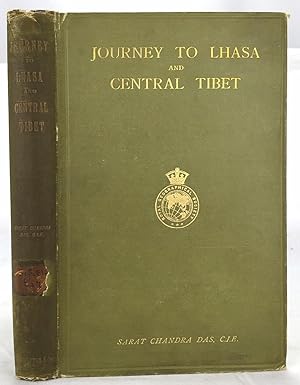
Journey to Lhasa and Central Tibet
Das, Sarat Chandra (edited By W.W. Rockhill; Frontispiece Photo of Author, 2 Large Folding Maps, 4 Folding Color Plans [Illustrator]
Published by John Murray 1902
- Hardcover
Seller: Sequitur Books, Boonsboro, MD, U.S.A.Sequitur Books
Contact seller5-star sellerHardcover. Condition: Good. Stated 2nd Edition, revised. Bound in publisher's green cloth. Gilt lettered and stamp of the Royal Geographical Society on front cover. Library stamps and markings. 285 pages. 34 illustrations and maps, 6 of which are folding. Large color map of Tibet at rear. Many of the plates are stamped with libr…ary stamps on blank side. Sarat Chandra Das (1849-1917) was a Bengali scholar of Tibet. Das has been described as "a traveler, explorer.linguist, a lexicographer, an ethnographer and an eminent Tibetologist." Das was also a British spy. Born in Chittagong, Das trained as an engineer in Calcutta. He became headmaster of the Bhutia Boarding School in Darjeeling. Bhutia was a school for Sikkimese and Tibetan boys, many of who would be trained to fill a special place in the British colonial regime, the role of a Pundit. Das became a "pundit" (and an instructor at the school) for British intelligence. Pundits acted as a network of British-trained operatives who were tasked to make inroads in the foreboding inner regions of Asia where white embassies could not gain entry. Tibet and other inland areas were increasingly gaining attention from competing British, Russian and Chinese economic and strategic interests. Derek Waller speculates that the character of Huree Chunder Mookerjee in Kipling's Kim was based on Das, p.193. As a teacher, Das learned Tibetan to speak with his students. He read the limited books on the region available, notably of Bogle (1773-5) and Manning's travels (1811) to Tibet. Manning and Bogle were the last successful British explorations of Tibet, a nation who steadfastly resisted western intrusion. Das's language ability secured him entry with his colleague, Lama Ugyen Gyasto, to Tashilhunpo monastery in 1879, as the Prime Minister wished to learn Hindi from him. In 1881, Das returned to Tashilhunpo and made his way to Lhasa, Sakya, and the Tsangpo River. There he met with Thupten Gyatso, the 13th Dalai Lama (d. 1933) and returned to Darjeeling with a Yak loaded with over 200 Tibetan manuscripts. After Das was revealed to be a British agent, Tibetan authorities increased restrictions on travelers and the Minister who had sponsored his entry was put to death. What makes Das's expedition so interesting is that he successfully brought back a wealth of information on an unknown land to the larger world. The Tibet that Das glimpsed is now gone, with the passage of history and the destructive forces of modernity and Chinese domination. This book compiles the story of Das's journey, his reports, photographs, diagrams, ethnographic observations, etc of a lost Tibet. Das went on to become an important Tibetan scholar and author an extensive multi-volume dictionary. The British would not successfully return to Tibet until 1903-4, with Colonel Francis Edward Younghusband's exhibition (invasion and massacre of ~5000 Tibetans). (Significantly, Younghusband was the President of the Royal Geographical Society, which notably published the 1902 edition of Das's book. An interesting, and dark connection to Das's legacy.) Ref: Derek Waller's The Pundits: British Exploration of Tibet and Central Asia. University Press of Kentucky, 1990, pp. 193-209. Also, Samanth Subramanian's superb piece in the New York Times Magazine, March 20, 2016, p. MM61. Peter Hopkirk, The Great Game: The Struggle for Empire in Central Asia, Kodansha, 1992. Yakushi D55, Yakushi D356. Marshall 1459.

