
Order Total (1 Item Items):
Shipping Destination:

Phoenix Maps (8 results)
Skip to main search results
Search filters
Product Type
- All Product Types
- Books (3)
- Magazines & Periodicals (No further results match this refinement)
- Comics (No further results match this refinement)
- Sheet Music (No further results match this refinement)
- Art, Prints & Posters (No further results match this refinement)
- Photographs (No further results match this refinement)
- Maps (5)
- Manuscripts & Paper Collectibles (No further results match this refinement)
Condition Learn more
- New (No further results match this refinement)
- As New, Fine or Near Fine (5)
- Very Good or Good (2)
- Fair or Poor (No further results match this refinement)
- As Described (1)
Binding
- All Bindings
- Hardcover (No further results match this refinement)
- Softcover (1)
Collectible Attributes
- First Edition (No further results match this refinement)
- Signed (No further results match this refinement)
- Dust Jacket (No further results match this refinement)
- Seller-Supplied Images (6)
- Not Print on Demand (8)
Language (2)
Free Shipping
- Free Shipping to U.S.A. (No further results match this refinement)
Seller Location
Seller Rating
-

Plan of Kilkenny City 1900
Language: English
Published by Phoenix Mapping Service, 1989
ISBN 10: 187225909X ISBN 13: 9781872259093
Condition: Very Good. 1989. New ed of 1900 ed. Sheet map, folded. . . . . . Books ship from the US and Ireland.
-
Plan of Kilkenny City 1900
Language: English
Published by Phoenix Mapping Service, 1989
ISBN 10: 187225909X ISBN 13: 9781872259093
Seller: Kennys Bookshop and Art Galleries Ltd., Galway, GY, Ireland
Seller rating 5 out of 5 stars

Condition: Very Good. 1989. New ed of 1900 ed. Sheet map, folded. . . . . .
-
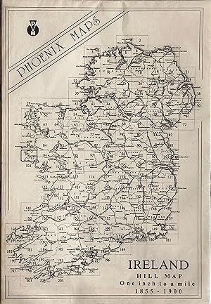
Ireland Hill Map Sheet 93
Published by Phoenix Maps, Dublin 1855-1900; 1989, 1855
Seller: Acanthophyllum Books, Holywell, FLINT, United Kingdom
Association Member: PBFA
Seller rating 3 out of 5 stars

Map
Folded map. Condition: Fine. No Jacket. Scale: 1 inch to 1 mile. Scarcely used. Weight: 1 Language: English.
-
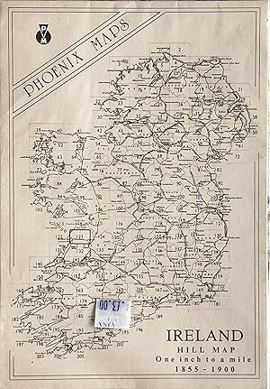
Ireland Hill Map Sheet 123
Published by Phoenix Maps, Dublin 1855-1900; 1989, 1855
ISBN 10: 1855930587 ISBN 13: 9781855930582
Seller: Acanthophyllum Books, Holywell, FLINT, United Kingdom
Association Member: PBFA
Seller rating 3 out of 5 stars
Map
Folded map. Condition: Fine. No Jacket. Scale: 1 inch to 1 mile. Scarcely used. Weight: 1 Language: English.
-
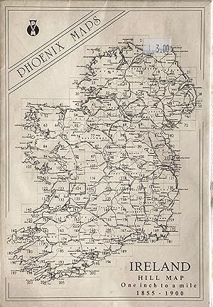
Ireland Hill Map Sheet 124
Published by Phoenix Maps, Dublin 1855-1900; 1989, 1855
ISBN 10: 1855930633 ISBN 13: 9781855930636
Seller: Acanthophyllum Books, Holywell, FLINT, United Kingdom
Association Member: PBFA
Seller rating 3 out of 5 stars
Map
Folded map. Condition: Fine. No Jacket. Scale: 1 inch to 1 mile. Scarcely used. Weight: 1 Language: English.
-

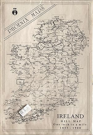
Ireland Hill Map Sheet 94
Published by Phoenix Maps, Dublin 1855-1900; 1989, 1855
ISBN 10: 1872259391 ISBN 13: 9781872259390
Seller: Acanthophyllum Books, Holywell, FLINT, United Kingdom
Association Member: PBFA
Seller rating 3 out of 5 stars
Map
Folded map. Condition: Fine. No Jacket. Scale: 1 inch to 1 mile. Scarcely used. Weight: 1 Language: English.
-
Ireland Hill Map Sheet 122
Published by Phoenix Maps, Dublin 1855-1900; 1989, 1855
ISBN 10: 1855930188 ISBN 13: 9781855930186
Seller: Acanthophyllum Books, Holywell, FLINT, United Kingdom
Association Member: PBFA
Seller rating 3 out of 5 stars
Map
Folded map. Condition: Fine. No Jacket. Scale: 1 inch to 1 mile. Scarcely used. Weight: 1 Language: English.
-
![Seller image for [Map of County] Roscommon for sale by MW Books Ltd.](https://pictures.abebooks.com/inventory/md/md32469693247.jpg)
[Map of County] Roscommon
Published by Dublin : Phoenix Maps, 1989
ISBN 10: 1855931060 ISBN 13: 9781855931060
Facsimile Edition. Near fine folding map; slightly dust-dulled and edge-bumped. Remains well-preserved overall. Physical description; 1 map ; 79 x 58 cm. on sheet 101 x 62 cm., folded to 21 x 15 cm. Notes; Reproduced from an original made available by the Neptune Gallery, Dublin; believed to be a section from a map by Willliam Larkin, circa 1819. Facsimile reprint. Subjects; Republic of Ireland ; Maps. 1 Kg.