
Order Total (1 Item Items):
Shipping Destination:

Moule Thomas Roderick Barron (10 results)
Skip to main search results
Search filters
Product Type
- All Product Types
- Books (10)
- Magazines & Periodicals (No further results match this refinement)
- Comics (No further results match this refinement)
- Sheet Music (No further results match this refinement)
- Art, Prints & Posters (No further results match this refinement)
- Photographs (No further results match this refinement)
- Maps (No further results match this refinement)
- Manuscripts & Paper Collectibles (No further results match this refinement)
Condition Learn more
- New (1)
- As New, Fine or Near Fine (6)
- Very Good or Good (3)
- Fair or Poor (No further results match this refinement)
- As Described (No further results match this refinement)
Binding
- All Bindings
- Hardcover (10)
- Softcover (No further results match this refinement)
Collectible Attributes
- First Edition (2)
- Signed (No further results match this refinement)
- Dust Jacket (8)
- Seller-Supplied Images (3)
- Not Print on Demand (10)
Language (2)
Free Shipping
- Free Shipping to U.S.A. (No further results match this refinement)
Seller Location
Seller Rating
-
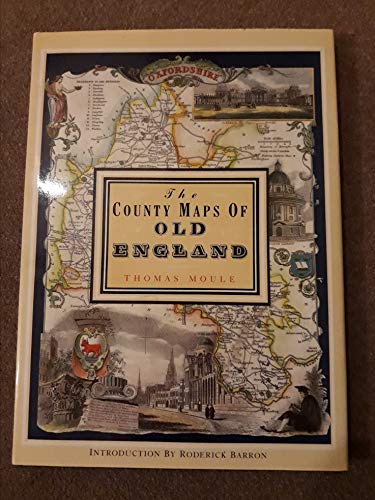
THE COUNTY MAPS OF OLD ENGLAND - Thomas Moule
Language: English
Published by Studio Editions, London, 1992
ISBN 10: 1851704035 ISBN 13: 9781851704033
Hardcover. Condition: Fine. Dust Jacket Condition: Fine. Fine copies of Moule's 56 maps in color from1830; 127pp. No name or writing. CLEAN!
-
The County Maps of Old England
Language: English
Published by Studio Editions, London, 1990
ISBN 10: 1851704035 ISBN 13: 9781851704033
Cloth. Condition: Very Good. Dust Jacket Condition: Very Good. Clean and solid. ; Color Illustrations; Folio; 128 pages.
-
The County Maps of Old England
Language: English
Published by Studio Editions, London, 1990
ISBN 10: 1851704035 ISBN 13: 9781851704033
Seller: Babushka Books & Framers, Isle of Wight, United Kingdom
Seller rating 4 out of 5 stars

First Edition
Hardcover. Condition: Very Good. Dust Jacket Condition: Very Good. 1st Edition.
-
The County Maps of Old England.
Language: English
Published by London; Studio Editions. 1991., 1991
ISBN 10: 1851704035 ISBN 13: 9781851704033
Seller: Elaine Beardsell, HOLMFIRTH, United Kingdom
Association Member: PBFA
Seller rating 4 out of 5 stars
Hardcover. Condition: Fine. Dust Jacket Included. Reprint. 14" x 10". 126[1]pp, illustrated with 56 full plate cold maps. Fine hardback in price clipped, else, fine protected dustwrapper.
-
The County Maps of Old England
Language: English
Published by Studio Editions, London, 1990
ISBN 10: 1851704035 ISBN 13: 9781851704033
Hardcover. Condition: Fine. Dust Jacket Condition: Fine. Dark-blue hardcover with gilt lettering to spine, in glossy pictorial dust-jacket. 265 x 362 x 20mm. 127pp. High-quality colour reproductions with text on facing pages. A pristine copy - as new. NB: An extra shipping charge may be requested for heavier or more valuable items. All our 'Seller Images' show the actual item you will receive.
-
COUNTY MAPS OF OLD ENGLAND
Language: English
Published by Studio Editions, London, 1990
ISBN 10: 1851704035 ISBN 13: 9781851704033
Hardcover. Condition: New. Dust Jacket Condition: As New. Thomas Moule (illustrator). First Thgus. This copy is in new, unmarked condition bound in blue cloth covered boards with bright gilt titling to the spine. This copy is bright, tight, white and square. The unclipped dust wrapper is in as new condition. International postal rates are calculated on a book weighing 1 Kilo, in cases where the book weighs more than 1 Kilo increased postal rates will be quoted, where the book weighs less then postage will be reduced accordingly. Thomas Moule is one of the most distinctive and beloved of early Victorian mapmakers. His charming series of English county maps, first published in 1830 as the 'English Counties,' are as popular and collectible today as when they first appeared. Their elaborate and decorative style, a synthesis of art and cartography, sets them apart from most other maps of the period, whose plain unembellished style owed much to the pioneering work of the Ordinance Survey. Moule's maps convey a picture of an England where 'ancientness' could still be found in abundance. This was an England where history was still alive in ancient country houses, parish churches with their escutcheoned Gothic memorials and tombs, in market towns and market place and in a landscape that still offered 'scenes, situations, and prospects remarkable fro extent and beauty." Moule is often compared to his distinguished 17th century predecessors, John Speed and Joan Bleau. This new edition of 'Moule's Maps' combines 56 coloured maps with the original text taken from 'Barclays Complete and Universal English Dictionary' in which they appeared in the editions published between 1842 and 1852. Ref DDD 1.
-
The county maps of old England
Seller: ACADEMIA Antiquariat an der Universit�t, Freiburg, Germany
Association Member: BOEV
Seller rating 5 out of 5 stars

Gebunden. Condition: Sehr gut. Reprinted. 126 Seiten , pages blaue gebundene Ausgabe im grosen Quartformat (hier: 26 x 36 cm) mit Schutzumschlag; derselbe an Kanten etwas brbrauchsspurig; sonst sehr gutes Exemplar mit zahlr. ganzseitigen farbigen Karten - well-kept hardcover copy with dust jacket and beautiful coloured historical maps of old England Sprache: Englisch Gewicht in Gramm: 1465.
-
Encuadernaci�n de tapa dura. Condition: Bien. 1? Edici�n. Studio Editions, London, 1990. Texto en ingl�s. Cartograf�a. Profusamente ilustrado. 128 pp. 36 x 26. Tela editorial tapa dura con dorados en lomo y sobrecubierta de editorial ilustrada. Sin subrayados ni anotaciones. PEQUE�O ROCE EN PARTE INFERIOR DE LOMO, por lo dem�s: Buen estado de conservaci�n. ISBN: 9781851704033.
-
![Seller image for The County Maps of Old England [2] for sale by Little Stour Books PBFA Member](https://pictures.abebooks.com/inventory/md/md5402207172.jpg)
The County Maps of Old England [2]
Published by Published by Studio Editions Ltd., 50 Eastcastle Street, London . London 1990., 1990
Seller: Little Stour Books PBFA Member, Canterbury, United Kingdom
Association Member: PBFA
Seller rating 5 out of 5 stars
Hard back binding in publisher's original navy paper covers, gilt lettering to the spine, navy end papers. Folio 14�'' x 10�''. ISBN 1851704035. Contains 128 printed pages of text with 56 full-page colour maps. Fine condition book, in Fine condition dust wrapper, unused new book. Member of the P.B.F.A. ISBN 1851704035 ENGLAND EXPLORATION.
-
![Seller image for Classic Print Portfolio County Maps of Old England [2] for sale by Little Stour Books PBFA Member](https://pictures.abebooks.com/inventory/md/md1051082051.jpg)
Classic Print Portfolio County Maps of Old England [2]
Published by Published by Studio Editions Ltd., 50 Eastcastle Street, London . London 1991., 1991
Seller: Little Stour Books PBFA Member, Canterbury, United Kingdom
Association Member: PBFA
Seller rating 5 out of 5 stars
Hard back binding in publisher's original half green cloth covers, colour printed design to the upper and lower panels, ivory cream silk ties. Folio. 15'' x 11�''. ISBN 1851706852. 12 single sided colour maps on thick card stock, 8 page introductory leaflet. Without any ownership markings and in very near Fine and unused condition, no dust wrapper as published. Member of the P.B.F.A. CARTOGRAPHY, MAPS, PLANS.
