Order Total (1 Item Items):
Shipping Destination:

Marcel Destombes (22 results)
Skip to main search results
Search filters
Product Type
- All Product Types
- Books (22)
- Magazines & Periodicals (No further results match this refinement)
- Comics (No further results match this refinement)
- Sheet Music (No further results match this refinement)
- Art, Prints & Posters (No further results match this refinement)
- Photographs (No further results match this refinement)
- Maps (No further results match this refinement)
- Manuscripts & Paper Collectibles (No further results match this refinement)
Condition Learn more
Binding
Collectible Attributes
- First Edition (2)
- Signed (No further results match this refinement)
- Dust Jacket (3)
- Seller-Supplied Images (11)
- Not Print on Demand (22)
Language (3)
Free Shipping
- Free Shipping to U.S.A. (No further results match this refinement)
Seller Location
Seller Rating
-

Rapport de la Commission pour la Bibliographie des Cartes Anciennes. Fasc. I. u. II.
Published by (Paris), Union G�ographique Internationale 1952., 1952
Kl.-8�. 63(1) u. 95(1) S. OBrosch. Enth�lt: Rapport au XVIIe Congr�s International, Washington 1952. Contributions pour un Catalogue des Cartes Manuscrites 1200-1500. Catalogue des cartes grav�es au XVe si�cle.
-
Bibliotheque Nationale. Catalogue des cartes nautiques sur velin conserv�es au Departement des Cartes et Plans
Language: French
Published by Paris: Bibliotheque Nationale, 1963
Soft cover. Condition: Very Good. Softcover in printed light gray paper covers xv + 317 pages in French, clean tight and unmarked.
-
Contributions Selectionnees a l'Histoire De La Cartographie et Des Instruments Scientifiques
Published by HES Publishers/A.G. Nizet, Utrecht/Paris, 1987
Seller: Alphaville Books, Inc., Hyattsville, MD, U.S.A.
Seller rating 3 out of 5 stars

Hard Cover. Condition: Very Good+. Dust Jacket Condition: Very Good+. Blue boards with bottom corner to front board very lightly bumped. Very light indents at front of dustwrapper not affecting the board below. TEXT PRIMARILY IN FRENCH. A clean and bright copy with the dj preserved by seller in a protective Brodart. A clean and bright copy. Careful packing and fast, efficient shipping including delivery confirmation. Please note: International and Domestic Priority orders for this item will require additional shipping.
-
Introduction to Kitab al 'amal bil Asturlab.
Published by Hyedrabad (Indien) ca., 1967
Seller: Wissenschaftliches Antiquariat K�ln Dr. Sebastian Peters UG, K�ln, Germany
Seller rating 5 out of 5 stars

Condition: gut. 44 S., 23 cm, Einband fleckig, Ecke geknickt. Sprache: Deutsch.
-
Une carte in�dite de Diogo Homem, circa 1566.
Published by Junta de Investiga��es Cient�ficas do Ultramar, Coimbra, 1970
In-4to. (291 mm) de 15-[1] pp. Ilustrado com 1 estampa em separado. Br. Bom exemplar. Agrupamento de Estudos de Cartografia Antiga, 42. Sep. de Revista da Universidade de Coimbra, XXIV.
-
I: Contributions pour un Catalogue des Cartes Manuscrites 1200-1500 �dit�es par M. Destombes. II: Catalogue des Cartes Grav�es au XVe Si�cle par Marcel Destombes. Rapport au XVIIe Congr�s International de G�ographie.
Published by Union G�ographique Internationale,, France,, 1952
Seller: Llibreria Antiqu�ria Delstres, Canet de Mar, B, Spain
Seller rating 4 out of 5 stars

Rapport de la Commission pour la Bibliographie des Cartes Anciennes. Fascicule I et II. Rapport au XVIIe Congr�s International, Washington 1952 par R. Almagi�, Pr�sident de la Commission. Publi� avec le concours financier de l'UNESCO. I: 63 p�ginas. II: 95 p�ginas. Cubiertas en r�stica impresa. Perfecto estado. 2 vol�menes. 18x13,5 cm.
-
Catalogue des Cartes Nautiques sur V�lin, conserv�es au D�partement des Cartes et Plans.
Published by Paris, Biblioth�que Nationale, ., 1963
Seller: Bibliographica Christian H�flich, Hamburg, HH, Germany
Seller rating 5 out of 5 stars
XV, 315 S. Sp�terer blauer Leinenband mit R�ckenschild. 25,5 : 17 cm. * Sehr gut erhalten.
-

Mappemondes, A.D. 1200-1500 : Catalogue pr�par�e par la Commission des Cartes Anciennes de l'Union G�ographique Internationale
Language: English
Published by N. Israel, Amsterdam, 1964
Hardcover. Condition: Very Good. 4to (27.5 cm), XXXII, 322, [2] pp, 38 plates (some folding). Publisher's laminated boards (ex-library copy, but without stamps or marks, clean and firm, binding slightly stained, small crack to front hinge at the tail, bookplates, front endpaper somewhat stained). The first volume in the Monumenta Cartographica Vetustioris Aevi series is a monograph devoted to medieval world maps. It includes an introduction by R. A. Skelton and an introductory chapter on the characteristics and typology of medieval world maps by Marcel Destombes. The subsequent chapters present: a list of medieval world maps before 1200 (by Marcel Destombes); a catalogue of medieval world maps in manuscripts from 1200-1500 (Marcel Destombes, Clara E. Le Gear, and R. A. Skelton); a catalogue of separate manuscript world maps and globes from 1200-1500 (Roberto Almagi�, Clara E. Le Gear, R. A. Skelton, Marcel Destombes, R. Herv�, and M. de la Ronci�re); a list of maps engraved on metal in the 15th century (R. A. Skelton and Marcel Destombes); and a list of world maps not described in this volume. A comprehensive bibliography and various indexes are also included.
-
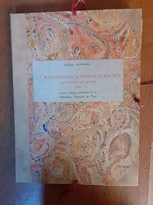
LA MAPPEMONDE DE PETRUS PLANCIUS grav�e par Josua van den Ende 1604, d apr�s l unique exemplaire de la Biblioth�que Nationale de Paris.
Published by Hanoi Soci�t� de G�ographie de Hanoi 1944, 1944
in-folio (30 x 40 cm), frontispice-50-(2) pages, 2 cartes contre-coll�es, 1 planche double (comparaison entre la carte de Petrus Plancius, 1592, et celle de Josua van den Ende, 1604), & 12 planches hors texte, en feuilles, sous chemise cartonn�e (30 x 40 cm) Publication de la Soci�t� de G�ographie de HanoiTirage limit� � 410 exemplaires Un des 260 exemplaires sur verg� ivoire, des papeteries Vidalon, d AnnonayTr�s bon �tat (complet de toutes ses illustrations).
-

Selected Contributions to the History of Cartography and Scientific Instruments
Language: English
Published by John Benjamins Pub Co, 1988
ISBN 10: 9061944856 ISBN 13: 9789061944850
Hardcover. Condition: Brand New. 01 edition. 592 pages. French language. 9.53x7.09x1.57 inches. In Stock.
-
Catalogue des Cartes Nautiques sur Velin conservees au Departement des Cartes et Plans
Published by Bibliotheque Nationale, Paris, France, 1963
Seller: Ground Zero Books, Ltd., Silver Spring, MD, U.S.A.
Seller rating 5 out of 5 stars
Hardcover. xv, 315, [1] p. Includes: index, bibliography. Annexes; Liste des Cartes, Table des Auteurs. Liste des Fac-Similes Manuscrits sur Velin. A few footnotes. Good. No dust jacket. Ex-library. Usual library markings. Rear pocket removed. Spine label removed. Cover has some wear and soiling.
-
Catalogue des cartes nautiques sur v�lin conserv�es au D�partement des Cartes et Plans
Publication Date: 1963
Seller: Librairie Alain Brieux, Paris, France
Association Member: ILAB
Seller rating 4 out of 5 stars
Couverture rigide. Condition: Bon. XV-315 pp. Paris, Biblioth�que Nationale, 1963, in-8, XV-315 pp, Broch�, couverture imprim�e, D�broch�.
-
Contrbutions selectionnees a l'Histoire de la Cartographie et des Instruments Scientifiques
Published by Hes Publishers, Utrecht A. G. Nizet, Paris, 1987
First Edition
Hardcover. Condition: Gut. Dust Jacket Condition: Leichtere Gebrauchsspuren. 1. Auflage. Selected Contributions to the History of Cartography and Scientific Instruments. Blaues Leinen/blue linnen. Spine: golden letters. 568 pages. Copy in French. Payment: Only via "abebooks/creditcard" Shippment: Due the weight of the book only as PACKAGING.
-

La mappemonde de Petrus Plancius graf� e par Josua van den Ende 1604: d'apr� s l'unique exemplaire de la Biblioth� que Nationale de Paris
Published by Hanoi : Soci� t� de G� ographie de Hanoi, 1944
Condition: Fair. Half cloth folder with book (original wrappers with mounted title, printed in black and red, 2 tipped-in b/w maps, folio) and 12 loose plates (as issued), folio (circa 40x30). From the collection of Peter van der Krogt (name and date on verso front cover folder.; Top corner folder damaged, contents very good.
-

Mappemondes. AD. 1200 1500. Catalogue prepare par la Commission des Cartes Anciennes de l'Union Geographique Internationale. A. D. Imago Mundi; A Reiew of Early Cartography. Supplement No. IV
Language: French
Published by N. Israel., Amsterdam., 1964
First Edition
Hardcover. Condition: Good. 1st Edition. Good. Ex-library; usual stamps and markings. Illustrated with 38 pages of plates from photographs. 322pp.
-
MAPPEMONDES A.D. 1200-1500: CATALOGUE PREPARE PAR LA COMMISSION DES CARTES ANCIENNES.
Language: French
Published by N Israel, Amsterdam, 1964
Hardcover. Condition: Very Good. xxxii+322pp + 37 plates. No name or writing. CLEAN!
-
Junta De Investiga�oes Do Ultramar. In-4 � une agrafe, 15pp, souple verte imprim�e �diteur - texte en langue fran�aise, Envoi de l'auteur - exemplaire qq peu jauni, couverture tach�e, qq traits au crayon � papier en marge de certains feuillets, sinon bon exemplaire de travail Coll. Agrupamento De Estudos De Cartografia Antiga XLII Sec��o de Ciombra.
-
MARCEL DESTOMBES, CONTRIBUTIONS SELECTIONNEES A L HISTOIRE DE LA CARTOGRAPHIE ET DES INSTRUMENTS SCIENTIFIQUES. SELECTED CONTRIBUTIONS TO THE HISTORY OF CARTOGRAPHY AND SCIENTIFIC INSTRUMENTS
Published by Hes Publishers, Utrecht, 1987
Seller: Oak Knoll Books, ABAA, ILAB, NEW CASTLE, DE, U.S.A.
Association Member: ABAA ILAB MBS
Seller rating 5 out of 5 stars
cloth, dust jacket. Destombes, Marcel (illustrator). 8vo. cloth, dust jacket. xxiv, 568 pages. Text in French with some English. Studies relating to the history of cartography and scientific instruments. Thirty-four articles and congress reports by Marcel Destombes are brought together in this volume. With a biography of the author, bibliography and black-and-white photographs and illustrations. Dust wrapper shows minor wear to the extremities and some rubbing to the boards. Several handwritten notations in the margins.
-
Catalogue des cartes nautiques manuscrites sur parchemin, 1300-1700. Cartes hollandaises. La cartographie de la Compagnie des Indes orientales, 1593-1743
Published by C. Ardin, Saigon, 1941
Seller: Librairie Paul Jammes, Paris, France
Association Member: ILAB
Seller rating 3 out of 5 stars
Couverture souple. Condition: Moyen. DESTOMBES (Marcel). - Catalogue des cartes nautiques manuscrites sur parchemin, 1300-1700. Cartes hollandaises. La cartographie de la Compagnie des Indes orientales, 1593-1743. - Saigon, C. Ardin, 1941. - Grand in-8 de [1] front., [4] ff., 99 pp., [5] f. dont 4 d�pliants, IV pl. h. t. - Broch� (tr�s usag�). - Edition tir�e � petit nombre (250 exemplaires) de ce dernier volet, premier et seul publi�, du Catalogue des cartes nautiques manuscrites sur parchemin. Catalogue de deux cent soixante-douze num�ros. Quatre index sur feuillets d�pliants : liste des types de cartes, index hydrographique, index g�ographique, index de localisation. (Leo Bagrow, History of cartography, Londres, 1964, n� 73, p. 291.)". - Exemplaire num�ro 1 d'�preuves de Marcel Destombes portant le visa de la commission de censure et de tr�s nombreux addenda, annotations et corrections de l'auteur. M. Destombes y avait joint plusieurs comptes rendus de son livre, ainsi qu'une lettre de R. A. Skelton, un tir� � part d'Albert Kammerer (L'h�misph�re australe en projection plaire �quidistante du portulan portugais anonyme du Vieux S�rra� d'Isamboul., Lisbonne, 1940), le Plan d'un catalogue des cartes nautiques manuscrites sur parchemin, et le prospectus de sa Mappemonde de Petrus Plancius.
-
Catalogue des Cartes Nautiques Manuscrites sur Parchemin 1300-1700. Cartes Hollandaises La Cartographie de la Compagnie des Indes Orientales 1593-1743
Published by Published by the author, Saigon, 1941
Seller: Keoghs Books, Skipton, United Kingdom
Association Member: PBFA
Seller rating 5 out of 5 stars
, 97 pages, illustrated title page, 4 black and white plates, no.35 of 250 copies, contains original flyer and a sheet of ammendments dated 1975 Limited Edition , edges rubbed, pages clean, very good condition , printed paper wraps , 29 cm x 22 cm Paperback ISBN:
-
UNE CARTE IN�DITE DE DIOGO HOMEM, CIRCA 1566.
Seller: Livraria Castro e Silva, Lisboa, Portugal
Seller rating 5 out of 5 stars
Soft Cover. Condition: Good. Separata da Revista da Universidade de Coimbra. De 19x26 cm. Com 15 pag. Brochado. Ilustrado com reprodu��es do mapa. Language: Franc�s / French Location/localizacao: I-54-B-102.
-
La Mappemonde de Petrus Plancius. Grav�e par Josua van den Ende 1604 d'apr�s l'unique exemplaire de la Biblioth�que Nationale de Paris
Publication Date: 1944
Seller: Librairie Alain Brieux, Paris, France
Association Member: ILAB
Seller rating 4 out of 5 stars
Couverture rigide. Condition: Bon. 1 page de titre et 12 ff. Publications de la Soci�t� de G�ographie de Hano�, 1944, in-folio, 1 page de titre et 12 ff, En feuilles sous couverture ocre de l'�diteur, Premi�re �dition des 12 planches en facsimil� reproduisant la mappemonde ou planisph�re grav� de 1592 de Petrus Plancius (1552-1622), d�couvert en 1903, au Colegio del Corpus Christi de Valence*. Fac-simil� de la carte conserv�e � la BnF sous la cote GE DD 2974 : "Nova Et Exacta Terrarum Orbis Tabula Geographica Ac Hydrographica / Josua Van den Ende fecit". Exemplaire sans le volume de texte publi� en 1941 (vol. in-4 de VIII-51 pp.), cachet ex-libris "JNR" � la premi�re de couverture. Bon �tat des planches, une aur�ole p�le � la page de titre. *Voir Roger Herv�, "M. Destombes, Cartes hollandaises. La cartographie de la Compagnie des Indes orientales, 1593-1743. La mappemonde de P�trus Plancius grav�e par Josua Van den Ende, 1604, d'apr�s l'unique exemplaire de la Biblioth�que Nationale de Paris." [compte-rendu] : Revue d'histoire des sciences Ann�e 1949 2-4 pp. 374-378.