Order Total (1 Item Items):
Shipping Destination:

Illustrated Folding Maps (38 results)
Skip to main search results
Search filters
Product Type
- All Product Types
- Books (38)
- Magazines & Periodicals (No further results match this refinement)
- Comics (No further results match this refinement)
- Sheet Music (No further results match this refinement)
- Art, Prints & Posters (No further results match this refinement)
- Photographs (No further results match this refinement)
- Maps (No further results match this refinement)
- Manuscripts & Paper Collectibles (No further results match this refinement)
Condition Learn more
- New (No further results match this refinement)
- As New, Fine or Near Fine (2)
- Very Good or Good (28)
- Fair or Poor (1)
- As Described (7)
Binding
Collectible Attributes
Language (3)
Free Shipping
Seller Location
Seller Rating
-

The Atlantic Pilot (Floridiana Facsimile & Reprint Ser.)
Language: English
Published by University Press of Florida, 1974, Gainesville, FL, 1974
Hardcover. Condition: As New. br. cl. New/No Jacket. Facsimile. 8vo. ISBN:0813003660. pp 107. Multiple copies.
-
Soft cover. Condition: Very Good. Pr. & Dec. Wraps. Very Good/No Jacket. 3rd Eng. Ed. 8vo. pp 71. Sl. foxing/toning.
-
A Pictorial and Descriptive Guide to Inverness, Strathpeffer, The Black Isle, The Caledonian Canal, Nairn, Forres & Elgin
Published by Ward, Lock [1913], London, 1913
Paperback. Condition: Good+. Illustrated by Illus; 3 Folding maps. (illustrator). Third Edition. Good+ in cloth over flex. boards (fold to board, frayed, worn) three fold out maps (one plan missing) 8vo 128+96pp+ads Charming pre-WWI guide to Scotland's Inverness region. Size: 8vo - over 7¾" - 9¾" tall. Book.
-
Florida Geological Survey. Bulletin No. 47. Geology and Ground-Water Resources of LeonCounty, Florida
Published by Tallahassee: Florida Geological Survey, 1964, 1964
Soft cover. Condition: Very Good. Pr. Wraps. Very Good/No Jacket. 8vo. pp 178, ind., bib., tables.
-
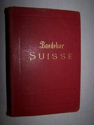
Hardcover. Condition: Very Good. Illustrated by Maps, Plans & Folding Plates (illustrator). Experience the pleasure of reading and appreciating this actual printed item. It has its own physical history that imbues it with a character lacking in ephemeral electronic renderings.; A nice copy of the French edition of the baedeker Guide for Switzerland. Plates & Maps in good condition. Verlag Karl Baedeker, founded by Karl Baedeker in 1827, is a German publisher that pioneer worldwide travel guides. Usually referred to simply as "Baedekers", these excellent guidebooks contain important introductions to various regions of the world, along with specific information about routes and travel facilities; and historical descriptions of important buildings, sights, attractions and museums. For the convenience of travellers, they contain many reliable maps and town plans all bound in a convenient pocket format.
-
Vancouver North, Coquitlam, and Pitt Lake Map-Areas, British Columbia, With Special Emphasis on the Evolution of the Plutonic Rocks (Memoir 335 of Geological Survey of Canada)
Language: English
Published by Ottawa,: Department of Mines and Technical Surveys Canada, 1965, 1965
Hardcover. Condition: Very Good. Pr., pap. wraps in Slipcase. Good/No Jacket. Royal 8vo. pp xiv 276, ind., bib., app. Very sl. gouge at fr. cover. B/W PHOTOS, DRAWINGS, 3 COLOR MAPS & FOLDING CHARTS IN POCKET NATURAL HIST ORY.
-
CHAMBERS'S ENCYCLOPAEDIA Volume IV, (G to Kidneys) A Dictionary of Universal Knowledge for the People, with maps and numerous engarvings, REVISED EDITION, unaltered and unabridged
Published by Collier, New York, 1887
Seller: Walk A Crooked Mile Books, Williamsburg, PA, U.S.A.
Seller rating 3 out of 5 stars

Hardcover. Condition: Good. Dust Jacket Condition: No Dust Jacket. illustrated entries throughout including color folding maps of German Empire, England and Wales, Scotland, Ancient Greece, India or Hudustan, Ireland, Italy and Ancient Italy (illustrator). OLD 040014 CARP Full leather, Volume 4 only of this 8 volume work. The volume is still well bound in spite of cracking along the rear spine. The leather spine cover is attached to the front board but loose from the rear board at the hinge. We have reglued to protect further damage. The black title label is chipped and portions of three letters are missing. Front board is still well attached. Boards are rubbed through along some edges. Book is big and heavy and may require extra postage.
-
CHAMBERS'S ENCYCLOPAEDIA Volume III, (Darnley to Fyzabad) A Dictionary of Universal Knowledge for the People, with maps and numerous engarvings, REVISED EDITION, unaltered and unabridged
Published by Collier, New York, 1887
Seller: Walk A Crooked Mile Books, Williamsburg, PA, U.S.A.
Seller rating 3 out of 5 stars
Hardcover. Condition: Good. Dust Jacket Condition: No Dust Jacket. illustrated entries throughout including color folding maps of Denmark and 2 maps of Europe (illustrator). OLD 040013 CARP Full leather, Volume 3 only of this 8 volume work. The volume is still well bound in spite of cracking along the front spine. The leather spine cover is attached to the back board but loose from the front board at the hinge. We have reglued to protect further damage. The black title label is chipped and portions of three letters are missing. Front board is still well attached. Boards are rubbed through along some edges. Book is big and heavy and may require extra postage.
-
CHAMBERS'S ENCYCLOPAEDIA Volume V, (Kidron to Ox-Eye) A Dictionary of Universal Knowledge for the People, with maps and numerous engarvings, REVISED EDITION, unaltered and unabridged
Published by Collier, New York, 1887
Seller: Walk A Crooked Mile Books, Williamsburg, PA, U.S.A.
Seller rating 3 out of 5 stars
Hardcover. Condition: Very Good. Dust Jacket Condition: No Dust Jacket. illustrated entries throughout including color folding maps of Holland and Belgium and New Zealand (illustrator). OLD 040003 CARP Full leather, Volume 5 only of this 8 volume work. The volume is still well bound and there is NO cracking along the front spine. The black title label is chipped but no letters are missing. Front board is still well attached. Boards are scuffed through the top layer of leather but not down to cardboard. Book is big and heavy and may require extra postage.
-
CHAMBERS'S ENCYCLOPAEDIA Volume VI, (Oxford to Ruvigado) A Dictionary of Universal Knowledge for the People, with maps and numerous engarvings, REVISED EDITION, unaltered and unabridged
Published by Collier, New York, 1887
Seller: Walk A Crooked Mile Books, Williamsburg, PA, U.S.A.
Seller rating 3 out of 5 stars
Hardcover. Condition: Good. Dust Jacket Condition: No Dust Jacket. illustrated entries throughout including color folding maps of Palestine, Prussia, Queensland, Roman Empire Ancient and Russia in Europe (illustrator). OLD 039941 CARP Full leather, Volume 6 only of this 8 volume work. The volume is still well bound in spite of cracking along the front spine. The leather spine cover is attached to the back board but loose from the front board at the hinge. We have reglued to protect further damage. The black title label is chipped and portions of three letters are missing. Front board is still well attached. Boards are rubbed through along some edges. Book is big and heavy and may require extra postage.
-
Baedeker's Belgium and Holland: A Handbook For Travelers
Published by Karl Baedeker, 1897
Seller: Sequitur Books, Boonsboro, MD, U.S.A.
Association Member: IOBA
Seller rating 5 out of 5 stars

Hardcover. Condition: Good. 7th Ed. 1897 printing. Bound in publisher's red cloth. Hardcover. Good binding and cover. Shelf wear. Light water damage to edges of front end pages (does not affect text). Founded in 1827, Baedeker guides gained popularity during the second half of the 19th century (so much so that Baedekering became part of everyday language). They were an invaluable and essential part of civilized travel in the fin-de-siecle. Baedeker guides were known for both their accuracy and attention to detail. Included in each are intricate colored fold-out maps and floor plans. Baedekers comments and recommendations open a fascinating window into the mores of a world now past.
-
Baedeker's Belgium and Holland: A Handbook For Travelers
Published by Karl Baedeker, 1910
Seller: Sequitur Books, Boonsboro, MD, U.S.A.
Association Member: IOBA
Seller rating 5 out of 5 stars
Hardcover. Condition: Good. 7th Ed. 15th Edition. 489p., maps. Bound in publishers red cloth. Good binding and cover. Shelfwear. Library markings. Founded in 1827, Baedeker guides gained popularity during the second half of the 19th century. The guides contain, among other things, maps and introductions; information about routes and travel facilities; and descriptions of noteworthy buildings, sights, attractions and museums, written by specialists.
-
A Guide to the Geology and Oil Fields of the Los Angeles and Ventura Regions
Published by Pacific Section, AAPG, 1958
Seller: Zubal-Books, Since 1961, Cleveland, OH, U.S.A.
Seller rating 5 out of 5 stars
Condition: Good. *Price HAS BEEN REDUCED by 10% until Monday, July 13 (SALE Item)* 204 pp., hardcover, ex library, else text clean and binding tight. - If you are reading this, this item is actually (physically) in our stock and ready for shipment once ordered. We are not bookjackers. Buyer is responsible for any additional duties, taxes, or fees required by recipient's country.
-
Baedeker's Belgium and Holland, including the grand-duchy of Luxembourg; handbook for travellers,
Published by Karl Baedeker, 1910
Seller: Sequitur Books, Boonsboro, MD, U.S.A.
Association Member: IOBA
Seller rating 5 out of 5 stars
Hardcover. Condition: Very Good. 7th Ed. Red cloth. 15 ed. lxxxii, 489 pages 19 maps (some folded) 45 plans (some folded) 16 cm. With 19 maps, 37 plans of towns, and 8 ground plans. Hardcover. Good binding and cover. Clean, unmarked pages. Ships daily. Founded in 1827, Baedeker guides gained popularity during the second half of the 19th century (so much so that Baedekering became part of everyday language). They were an invaluable and essential part of "civilized travel" in the fin-de-siecle. Baedeker was known for both its accuracy and attention to detail. Included in each are intricate colored fold-out maps and floor plans. Baedeker's comments and recommendations open a fascinating window into the mores of a world now past. An interesting side note: Literary references to Baedeker's abound, from E. M. Forester's A Room with a View to Mark Twain's A Tramp Abroad. T.E. Lawrence is reputed to have used Baedeker's guide to Palestine during his Doctoral work in the Levant and prompted his Allied superiors to make facsimile copies during WWI. During the Luftwaffe's Vergeltungsangriffe the guides were important enough to be reportedly cited by Gustav Braun von Stumm, that "We shall go out and bomb every building in Britain marked with three stars in the Baedeker Guide."[3] In the so-called "Baedeker Blitz" of 1942 the English cities of Exeter, Bath, Norwich, York, and Canterbury were bombed.
-

Jenkinsons Practical Guide to North Wales
Published by Edward Stanford, 1887
Seller: Lavender Fields Books PBFA, Gloucestershire, United Kingdom
Association Member: PBFA
Seller rating 5 out of 5 stars
First Edition
Hardcover. Condition: Very Good. Illustrated And with Four Maps (one Folding in Pocket in front) (illustrator). 1st Edition. All books outside UK sent airmail. All books sent tracked. Paypal accepted.Name etc on map pocket wallet and two tears on wallet. Original dark green cloth, gilt titling. A few indentations on front. All four maps are present, folding map as frontispiece and three others in pocket.
-

A Short History of Sherborne from 705 AD
Published by F Bennett, 1911
Seller: Lavender Fields Books PBFA, Gloucestershire, United Kingdom
Association Member: PBFA
Seller rating 5 out of 5 stars
Soft cover. Condition: Very Good. Illustrated and Folding Maps (illustrator). 3rd Edition. All books outside UK sent airmail. All books sent tracked. Paypal accepted. History of Dorset town. Original green cloth. End papers browned.
-
A Ride to Khiva
Published by Cassell Peter and Galpin, 1877
Seller: Lavender Fields Books PBFA, Gloucestershire, United Kingdom
Association Member: PBFA
Seller rating 5 out of 5 stars
Hardcover. Condition: Fair. Illustrated with coloured map frontispiece and with two other maps, one a large folding map of Turkistan which has a couple of tears at the folds but is ni good order otherwise (illustrator). Eleventh edition. Illustrated with maps. Pictorial covers are worn as is the spine and faded too but a scarce acceptable copy. Hinges are tender and front cover is partially detached. All books outside UK sent airmail. All books sent tracked. PayPal accepted.
-

Glympton
Published by Oxford University Press, 1923
Seller: Lavender Fields Books PBFA, Gloucestershire, United Kingdom
Association Member: PBFA
Seller rating 5 out of 5 stars
First Edition
Hardcover. Condition: Very Good. illustrated with plates fascimilies and folding maps - all present as listed (illustrator). 1st Edition. All books outside UK sent airmail and over £30 sent tracked and inside UK sent signed for. PayPal accepted. First Edition. The history of an Oxfordshire Manor. Original blue cloth, a ring mark on front cover and a little marked on end papers.
-

The Shropshire Yeomanry MDCCXCV - MCMXLV
Published by The Whitethorn Press, 1953
Seller: Lavender Fields Books PBFA, Gloucestershire, United Kingdom
Association Member: PBFA
Seller rating 5 out of 5 stars
First Edition
Hardcover. Condition: Very Good. Illustrated in Colour and black and White and with Folding Maps (illustrator). 1st Edition. All books outside UK sent airmail. All books sent tracked. PayPal accepted. With a foreword by Lt. General Sir oliver Leese Hon. Colonel of the Regiment. Original blue cloth, gilt decorated to front. Quarter bound spine with gilt titling on blue background.
-
Hardcover. Condition: Good. Illustrated By Illustrated, Folding Maps. (illustrator). Book is pre-owned, vintage - please see photos. Explore Belgium and Holland with the historical insight of Karl Baedeker's travel guide from 1910. This original edition, bound in a robust water-resistant bookbinder's cloth, promises to be a durable companion for your journey through time. Written in German, it offers authentic information and recommendations that are just as relevant for the modern traveller interested in the rich history and culture of Europe. Baedeker, renowned for his meticulous attention to detail, provides invaluable guidance on the sights and experiences that are worth mentioning in these captivating regions. Whether for academic study, personal interest, or a unique addition to your collection, this travel guide is a portal to the past, ready to be discovered by you.
-

The Turn of the Road
Published by Chatto and Windus, 1946
Seller: Lavender Fields Books PBFA, Gloucestershire, United Kingdom
Association Member: PBFA
Seller rating 5 out of 5 stars
First Edition
Condition: Near Fine. Dust Jacket Condition: Pictorial Dustwrapper. Illustrated with Folding Maps (illustrator). First Edition. All books outside UK send airmail. All dustwrappers are film protected. Story of Navy in Algeria and Morocco in the Second World War on 8th November 1942.
-
Warren's Winchester & District Directory 1912. Including 160 Neighbouring Places. With Two Folding Maps.
Language: English
Published by Simpkin & Co., London., 1912
Seller: James Hine, Ilminster, SOMER, United Kingdom
Association Member: PBFA
Seller rating 4 out of 5 stars

First Edition
Soft cover. Condition: Very Good. No Jacket. Two Folding maps and large number of illustrated adverts throughout. (illustrator). 1st Edition. First edition thus 1912. Two folding maps and with large number of illustrated adverts throughout. Paper slightly age toned and with some light foxing in places. Publishers printed orange card wrappers lightly creased at edges, spine darkened and some darkening to edges, light rubbing. Still a very good copy for such an ephemeral item. Scarce. Wonderful illustrated adverts throughout.
-

The American Gazetteer, Exhibiting A Full Account Of The Civil Divisions, Rivers, Harbours, Indian Tribes, &C. Of The American Continent, Also Of The West India And Other Appendant Islands; With A Particular Description Of Louisiana. Third Edition, Revised And Corrected. (Lacking The Rare "General Atlas Of The World"
Language: English
Published by Thomas & Andrews, Boston Ma, 1810
Seller: Arroyo Seco Books, Pasadena, Member IOBA, Pasadena, CA, U.S.A.
Association Member: IOBA
Seller rating 4 out of 5 stars
Hardcover. Condition: Good. Illustrated With 2 Folding Maps But Lacking The Separate Atlas Volume (illustrator). 3rd Edition. Third And Best Edition. Full Sheep With Red Morocco Spine Label Lettered In Git. Unpaginated, Two Column Format. Massive Alphabetical Geography Of The Western Hemisphere. Quite Worn But Intact, Morocco Spine Label Complete With Bright Gilt. Folding Maps Of North America (With Caribbean) And South America, Worn And With Tears Along Creases But Intact. Lacking The Rare Atlas Volume. Front Free Endpaper With Attached Slip Of Paper With Ownership Signatures Of Jabez Harding (1813-1897), Sturbridge Ms, Jan 25, 1836, Reverse With Signature Of Cynthia A. Harding, Sturbridge Mass.
-
With General French And The Cavalry In South Africa.
Language: English
Published by Macmillan & Co., Limited., London., 1902
Seller: James Hine, Ilminster, SOMER, United Kingdom
Association Member: PBFA
Seller rating 4 out of 5 stars
First Edition
Hardcover. Condition: Very Good. No Jacket. Profusely illustrated with folding maps throughout. 8 sketch maps in rear pocket. (illustrator). 1st Edition. First edition, 1902. Some slight foxing to tissue guard, uncut page edges and endpapers. Bound in publishers black cloth with red cloth spine. slightly faded. light rubbing to edges, else very good solid copy. Eight freehand sketches are present in the pocket at the rear of the book.
-
Bradshaw's Railway Manual, Shareholders Guide, And Official Directory For 1898, Etc., Etc. With four folding maps.
Language: English
Published by W. J. Adams & Sons., London & Manchester., 1898
Seller: James Hine, Ilminster, SOMER, United Kingdom
Association Member: PBFA
Seller rating 4 out of 5 stars
First Edition
Hardcover. Condition: Very Good. No Jacket. Illustrated adverts and four folding maps. (illustrator). 1st Edition. First edition thus, 1898. Illustrated adverts and four folding maps with adverts printed on the verso. One map slightly torn. Contents very good and clean. This copy is in the de-luxe full leather binding with gilt decorations and the name of the owner in gilt on the front cover, R. Turnbull, Esq. The burgundy leather has gilt decorated raised bands, and gilt lines and decorations to the edges. Edges rubbed and scuffed. Generally a very good solid copy. Scarce in this binding.
-
Bradshaw's Railway Manual, Shareholders Guide, And Official Directory For 1875, Etc., Etc. With Three Folding Maps.
Language: English
Published by W. J. Adams & Sons., London & Manchester., 1875
Seller: James Hine, Ilminster, SOMER, United Kingdom
Association Member: PBFA
Seller rating 4 out of 5 stars
First Edition
Hardcover. Condition: Very Good. No Jacket. Illustrated adverts and three folding maps. (illustrator). 1st Edition. First edition thus, 1875. Interesting illustrated adverts and three fine folding railway maps. One of India. Contents clean. Marbled endpapers and marbled page edges to match. Bound in publishers de-luxe full burgundy leather with gilt decorated raised bands and gilt lines to edge the boards. Spine edges and corners rubbed. Still a very good solid copy. An appendix at the end is separately numbered to 143 pages. Rare in this de-luxe binding.
-
Scott's Last Expedition. Being The Journals Of Captain R. F. Scott, R.N., C.V.O. The Reports Of The Journeys & The Scientific Work Undertaken By Dr. E. A. Wilson And The Surviving Members Of The Expedition. First Edition Of TheTwo Volume Set.
Language: English
Published by Smith Elder & Co., London., 1913
Seller: James Hine, Ilminster, SOMER, United Kingdom
Association Member: PBFA
Seller rating 4 out of 5 stars
First Edition
Hardcover. Condition: Very Good. No Jacket. Profusely illustrated throughout with photographs & maps. Two large folding maps at the end of each volume. (illustrator). 1st Edition. The scarce first edition set, 1913. Top edges gilt. Other edges uncut. Crease across middle of the cloth of the front cover, volume one ( publishers fault). Some light foxing in places. Publishers full blue ribbed cloth very lightly marked. Volume one has 633pp & volume two has 534pp. Generally a very good solid set.
-
The History, Civil and Commercial, of The British Colonies in the West Indies. THREE VOLUME SET.
Language: English
Published by John Stockdale, Piccadilly., London., 1794
Seller: James Hine, Ilminster, SOMER, United Kingdom
Association Member: PBFA
Seller rating 4 out of 5 stars
Hardcover. Condition: Very Good. No Jacket. Illustrated throughout with finely engraved folding maps and plates. (illustrator). 2nd Edition. Volume one has frontispiece and one other engraved plate + 7 full page maps & three large folding maps ( two general West indies maps + folding map of Jamaica). Volume two has frontispiece and two finely engraved plates. Complete with volume three (often not with the first two volumes as it was published in 1801) . This volume has frontispiece + two engraved plates & two maps ( one folding). This set has been fully collated and is complete, textually, with all plates & maps present. One general map has been repaired on the verso and is slightly torn ( Complete). Some foxing & thumbing in places but is generally in a very clean condition internally. Contemporary full tree calf rebacked with original titling labels laid down. The volume one label is new. Leather rubbed at edges and slightly scuffed. Generally a good solid set of this rare work in a contemporary binding. With the 18th century bookplate of John Clarke Esq., & two 19th century bookplates one of burton & the other of Rutherford Trowbridge. Volume one has 494pp, volume two 520pp + errata, volume three 443pp. No half titles present in any of the three volumes.
-
A System of Geography Popular and Schientific. Fullarton, 1841, Vol. 1 Only. Leather Binding
Published by A. Fullarton & Co., Edinburgh, 1841
Illustrated with a Folding Mountains Plate, Folding Chart of the world- Mercators Projection, a Double-page West and East Hemispheres Plus 8 Folding Maps, 4 with a Small View. (illustrator). This volume covers Europe, with the following double page maps (the first 4 with a small view: Russia in Europe; Denmark; Sweden & Norway; Germany (Southern part); Germany Norther part; Europe; Austrian Empire; & Prussia. CONDITION: Light rubbing to covers; occasional foxing. (PLEASE NOT THAT I HAVE FOR SALE VOLS: 1,2,4,5,&6). Size: 8vo.
-
A System of Geography Popular and Schientific. Fullarton, 1841, Vol. 2 Only. Leather Binding
Published by A. Fullarton & Co., Edinburgh, 1841
Illustrated with 6 Folding Maps (1 with a Small View); Plus one Plate: ROME. (illustrator). This volume covers Europe, with the following double page maps (the first 3 with a small view): Netherlands; Italy; Turkey in Europe; Switzerland; France; & Spain and Portugal. CONDITION: Light rubbing to covers; occasional foxing. (PLEASE NOT THAT I HAVE FOR SALE VOLS: 1,2,4,5,&6). Size: 8vo.