
Order Total (1 Item Items):
Shipping Destination:

Heere Elger (11 results)
Skip to main search results
Search filters
Product Type
- All Product Types
- Books (11)
- Magazines & Periodicals (No further results match this refinement)
- Comics (No further results match this refinement)
- Sheet Music (No further results match this refinement)
- Art, Prints & Posters (No further results match this refinement)
- Photographs (No further results match this refinement)
- Maps (No further results match this refinement)
- Manuscripts & Paper Collectibles (No further results match this refinement)
Condition Learn more
- New (No further results match this refinement)
- As New, Fine or Near Fine (2)
- Very Good or Good (5)
- Fair or Poor (No further results match this refinement)
- As Described (4)
Binding
Collectible Attributes
- First Edition (1)
- Signed (No further results match this refinement)
- Dust Jacket (No further results match this refinement)
- Seller-Supplied Images (9)
- Not Print on Demand (11)
Language (2)
Free Shipping
- Free Shipping to U.S.A. (No further results match this refinement)
Seller Location
Seller Rating
-

GIS voor historisch landschapsonderzoek. Opzet en gebruik van een historisch GIS voor prekadastrale kaarten. Netherlands Geographical Studies 375
Language: English
Publication Date: 2008
Seller: books4less (Versandantiquariat Petra Gros GmbH & Co. KG), Welling, Germany
Seller rating 5 out of 5 stars

Broschiert. Condition: Gut. 231 Seiten; Der Erhaltungszustand des hier angebotenen Werks ist trotz seiner Bibliotheksnutzung sehr sauber. Es befindet sich neben dem R�ckenschild lediglich ein Bibliotheksstempel im Buch; ordnungsgem�� entwidmet. In ENGLISCHER Sprache. Sprache: Englisch Gewicht in Gramm: 460.
-
Ormeling's Cartography. Presented to Ferjan Ormeling on the occasion of his 65th brithday and his retirement as Professor of Cartography. Netherlands Geographical Studies 365.
Language: English
Publication Date: 2007
Seller: books4less (Versandantiquariat Petra Gros GmbH & Co. KG), Welling, Germany
Seller rating 5 out of 5 stars
Broschiert. Condition: Gut. 212 Seiten; Der Erhaltungszustand des hier angebotenen Werks ist trotz seiner Bibliotheksnutzung sehr sauber. Es befindet sich neben dem R�ckenschild lediglich ein Bibliotheksstempel im Buch; ordnungsgem�� entwidmet. In ENGLISCHER Sprache. Sprache: Englisch Gewicht in Gramm: 420.
-

Ormeling's cartography: presented to Ferjan Ormeling on the occasion of his 65th birthday and his retirement as professor of cartography
Published by Utrecht : Universiteit Utrecht, 2007
ISBN 10: 9068094076 ISBN 13: 9789068094077
Condition: Good. Paperback, illustrations in b/w and colour; Netherlands Geographical Studies 365, ISSN 0169-4839.
-
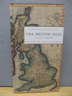
GUIDES TO DUTCH ATLAS MAPS: THE BRITISH ISLES, VOLUME 1: ENGLAND
Language: English
Published by Oak Knoll Press and HES & DE GRAAF, New Castle and Houten, 2011
ISBN 10: 9061943906 ISBN 13: 9789061943907
Seller: Oak Knoll Books, ABAA, ILAB, NEW CASTLE, DE, U.S.A.
Association Member: ABAA ILAB MBS
Seller rating 5 out of 5 stars
Hardcover. 5 x 9.5 inches. Hardcover. 256 pages. This is the first in a series of sixteen reference guides designed for the historic and antique map collector, curator, or enthusiast. Between the sixteenth and eighteenth centuries, the Netherlands had a thriving map production and publishing industry, with figures like Johannes Blaeu and Abraham Ortelius leading the Dutch cartographic industry. The maps produced in these three centuries are now rare and highly sought after by a large community of collectors, map curators, dealers of antiquities, and enthusiasts. This series will provide short, clear, and academically valid information about all Dutch atlas maps regarding a certain country or area. Counties and regions to be examined include Scandinavia, Baltic/Russia, Germany, Austria/Hungary, France, Switzerland, England, Scotland, Wales, Ireland, Spain, Portugal, Italy, Greece, Asia, Africa, and America. Each part will detail the edition of the atlas(es) in which the maps have been incorporated, the year of publication, the known states, cartographic references, and remarks by the author. This first volume offers a descriptive catalogue of all the maps of England and English counties, published in Dutch atlases between 1570 and 1650. The catalogue of maps is preceded by a guide to the descriptions and a comprehensive list of the atlases cited. The map descriptions are given in a simplified ISBD format listing map number as it appears in the Atlantis Neerlandici, area description, title, translated title (usually from Latin to English), imprint, dimensions, notes (on the map, mapped area, the atlas in which the map first appeared, or the person to whom the map is dedicated), occurrence in atlases, and references to general carto-bibliographies or literature. Each entry is accompanied by a black-and-white map illustration. The book also contains biographies of Dutch atlas publishers including Abraham Ortelius, Gerard Mercator, Hondius & Janssonius, The Blaeus, and others. Available outside North America from HES & DE GRAAF.
-

Condition: fine. 2012, Hardcover, 256 blz.
-

The British Isles. Volume 1: England (Guides to Dutch Atlas Maps I)
Language: English
Published by Houten, HES & De Graaf Publishers bv 2012, 2011
ISBN 10: 9061943906 ISBN 13: 9789061943907
Seller: Antiquariaat Schot, Hendrik-Ido-Ambacht, Netherlands
Seller rating 5 out of 5 stars
256 p. Hardcover (Very fine copy.).
-
The British Isles. Volume 1: England (Guides to Dutch Atlas Maps I)
Language: English
Published by Houten, HES & De Graaf Publishers bv. 2011, 2011
ISBN 10: 9061943906 ISBN 13: 9789061943907
Seller: Antiquariaat Schot, Hendrik-Ido-Ambacht, Netherlands
Seller rating 5 out of 5 stars
256 p. Hardcover (Very fine copy, like new. Still shrink-wrapped.).
-
Guides to Dutch Atlas Maps I - The British Isles, Vol. 1: England
Language: English
Published by Hes & De Graaf, Netherlands, 2011
ISBN 10: 9061943906 ISBN 13: 9789061943907
Seller: PsychoBabel & Skoob Books, Didcot, United Kingdom
Seller rating 5 out of 5 stars
hardcover. Condition: Very Good. Dust Jacket Condition: No Dust Jacket. Hardcover (no jacket) in very good condition. A few scores and imperfections on page block. Text is clear throughout. TS. Used.
-

Guides to Dutch Atlas Maps The Britsh Isles Volume 1; England.
Language: English
Published by Hes & de Graaf Publishers - Oak Knoll Press, 2011
ISBN 10: 9061943906 ISBN 13: 9789061943907
Seller: Emile Kerssemakers ILAB, Heerlen, Netherlands
Seller rating 5 out of 5 stars
2012, 255pp. Illustrated. Hardcover. 24,5x13,5cm. In very good condition.
-

The British Isles, Volume 1: England. Guide to Dutch Atlas Maps I.
Language: English
Published by Hes & De Graaf Publishers; Oak Knoll Press, Houten (Netherlands) and New Castle (Delaware), 2012
ISBN 10: 9061943906 ISBN 13: 9789061943907
Seller: Ken Sanders Rare Books, ABAA, Salt Lake City, UT, U.S.A.
Association Member: ABAA ILAB IOBA RMABA
Seller rating 5 out of 5 stars
First Edition
Hardcover. Condition: As new. First edition. 255pp. Octavo [24.5 cm] Pictorial paper over boards. A pocket reference guide offering a descriptive catalogue of all the maps of England, and specific parts of the country, published in Dutch atlases between 1570 and 1650. Each map found in the atlases of Ortelius, Mercator-Hondius, Janssonius, and Blaeu is recorded.
