
Order Total (1 Item Items):
Shipping Destination:

Derek Brumhead (35 results)
Skip to main search results
Search filters
Product Type
- All Product Types
- Books (26)
- Magazines & Periodicals (No further results match this refinement)
- Comics (No further results match this refinement)
- Sheet Music (No further results match this refinement)
- Art, Prints & Posters (No further results match this refinement)
- Photographs (No further results match this refinement)
- Maps (9)
- Manuscripts & Paper Collectibles (No further results match this refinement)
Condition Learn more
Binding
Collectible Attributes
- First Edition (3)
- Signed (No further results match this refinement)
- Dust Jacket (No further results match this refinement)
- Seller-Supplied Images (13)
- Not Print on Demand (35)
Language (2)
Free Shipping
- Free Shipping to U.S.A. (No further results match this refinement)
Seller Location
Seller Rating
-

REMAKING THE CITY: the impact of railways on Late-Victorian Manchester.
Published by Lancashire & Cheshire Antiquarian Society. 2004, 2004
Card Cover. 24 pages. B/W illus. Off print from Vol.100 of Transactions. Fine.
-
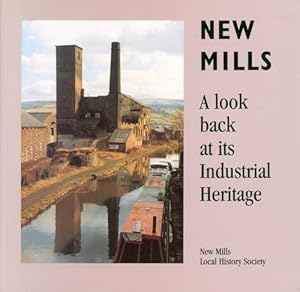
New Mills : A Look Back at its Industrial Heritage
Language: English
Published by New Mills Local History Society, New Mills, High Peak, Derbyshire, 1997
ISBN 10: 1899109013 ISBN 13: 9781899109012
Seller: The Haunted Bookshop, LLC, Iowa City, IA, U.S.A.
Seller rating 5 out of 5 stars

Paperback. Condition: Very Good. Clean and bright; no owners' marks; except for light rubbing at the corners and spine ends of the soft cover, as new. [60]pp. with black-and-white photo illustrations throughout.
-

A Walk Round All Saints
Language: English
Published by Manchester Polytechnic Publications Unit, 1980
ISBN 10: 1870355008 ISBN 13: 9781870355001
Very Good paperback, minor edgewear, clean and unmarked. 42 pp Paperback. The image on this page is of the actual book for sale.
-

White Peak
Map
Map. Condition: Brand New. facsimile of 1906 ed edition. 8.27x4.49x0.00 inches. In Stock.
-

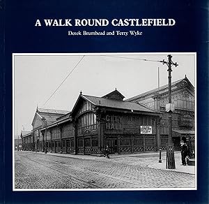
A Walk Round Castlefield
Language: English
Published by Manchester Polytechnic, 1989
ISBN 10: 1870355024 ISBN 13: 9781870355025
Paperback. Condition: Very Good. Inscribed 'with best wishes' and signed 'Derek' inside top corner of front cover. Spine not creased. 210 x 200 mm. [iv] 44 pp. Notes on the history of the Castlefield area of Manchester. B&w illustrations.
-

A Walk Round All Saints.
Language: English
Published by Manchester Polytechnic, Manchester, 1980
ISBN 10: 1870355008 ISBN 13: 9781870355001
Soft cover. Condition: Very Good. Appears to be the First Edition. Card covers, pp.iv, 42. Illustrated. Introduction to the history of a small area of Manchester, presumably in the close vicinity of Manchester Polytechnic who published this. Binding clean and sound but quite heavily foxed, particularly to cover margins. Owners name to title page. Occasional spots in text. VG.
-
Walk Round Castlefield
Language: English
Published by Manchester Polytechnic, 1989
ISBN 10: 1870355024 ISBN 13: 9781870355025
Seller: WorldofBooks, Goring-By-Sea, WS, United Kingdom
Seller rating 5 out of 5 stars
Paperback. Condition: Very Good. The book has been read, but is in excellent condition. Pages are intact and not marred by notes or highlighting. The spine remains undamaged.
-

Social Structure in Some Dark Peak Hamlets of North-West Derbyshire in The Seventeenth & Eighteenth Centuries. An original article from the Local Historian, 1998.
Published by Local Historian, Sussex, 1998
Booklet - Unbound Pages. Condition: Very Good. 14 pages, illustrated, 3 tables. An authentic standalone article, extracted from a larger volume. Not a reprint or reproduction, but an original work in its own right. Supplied without title page or cover. Size: 18 x 26 cms. Category: Local Historian; Cosmo Books : 29 years on ABE, 47 years taking care of customers. A bookseller you can rely on.
-
Moving Manchester. An original article from the Transactions of The Lancashire and Cheshire Antiquarian Society, 2004.
Published by Lancashire and Cheshire Antiquarian Society, Manchester, 2004
Booklet - Unbound Pages. Condition: Very Good. 29 pages, 6 figures. An authentic standalone article, extracted from a larger volume. Not a reprint or reproduction, but an original work in its own right. Supplied without title page or cover. Size: 13 x 17 cms. Category: Lancashire and Cheshire Antiquarian Society; Cosmo Books : 29 years on ABE, 47 years taking care of customers. A bookseller you can rely on.
-
Remaking The City: The Impact of The Railway on Late-Victorian Manchester. An original article from the Transactions of The Lancashire and Cheshire Antiquarian Society, 2004.
Published by Lancashire and Cheshire Antiquarian Society, Manchester, 2004
Booklet - Unbound Pages. Condition: Very Good. 24 pages, 4 figures. An authentic standalone article, extracted from a larger volume. Not a reprint or reproduction, but an original work in its own right. Supplied without title page or cover. Size: 13 x 17 cms. Category: Lancashire and Cheshire Antiquarian Society; Cosmo Books : 29 years on ABE, 47 years taking care of customers. A bookseller you can rely on.
-

Land Tenure in The Royal Forest of Peak in The Sixteenth and Seventeenth Centuries. An original article from the Transactions of The Lancashire and Cheshire Antiquarian Society, 2000.
Published by Lancashire and Cheshire Antiquarian Society, Manchester, 2000
Booklet - Unbound Pages. Condition: Very Good. 15 pages, 2 figures. An authentic standalone article, extracted from a larger volume. Not a reprint or reproduction, but an original work in its own right. Supplied without title page or cover. Size: 13 x 17 cms. Category: Lancashire and Cheshire Antiquarian Society; Cosmo Books : 29 years on ABE, 47 years taking care of customers. A bookseller you can rely on.
-
The Provision of Hydraulic Power in Manchester 1894-1972. An original article from the Transactions of The Lancashire and Cheshire Antiquarian Society, 2007.
Published by Lancashire and Cheshire Antiquarian Society, Manchester, 2007
Booklet - Unbound Pages. Condition: Very Good. 14 pages, 7 figures. An authentic standalone article, extracted from a larger volume. Not a reprint or reproduction, but an original work in its own right. Supplied without title page or cover. Size: 13 x 17 cms. Category: Lancashire and Cheshire Antiquarian Society; Cosmo Books : 29 years on ABE, 47 years taking care of customers. A bookseller you can rely on.
-

CUMBRIAN INDUSTRIAL ARCHAEOLOGY
Published by 1988, 1988
Seller: Gage Postal Books, Westcliff-on-Sea, United Kingdom
Association Member: PBFA
Seller rating 5 out of 5 stars
There is some fading to the spine, otherwise a near fine booklet.- Maps, 79 + 6 +[1].
-

hardcover. Condition: Acceptable. Ex-library book, usual markings. Well read copy and cover is partly detached form spine, but still very useable. Quick dispatch from UK seller.
-

A walk round Manchester statues
Seller: Richmond Books, Prestbury, CHESH, United Kingdom
Seller rating 4 out of 5 stars

Condition: As New. This book is in good clean condition without any annotations. Gives in-depth insight into this subject. All our books have been checked before listing. Dispatched promptly using recyclable strong envelopes.
-
White Peak 1906: One Inch Sheet 111 (Old O.S. Maps of England and Wales)
Seller: GENERATIONS GONE BY, Manchester, United Kingdom
Seller rating 5 out of 5 stars
Map
No Binding. Condition: New. No Jacket. Here is information about Sheet 111: One Inch Sheet 111 The White Peak 1906 - published 2002; intro by Derek Brumhead. ISBN.978-1-84151-418-5 This One Inch to the Mile map covers an area of the Peak District. "There is an astonishing degree of variety in the physical and cultural landscapes portrayed on this map", says author Derek Brumhead. The great spa town of Buxton is at the top of the map, and other towns are Leek, in the SW corner, and Bakewell, near the eastern margin. On the back we include an extract from Derbyshire Sheet 27.16, showing Hartington in 1919, complete with a directory of 'Hartington Town Quarter'. For railway historians the Ashbourne & Buxton line runs through the main map, and sections of the Buxton & High Peak and main Midland line to Buxton are also shown. It is not possible to list the many hamlets, farmsteads and other topographical features shown on these maps. However, you may find it useful if we list the towns and principal villages or church parishes that are included on this map. Links are given for those for which detailed large-scale maps are also available. Cheshire: Macclesfield Forest, Wildboarclough. Derbyshire: Aldwark, Ashford, Bakewell, Birchover, Blackwell, Brushfield, Burbage, Buxton, Chelmorton, Edensor, Elton, Fairfield, Flagg, Great Longstone, Great Rowsley, Hassop, Kingsteindale, Little Longstone, Monyash, Over Haddon, Pilsley, Rowland, Sheldon, Taddington, Winster, Wormhill, Youlgreave. Staffordshire: Alstonfield, Butterton, Hartington, Hollinsclough, Leek, Longnor, Onecote, Wetton.
-

Hayfield 1919: Derbyshire Sheet 05.16 (Old O.S. Maps of Derbyshire)
Seller: GENERATIONS GONE BY, Manchester, United Kingdom
Seller rating 5 out of 5 stars
Map
No Binding. Condition: New. No Jacket. Here are the details of maps for Hayfield: Derbyshire Sheet 5.16 Hayfield 1919 - published 1998; intro by Derek Brumhead. ISBN.978-1-84151-025-5 This detailed map covers the north Derbyshire village of Hayfield, with some rural coverage southward to Ollersett. Features include railway with station, Hayfield village, Print Works, Birch Quarry, Swallowhouse Mills, St Matthew's church, Jumble, Rockhall, Kinder Row, Bowden Bridge. On the reverse we include directories for Hayfield in 1904 and 1916, together with a timetable for the Hayfield branch in 1922. The map links up with Derbyshire sheets 5.15 Birch Vale to the west.
-

The High Peak 1906: One Inch Sheet 099 (Old Ordnance Survey Maps - Inch to the Mile)
Seller: GENERATIONS GONE BY, Manchester, United Kingdom
Seller rating 5 out of 5 stars
Map
No Binding. Condition: New. No Jacket. Here is information about Sheet 99: One Inch Sheet 99 The High Peak 1906 - published 2002; intro by Derek Brumhead. ISBN.978-1-84151-429-1 This Inch to the Mile map covers the area from Disley and New Mills eastward to Hathersage and Stanage Edge; and from Tideswell northward to the outskirts of Glossop. This is the High Peak, with Edale almost in the centre of the map. The principal towns are New Mills and Chapel en le Frith. On the reverse we include a map of Hathersage, complete with directory. It is not possible to list the many hamlets, farmsteads and other topographical features shown on these maps. However, you may find it useful if we list the towns and principal villages or church parishes that are included on this map. Links are given for those for which detailed large-scale maps are also available. Cheshire: Disley, Kettleshulme, Taxal. Derbyshire: Aston, Bamford, Birch Vale, Bradwell, Calver, Castleton, Chapel en le Frith, Charlesworth, Chisworth, Curbar, Derwent, Edale, Eyam, Fernilee, Foolow, Froggatt, Great Hucklow, Litton, Mellor, Nether Padley, New Mills, New Mills Newtown, Offerton, Peak Forest, Stony Middleton, Thornhill, Tideswell, Wardlow, Whaley Bridge.
-

New Mills (Newtown) 1899: Derbyshire Sheet 08.02 (Old O.S. Maps of Derbyshire)
Seller: GENERATIONS GONE BY, Manchester, United Kingdom
Seller rating 5 out of 5 stars
Map
No Binding. Condition: New. No Jacket. Here are the details of maps for New Mills (Newtown): Derbyshire Sheet 8.02 New Mills (Newtown) 1896 - published 1996; intro by Derek Brumhead & Roger Bryant. ISBN.978-0-85054-829-7 This detailed map covers parts of Derbyshire and Cheshire. It covers theNewtown area of New Mills, with coverage stretching from Market Street southward to Bankend, and westward to Shady Oak. Features include LNWR railway with New Mills station, Sheffield & Midland Jt Railway with station, Torn Top, Peak Forest Canal, Grove Paper Mill, Bankend, Albert Works, Warkmoor Mill, Victoria Mills, Torvale, Higher Waterside, Waterside Mill, Disley Hall (in SW corner), Knathole Wood, Torvale Mill, Rock Mills, Highlee Hall, St Mary's RC Chapel, etc.On the reverse we include a commercial directory. The map links up with Derbyshire sheets 5.14 New Mills North to the north, 8.03 Low Leighton to the east and Cheshire sheet 20.15 Higher Disley to the south.
-
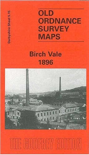
Birch Vale 1896: Derbyshire Sheet 05.15
Seller: GENERATIONS GONE BY, Manchester, United Kingdom
Seller rating 5 out of 5 stars
Map
No Binding. Condition: New. No Jacket. Here are the details of maps for Birch Vale: Derbyshire Sheet 5.15 Birch Vale 1896 - published 1998; intro by Derek Brumhead & Roger Bryant. ISBN.978-0-85054-972-0 This detailed map covers an area east of New Mills, with coverage stretching from Watford Lodge eastward to Birch Vale. Features include Print Works (Calico), Hayfield Union Workhouse, Sheffield & Midland Jt railway with Birch Vale station, Garrison Bleach Works, Pleasant View, High Hill Farm, Ravensleach Quarry, Birch Vale print works, colliery, Thornset etc. On the reverse we include a large extract of the 1919 map, showing the Birch Vale and Thornset area at a later stage, together with directory entries for Birch Vale and Thornset. The map links up with Derbyshire sheets 5.14 New Mills (N) to the west, 5.16 Hayfield to the east and 8.03 New Mills (Low Leighton) to the south.
-
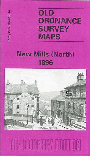
New Mills (North) 1896: Derbyshire Sheet 05.14 (Old O.S. Maps of Derbyshire)
Seller: GENERATIONS GONE BY, Manchester, United Kingdom
Seller rating 5 out of 5 stars
Map
No Binding. Condition: New. No Jacket. Here are the details of maps for New Mills (NW): Derbyshire Sheet 5.14 New Mills (North) 1896 - published 1996; intro by Derek Brumhead & Roger Bryant. ISBN.978-0-85054-858-7 This detailed map covers the North West part of New Mills, with coverage stretching from Meal Street northward to Leaver Castle and westward to Woodend Bridge. Features include Shaw Marsh, Hague Bar, Brook Bottom, Woodend Mill, Eaves Knoll, Shaw Farm, Whitle, Tanpits Farm, High Lee, Mount Pleasant Chapel, St James church, Salem Mill, Beardhough, Hidebank etc. The map links up with Derbyshire sheets 5.15 Birch Vale to the east and 8.02 New Mills Newtown to the south.
-

Furness Vale 1897: Derbyshire Sheet 8.07
Seller: GENERATIONS GONE BY, Manchester, United Kingdom
Seller rating 5 out of 5 stars
Map
No Binding. Condition: New. No Jacket. Here are the details of maps for Furness Vale: Derbyshire Sheet 8.07 Furness Vale 1897 - published 1999; intro by Derek Brumhead & George Tomlinson. ISBN.978-1-84151-084-2 This detailed map covers Furness Vale (in Cheshire) and an area of rural Derbyshire to the east, eastward to Laneside Farm, southward to Bridgemont. Features include Furness Print Works, Yeardsley Hall, Ringstone Pit, Ringstones Chemical Works, Bridgemont, Bottoms Hall, Furness Vale, LNWR railway with station, Gowhole, Midland Railway, Waterside, Lady Pit, Dolly Pit (disused), Cloughhead etc. On the reverse we include a section of the Inch to the Mile map for 1906 for the area. The map links up with Derbyshire sheets 8.03 New Mills (Low Leighton) to the north and 8.11 Whaley Bridge to the south.
-

New Mills (Low Leighton and Beard) 1896: Derbyshire Sheet 08.03 (Old O.S. Maps of Derbyshire)
Seller: GENERATIONS GONE BY, Manchester, United Kingdom
Seller rating 5 out of 5 stars
Map
No Binding. Condition: New. No Jacket. Here are the details of maps for New Mills (SE): Derbyshire Sheet 8.03 New Mills (Low Leighton & Beard) 1899 - published 1996; intro by Derek Brumhead & Ron Weston. ISBN.978-1-84151-078-1 This detailed map covers the area SE of New Mills, a largely rural area stretching from Low Leighton eastward to Piece Farm and southward to Shedyard Piece. Features on this rural map include a stretch of Midland Railway but no station, Low Leighton, Ballbeard, Beard Hall, Ollersetthall Farm, Pingot Colliery, Brownbrow Quarry, St George's church, Hollinhurst Head, Moor Lodge. Directories of Beard and Ollersett are included on the reverse. The map links up with Derbyshire sheets 5.15 Birch Vale to the north, 8.02 New Mills Newtown to the west and 8.07 Furness Vale to the south.
-

The Chelmorten Enclosure Award 1809 - Chelmorten History Notes No 1
Language: English
Published by Workers' Educational Association, New Mills, 1988
Seller: M & P BOOKS PBFA MEMBER, Buxton, Derbyshire, United Kingdom
Association Member: PBFA
Seller rating 5 out of 5 stars
Soft cover. Condition: Very Good. No Jacket. Not Known. Tight Firm Clean Copy - Edition Not Stated But Believed First - - No Signatures, Inscriptions Or Notations Discovered. Illustrated. Green Paper Soft Cover With Titles On Front - Edge Wear And Rubbing And In Read Condition.
-
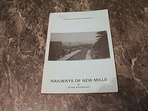
Railways Of New Mills - New Mills History Notes No. 6
Language: English
Published by New Mills Local History Society, New Mills, 1987
Seller: M & P BOOKS PBFA MEMBER, Buxton, Derbyshire, United Kingdom
Association Member: PBFA
Seller rating 5 out of 5 stars
Soft cover. Condition: Very Good. No Jacket. Second Edition. Tight Firm Clean Copy - Second Edition - No Signatures Inscriptions Or Notations Discovered. Illustrated. Pictorial Blue Soft Card Cover With Titles On Front - One Small Price Sticker Removal Mark On Front - Slight Edge Wear.
-

New Mills: A Look Back at Its Industrial Heritage
Language: English
Published by New Mills Local History Society, 1997
ISBN 10: 1899109013 ISBN 13: 9781899109012
First Edition
Soft cover. Condition: Very Good. 1st Edition. Slight sun fading to cover Spine slightly bent Knocks to corners.
-
The Enclosure Award for Chelmorton 1809 (Chelmorton History Notes No.1)
Published by WEA, 1988, 1988
Seller: Peter Bell Books, PBFA, est. 1974, Edinburgh, United Kingdom
Association Member: PBFA
Seller rating 4 out of 5 stars
39pp, 2-page map, illus., wrappers (Reduced postage here).
-
A walk round All Saints
Language: English
Published by Manchester Polytechnic, UK, 1987
ISBN 10: 1870355008 ISBN 13: 9781870355001
Seller: Aynam Book Disposals (ABD), Kendal, CUMBR, United Kingdom
Seller rating 3 out of 5 stars

First Edition
Soft Cover. Condition: Very Good. First Edition. V sl tanning at spine; neat gift inscr under front o/w no marks or inscr'ns. Size: 8vo - over 7�" - 9�" tall. Softback.
-
Stapled. Condition: Very Good Plus. Light cover wear Size: 8vo.
-
A Walk Round Castelfield
Published by Manchester Polytechnic, Manchester, Great Britain, 1989
Seller: Delph Books PBFA Member, Manchester, United Kingdom
Association Member: PBFA
Seller rating 5 out of 5 stars
First Edition
Soft cover. Condition: Very Good. 1st Edition. 1st edition. 44 pages + fold-out street plan. Very well illustrated throughout with maps, photographic plates, reproductions of old documents and drawings. Good supporting text. This is an Ex-Library book but bears very little indication of this. In original attractive pictorial blue card covers. Very Good. REDUCED POSTAGE ON THIS ITEM.


