Order Total (1 Item Items):
Shipping Destination:

Colom Arnold (4 results)
Skip to main search results
Search filters
Product Type
- All Product Types
- Books (2)
- Magazines & Periodicals (No further results match this refinement)
- Comics (No further results match this refinement)
- Sheet Music (No further results match this refinement)
- Art, Prints & Posters (No further results match this refinement)
- Photographs (No further results match this refinement)
- Maps (2)
- Manuscripts & Paper Collectibles (No further results match this refinement)
Condition Learn more
- New (No further results match this refinement)
- As New, Fine or Near Fine (No further results match this refinement)
- Very Good or Good (1)
- Fair or Poor (No further results match this refinement)
- As Described (3)
Binding
- All Bindings
- Hardcover (No further results match this refinement)
- Softcover (No further results match this refinement)
Collectible Attributes
- First Edition (No further results match this refinement)
- Signed (No further results match this refinement)
- Dust Jacket (No further results match this refinement)
- Seller-Supplied Images (2)
- Not Print on Demand (4)
Language (1)
Price
- Any Price
- Under � 20 (No further results match this refinement)
- � 20 to � 35 (No further results match this refinement)
- Over � 35
Free Shipping
Seller Location
Seller Rating
-
Zuyder deel van America
Published by Amsterdam, 1658
Seller: Clive A. Burden Ltd., Chalfont St. Giles, BUCKS, United Kingdom
Seller rating 5 out of 5 stars

Map
No binding. Condition: Very Good. IN ORIGINAL COLOUR HEIGHTENED IN GOLD. 545 x 620 mm., in early outline colour heightened in gold, small repaired tear lower left corner just into the image, otherwise and excellent thick paper example. An excellent example of the second state of Arnold Colom's sea chart of South America below the equator. An inset extends the west coast coverage northwards to include Guatemala. Longitude is not recorded the results of which make the width of the continent look out of proportion. This is particularly noticeable with the Atlantic coastline of present-day Argentina. Considering how late the mapping of the southwest coast of South America was, it is much more accurate. Tierra del Fuego is displayed although lacking a southern shoreline.The atlas is larger in format than most folio atlases of the time, so this is a nice larger chart. As might be expected it is covered in rhumb lines and contains two compass roses heightened in gold. The flourishes on the inset and title cartouche are also extensively gilded. This is one of the first and the rarest Dutch sea charts of South AmericaArnold Colom (1623/4-68) was the son of Jacob Aerstz. Colom (1600-73) from Dordrecht, a printer and publisher of maps, globes, and books. "Father and son appear to have followed separate careers at first, Arnold producing his own independent atlases. In fact, his world atlas was published before that of his father. The first Dutch sea atlas of the world was Joannes Janssonius' of 1650. However, that atlas was not particularly uniform or complete. Colom's was large in format and is one of the most important of all the Dutch sea atlases produced." (Burden).This chart appears in the two Dutch editions of the 'Zee-Atlas' along with a French one unidentified by Koeman. The atlas is undated but was issued c.1658. In quick succession the plate number lower right was altered from '10' to '13'. "Within a short time, the atlas faced competition from those of van Alphen, Doncker, van Loon, and even his father. It does not seem to have fared well, being very rare today. By 1663 he owed a considerable amount of back rent to his landlord, none other than Nicolaas Visscher. Colom gave him all eighteen of the plates for his atlas to cover this. Within five years Colom was dead." (Burden). The copper plates ended up with Hendrick Doncker who re-issued them with his own imprint.Provenance: Richard B. Arkway Inc. 1996; Juan and Peggy Rada Collection.Alegria et. al. (2007) pp. 1028-34; Buisseret (2007) pp. 1143-71; refer Burden (1996) 316; Koeman (1967) vol. 4 pp. 114-17 A.Col 2 no. 10; Martinic (1999) p. 201 no. 77; The A. E. Nordenski� ld Collection (1979) no. 53 no. 14; Phillips (1909-) nos. 464 & 3330.
-

Nova Delineatio Totius Orbis Terrarum Auctore A. Colom.
Published by Arnold Colom,
Seller: Daniel Crouch Rare Books Ltd, London, United Kingdom
Association Member: ABA ILAB PBFA
Seller rating 5 out of 5 stars
Map
"Benevole Spectator" Double-page engraved map, with fine hand-colour in full, laid down, repaired tears. Arnold Colom's version of his father, Jacob's, world map, 'Nova Totius Terrarum Orbis Geographica Ac Hydrographica Tabula. Auct. Iacobus Colom' (1650), but with a brand new border. The cartography of both maps is very similar in style and geography to Henricus Hondius's 'Nova Totius Terrarum Orbis Geographica Ac Hydrographica Tabula. Auct: Henri: Hondio' (1633, Shirley 336). However, Colom pere also borrowed from Hugo Allard's 'Nova Totius Terrarum Orbis Geographica ac Hydrographica Tabula. Auct. Hugo Allart' (c1650, Shirley 378): the discoveries of Willem Janszoon and Jan Carstensz in northern Australia are recorded, just as in Hondius's map, but Colom "improved" on Hondius by following Allard and adding a sketchy outline of Western Australia, with accounts of Dutch discoveries there, but not to the full extent of Abel Tasman's voyages of 1642-1644. Arnold's map, as here, appears in his 'Zee-Atlas' from 1654 1658, and some examples of the 'Werelts-Water-Deal' of 1663. The two hemispheres are surrounded by six "robust statuesque figures typically representing Day and Night, and the four elements; each, except for Mother Earth, proudly unclothed. There are three small cartouches, one of which repeats the title in Dutch, one is a note to the "Benevole Spectator" (kind beholder) of the map, another relates to Christopher Columbus having discovered that part of the world in 1492" (Brown). At some point, "the map came into the hands of Frederick de Wit who reduced its size by re-engraving a new title 'Nova Totius Terrarum Orbis Tabula' below the original top border" (1660 Shirley 421). De Wit also borrowed some of the elements from the border of Hugo Allard and Jacob Colom's map, with a similar sun within a zodiac circle between swags of fruit and foliage at the upper edge, but the overall effect is superior in every way to the earlier maps. The mapmaker Arnold Colom, the son of Jacob Colom, was, like his father, a bookseller, printer, and chartmaker. He would appear to have produced only two maritime atlases throughout his career: a pilot of the Mediterranean, and a sea atlas of the world. The reasons for this are unclear although with the market so dominated by the likes of Janssonius, Goos, and Doncker, his work might have struggled to secure a foot-hold. However, his 'Zee Atlas', which Colom published between 165458, was one of the largest format sea atlases produced in Amsterdam, with each chart printed from an oversized copperplate. According to Koeman it is: "One of the most important atlases in the well known category of Dutch sea-atlases". Literature: Shirley, 'The mapping of the world: early printed world maps, 1472-1700', 395; Suarez, 'Shedding the Veil', 37, plate XVII.
-
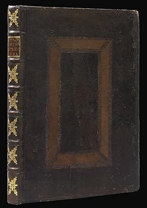
Lighting Colom of the Midland-Sea, Containing a Description of all the knowne Coast, Islands, Sands, Depthes, and Roads, begining from the narrowest, of the Streat, unto Alexandrette in the Levant.
Published by By Arnold Colom, for John Tuthill, Book-seller in Great Yarmouth, and to be sold by Severall, Bookesellers in London,, Amsterdam,, 1660
Seller: Daniel Crouch Rare Books Ltd, London, United Kingdom
Association Member: ABA ILAB PBFA
Seller rating 5 out of 5 stars
Rare English edition of Colom's Mediterranean Sea pilot Folio (420 by 375mm), engraved title, nineteen double-page engraved charts, numerous woodcut charts and coastal profiles within text, contemporary English panelled calf, rebacked. Arnold Colom, the son of Jacob Colom, was, like his father, a bookseller, printer, and chartmaker. He would appear to have produced only two maritime atlases throughout his career: a pilot of the Mediterranean, and a sea atlas of the world. The reasons for this are unclear, although, with the market so dominated by the likes of Janssonius, Goos, and Doncker, his work might have struggled to secure a foothold. Both Arnold and his father Jacob, produced pilots of the Mediterranean. However, when Arnold published his pilot in 1660 he chose not to reuse his father's copper plates, instead cutting new plates at the behest of John Tuthill, an English bookseller from Yarmouth. The contract that they signed survives, and states that Colom was to deliver 500 Strait-books unbound to John Tuthill at 45 pennies a piece; one hundred of which were to be sold by Colom. A penalty of 500 guilders was set out for both parties if the contract was breached: Tuthill for commissioning another chartseller to produce a Straitsbook; and Colom for printing more than the agreed amount. The work was to be sold for no less than six guilders for the period of the 12 year contract. A notary act of 1664 goes into some detail regarding the originality of Colom's Mediterranean pilot. Arnold states that his father, Jacob, had previously supplied Tuthill with pilots of the Mediterranean. However, when Jacob was contacted by Tuthill in 1660, he was unable to fulfil the order and referred Tuthill to his son, who agreed to cut new plates and provide a new translation of the text. Rare. Koeman records only three institutional examples of this edition: the Bodleian Library; the National Maritime Museum; and the Admiralty Library, Portsmouth. Koeman, IV, A. Col 4.
-
Osst Indien Van Cabo de Bona Esperanca tot Ceilon.
Published by Amsterdam: Arnold Colom, [ca 1654-1658]., 1658
Seller: Arader Galleries - AraderNYC, New York, NY, U.S.A.
Seller rating 5 out of 5 stars
Single sheet ( 21 x 24 4/8 inches to the neat-line, full margins showing the plate-mark). Fine engraved map shoeing the east coast of Africa, the Arabian Peninsular, India and the islands of Madagascar, the Maldives and Ceylon, all with original hand-colour in outline, the title in a fine baroque cartouche with original hand-colour in full HEIGHTENED IN GOLD, decorated with two fine compass roses and numerous rhumb lines (some minor spotting). From Colom's "Zee-atlas, ofte water-wereldt: In houdende een Korte beschryvinge van alle de bekende zee-Kusten des aardtrycks. Nieuwelijcks uyt-ghegheven" (Sea atlas of the water world: Containing a short description of all the well-known sea coasts of the earth. Newly issued). "One of the most important atlases in the well known category of Dutch sea-atlases" (Koeman). Unlike the sea atlas of his contemporary Joannes Jansson, Colom "assembled a coherent group of 15 charts, later increased to 17 plus a world map. He was also the first to publish a chart of what was called "Nieu Nederland" (Koeman). It is recorded that in 1663 Colom was a tenant of Nicolaas Visscher "He then owed a considerable amount of rent, and as his security for his debt he gave his landlord 18 copper-plates of his sea atlas, plates which he was not able to redeem before he died. Koeman IV pages 114-115.