Order Total (1 Item Items):
Shipping Destination:

Casgrain Capt (4 results)
Skip to main search results
Search filters
Product Type
- All Product Types
- Books (No further results match this refinement)
- Magazines & Periodicals (No further results match this refinement)
- Comics (No further results match this refinement)
- Sheet Music (No further results match this refinement)
- Art, Prints & Posters (No further results match this refinement)
- Photographs (No further results match this refinement)
- Maps (4)
- Manuscripts & Paper Collectibles (No further results match this refinement)
Condition Learn more
- New (No further results match this refinement)
- As New, Fine or Near Fine (No further results match this refinement)
- Very Good or Good (1)
- Fair or Poor (No further results match this refinement)
- As Described (3)
Binding
- All Bindings
- Hardcover (No further results match this refinement)
- Softcover (2)
Collectible Attributes
- First Edition (1)
- Signed (No further results match this refinement)
- Dust Jacket (No further results match this refinement)
- Seller-Supplied Images (4)
- Not Print on Demand (4)
Language (1)
Price
- Any Price
- Under £ 20 (No further results match this refinement)
- £ 20 to £ 35 (No further results match this refinement)
- Over £ 35
Free Shipping
- Free Shipping to U.S.A. (No further results match this refinement)
Seller Location
Seller Rating
-
Map of the Malmesbury District. Sheet 1 of the One Inch Series.
Published by Cape Town Intelligence Department, 1901
Seller: Quagga Books ABA ; ILAB, Cape Town, South Africa
Seller rating 5 out of 5 stars

Map
Surveyed by the Royal Engineers under the supervision of Captain Casgrain. Linen backed folding map. A detailed topographical map from the Anglo-Boer War period. Indicated are main roads and tracks, veld types, homesteads, towns and villages. From Melkbosch Strand to Ganze Kraal on the coast and Blaauwberg to Mamre inland. Condition: good. Some wear to the outer wraps and foxing, mostly to the verso. Dimensions: 61.5 x 50cm.
-
Map of the Malmesbury District. Sheet 2 of the One Inch Series.
Published by Cape Town Intelligence Department, 1901
Seller: Quagga Books ABA ; ILAB, Cape Town, South Africa
Seller rating 5 out of 5 stars
Map First Edition
Condition: Good. Surveyed by the Royal Engineers under the supervision of Captain Casgrain. Linen backed folding map. A detailed topographical map from the Anglo-Boer War period. Indicated are main roads and tracks, veld types, homesteads, towns and villages. Showing Yzerfontein on the coast. Condition: good. Some wear to the outer wraps and foxing, mostly to the verso. Dimensions: 87 x 47cm.
-
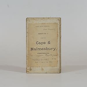
Cape & Malmesbury Districts - Folding Map
Published by Cape Town Intelligence Dept., 1901
Seller: Quagga Books ABA ; ILAB, Cape Town, South Africa
Seller rating 5 out of 5 stars
Map
Linen backed folding map produced during the Anglo-Boer War. Interesting topographical detail including farm boundaries. 60 x 49cm.
-

Map of the Cape Colony - Folding Map
Publication Date: 1901
Seller: Quagga Books ABA ; ILAB, Cape Town, South Africa
Seller rating 5 out of 5 stars
Map
Linen backed folding map of the Colony compiled during the Anglo-Boer War. 25 miles to 1 inch, Showing districts, towns, villages, railway stations, sidings and telegraph offices. 76 x 54cm. Condition: good. Some foxing to the verso. Front wrap is missing. Dimensions: 76 x 54cm.