
Order Total (1 Item Items):
Shipping Destination:

Blaeu Willem Janszoon (402 results)
Feedback
Skip to main search results
Search filters
Product Type
- All Product Types
- Books (273)
- Magazines & Periodicals (No further results match this refinement)
- Comics (No further results match this refinement)
- Sheet Music (No further results match this refinement)
- Art, Prints & Posters (50)
- Photographs (No further results match this refinement)
- Maps (79)
- Manuscripts & Paper Collectibles (No further results match this refinement)
Condition Learn more
Binding
Collectible Attributes
Language (6)
Free Shipping
Seller Location
Seller Rating
-
� 4.82
Convert currency� 8.67 shipping from Czech Republic to United KingdomQuantity: 1 available
Add to basketCondition: Fine. Leichte Risse.
More buying choices from other sellers on AbeBooks
Used offers from � 13.49
-
� 4.82
Convert currency� 8.67 shipping from Czech Republic to United KingdomQuantity: 1 available
Add to basketHardcover. Condition: Fine. Leichte Risse.
-

Deutschland vor drei Jahrhunderten : seine St�dte, Fl�sse u. W�lder. betrachtet von Willem u. Joan Blaeu [u. a.]. Mit e. Nachw. von C. Broekema
Published by G�tersloh, Berlin : Kartographisches Institut Bertelsmann, 1971
Language: German
Seller: H�bner Einzelunternehmen, Hamburg, HH, Germany
Seller rating 5 out of 5 stars

� 16.10
Convert currency� 8.68 shipping from Germany to United KingdomQuantity: 1 available
Add to basketIll.Opd. 300 S. : �berwiegend. Ill. u. Kt., , 30 cm In Fraktur. vord. einbanddeckel etw. fleckig Sprache: Deutsch Gewicht in Gramm: 1400.
-

Three World Maps by Francois van den Hoeye of 1661, Willem Janszoon (Blaeu) of 1607, Claes Janszoon Visscher of 1650
Published by Nico Israel, aMSTERDAM, 1981
ISBN 10: 9060721217 ISBN 13: 9789060721216
Language: English
� 26.83
Convert currency� 9.98 shipping from France to United KingdomQuantity: 1 available
Add to basketSoft cover. Condition: Fine. Fine paperback copy. 55 X 44 cms. 51 pages of text, 18 plates. Book.
-
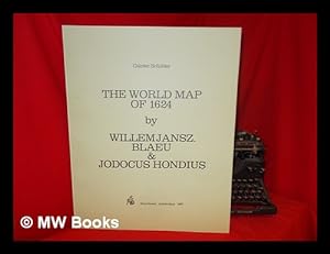
The World Map of 1624 / by Willem Jansz. Blaeu and Jodocus Hondius ; Gunter Schilder
Published by Amsterdam : N. Israel, 1977
ISBN 10: 9060721187 ISBN 13: 9789060721186
Language: English
� 44.03
Convert currencyFree shipping from U.S.A. to United KingdomQuantity: 2 available
Add to basket1st Edition in this form. Fine paperback copy. Particularly and surprisingly well-preserved; tight, bright, clean and especially sharp-cornered.; 8vo 8" - 9" tall; 0 pages; Description: 17 leaves, A-V leaves of plates : ill., maps ; 56 cm. Includes bibliographical references. Reprint of the 1624 map by W. J. Blaeu, as revised and published by J. Hondius, Amsterdam. Title of original map reads: Nova universi terrarum orbis mappa. Series: Wall-maps of the 16th and 17th centuries ; 1. Subjects: World maps --Early works to 1800 --Early maps. 3 Kg.
-
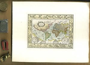
Nova Totius Terrarum Orbis Geographica Ac Hydrographica Tabula auct Guiljelmo Blaeuw. Kolerierter Nachdruck. Motivgr��e 12 x 16 cm // Blattgr��e 20 x 25 cm //. Ungerasterter Druck mit Plattenrand auf starkem B�tten. Dekorative Karte, umrahmt mit bildlichen Darstellungen der vier Elemente, sieben Weltwunder, sieben Planeten und vier Jahreszeiten.
Published by Ohne Verlag, um 1970 ???, Ohne Ort,, 1970
Art / Print / Poster
� 14.31
Convert currency� 14.85 shipping from Germany to United KingdomQuantity: 1 available
Add to basket20 x 25 cm. 1 Blatt. . ISBN: Keine. Kartoniert / Soft cover. No jacket. Kartoniert / Soft cover. 1. Auflage. Sprache: de. * Versandfertig innerhalb von 20 Stunden! Meersburg ist eine Kleinstadt im baden-w�rttembergischen Bodenseekreis. Sie liegt zwischen Friedrichshafen und �berlingen. R1B2. (Rad). Jpg.
-
Condition: New.
More buying choices from other sellers on AbeBooks
New offers from � 27.43
-
Blaeu. Der Grosse Atlas. Die Welt im 17. Jahrhundert. Einf�hrung, Texte und Auswahl der Karten von John Goss. Vorwort von Peter Clark. Hrsg. in Zusammenarbeit mit der Royal Geographical Society, London.
Published by Neff Wien (), 1990
Seller: Heilbronner Antiquariat - Michael Wahl, Heilbronn, Germany
Seller rating 5 out of 5 stars
� 26.83
Convert currency� 24.31 shipping from Germany to United KingdomQuantity: 1 available
Add to basketMit 100 farbigen Karten. 2�. 224 S. OPpbd. Schutzumschlag gering bestossen. Gutes Exemplar. *** 40 Jahre - Heilbronner Antiquariat - Michael Wahl - 1983-2023 ***.
-
Blaeu. Der Grosse Atlas. Die Welt im 17. Jahrhundert. Einf�hrung, Texte und Auswahl der Karten von John Goss. Vorwort von Peter Clark. Hrsg. in Zusammenarbeit mit der Royal Geographical Society, London.
Published by Neff Wien (), 1990
Seller: Heilbronner Antiquariat - Michael Wahl, Heilbronn, Germany
Seller rating 5 out of 5 stars
� 26.83
Convert currency� 24.31 shipping from Germany to United KingdomQuantity: 1 available
Add to basketMit 100 farbigen Karten. 2�. 224 S. OPpbd. Schutzumschlag leicht berieben. Gutes Exemplar. *** 40 Jahre - Heilbronner Antiquariat - Michael Wahl - 1983-2023 ***.
-

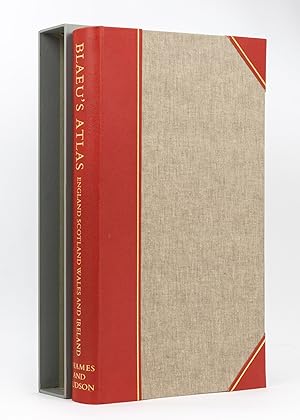
Blaeu's Atlas of England, Scotland, Wales and Ireland;
Published by Thames & Hudson, London, 1970
ISBN 10: 050024071X ISBN 13: 9780500240717
Language: English
Seller: Antipodean Books, Maps & Prints, ABAA, Garrison, NY, U.S.A.
Association Member: ABAA ANZAAB ESA ILAB
Seller rating 5 out of 5 stars
� 335.18
Convert currency� 26.44 shipping from U.S.A. to United KingdomQuantity: 1 available
Add to basketCondition: Fine in near fine slipcase. Limited edition. with an Introduction by R. V. Tooley and 115 Maps of Which 5 are coloured and Blaeu's title Pages in Colour. Elephant folio, unpaginated. Facsimile reprint of maps of John Blaeu of 1645 and 1654; a limited edition of 500 copies, of which this is number 242. Brown cloth covers, half red leather, with gilt rules, and gilt title on red spine. In a custom gray slipcase with dark brown edges; very good condition. Internally immaculate. Tooley states in the introduction, "known as the foremost mapmakers of their time, their fame was not confined to their native country of Holland, but reached into most of the cultured and leisured circles of Europe and even further, sumptuous examples of their atlases being sent as princely gifts to oriental potentates and ministers, as a symbol of the Republic of the United Netherlands.".
-
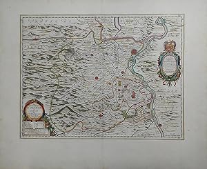
![Seller image for Namur / Nam�r / Hennegau. - Historische Kupferstichkarte. Comitatuum Hannoniae et Namurci descriptio. [Grafschaft Hennegau, frz: Hainaut in Belgien nebst angrenzender Gebiete. Wahrscheinlich aus: van der Krogt, Koeman's Atlantes Neerlandici, Vol. I.] for sale by Antiquariat Carl Wegner](https://pictures.abebooks.com/inventory/md/md14339280276.jpg)
Namur / Nam�r / Hennegau. - Historische Kupferstichkarte. Comitatuum Hannoniae et Namurci descriptio. [Grafschaft Hennegau, frz: Hainaut in Belgien nebst angrenzender Gebiete. Wahrscheinlich aus: van der Krogt, Koeman's Atlantes Neerlandici, Vol. I.]
Published by [Johannes Janssonius (Jansson). Amsterdam, 1636.], 1636
Language: Latin
Seller: Antiquariat Carl Wegner, Berlin, B, Germany
Association Member: GIAQ
Seller rating 5 out of 5 stars
First Edition
� 50.97
Convert currency� 7.81 shipping from Germany to United KingdomQuantity: 1 available
Add to basketSoftcover. Kartengr��e: 49 x 51,5 cm. Oben links einEngel die Meilenanzeige haltend, unten rechts die Titelkartusche von zwei Wappen flankiert: rechts vier L�wen unter einer Krone (das Wappen von Hennegau), rechts ein L�we unter einer Krone (das Wappen Belgiens). Im unteren Randbereich ein 2 cm langer Einriss, der bis in die Karte hineinreicht, sonst im Randbereich kleinere Fehlstellen und Einrisse. Der Kartenbereich im unteren rechten Eck nur in der Randung mit L�ngen- und Breitengraden etwas abgerieben. Weiterhin auf der Karte: Wallonien, Mons, Teile von Brabant begrenzt durch Oudenaarde, Huy und Cambrai, oben links Flandern. - Versand als Rolle zu 5.-Euro. - -- Bitte Portokosten au�erhalb EU erfragen! / Please ask for postage costs outside EU! / S ' il vous plait demander des frais de port en dehors de l ' UE! // Bitte beachten Sie auch unsere Fotos! / Please also note our photos! / Veuillez noter nos photos -- Genie�en Sie ein gutes Buch auf einer Sommerwiese oder im k�hlen Schatten bei einem erfrischenden Getr�nk. Fe2Klavier.
-
� 26.83
Convert currency� 13.02 shipping from Germany to United KingdomQuantity: 1 available
Add to basketFarbige faksimilierte Rheinkarte aus K. Stopp: Die monumentalen Rheinlaufkarten aus der Bl�tezeit der Kartographie. Wiesbaden: Kalle, (1975). - 51 x 108, einmal gefaltet 51 x 53,5. * Sehr gut erhalten. - Diese Rheinlaufkarte von W. Blaeu geh�rt zu den sch�nsten des Barocks, reich verziert durch zehn, von Putten gehaltenen Wappen derjenigen Gebiete, die der Rhein umschlie�t.
-

Blaeu's Atlas von Deutschland. Limmitierte Faksimileausgabe Nr. 366 von 500 Exemplaren.
Published by G�tersloh ; Berlin : Kartographisches Institut Bertelsmann , 1972, 1972
ISBN 10: 3570045439 ISBN 13: 9783570045435
Seller: Wissenschaftliches Antiquariat K�ln Dr. Sebastian Peters UG, K�ln, Germany
Seller rating 5 out of 5 stars
� 80.48
Convert currency� 8.68 shipping from Germany to United KingdomQuantity: 1 available
Add to basketHalbledereinband. Condition: wie neu. XXII, 97 Kt. z. T. farb., 54 cm, Halbledereinband im orig. Ganzleinenschuber. Mit einer Einleitung von R. V. Tooley und C. Broekema. Sprache: deu.
-
La Principaute d'Orange et Comtat de Venaissin Par Jacques de Chieze Orangeois.
Published by Amsterdam, 1627
Language: French
Seller: Stephen Peterson, Bookseller, Eden Prairie, MN, U.S.A.
Seller rating 5 out of 5 stars
Map
� 60.18
Convert currency� 39.94 shipping from U.S.A. to United KingdomQuantity: 1 available
Add to basketNo Binding. Condition: Very Good. 19" X 15", hand-colored map that is VG with very slight soiling, and small edge tears and edge chips in margins. Photo available upon request.
-
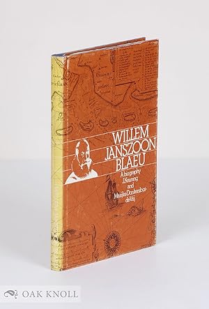
WILLEM JANSZOON BLAEU, A BIOGRAPHY AND HISTORY OF HIS WORK AS A CARTOGRAPHER
Published by Theatrum Orbis Terrarum, Amsterdam, 1973
Seller: Oak Knoll Books, ABAA, ILAB, NEW CASTLE, DE, U.S.A.
Seller rating 4 out of 5 stars

First Edition
� 68.56
Convert currency� 37.72 shipping from U.S.A. to United KingdomQuantity: 1 available
Add to basketcloth, dust jacket. Blaeu, Willem Janszoon (illustrator). 8vo. cloth, dust jacket. 164 pages. First edition. Spine of jacket faded and rubbed, else very good. Illustrated.
-
COLONIENSIS ARCHIEPISCOPATUS. Blaeuw Karte.
Published by Blaeuw um 1660. *Altkoloriertes Blatt 58x48., 1660
Seller: Antiquariat Bergische B�cherstube Mewes, Overath, Germany
Association Member: GIAQ ILAB VDA
Seller rating 5 out of 5 stars
� 51.86
Convert currency� 17.36 shipping from Germany to United KingdomQuantity: 1 available
Add to basketcm* in der Mitte gefalzt, hinterlegt, eingerrissen*. r�ckseitig bedruckt* leicht gebr�unt, abgesehen von dem restaurierungsw�rdigem Mittelfalz sch�nes Blatt*.
-

Palatinatus Bavariae. Kupferstich-Karte von Blaeu, Oberpfalz n�rdlich der Donau. Mittelpunkt: Dietldorf
Published by Excudit Guiljelmus Blaeuw 0, Amsterdam
� 88.53
Convert currency� 47.75 shipping from Germany to United KingdomQuantity: 1 available
Add to basketSoftcover. Condition: Gut. 38 x 50 cm Alle unsere Graphiken sind Originalstiche aus der angegebenen Zeit und befinden sich in gutem Zustand, soweit nicht anders beschrieben oder abgebildet Mittelfalz, tr�s bon �tat, gut erhaltenes Exemplar---"Rechts unten manieristische Titelkartusche mit Grotesken, rechts daneben Meilenzeiger, links daneben Druckvermerk "Excudit Guiljelmus Blaeuw.". Mit niederl�ndischem R�ckentext." F�r Ihre Zufriedenheit versenden wir mit DHL und ausschlie�lich mit Trackingcode f�r eine sichere Sendungsverfolgung! Weitere Angebote unter antiquariat-kastanienhof , 2 Seiten. nein.
-
Willem Janszoon Blaeu (1573 - 1638). The greatest globe maker of the Dutch Golden Age.
Seller: Antiquariaat Wim de Goeij, Kalmthout, ANTW, Belgium
Association Member: ILAB
Seller rating 5 out of 5 stars
� 33.98
Convert currency� 15.80 shipping from Belgium to United KingdomQuantity: 1 available
Add to basket2. Bergen (Noord-Holland), Rob Kattenburg, s.d. (ca. 2010 ), oblong format , in-4�, 22 x 32 cm, 16 nn pp, colour ills. stapled, original illustrated wrapper. Presentation trade catalogue for a pair of globes made by Blaeu, with an informative description.
-
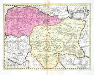
Stiria Vulgo Steyrmarck
Published by Valk, Gerard and Schenk, Peter, Amsterdam, 1700
Seller: Antikvariat Krenek, Prag, Czech Republic
Association Member: ILAB
Seller rating 5 out of 5 stars
� 178.86
Convert currency� 10.85 shipping from Czech Republic to United KingdomQuantity: 1 available
Add to basket"Stiria vulgo Steyrmarck". Altkot. Kupf.-Kte. bei P. Schenk und G. Valk, um 1700. Mit fig. und ornament. Titelkart. und andere fig. und ornament. Kart. mit "Milliaria Germanica". 37,5:49,5 cm. Decorative map of the south-eastern part of Austria with part of Slovenia and Hungary. Centered on the city of Graz.
-

Institution Astronomique de L'Usage Des Globes Et Spheres Celestes Et Terrestres (1642)
Seller: THE SAINT BOOKSTORE, Southport, United Kingdom
Seller rating 5 out of 5 stars
� 28.83
Convert currencyFree shipping within United KingdomQuantity: Over 20 available
Add to basketPaperback / softback. Condition: New. This item is printed on demand. New copy - Usually dispatched within 5-9 working days.
-
A Biography and history of his work as a cartographer and publisher. [Mit Schwarzwei��-Abbildungen im Text.].
Publication Date: 1973
Seller: Riverow Bookshop, Owego, NY, U.S.A.
Seller rating 4 out of 5 stars
� 38.09
Convert currency� 34.76 shipping from U.S.A. to United KingdomQuantity: 1 available
Add to basketCondition: --/No Dustjacket. --/No Dustjacket. 1973. Theatrum Orbis Terrarum B. V., Amsterdam, 1973. Leinengepr�¤gter Original- Pappband, XI, 164 Seiten, 8�° .
-
Blaeu's Atlas of England, Scotland, Wales and Ireland
Published by Thames and Hudson, London, 1970
Seller: Michael Treloar Booksellers ANZAAB/ILAB, Adelaide, SA, Australia
Association Member: ANZAAB ILAB
Seller rating 5 out of 5 stars
� 249.62
Convert currency� 14.79 shipping from Australia to United KingdomQuantity: 1 available
Add to basketHardcover. Condition: Fine. London, Thames and Hudson, [1970s] (facsimile edition)/ 1645 and 1654. Folio, [xvi] pages plus 115 double-page maps (5 in colour) and 2 facsimile colour title pages (all plates printed one side of each leaf only). Half morocco and cloth; tiny light mark to the leading edge; endpapers slightly discoloured by the leather turn-ins; essentially a fine copy with the lightly scuffed slipcase. Number 26 of only 500 copies; with an introduction by R.V. Tooley.
-

Territorium Norimbergense
Published by Blaeu, Joannes, Amsterdam, 1644
Seller: Antikvariat Krenek, Prag, Czech Republic
Association Member: ILAB
Seller rating 5 out of 5 stars
� 279.47
Convert currency� 10.85 shipping from Czech Republic to United KingdomQuantity: 1 available
Add to basketNuremberg. "Territorium Norimbergense". Orig. copperplate engreving, W. J. Baleu. Published by J. Blaeu in Amsterdam, ca. 1660. With decorative title cartouche, ornament. cartouche with dedication and another cart. with a view of Nuremberg (9:11,5 cm) with explanatory notes. 37:47 cm. Koeman II, map 2580:2, ed. 2:641-2 (1659-72 Spanish). - A map of the wide surroundings of Nuremberg. From the luxurious Spanish edition of Atlas Maior - colouring is hightened with gold.
-

Fossa Sanctae Mariae, quae et Eugeniana dicitur vulgo de Nieuwe Grift
Published by Blaeu, W. J., Amsterdam, 1635
Seller: Antikvariat Krenek, Prag, Czech Republic
Association Member: ILAB
Seller rating 5 out of 5 stars
� 316.73
Convert currency� 10.85 shipping from Czech Republic to United KingdomQuantity: 1 available
Add to basket"Fossa Sanctae Mariae, quae et Eugeniana dicitur vulgo de Nieuwe Grift". Altkol. Kupf.-Kte. von W. J. Blaeu, 1635. Mit 3 ausgem. fig. u. ornament. Kart., 4 farb. Wappen u. Legende 1-6. 39:51 cm. Koeman II, map 3790:2.2, ed. 2:101 (1635 Latin). - Map of the Fossa Eugeniana, a never completed canal from the Rhine near Rheinberg to the Meuse near Venlo.
-
(Facsimile) Blaeu's Atlas of England, Scotland, Wales and Ireland
Published by London: Thames and Hudson, 1970
First Edition
Hardcover. Condition: Near Fine. Dust Jacket Condition: Very Good. 1st Edition. A limited edition of 500 copies, of which this is number 113. A gorgeous facscmile of one of the Dutch master cartographers "known as the foremost mapmakers of their time, their fame was not confined to their native country of Holland, but reached into most of the cultured and leisured circles of Europe and even further, sumptuous examples of their atlases being sent as princely gifts to oriental potentates and ministers, as a symbol of the Republic of the United Netherlands.".
-
![Seller image for [Mapa de Arag�n] Arragonia Regnum for sale by Bolivar Old Prints Anticuario](https://pictures.abebooks.com/inventory/md/md32007402304.jpg)
[Mapa de Arag�n] Arragonia Regnum
Published by Amsterdam, 1643
Seller: Bolivar Old Prints Anticuario, Barcelona, B, Spain
Seller rating 4 out of 5 stars
Map
� 402.39
Convert currency� 17.36 shipping from Spain to United KingdomQuantity: 1 available
Add to basketSin Encuadernar - No binding. Condition: Bueno. Mapa de Arag�n Joao Baptista Lavanha [Laba�a], c. 1642. Muestra la imagen m�s antigua de Arag�n, dibujada con procedimientos cient�ficos de su �poca. En el siglo XVII, las autoridades ib�ricas se apresuraron a editar mapas modernos de sus reinos, pues ya no confiaban en la informaci�n de segunda mano ni estaban satisfechas con la cartograf�a peninsular de finales del siglo XVI realizada por Pedro Esquivel. Ya en 1613-1614, el cart�grafo Juan Baptista Laba�a (conocido tambien por su nombre portug�s Jo�o Baptista Lavanha), por encargo del Reino de Arag�n, hab�a terminado de cartografiar su territorio. Este mapa de Lava�a ofrece al viajero una visi�n m�s precisa de la ubicaci�n de las monta�as y r�os de Arag�n. La plancha original del mapa fue producida hacia 1620 en Madrid, y las copias posteriores se derivaron de ella. Aunque hace hincapi� en las jurisdicciones eclesi�sticas, el mapa se centra en Zaragoza y se extiende hasta Calahorra y Cuenca al oeste, Pamplona al norte y L�rida al este. Una cartela rematada por un escudo de armas encierra el t�tulo del mapa y una inscripci�n en lat�n. En una segunda cartela, rematada por un escudo de armas, figura una menci�n dedicatoria a Gaspari Charles. Hay seis escudos de armas repartidos por el mapa. Escala en una cartela en la parte superior del mapa. Grabado orignal en cobre, iluminado a mano. ------------------------------------------------------- A hand-coloured map of Aragon by Joao Baptista Lavanha [Labanna], [1642?] 17th century. The map shows the oldest image of Aragon, drawn using scientific procedures of its time. In the 17th century, the Iberian authorities raced to issue modern maps of their realms, as they no longer relied on second-hand information or were no more satisfied with the peninsula's late 16th-century mapping by Pedro Esquivel. As soon as 1613-1614, Portuguese cartographer Lavanha, commissioned by Aragon, had finished mapping their kingdom. This map from Lavanha gives the traveller a better view of the lie of the mountains and rivers in Aragon. The map's original plate was produced circa 1620 in Madrid, and subsequent copies were derived from it. While emphasizing ecclesiastical jurisdictions, the map is centered around Zaragoza, extending to Calahorra and Cuenca in the west, Pamplona in the north, and Lerida in the east. A cartouche capped by a coat of arms encloses the map's title and a Latin inscription. A dedicatory mention to Gaspari Charles is enshrined in a second cartouche topped by a coat of arms. Six coats of arms are scattered across the map. Scale in a cartouche in the upper part of the map. FRA. Excellent.
-
[Mapa de Galicia, Espa�a] Gallaecia Regnum descripta a F.Fer. Ojea Ord. Pred.
Published by Amsterdam, 1640
Seller: Bolivar Old Prints Anticuario, Barcelona, B, Spain
Seller rating 4 out of 5 stars
Map
� 429.22
Convert currency� 17.36 shipping from Spain to United KingdomQuantity: 1 available
Add to basketNo Binding. Condition: Bueno. 38 x 51 cm. Decorativo mapa del reino de Galicia de Blaeu. Se extiende desde la regi�n de Asturias de Oviedo y Avil�s en el noreste, hasta Bayona y la frontera con Portugal en el sur. Al centro, Santiago de Compostela; destaca tambi�n la Coru�a, Pontevedra, Mondo�edo, Lugo y Orense. Lleno de detalles como castillos, ciudades amuralladas, pueblos, r�os y monta�as. Contiene un cartouche decorativo con un escudo de armas sostenido por dos querubines y uno m�s que representa a Neptuno sosteniendo el t�tulo. Se pueden apreciar tambi�n dos rosas de los vientos, tres embarcaciones y un monstruo marino, muy caracter�sticos de la cartograf�a holandesa de esta �poca. Willem Janszoon Blaeu (1571-1638) fue un prominente editor y ge�grafo holand�s. Estudi� con el famoso astr�nomo dan�s Tycho Brahe y estableci� una tienda de globos, mapas e instrumentos de astronom�a en �msterdam. En su faceta como editor public� obras de intelectuales como Descartes y Hugo Grotius. En 1635 public� su famos�simo atlas Theatrum Orbis Terrarum, sive, Atlas novus. Tres a�os m�s tarde, Blaeu muri� y hered� su firma editorial a sus hijos Cornelius y Johannes, con quienes sigui� prosperando. Dutch map of Galicia, Spain. Full English description upon request.". FRA. Muy bien.
-
[Mapa de las Islas Baleares, Espa�a] Insulae Balearides et Pytiusae
Published by Amsterdam, 1640
Seller: Bolivar Old Prints Anticuario, Barcelona, B, Spain
Seller rating 4 out of 5 stars
Map
� 518.64
Convert currency� 17.36 shipping from Spain to United KingdomQuantity: 1 available
Add to basketCondition: Bueno. 38 x 50 com (grabado/engraving); 49,5 x 59 cm (hoja/sheet). Muy bello y decorativo mapa de las Islas Baleares: Mallorca, Menorca e Ibiza, con la costa de Catalu�a. Descripci�n de las islas Baleares en lat�n al verso. En la parte continental est�n identificadas las ciudades de Valencia, Tortosa, Tarragona y Barcelona. Fue incluido en el notable Atlas Novus, la obra m�s significativa de Blaeu y uno de los mejores atlas de la historia. Coloreado a mano, incluye un elegante t�tulo sobre un list�n, dos escudos de armas, dos peque�as rosas de los vientos, algunas embarcaciones y monstruos marinos, muy caracter�sticos de la cartograf�a holandesa del siglo XVII. Willem Janszoon Blaeu (1571-1638) fue un prominente editor y ge�grafo holand�s. Estudi� con el famoso astr�nomo dan�s Tycho Brahe y estableci� una tienda de globos, mapas e instrumentos de astronom�a en �msterdam. En su faceta como editor public� obras de intelectuales como Descartes y Hugo Grotius. En 1635 public� su famos�simo atlas Theatrum Orbis Terrarum, sive, Atlas novus. Tres a�os m�s tarde, Blaeu muri� y hered� su firma editorial a sus hijos Cornelius y Johannes, con quienes sigui� prosperando. Colores originales, amplios margenes.Dutch map of the Balearic Islands, Spain. Full English description upon request. Latin. Macha de oxidacion que produj� un peque�o hueco (cerca de 3 x 6 mm) en el margen superior izquerdo, lejos de la imagen. Del resto, mapa en buen estado. . 38 x 50 com (grabado/engraving); 49,5 x 59 cm (hoja/sheet).
-

Mediolanum ducatus
Published by Blaeu, W., 1635
Seller: Antikvariat Krenek, Prag, Czech Republic
Association Member: ILAB
Seller rating 5 out of 5 stars
� 521.66
Convert currency� 10.85 shipping from Czech Republic to United KingdomQuantity: 1 available
Add to basket"Mediolanum ducatus". Altkol. Kupf.-Kte. von W. Blaeu, (um 1635). Mit 2 ausgem. herald. u. ornament. Kart. 38:49 cm. The city of Milan with its environs - Lago Maggiore, Lago de Como, Lago di Garda etc.
-
![Seller image for [Mapa de Arag�n, Espa�a] Episcopatus Balbastrensis for sale by Bolivar Old Prints Anticuario](https://pictures.abebooks.com/inventory/md/md31212703599.jpg)
[Mapa de Arag�n, Espa�a] Episcopatus Balbastrensis
Published by Amsterdam, 1640
Seller: Bolivar Old Prints Anticuario, Barcelona, B, Spain
Seller rating 4 out of 5 stars
Map
� 572.29
Convert currency� 17.36 shipping from Spain to United KingdomQuantity: 1 available
Add to basketNo Binding. Condition: Bueno. 38 x 52 cm. Lindo y decorativo ejemplar de este mapa de Blaeu de Arag�n, orientado con el oeste hacia arriba y con la ciudad de Barbastro, en Huesca, al centro. Los montes Pirineos aparecen del lado derecho del mapa. Colores originales plasmados a mano y con aplicaciones de hoja de oro. Bello cartouche decorativo con peque�os putti. Willem Janszoon Blaeu (1571-1638) fue un prominente editor y ge�grafo holand�s. Estudi� con el famoso astr�nomo dan�s Tycho Brahe y estableci� una tienda de globos, mapas e instrumentos de astronom�a en �msterdam. En su faceta como editor public� obras de intelectuales como Descartes y Hugo Grotius. En 1635 public� su famos�simo atlas Theatrum Orbis Terrarum, sive, Atlas novus. Tres a�os m�s tarde, Blaeu muri� y hered� su firma editorial a sus hijos Cornelius y Johannes, con quienes sigui� prosperando. T�tulo completo: Episcopatus Balbastrensis, Ribagor�a Comit et Sobrarbe cum Adjecentibus. Dutch map of Aragon, Spain, with the Pyrenees mountains. Full English description upon request. FRA. Muy bien.


![Seller image for [Mapa de Galicia, Espa�a] Gallaecia Regnum descripta a F.Fer. Ojea Ord. Pred. for sale by Bolivar Old Prints Anticuario](https://pictures.abebooks.com/inventory/md/md31212703600.jpg)
![Seller image for [Mapa de las Islas Baleares, Espa�a] Insulae Balearides et Pytiusae for sale by Bolivar Old Prints Anticuario](https://pictures.abebooks.com/inventory/md/md32218705319.jpg)