Blaeu John (40 results)
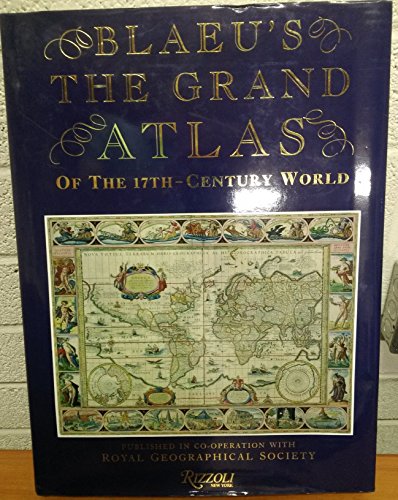
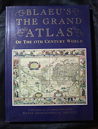
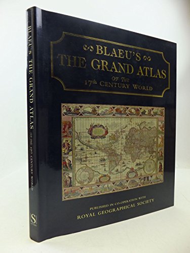
Blaeu's The Grand Atlas of the 17th-Century World
Joan Blaeu, John Goss, Royal Geographical Society (Great Britain)
- Hardcover
Seller: Sequitur Books, Boonsboro, MD, U.S.A.Sequitur Books
Contact seller5-star sellerCondition: Used - Very good
£ 23.03
£ 3.71 shippingShips within U.S.A.Quantity: 1 available
hardcover. Condition: Very Good. 224 pages : color maps ; 39 cm. Hardcover and dust jacket. Good binding and cover. Clean, unmarked pages. This is an oversized or heavy book, which requires additional postage for international delivery outside the US.
Blaeu's the Grand Atlas of the 17th Century World
Blaeu, Joan;Goss, John;Royal Geographical Society (Great Britain)
Language: English
Published by Rizzoli Intl Pubns, New York, New York, U.S.A. 1991
- Hardcover
Seller: Jay W. Nelson, Bookseller, IOBA, Austin, MN, U.S.A.Jay W. Nelson, Bookseller, IOBA
Contact seller5-star sellerCondition: Used - Near fine
£ 29.18
£ 2.05 shippingShips within U.S.A.Quantity: 1 available
Hardcover. Condition: Near Fine. Dust Jacket Condition: Near Fine.
Grand Atlas of the Seventeenth Century World
Blaeu, Joan (1596-1673). Goss, John (1947-). Royal Geographical Society (Great Britain)
- Softcover
Seller: WorldofBooks, Goring-By-Sea, WS, United KingdomWorldofBooks
Contact seller5-star sellerCondition: Used - Very good
£ 24.98
£ 5.60 shippingShips from United Kingdom to U.S.A.Quantity: 1 available
Paperback. Condition: Very Good. The book has been read, but is in excellent condition. Pages are intact and not marred by notes or highlighting. The spine remains undamaged.

Language: English
Published by Studio Editons for The Royal Geographic Society, London 1990
- Hardcover
- First Edition
Seller: Your Book Soon, Stroud, GLOS, United KingdomYour Book Soon
Contact seller5-star sellerCondition: Used - Near fine
£ 17.80
£ 18.95 shippingShips from United Kingdom to U.S.A.Quantity: 1 available
Hardcover. Condition: Near Fine. Dust Jacket Condition: Very Good. 1st Edition. 224 pp colour maps and illustrations throughout, blue cloth with gilt title to spine. Book clean and sound, a little shelf wear to dust wrapper. Over 2.6 Kg will need extra postage outside UK.
- Hardcover
Seller: Klondyke, Almere, NetherlandsKlondyke
Contact seller5-star sellerCondition: Used - Good
£ 10.75
£ 17.26 shippingShips from Netherlands to U.S.A.Quantity: 1 available
Condition: Good. Originele hardcover met goudopdruk op rug, stofomslag, veel grote afbeeldingen in kleur.
- Hardcover
Seller: Klondyke, Almere, NetherlandsKlondyke
Contact seller5-star sellerCondition: Used - Good
£ 10.75
£ 17.26 shippingShips from Netherlands to U.S.A.Quantity: 1 available
Condition: Good. Originele hardcover met goudopdruk op rug, stofomslag, veel grote afbeeldingen in kleur.

- Hardcover
Seller: Klondyke, Almere, NetherlandsKlondyke
Contact seller5-star sellerCondition: Used - Good
£ 12.22
£ 17.26 shippingShips from Netherlands to U.S.A.Quantity: 1 available
Condition: Good. Originele hardcover met goudopdruk op rug, stofomslag, veel grote afbeeldingen in kleur, groot 4to.; Voorkant stofomslag gevlekt.

- Hardcover
Seller: Klondyke, Almere, NetherlandsKlondyke
Contact seller5-star sellerCondition: Used - Good
£ 12.22
£ 17.26 shippingShips from Netherlands to U.S.A.Quantity: 1 available
Condition: Good. Originele blauwe hardcover met goudopdruk, grote kaarten in kleur, folio (circa 38x29cm). Uit de collectie van Peter van der Krogt (naamstempeltje op verso schutblad).; Klein scheurtje stofomslag geplakt.

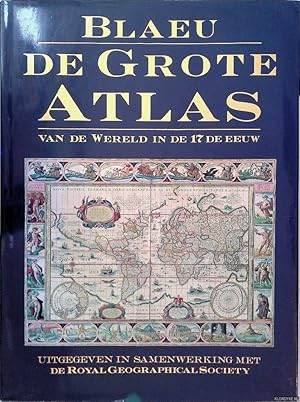
Blaeu's The grand atlas of the 17th century world / introduction, captions, and selection of maps by John Goss ; foreword by Peter Clark
Blaeu, Joan (1596-1673). Goss, John (1947-). Royal Geographical Society (Great Britain)
- Hardcover
- First Edition
Seller: MW Books, New York, NY, U.S.A.MW Books
Contact seller5-star sellerCondition: Used
£ 46.73
Free ShippingShips within U.S.A.Quantity: 2 available
First Edition. Fine cloth copy in a near fine, very slightly edge-nicked and dust-dulled dust wrapper, now mylar-sleeved. Remains particularly and surprisingly well-preserved; tight, bright, clean and sharp-cornered. Physical description; 1 atlas (224 pages) : color maps ; 37 cm. Notes; "The original maps . first appeared in Dr.… Joan Blaeu's 'Atlas major, ' published in Amsterdam in 1662"--Title page verso. "Published in cooperation with the Royal Geographical Society, London." Includes bibliographical references (page 224). Introduction and commentary in English, maps in Latin. Subjects; Blaeu, Joan (1596-1673). Atlas maior. Atlases Early works to 1800 ; Facsimiles. Civilization, Modern 17th century ; Maps. Early maps ; Facsimiles. Cartography History. History of cartography ; [Literature]. Atlases. Cartography. Civilization, Modern. Early maps. Atlases Netherlands ; Early works to 1800 ; Facsimiles. Classical geography ; Maps. Geography, Ancient ; Maps. Historical geography ; Maps. Geography, Medieval ; Maps. Atlases, Dutch. History of cartography. ; [Literature] 1990. Atlases Netherlands. Atlases Netherlands ; Early works to 1800. World maps To 1800. Atlases ; Early works to 1800. World - ; Atlases 1662 (1997). Maps. Atlases. World. Atlases 17th century. Maps 17th century. World Facsimiles 1662 Atlases. Scales differ. Genres; cartographic image. Early works. Facsimiles. History. Maps. 1 Kg.

- Hardcover
Seller: Klondyke, Almere, NetherlandsKlondyke
Contact seller5-star sellerCondition: Used - Good
£ 14.67
£ 17.26 shippingShips from Netherlands to U.S.A.Quantity: 1 available
Condition: Good. Originele blauwe hardcover met goudopdruk, grote kaarten in kleur, folio.

Published by Benedikt Taschen, Koln 2006
- Hardcover
Seller: Artis Books & Antiques, Calumet, MI, U.S.A.Artis Books & Antiques
Contact seller5-star sellerHardcover. Condition: Fine. Dust Jacket Condition: Fine Dust Jacket. 232pp. Index of maps. A full color reproduction of the copy in the Osterreichische Nationalbibliothek, Wien, with additional text. All 64 maps with original commentaries. Spectacular. Crisp & unread condition. Tall Folio Size: Tall Folio.

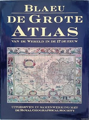
Blaeu's The grand atlas of the 17th century world / introduction, captions, and selection of maps by John Goss ; foreword by Peter Clark
Blaeu, Joan (1596-1673). Goss, John (1947-). Royal Geographical Society (Great Britain)
- Hardcover
- First Edition
Seller: MW Books Ltd., Galway, , IrelandMW Books Ltd.
Contact seller5-star sellerCondition: Used
£ 42.66
£ 12.04 shippingShips from Ireland to U.S.A.Quantity: 2 available
First Edition. Fine cloth copy in a near fine, very slightly edge-nicked and dust-dulled dust wrapper, now mylar-sleeved. Remains particularly and surprisingly well-preserved; tight, bright, clean and sharp-cornered. Physical description; 1 atlas (224 pages) : color maps ; 37 cm. Notes; "The original maps . first appeared in Dr.… Joan Blaeu's 'Atlas major, ' published in Amsterdam in 1662"--Title page verso. "Published in cooperation with the Royal Geographical Society, London." Includes bibliographical references (page 224). Introduction and commentary in English, maps in Latin. Subjects; Blaeu, Joan (1596-1673). Atlas maior. Atlases Early works to 1800 ; Facsimiles. Civilization, Modern 17th century ; Maps. Early maps ; Facsimiles. Cartography History. History of cartography ; [Literature]. Atlases. Cartography. Civilization, Modern. Early maps. Atlases Netherlands ; Early works to 1800 ; Facsimiles. Classical geography ; Maps. Geography, Ancient ; Maps. Historical geography ; Maps. Geography, Medieval ; Maps. Atlases, Dutch. History of cartography. ; [Literature] 1990. Atlases Netherlands. Atlases Netherlands ; Early works to 1800. World maps To 1800. Atlases ; Early works to 1800. World - ; Atlases 1662 (1997). Maps. Atlases. World. Atlases 17th century. Maps 17th century. World Facsimiles 1662 Atlases. Scales differ. Genres; cartographic image. Early works. Facsimiles. History. Maps. 2 Kg.

- Hardcover
Seller: Antiquariat J. Hünteler, Hamburg, , GermanyAntiquariat J. Hünteler
Contact seller5-star sellerCondition: Used - Very good
£ 22.22
£ 38.83 shippingShips from Germany to U.S.A.Quantity: 1 available
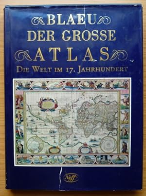
Condition: Gut. 224 Seiten, 39 cm, Mit zahlreichen farbigen Abbildungen, sauberes Exemplar. 208233_Atlanten Sprache: Englisch Gewicht in Gramm: 2560 Gr.-4°, Pappband mit Umschlag-O.

- Hardcover
Seller: Emile Kerssemakers ILAB, Heerlen, NetherlandsEmile Kerssemakers ILAB
Contact seller5-star sellerCondition: Used
£ 13.33
£ 28.48 shippingShips from Netherlands to U.S.A.Quantity: 1 available
Hardcover with dust-jacket. 224 pp., many colour illustrations/ maps; 38.5x29 cm. Text in Dutch / Nederlands. (tear in dust-jacket, previous owner's name) Otherwise very good, see picture 2560g.
Blaeu's Atlas of the 17th Century World
Joan Blaeu. Introduction by John Goss. Foreword by Peter Clark
Published by Studio / Royal Geographical Society 1997
- Hardcover
Seller: Tacoma Book Center, Tacoma, WA, U.S.A.Tacoma Book Center
Contact seller4-star sellerCondition: Used - Fine
£ 42.23
£ 4.10 shippingShips within U.S.A.Quantity: 1 available
Hardcover. Condition: Fine. Later Edition. ISBN 1858915880. Hardback. Reprint edition. Very Good to Near Fine condition book, with slight dustsoiling to top edge of book, in a Very Good to Near Fine condition dustjacket. Tight, bright, attractive copy with no markings to the book. Circular sticker over price on front jacket flap…. Oversized.
Published by Rizzoli New York 1990 1990
- Hardcover
- First Edition
Seller: Andrew Barnes Books / Military Melbourne, Melbourne, VIC, AustraliaAndrew Barnes Books / Military Melbourne
Contact seller4-star sellerCondition: Used
£ 35.63
£ 14.91 shippingShips from Australia to U.S.A.Quantity: 1 available
1st edition hardback with dust jacket Nice copy folio 224pp., colour maps, bibliog., 100 double-page coloured maps. Published in co-operation with Royal Geographical Society. Minor rubbing to dust jacket at edges o/w nice copy.
Published by London, Studio, 1997. 1997
- Hardcover
Seller: Grant's Bookshop, Cheltenham, VIC, AustraliaGrant's Bookshop
Contact seller4-star sellerCondition: Used
£ 38.69
£ 14.16 shippingShips from Australia to U.S.A.Quantity: 1 available
c.224pp. Folio. Original cloth and dustwrapper, in near fine condition. Illustrated.
- Hardcover
Seller: Antiquariaat A. Kok & Zn. B.V., Amsterdam, , NetherlandsAntiquariaat A. Kok & Zn. B.V.
Contact seller5-star sellerCondition: Used
£ 17.11
£ 24.39 shippingShips from Netherlands to U.S.A.Quantity: 1 available
[Lisse] Zuid Boekproducties, [1992]. 224 pp. Col. maps. orig. hardcover (blue cloth, gilt lettered on spine), d./j. Small folio.

- Hardcover
Seller: Mooney's bookstore, Den Helder, NetherlandsMooney's bookstore
Contact seller4-star sellerCondition: Used - Very good
£ 45.66
£ 12.90 shippingShips from Netherlands to U.S.A.Quantity: 1 available
Condition: Very good.
- Hardcover
Seller: Elops e.V. Offene Hände, Bad Windsheim, GermanyElops e.V. Offene Hände
Contact seller5-star sellerCondition: Used
£ 13.33
£ 43.14 shippingShips from Germany to U.S.A.Quantity: 1 available
Festeinband, 39 cm. 224 S.; farbige Karten Schutzumschlag mit Läsuren und Einrissen; Einband bestoßen und gering lichtrandig Sprache: Deutsch Gewicht in Gramm: 2561.

- Hardcover
Seller: Frans Melk Antiquariaat, HILVERSUM, NetherlandsFrans Melk Antiquariaat
Contact seller5-star sellerCondition: Used
£ 13.33
£ 58.68 shippingShips from Netherlands to U.S.A.Quantity: 1 available
Lisse, REBO, 1991. Folio. 37 x 29 cm. Gebonden met licht ongave stofomslag. Hardcover. Met illustraties in kleur. 224 pag. GOED EXEMPLAAR [Cartografie / Cartography ].
Published by Benedikt Taschen, Koln 2006
- Hardcover
Seller: Artis Books & Antiques, Calumet, MI, U.S.A.Artis Books & Antiques
Contact seller5-star sellerHardcover. Condition: Fine. Dust Jacket Condition: Fine Dust Jacket. 392pp. Index of maps. A full color reproduction of the copy in the Osterreichische Nationalbibliothek, Wien, with additional text. All 113 maps. Spectacular. Crisp & unread condition. In the slipcase. Tall Folio Size: Tall Folio.
Language: English
Published by Blaeu, John, Amsterdam 1648
Seller: K Books Ltd ABA ILAB, York, YORKS, United KingdomK Books Ltd ABA ILAB
Contact seller5-star sellerCondition: Used - Very good
£ 500.00
£ 19.50 shippingShips from United Kingdom to U.S.A.Quantity: 1 available
No Binding. Condition: Very Good. Beautifully engraved map, the detail derived from John Speed, showing towns, villages, wapentakes, woods, rivers etc. Very decorative, with 6 coats of arms of the Earls of Holderness in the top right. The title in an elaborate cartouche, bottom left. This printing is a reprint of Blaeu's map of…1645. Dutch text on verso, pagination 305 & 306, Register Qqqqq. Early hand colouring. Excellent condition, with fine wide margins. YAS No 97. Blaeu, John (illustrator).
Language: English
Published by Blaeu, John, Amsterdam 1648
Seller: K Books Ltd ABA ILAB, York, YORKS, United KingdomK Books Ltd ABA ILAB
Contact seller5-star sellerCondition: Used - Very good
£ 500.00
£ 19.50 shippingShips from United Kingdom to U.S.A.Quantity: 1 available
No Binding. Condition: Very Good. Published by John Blaeu in 1648 (reprint of Blaeu's map of 1645 with French text on verso). Plate size 21.5 x 17 ins, 55 x 43 cms - engraved portion 18.75 x 14.5 ins, 48 x 37 cms. A rare copy of a map of Yorkshire, probably coloured early last century. A beautifully engraved map, the detail deri…ved from that of John Speed - showing towns, villages, wapentakes, woods, rivers etc. Very decorative with 3 coats of Arms. The title in an elaborate cartouche and a scale decorated with a cherub. Excellent condition in double sided frame showing text on verso. Attractive and scarce. (Ref: Y.A.S. No. 95). Blaeu, John (illustrator).
Language: English
Published by Blaeu, John, Amsterdam 1648
Seller: K Books Ltd ABA ILAB, York, YORKS, United KingdomK Books Ltd ABA ILAB
Contact seller5-star sellerCondition: Used - Very good
£ 500.00
£ 19.50 shippingShips from United Kingdom to U.S.A.Quantity: 1 available
No Binding. Condition: Very Good. Published by John Blaeu in 1648 (reprint of Blaeu's map of 1645 with French text on verso). Plate size 24 x 20 ins, 61 x 51 cms - engraved portion 19 x 14 ins, 48 x 36 cms. A rare copy of a map of the East Riding, probably coloured early last century. A beautifully engraved map, the detail deriv…ed from that of John Speed - showing towns, villages, wapentakes, woods, rivers etc. Very decorative with Arms of the Earl of Holderness, top right, and a sailing ship in the sea - bottom left, ornamental cartouche with title. Excellent condition. With fine wide margins. Attractive and scarce. (Ref: Y.A.S No. 95). Blaeu, John (illustrator).
Published by Thames & Hudson 1970
- Hardcover
Seller: Voltaire and Rousseau Bookshop, Glasgow, , United KingdomVoltaire and Rousseau Bookshop
Contact seller2-star sellerCondition: Used - Near fine
£ 175.00
£ 25.00 shippingShips from United Kingdom to U.S.A.Quantity: 1 available
Hardcover. Condition: Near Fine. No Jacket. (Ref. II1+) Number 466 out of 500 limited copies. Grey slipcase present but taped with grey gaffa tape to seams. Otherwise reasonable condition slipcase. Book itself has a few scuffs and marks to spine hinge and around but generally very good. Some marks, light stains to foredge. Signs… of erased pencil notation to rear endpapers otherwise unmarked inside. **Heavy volume will be extra postage. Please message for details prior to ordering.**.
Published by London: Thames and Hudson, no date [1970]. 1970
- Hardcover
Seller: Cornell Books Limited, Tewkesbury, United KingdomCornell Books Limited
Contact seller5-star sellerCondition: Used - Near fine
£ 200.00
£ 14.95 shippingShips from United Kingdom to U.S.A.Quantity: 1 available
Condition: Near Fine. Facsimile of the 1645/1654 edition (hardback). Folio (53cm by 33cm), xvi, 103 double-page maps (mostly in b&w, although five are in colour), two colour plates (of Blaeu's title pages). Original two-tone cloth binding (red spine and corners, grey boards), grey card slipcase. The book is in very good conditio…n; the slipcase is good to very good (repaired partial split to one edge). Limited to 500 copies, of which this is copy number 215. ISBN 050024071X.
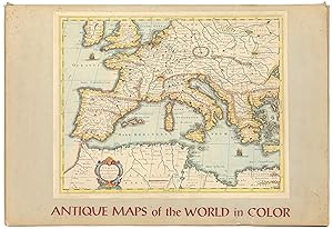
Published by Sterling Publishing House, Co., Inc, New York 1960
- First Edition
Seller: Between the Covers-Rare Books, Inc. ABAA, Gloucester City, NJ, U.S.A.Between the Covers-Rare Books, Inc. ABAA
Contact seller5-star sellerCondition: Used - Very good
£ 76.78
£ 4.10 shippingShips within U.S.A.Quantity: 1 available
Unbound. Condition: Very Good. Portfolio. Color facsimiles of 36 historical maps. Each map measures approximately 12" x 9", printed on 17" x 11½" paper with descriptive text in the left margin. Housed with a title page sheet and unprinted top sheet in a four-fold chemise. Unprinted topsheet sunned at the edges, first two leaves…with some very light toning and a couple of tiny corner creases; the maps are otherwise bright and fine. The chemise is good only with toning, wear, and soil, and a 1" creased tear on the cover panel. A nice production, and the chemise has done its job, keeping the maps bright and fresh.
Published by LIBSA -ROYALL GEOGRAPHICAL SOCIETY 1991
Seller: CALLE 59 Libros, Tarancón, CU, SpainCALLE 59 Libros
Contact seller5-star sellerCondition: Used - Near fine
£ 62.21
£ 44.87 shippingShips from Spain to U.S.A.Quantity: 1 available
Condition: ESTADO MUY BUENO. TAPA BLANDA RUSTICA EDITORIAL.
 More images
Published by 1648 1648
- Map
Seller: PROCTOR / THE ANTIQUE MAP & BOOKSHOP, DORCHESTER, United KingdomPROCTOR / THE ANTIQUE MAP & BOOKSHOP
Contact seller5-star sellerCondition: Used
£ 215.00
£ 20.00 shippingShips from United Kingdom to U.S.A.Quantity: 1 available
Large double sided map (engraved surface 19.5 x 15 inches). Gold tinted black hardwood Frame, with glass front & back. Frame Size 27 x 23.5 inches. Pleasing hand-colouring. An attractive and decorative map with elaborate title-cartouche and coats of arms. There is very light publishers centrefold. Strong impression. Overall in v…ery good condition. Mount a little tanned, and in a wide black Hogarth frame, has some chipping. With DUTCH text on verso. One of the largest and most prolific map publishing houses of the 17th. century. The decorative merit and cartographic excellence of their maps are without doubt.


