
Baudin Thomas (5 results)

- Softcover
Seller: Gallix, Gif sur Yvette, FranceGallix
Contact seller4-star sellerCondition: New
£ 28.98
£ 14.67 shippingShips from France to U.S.A.Quantity: 1 available
Condition: Neuf.
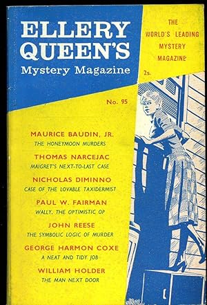
Ellery Queen's Mystery Magazine [British Edition] No. 95 December 1960.
Maurice Baudin, Thomas Narcejac, Nicholas Diminno [Contribute to:] Edited by Ellery Queen
Published by Published by Mellifont Press Ltd., Furnival Street, London December . 1960., 1960
- Softcover
Seller: Little Stour Books PBFA Member, Canterbury, United KingdomLittle Stour Books PBFA Member
Contact seller5-star sellerAssociation member: PBFA
Condition: Used - Very good
£ 12.50
£ 30.00 shippingShips from United Kingdom to U.S.A.Quantity: 1 available
Condition: Very Good. Publisher's original colour illustrated paper card wrap covers. 8vo. 7½'' x 5½''. Slight tanning to the page margins, small rubs to the spine tips and in Very Good clean and sound condition. We currently hold 83 other Ellery Queen Mystery Magazine titles in stock. Member of the P.B.F.A. DETECTIVE | CRIME FI…CTION.

Plan de la ville de Sydney: capitale des colonies anglaises aux terres australes leve par Mr Lesueur et assujetti aux relevemens de Mr Boullanger, 9bre 1802.
BAUDIN, Nicolas Thomas; Louis Claude de Saulces de FREYCINET; Charles-Alexandre LESUEUR; and Jean Baptiste Antoine CLOQUET
Published by de l'Imprimerie de Langlois,
- Map
Seller: Daniel Crouch Rare Books Ltd, London, United KingdomDaniel Crouch Rare Books Ltd
Contact seller4-star sellerCondition: Used
£ 1,200.00
£ 20.00 shippingShips from United Kingdom to U.S.A.Quantity: 1 available
An early bird's-eye view of Sydney First issue. Engraved map. Plate II from 'Voyage de decouvertes aux terres australes. Atlas Francois Peron' (1807), the official account of the Baudin expedition to Australia. An attractive bird's-eye view of Sydney which includes an extensive key to 38 locations. Nicolas Baudin's exploration o…f Sydney and the surrounding area was not part of his original commission. However, the expedition's extended sojourn at Port Jackson began in May of 1801, where he replaced his ship, the 'Naturaliste', with the 'Casuarina', and then sent a number of his crew back to France. The 'Géographe' arrived in Port Jackson in mid-1802, and then the whole expedition departed northwards in November of 1802. The Baudin Expedition In 1800, Napoleon Bonaparte commissioned captain Nicolas Thomas Baudin (17541803) to complete the discovery of "Terra Australis". He duly set fort with two ships, 'Le Geographie' and 'Le Naturaliste' in order to find a strait which supposedly divided the Australian island in two halves. The French zoologist François Auguste Péron (17751810), who had studied under the anatomist George Cuvier in Paris, was the naturalist of the expedition, and Louis Claude de Saulses de Freycinet (17791842) served as cartographer. Meanwhile, Matthew Flinders was also attempting a circumnavigation of the Australian Continent, and the explorers met each other in the consequently named "Encounter Bay". Although Flinders completed the task before Baudin's expedition, he had the misfortune to be captured and imprisoned for six years at Mauritius on his voyage home, and his charts and manuscripts also held hostage. This allowed the French explorers to print their account of the new discoveries before Flinders, and to produce the first complete chart of the Australian continent in 1807. When Baudin died during the voyage in 1803, Freycinet took over command, much to the relief of all, and brought the expedition back to France. On the return of the expedition, Péron was charged with producing the narrative for publication. However, he died in 1810 before the second volume had been finished, with the result that the work had to be completed by Freycinet.

Carte Generale de la Terre Napoleon (a la Nouvelle Hollande) redigee d'apres les travaux executes bord de la corvette le Geographe et de la Goelette le Casuarina par M. L. Freycinet, an 1808.
BAUDIN, Nicolas Thomas; Louis Claude de Saulces de FREYCINET; and Charles-Alexandre LESUEUR
Published by Depot de la Marine,
- Map
Seller: Daniel Crouch Rare Books Ltd, London, United KingdomDaniel Crouch Rare Books Ltd
Contact seller4-star sellerCondition: Used
£ 3,000.00
£ 20.00 shippingShips from United Kingdom to U.S.A.Quantity: 1 available
Separate issue Later issue. Double-page engraved chart. A very fine example, of this separately issued chart of the south Australian coastline from Cape Adieu to Wilsons Promontory, showing Baudin's discoveries in 'Le Geographe' and 'Le Casuarina'. Decorated with two lovely cartouches designed by Charles-Alexandre Lesueur, depic…ting kangaroos, emus, parrots, and local flora. With "HydFr. No. 636" upper right, and "Prix 1F-50c" lower right. The chart is one of the earliest of the coastline around Adelaide, "B. Dugueselin", "C. Sully" and "C. Mondovi", and includes the complete coastline of Kangaroo Island, "Ile Decres", which had only charted partially by Flinders a bit before. It extends eastwards to Portland, "Sealers Cove", and Cape Nelson State Park, "Promontorie de Wilson", and westward to the area of Nullarbor National Park. The map was first included in 'Voyage de decouvertes aux terres australes.', 'Atlas Historique' (1811), with "No 2" in the top right corner, it then appeared in the second 'Atlas Navigation et Geographie' (1812) with "No 10" upper right. However, this example was not included in either atlas, but was sold separately. It has the "No 10", upper right, but also "HydFr. No. 636", and "Prix 1F-50c" lower right. "It appears that, in 1832, prices were increased from F1.50 to F2" (Brown), and so, as the next previous catalogue was issued in 1822 by Jean-Andre Dezauche, it can be assumed that this examples dates from then, at the earliest. The Baudin Expedition In 1800, Napoleon Bonaparte commissioned captain Nicolas Thomas Baudin (17541803) to complete the discovery of "Terra Australis". He duly set fort with two ships, 'Le Geographie' and 'Le Naturaliste' in order to find a strait which supposedly divided the Australian island in two halves. The French zoologist François Auguste Péron (17751810), who had studied under the anatomist George Cuvier in Paris, was the naturalist of the expedition, and Louis Claude de Saulses de Freycinet (17791842) served as cartographer. Meanwhile, Matthew Flinders was also attempting a circumnavigation of the Australian Continent, and the explorers met each other in the consequently named "Encounter Bay". Although Flinders completed the task before Baudin's expedition, he had the misfortune to be captured and imprisoned for six years at Mauritius on his voyage home, and his charts and manuscripts also held hostage. This allowed the French explorers to print their account of the new discoveries before Flinders, and to produce the first complete chart of the Australian continent in 1807. When Baudin died during the voyage in 1803, Freycinet took over command, much to the relief of all, and brought the expedition back to France. On the return of the expedition, Péron was charged with producing the narrative for publication. However, he died in 1810 before the second volume had been finished, with the result that the work had to be completed by Freycinet. Literature: Hill, 'The Hill Collection of Pacific Voyages', 80; Tooley, 'The Mapping of Australia', 633.
Plan de la ville de Sydney: (Capitale des colonies Anglaises aux Terres Australes) leve par Mr. Lesueur & assujetti aux relevemens de Mr. Boullanger (Novembre, 1802).
BAUDIN, Nicolas Thomas; Louis Claude de Saulces de FREYCINET; and Charles-Alexandre LESUEUR
Published by Publie par Decret Imperial sous le Ministere de son excellence le vice-amiral comte Decres,
- Map
Seller: Daniel Crouch Rare Books Ltd, London, United KingdomDaniel Crouch Rare Books Ltd
Contact seller4-star sellerCondition: Used
£ 1,500.00
£ 20.00 shippingShips from United Kingdom to U.S.A.Quantity: 1 available
One of the earliest maps of Sydney First issue. Engraved map, close trimmed, restored. Plate 30 from 'Voyage de decouvertes aux Terres Australes. : partie Navigation et Geographie. Atlas par Louis Freycinet' (1812), the official account of the Baudin expedition to Australia. The map gives a detailed plan of layout of Sydney with… a key to 34 locations, from Sydney Cove to the "Village de Brick-field", and from Darling Harbour to "Palmer's Cove". Nicolas Baudin's exploration of Sydney and the surrounding area was not part of his original commission. However, the expedition's extended sojourn at Port Jackson began in May of 1801, where he replaced his ship, the 'Naturaliste', with the 'Casuarina', and then sent a number of his crew back to France. The 'Géographe' arrived in Port Jackson in mid-1802, and then the whole expedition departed northwards in November of 1802. The Baudin Expedition In 1800, Napoleon Bonaparte commissioned captain Nicolas Thomas Baudin (17541803) to complete the discovery of "Terra Australis". He duly set fort with two ships, 'Le Geographie' and 'Le Naturaliste' in order to find a strait which supposedly divided the Australian island in two halves. The French zoologist François Auguste Péron (17751810), who had studied under the anatomist George Cuvier in Paris, was the naturalist of the expedition, and Louis Claude de Saulses de Freycinet (17791842) served as cartographer. Meanwhile, Matthew Flinders was also attempting a circumnavigation of the Australian Continent, and the explorers met each other in the consequently named "Encounter Bay". Although Flinders completed the task before Baudin's expedition, he had the misfortune to be captured and imprisoned for six years at Mauritius on his voyage home, and his charts and manuscripts also held hostage. This allowed the French explorers to print their account of the new discoveries before Flinders, and to produce the first complete chart of the Australian continent in 1807. When Baudin died during the voyage in 1803, Freycinet took over command, much to the relief of all, and brought the expedition back to France. On the return of the expedition, Péron was charged with producing the narrative for publication. However, he died in 1810 before the second volume had been finished, with the result that the work had to be completed by Freycinet. Literature: Tooley, 'The Mapping of Australia', 653.


