About this Item
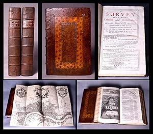
First Strype Edition, best and most desirable edition of Stow's magisterial studyâ "the "starting point of all inquiry into the subject of Elizabethan London." Complete in two folio volumes; each of the six 'books,' introduced by a drop-head title, with its own pagination: [4], xii, xlii, [2], 308, 208, 285, [1]; [2], 120, 459, [1], 93, [3], 143, [1], 26, [2]pp, with 70 plates, plans and maps (31 double-page or folding), including those of London, Westminster and Southwark. Title pages in red and black. Superbly bound in handsome contemporary paneled calf sewn on six raised bands, very skillfully rebacked with the original lettering pieces laid down. A crisp, clean, fresh copy, with only occasional minor soiling, the copper-engraved plates in deep, rich impressions. Provenance: On the verso of the title pages, the engraved armorial bookplate of Jacob Bouverie, 1st Viscount Folkestone (bapt. 14 October 1694 - 17 February 1761), English Politician and first elected president of the Royal Society for the encouragement of Arts, Manufactures & Commerce, whose members included Benjamin Franklin, Karl Marx, Adam Smith, William Hogarth and Charles Dickens. Maslen & Lancaster. Bowyer ledgers, 584. Lowndes V, 2526. Gibson's Library, p. 258. ESTC Citation No. T48975. This edition of Stow's Survey was the first to contain a series of ward maps: "Many of these maps are excellent. Their clarity and accuracy fulfill the requirements of the student of London history" (Hyde). Fifth and Best Edition.Titlepage in red and black. Each of the 6 'books' has its own pagination, and is introduced by a drop-head title. Adams London Illustrated 25; Lowndes III, 2526; Upcott II, pp, 605-617; Darlington and Howgego 16, 8 (London maps). "Fifth and grandest edition. John Strype was already collecting materials for the text by 1703, and an ambitious reprint 'with very great Additions throughout, and illustrated with about 100 large Copper Cutts . requiring much Time and Great expence' was advertised as early as 1708. The advertisement was on the title verso of Hatton's New View of London, a smaller and cheaper book whose popularity actually caused the postponement of Strype's more monumental work. His two folio volumes cost six guineas and the print run was probably at least 500 copies. He included what he believed to be Stow's entire original text, which had become conflated with the 1618 and 1633 editions of Anthony Munday, clearly identifying his own additions in the margins. John Kip, who had been responsible for the views of London buildings in volume I of Mortier's Nouveau theatre de la Grande Bertagne (1707), is credited with about half the 28 engraved views of 'eminent places'. In addition there are two folding general maps of London, one showing the city as it was in Queen Elizabeth's time, 17 ward maps (bks. II-III) and 20 parish maps (bks. IV and VI). The only map to be signed is the Parish of St. Mary Rotherhithe revised by John Pullen and engraved by John Harris. (2)" Christies. John Stow's Survey of London, first published in 1598, brims with amusing descriptions and anecdotes as well as highly detailed accounts of the buildings, social conditions and customs of the time, based on a wide range of classical and medieval historical literature, public and civic records, and Stow's own intimate knowledge of the city where he spent his life. "The reader of A Survey travels with Stow through each of the city's wards and the adjoining city of Westminster, learns about the wall, bridges, gates, and parish churches . . . [Stow] also records the negative aspects of urban growth, in the shape of unsightly sprawl, filth, the destruction of ancient monuments, and above all poverty. His book approaches the thoroughness of an encyclopaedia . . . It is noteworthy that while Camden's Britannia was written in Latin for the educated élite, Stow's Survey was composed in the language of his fellow countrymen." This edition, of 1720, greatly expanded with interpolat. Seller Inventory # BB0673
Contact seller
Report this item
![]()


