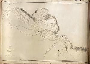
Wangari Harbour. New Zealand, North Island.1849
Admiralty Hydrographic Office
From Anah Dunsheath RareBooks ABA ANZAAB ILAB, Auckland, NZ, New Zealand
Seller rating 5 out of 5 stars
AbeBooks Seller since 3 May 2010
From Anah Dunsheath RareBooks ABA ANZAAB ILAB, Auckland, NZ, New Zealand
Seller rating 5 out of 5 stars
AbeBooks Seller since 3 May 2010
About this Item
Original survey map of Whangarei (Wangari) Harbour. The map shows soundings and coastal features from Bream Head west to Limestone Island, based on the survey of Capt. Stokes on the Acheron, in 1849. Heavy card with mostly minor tears on edges, all outside the margins of the map. Small hole within image easily repairable.106 x 66 cm. Rare item showing the survey soundings and geographic features of Whangarei Harbour and its bays and inlets. Seller Inventory # 019614
Bibliographic Details
Title: Wangari Harbour. New Zealand, North Island...
Publisher: Admiraty Charts, Hydrographic Office, London
Publication Date: 1851
Binding: No Binding
Condition: Very Good
Store Description
We guarantee the condition of every book as it's described on the Abebooks web sites. If you're dissatisfied with your purchase (Incorrect Book/Not as Described/Damaged) or if the order hasn't arrived, you're eligible for a refund within 30 days of the estimated delivery date. If you've changed your mind about a book that you've ordered, please use the Ask bookseller a question link to contact us and we'll respond within 2 business days.
Anah Dunsheath Rare Books
6 High St
PO Box 4181
Auckland 1...
Shipping costs based on average book weight of 1kg.
Payment Methods
accepted by seller