
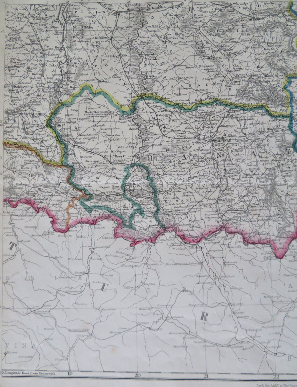


Transylvania & Brant Austria-Hungary Temesvar Cluj Klausenburg 1850's Dower map
Publication Date: 1850
Used
From
RareMapsandBooks, Dover, NH, U.S.A.
Seller rating 5 out of 5 stars
![]()
AbeBooks Seller since 27 November 2015
This book is no longer available. AbeBooks has millions of books. Please enter search terms below to find similar copies.
About this Item
Description:
India - Bombay &c.(Old Maps, 19th Century Maps, Europe, Austria-Hungary, Hungary, Brant, Transylvania, Klausenburg, Temesvar, Cluj). Issued c. 1850's, London by Day & Son for the London Dispatch. Engraved by John Dower. Late 19th century lithographed with original outline hand color. Soft old original crease across the map which only shows up in certain light angles (we picture it so as to emphasize). Sheet Measures c. 18 3/4" H x 13" W. Printed Area Measures c. 17" H x 12" W. Cartographic Reference (s):Tooley's Dictionary of Mapmakers, vol. 2.[R32507]. Seller Inventory # R32507
Bibliographic Details
Title: Transylvania & Brant Austria-Hungary ...
Publication Date: 1850
Condition: good
AbeBooks offers millions of new, used, rare and out-of-print books, as well as cheap textbooks from thousands of booksellers around the world. Shopping on AbeBooks is easy, safe and 100% secure - search for your book, purchase a copy via our secure checkout and the bookseller ships it straight to you.
Search thousands of booksellers selling millions of new & used books
New & Used Books

New and used copies of new releases, best sellers and award winners. Save money with our huge selection.
Rare & Out of Print Books

From scarce first editions to sought-after signatures, find an array of rare, valuable and highly collectible books.
