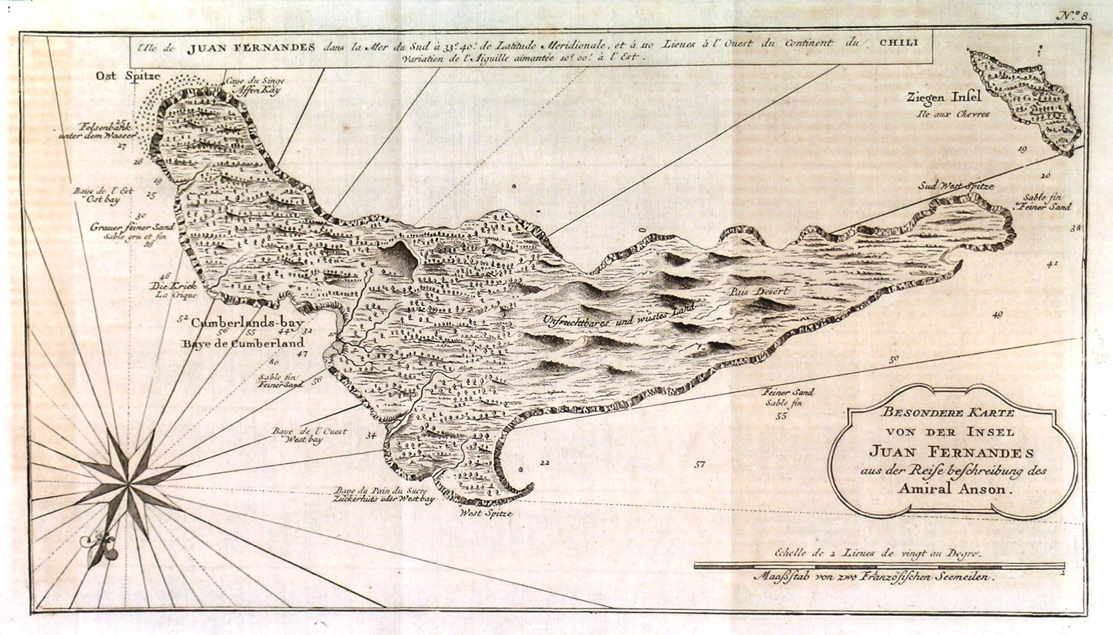
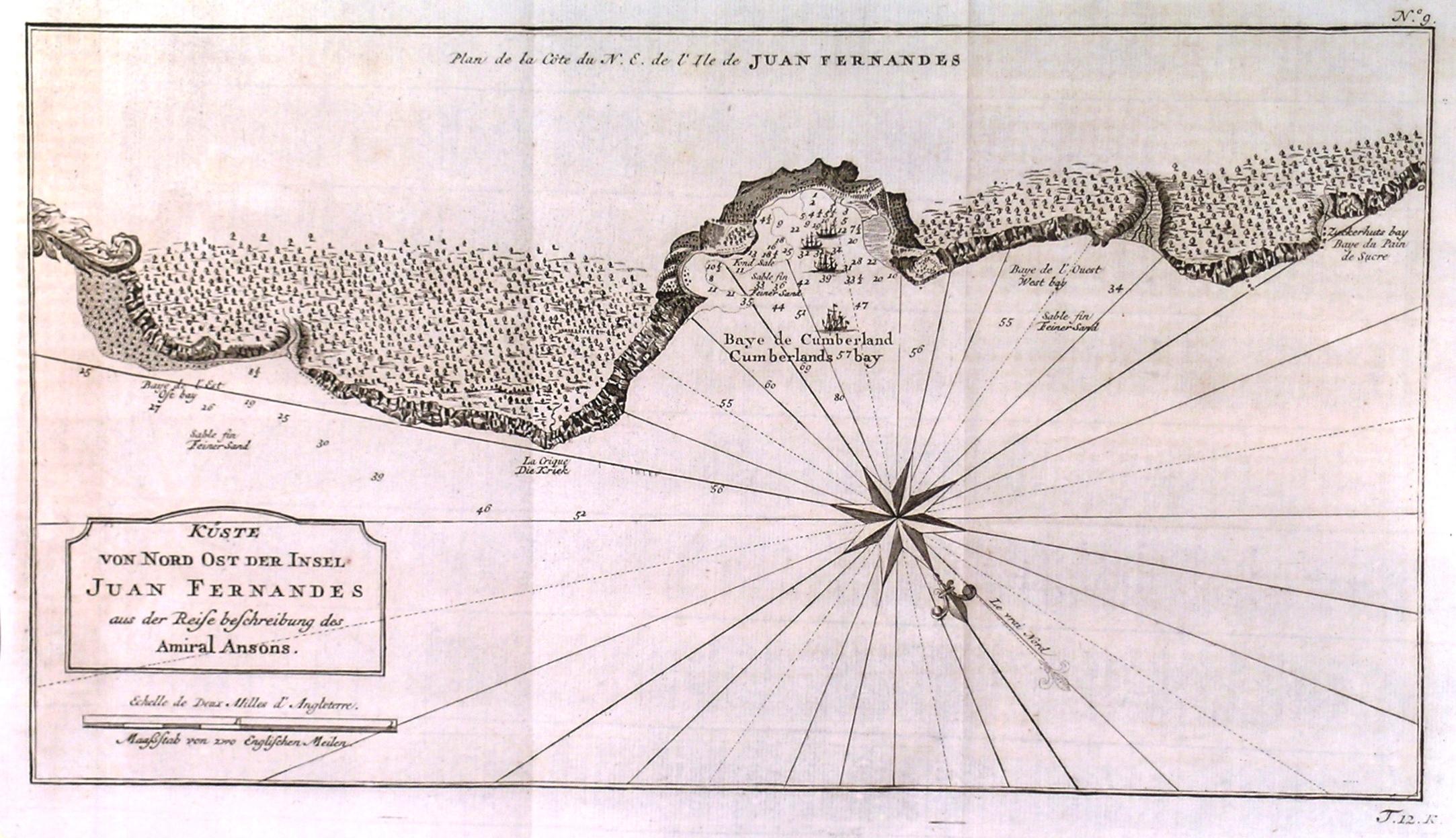
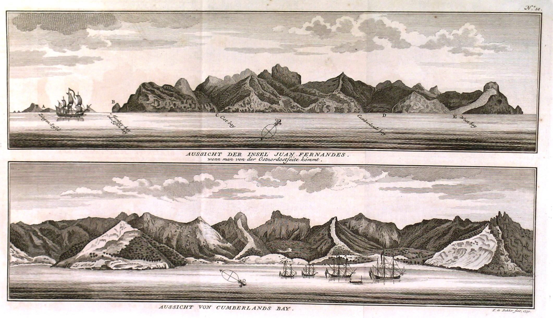
Three Maps: 'BESONDERE KARTE VON DER INSEL JUAN FERNANDES', together with: 'K�STE VON NORD OST DER INSEL JUAN FERNANDES' and 'AUSSICHT DER INSEL JUAN FERNANDES VON DER OSTNORDOSTSEITE / VON CUMBERLANDS BAY'. Three maps/views of Juan Fernandez 650km off the coast of Chile. After Anson engraved by de Bakker and
Bellin, N.
Published by Nicolas Bellin ca. 1750
Map
From Garwood & Voigt, Sevenoaks, United Kingdom
Seller rating 5 out of 5 stars
![]()
AbeBooks Seller since 25 November 2013