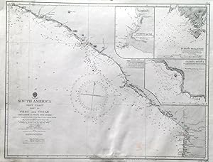
'SOUTH AMERICA WEST COAST SHEET XII / PERU AND CHILE / CABO LOBOS TO PUNTA PESCADORES'. Sea chart of the south Peruvian coastline to the Chilean border at Arica, with 3 inset harbour plans of Puerto de Ilo, Puerto Mollendo and Caleta Ocona. First published at the Admiralty 1840, and now with a few corrections by the
Admiralty Charts.
From Garwood & Voigt, Sevenoaks, United Kingdom
Seller rating 5 out of 5 stars
![]()
AbeBooks Seller since 25 November 2013
Used -
Quantity: 1 available
Add to basket