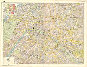
Plan of Paris; Inset map of Arrondissements
Harmsworth
Sold by Antiqua Print Gallery, London, United Kingdom
AbeBooks Seller since 14 January 2022
Used
Condition: Used - Good
Quantity: 1 available
Add to basketSold by Antiqua Print Gallery, London, United Kingdom
AbeBooks Seller since 14 January 2022
Condition: Used - Good
Quantity: 1 available
Add to basketPARIS CITY PLAN. tramways railways fortifications Arrondissements 1920 old map. Vintage colour map; Harmsworth (1920). 34.0 x 45.0cm, 13.25 x 17.5 inches. Condition: Good. This map was originally printed as two separate pages which have been professionally joined to form a single sheet. There is interesting related text and images printed on the reverse side of the picture. The paper is thick, and the verso text does not show through to the front of the map.
Seller Inventory # P-7-011307
Terms:
All items are offered subject to prior sale and remain our property until full payment has been received. Goods will be sent within 2 business days of receipt of cleared payment, except during holidays.
Returns:
We accept returns for any reason initiated within 30 days of the estimated delivery date according to Abebooks standard conditions of return.
Authenticity:
All items are genuine antique or vintage and printed at the date stated unless specifically stated to be later reproductions....
Smaller items (up to A4 in size) are packed flat in a board-backed envelope. Larger items are rolled into a strong postal tube. Items are sent insured.
Order quantity | 1 to 4 business days | 1 to 2 business days |
---|---|---|
First item | £ 5.00 | £ 10.00 |
Delivery times are set by sellers and vary by carrier and location. Orders passing through Customs may face delays and buyers are responsible for any associated duties or fees. Sellers may contact you regarding additional charges to cover any increased costs to ship your items.