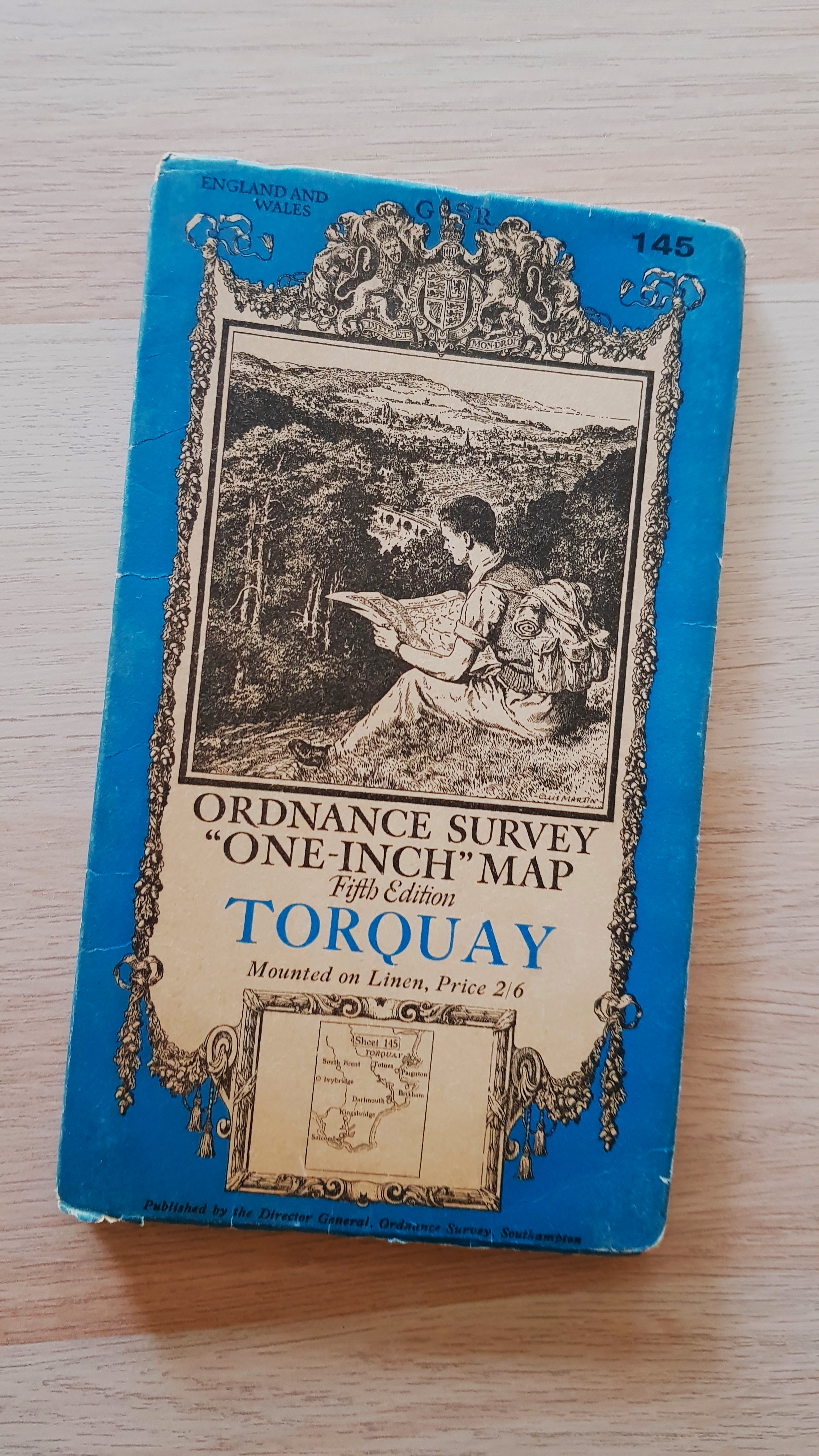
Ordnance Survey 'One-Inch' Map, Fifth Edition, Sheet 145 Torquay
Ordnance Survey
Published by Ordnance Survey, 1932
Used
Soft cover
From
Old Shelves, Woking, SURRE, United Kingdom
Seller rating 5 out of 5 stars
![]()
AbeBooks Seller since 27 May 2024
This specific copy is no longer available. Here are our closest matches for Ordnance Survey 'One-Inch' Map, Fifth Edition, Sheet 145 Torquay by Ordnance Survey.
About this Item
Description:
Published by the Director General of the Ordnance Survey, Southampton, 1932 with periodical corrected reprint. Imprint no 5036. Cover is clean and unmarked. Cloth map is clean, crisp and unmarked. Reduced postage for multiple orders. Seller Inventory # M121
Bibliographic Details
Title: Ordnance Survey 'One-Inch' Map, Fifth ...
Publisher: Ordnance Survey
Publication Date: 1932
Binding: Soft cover
Condition: Very Good
Dust Jacket Condition: Very Good
Edition: 5th or later Edition
Top Search Results from the AbeBooks Marketplace

Seller Image
Ordnance Survey one-inch map, fifth edition, sheet 145, Torquay.
Published by
Southampton: Ordnance Survey, 1938., 1938
Used
Hardcover
Seller: Cornell Books Limited, Tewkesbury, United Kingdom
Seller rating 5 out of 5 stars
![]()
Condition: Good. First published in 1932, this is a reprint from 1938 (print code 6038). Mounted on cloth and folded in the original blue card covers, with a front cover illustration by Ellis Martin. The map is in good condition (some ink annotation near Dartmouth, some creasing of the map). The covers are in good to very good condition (lightly rubbed and chafed). Also covers Salcombe, Kingsbridge, Dartmouth, Brixham, Paignton, Totnes, Ivybridge, South Brent, Buckfastleigh, Ashburton, Newton Abbot and Teignmouth. Seller Inventory # 30929
Buy Used
� 10
� 14.95 shipping
Ships from United Kingdom to U.S.A.
Ships from United Kingdom to U.S.A.
Quantity: 1 available
Seller Image
Ordnance Survey 'One-Inch' Map Fifth Relief Edition, Sheet 145 Torquay
Published by
Ordnance Survey, 1932
Used
Soft cover
Seller: Old Shelves, Woking, SURRE, United Kingdom
Seller rating 5 out of 5 stars
![]()
Soft cover. Condition: Very Good. Dust Jacket Condition: Good. 5th or later Edition. Published by the Director General of the Ordnance Survey, Southampton, 1932. Cover is clean and unmarked, just a little worn around the edges. Cloth map is clean and unmarked. A nice copy of this less common and very attractive edition! Reduced postage for multiple orders. Seller Inventory # M119
Buy Used
� 15
� 14.50 shipping
Ships from United Kingdom to U.S.A.
Ships from United Kingdom to U.S.A.
Quantity: 1 available