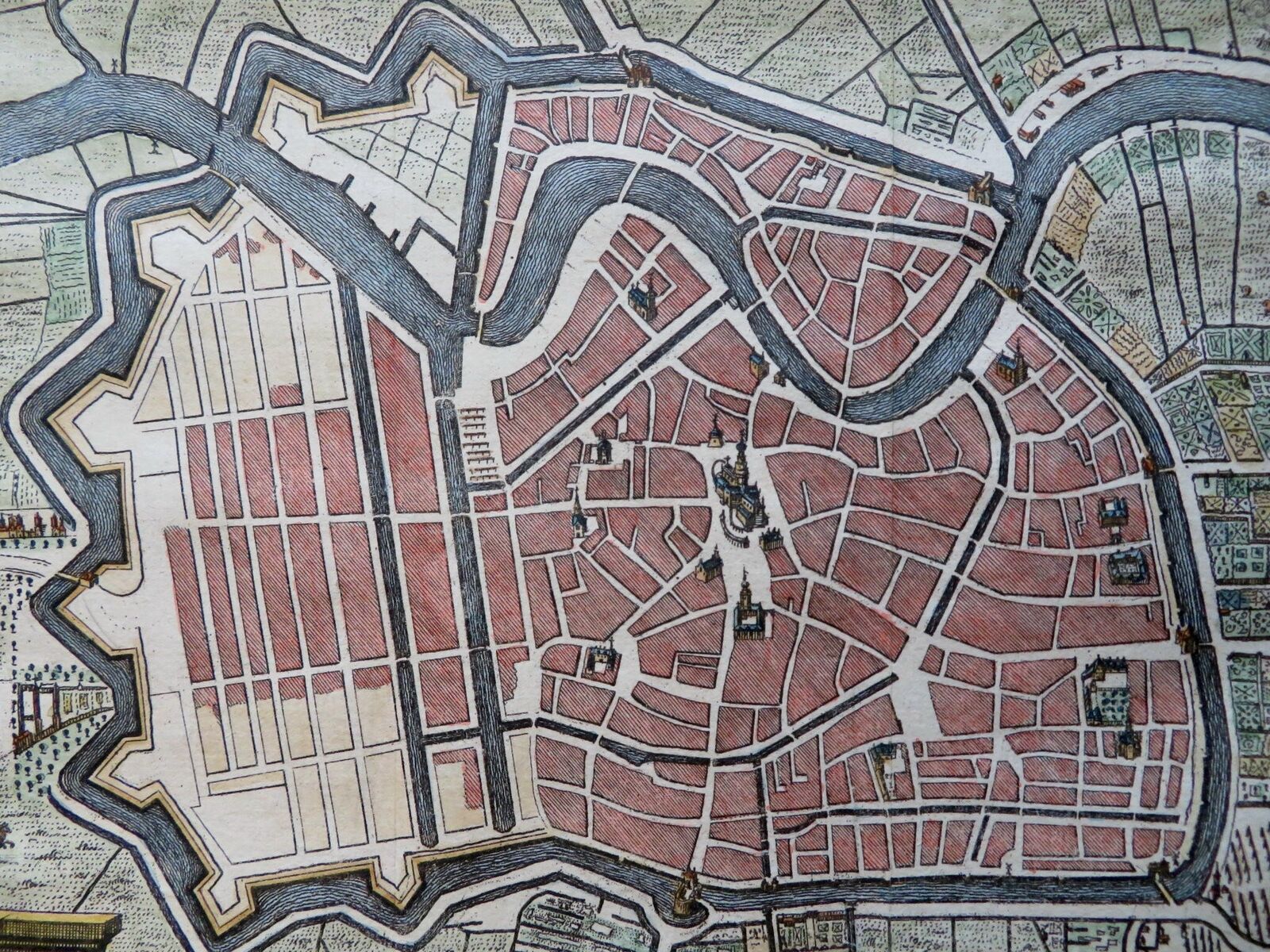
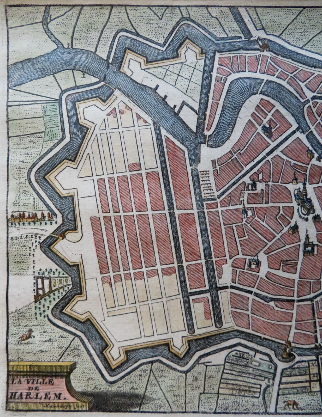
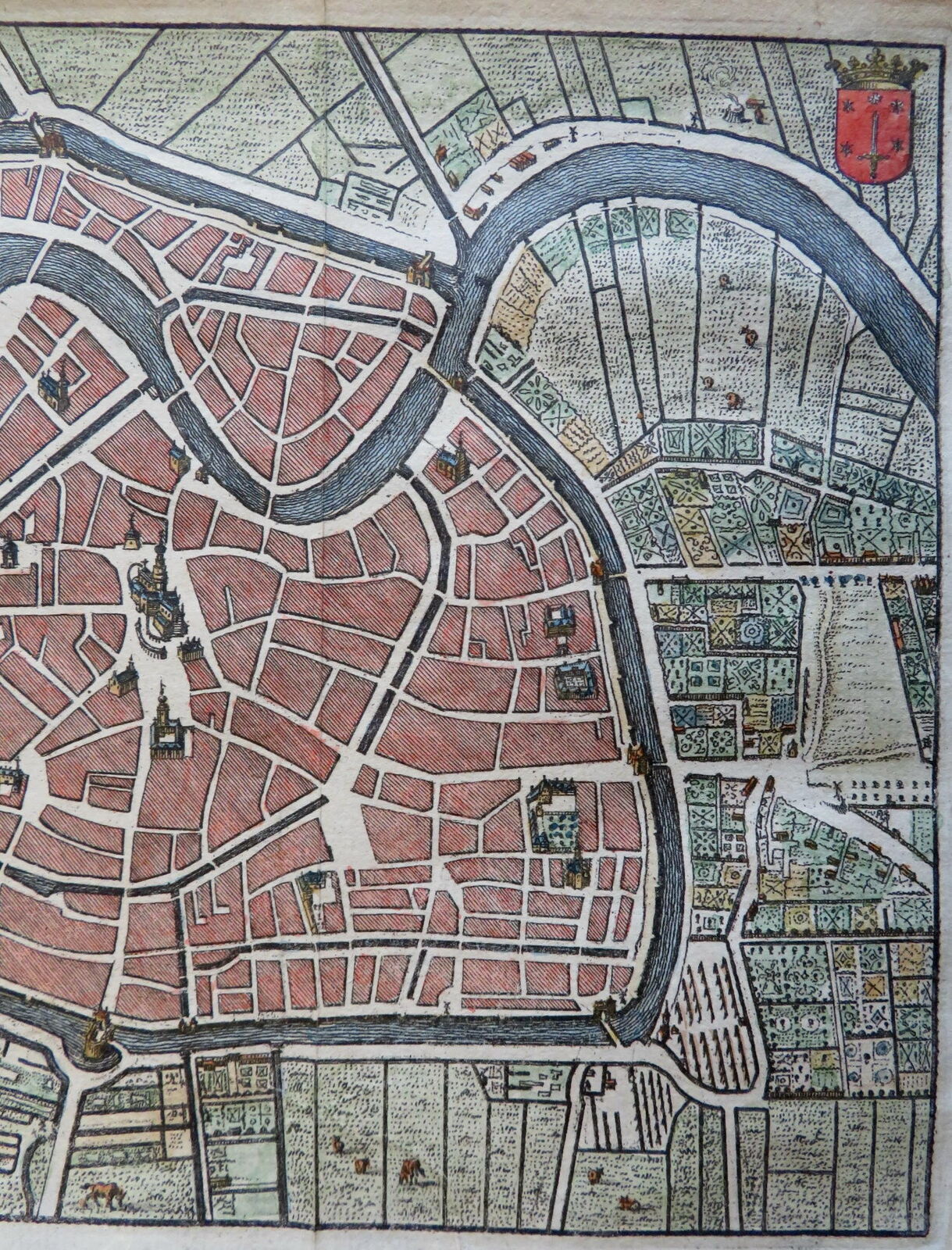
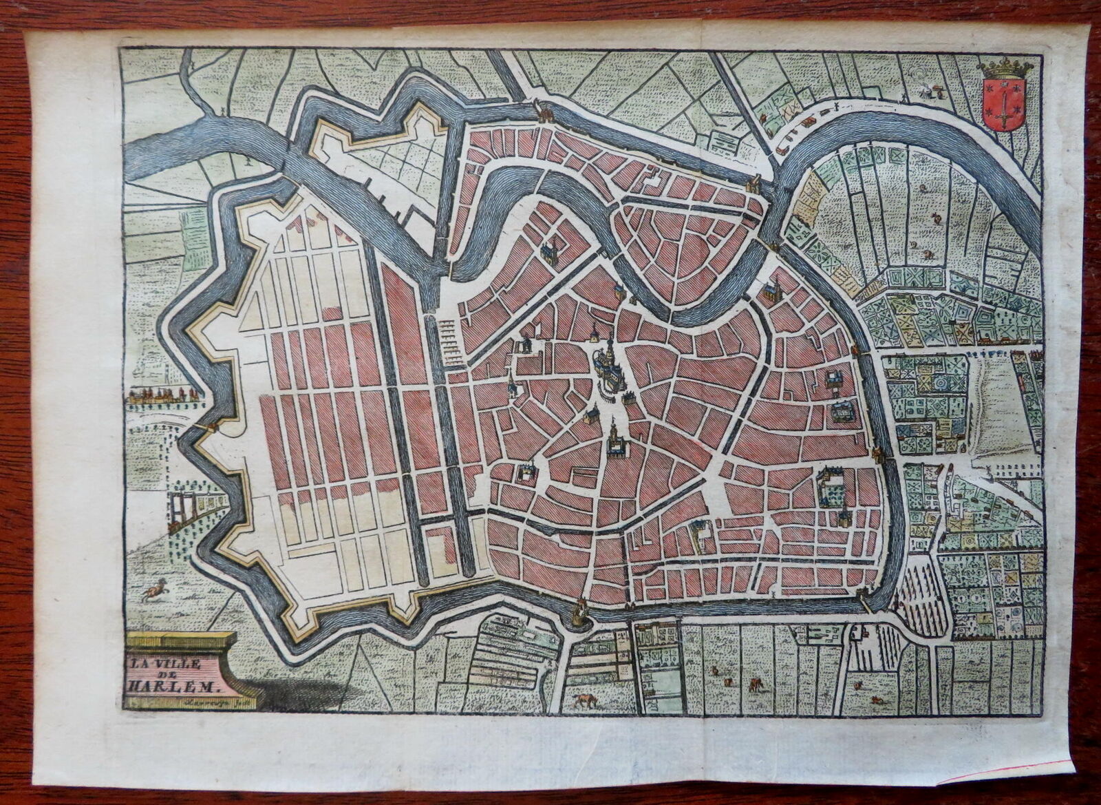
Haarlem Holland Netherlands c. 1720 map Harrewijn detailed hand color city plan
Publication Date: 1720
Used
No Binding
From
RareMapsandBooks, Dover, NH, U.S.A.
Seller rating 5 out of 5 stars
![]()
AbeBooks Seller since 27 November 2015
This book is no longer available. AbeBooks has millions of books. Please enter search terms below to find similar copies.
About this Item
Description:
La Ville de Harlem.(Old Maps, 18th Century Maps, Europe, Low Countries, Netherlands, Holland, Haarlem, City Plan, Military Fortifications, Churches, Canals). Issued 1720, Brussels by Harrewijn. Charming little early 18th century engraved city plan with attractive hand color. City coat of arms in upper left corner, several key buildings rendered in prospect view, dozens of tiny garden plans clearly visible surrounding the original ramparts. Remains a very nice looking example with a pleasing age patina. Any age flaws mostly minor and easy to overlook or forgive. Original fold lines as issued. Perfect small size for framing/ gift giving. Sheet Measures c. 6 1/2" H x 8 3/4" W. Engraved Area Measures c. 5 1/2" H x 7 3/4" W.[B15818- R31778]. Seller Inventory # R31778
Bibliographic Details
Title: Haarlem Holland Netherlands c. 1720 map ...
Publication Date: 1720
Binding: No Binding
Condition: Near Fine
AbeBooks offers millions of new, used, rare and out-of-print books, as well as cheap textbooks from thousands of booksellers around the world. Shopping on AbeBooks is easy, safe and 100% secure - search for your book, purchase a copy via our secure checkout and the bookseller ships it straight to you.
Search thousands of booksellers selling millions of new & used books
New & Used Books

New and used copies of new releases, best sellers and award winners. Save money with our huge selection.
Rare & Out of Print Books
From scarce first editions to sought-after signatures, find an array of rare, valuable and highly collectible books.
