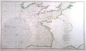
A CHART OF THE BRITISH CHANNEL AND THE BAY OF BISCAY, WITH A PART OF THE NORTH SEA, AND THE ENTRANCE OF ST. GEORGE S CHANNEL . Sea chart of the British Channel, the Bay of Biscay and the Western Atlantic, with an extension showing the tracks of the encounter of the British and French fleets in May 1794. After L Abbé Diquemare and L.S. De la Rochette engraved and published by
Faden, William / L Abbé Diquemare and L.S. De La Rochette.
Sold by Garwood & Voigt, Sevenoaks, United Kingdom
AbeBooks Seller since 25 November 2013
Used
Condition: Used - Fine
Quantity: 1 available
Add to basket