


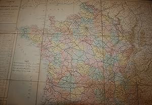
CARTE DES CHEMINS DE FER FRANÇAIS D'INTÉRĘT LOCAL. - Une Carte Dépliante en Couleurs & Entoilée du 19čme Sičcle (1878). - 82x104 cm.
CHAPUIS M.
Published by Ministère des Travaux Publics. - Bureau de la Statistique Centrale des Chemins de Fer., 1878
Map
Condition: Satisfaisant
Soft cover
Used - Soft cover
Price:
Ł 56.25
Convert Currency
Ł 31.57
shipping from France to U.S.A.
Destination, rates & speeds
Quantity: 1 available
Add to basket