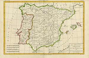
Antique Print-TOPOGRAPHY-MADRID-SPAIN-PORTUGAL-GIBRALTAR-Bonne-Andre-ca. 1780
From ThePrintsCollector, Zeeland, Netherlands
Seller rating 5 out of 5 stars
AbeBooks Seller since 3 April 2017
From ThePrintsCollector, Zeeland, Netherlands
Seller rating 5 out of 5 stars
AbeBooks Seller since 3 April 2017
About this Item
Antique print, titled: 'Les royaumes d'Espagne et de Portugal.' - Map of Spain and Portugal. From "Atlas de toutes parties connues du Globe terrestre" by Rigobert Bonne (1727-1795 ), one of the most important cartographers of the late 18th century. Spain and Portugal. Engraving on Laid paper. Watermark: Textband Made by 'Andre' after 'Rigobert Bonne'. Rigobert Bonne (1727-1795 ) was one of the most important cartographers of the late 18th century. In 1773 he succeeded Jacques Bellin as Royal Cartographer to France in the office of the Hydrographer at the Depôt de la Marine. Very good, given age. Small margins, central fold as published. General age-related toning and/or occasional minor defects from handling. Please study scan carefully. The overall size is ca. 36.5 x 25.3 cm. The image size is ca. 35 x 23 cm. The overall size is ca. 14.4 x 10 inch. The image size is ca. 13.8 x 9.1 inch. Storage location: MAN-A3-21. Seller Inventory # 71981
Bibliographic Details
Title: Antique ...
Publication Date: 1780
Condition: Very Good
Store Description
Payment Methods
accepted by seller