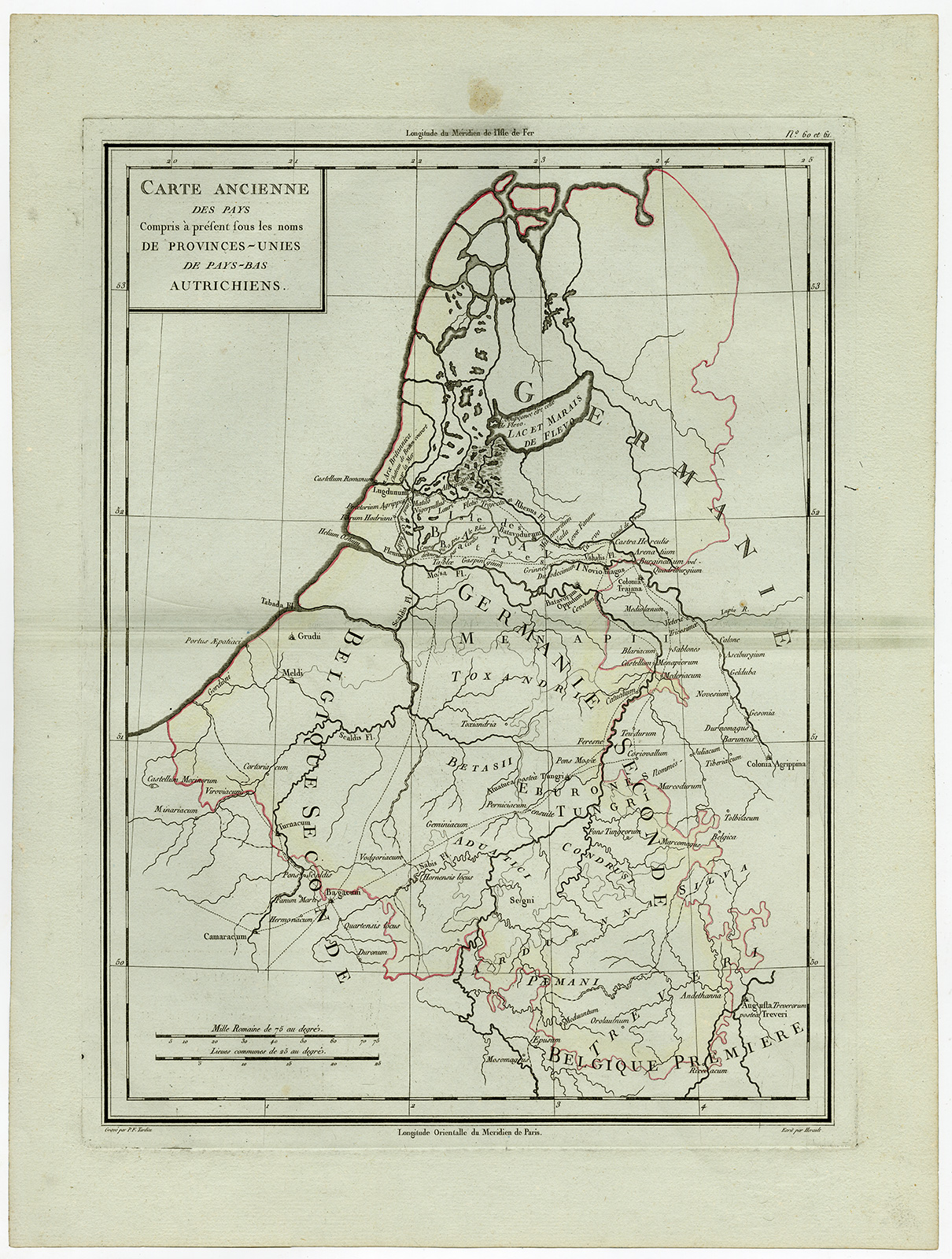
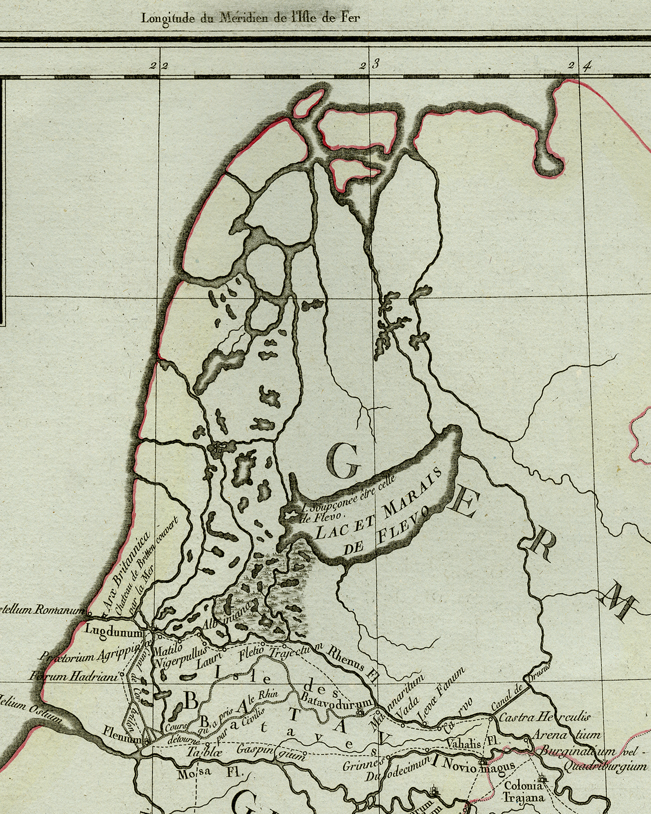
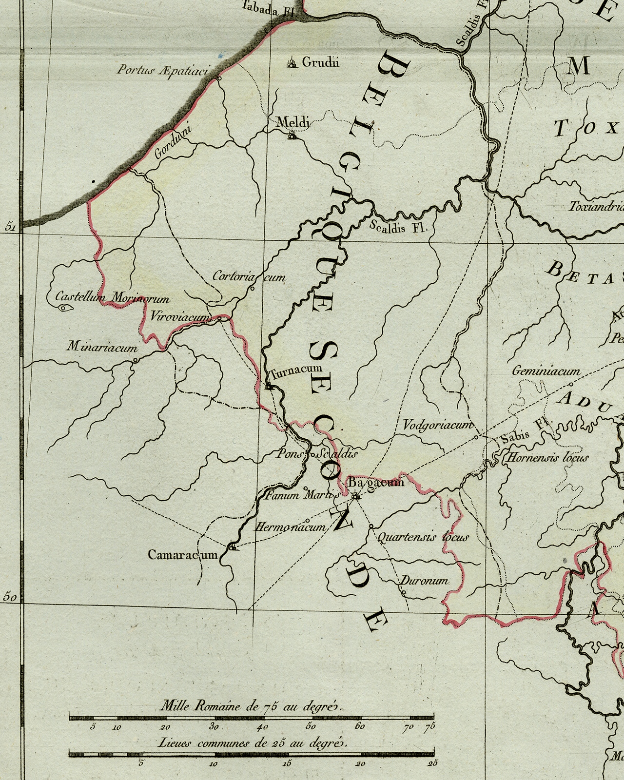
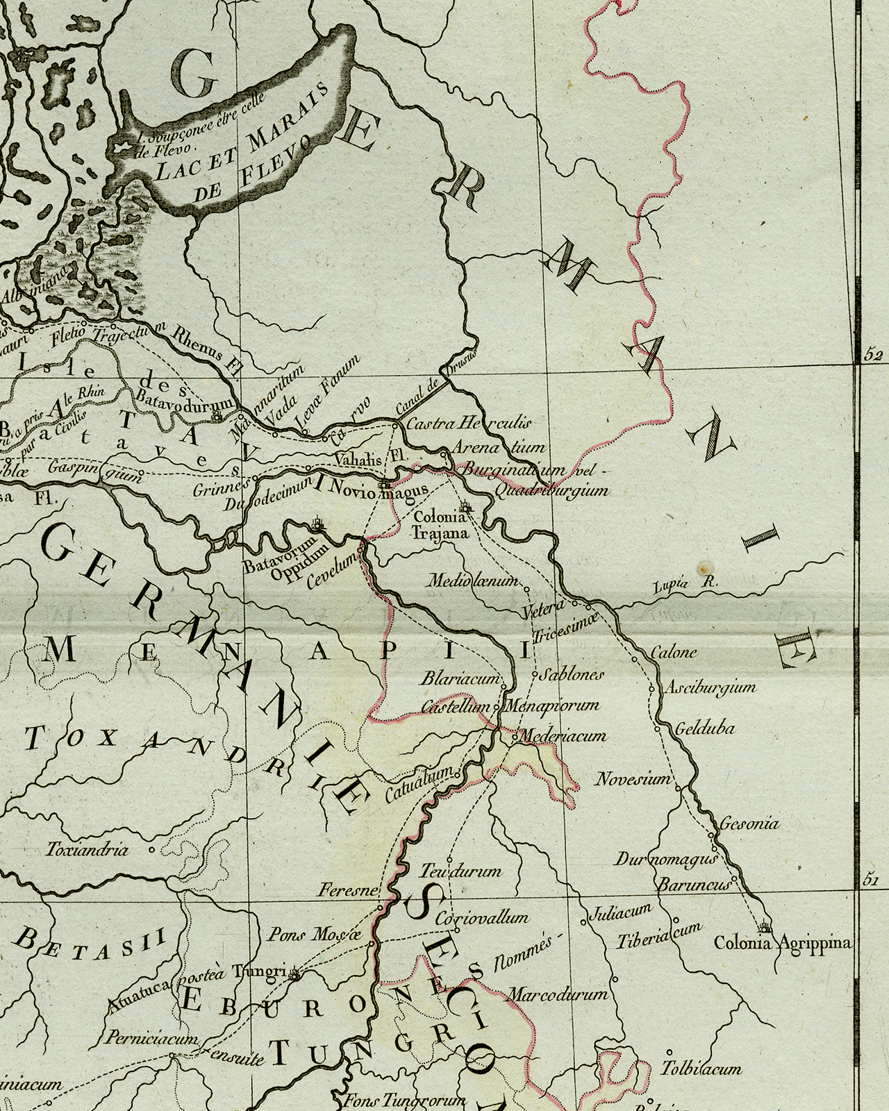
Antique Print-ANCIENT NETHERLANDS-HOLLAND-BELGIUM-Tardieu-Herault-1805
Sold by ThePrintsCollector, Zeeland, Netherlands
AbeBooks Seller since 3 April 2017
Used
Condition: Used - Very good
Quantity: 1 available
Add to basketSold by ThePrintsCollector, Zeeland, Netherlands
AbeBooks Seller since 3 April 2017
Condition: Used - Very good
Quantity: 1 available
Add to basketAntique print, titled: 'Carte Ancienne des Pays. Compris a present sous les noms de Provinces - Unies de Pays-Bas Autrichiens.' - Antique map, titled: Carte Ancienne des Pays. Compris a present sous les noms de Provinces - Unies de Pays-Bas Autrichiens. Map of the old countries, of the United Provinces of the Netherlands during the Roman Empire. Verso blank. Atlas Universel de Geographie physique et politique, ancienne et moderne, presenté a l'Ínstruction des écoles centrales. Engraving on laid paper. Watermark: no Made by 'Herault' after 'Pierre Tardieu'. Pierre Antoine Francois Tardieu (1757-1822). Very good, given age. Original middle fold, as issued. A small stain in top margin. General age-related toning and/or occasional minor defects from handling. Please study scan carefully. The overall size is ca. 54 x 40.8 cm. The image size is ca. 45.1 x 34 cm. The overall size is ca. 21.3 x 16.1 inch. The image size is ca. 17.8 x 13.4 inch. Storage location: B64-13.
Seller Inventory # 71952
Order quantity | 4 to 14 business days | 4 to 14 business days |
---|---|---|
First item | £ 15.70 | £ 15.70 |
Delivery times are set by sellers and vary by carrier and location. Orders passing through Customs may face delays and buyers are responsible for any associated duties or fees. Sellers may contact you regarding additional charges to cover any increased costs to ship your items.