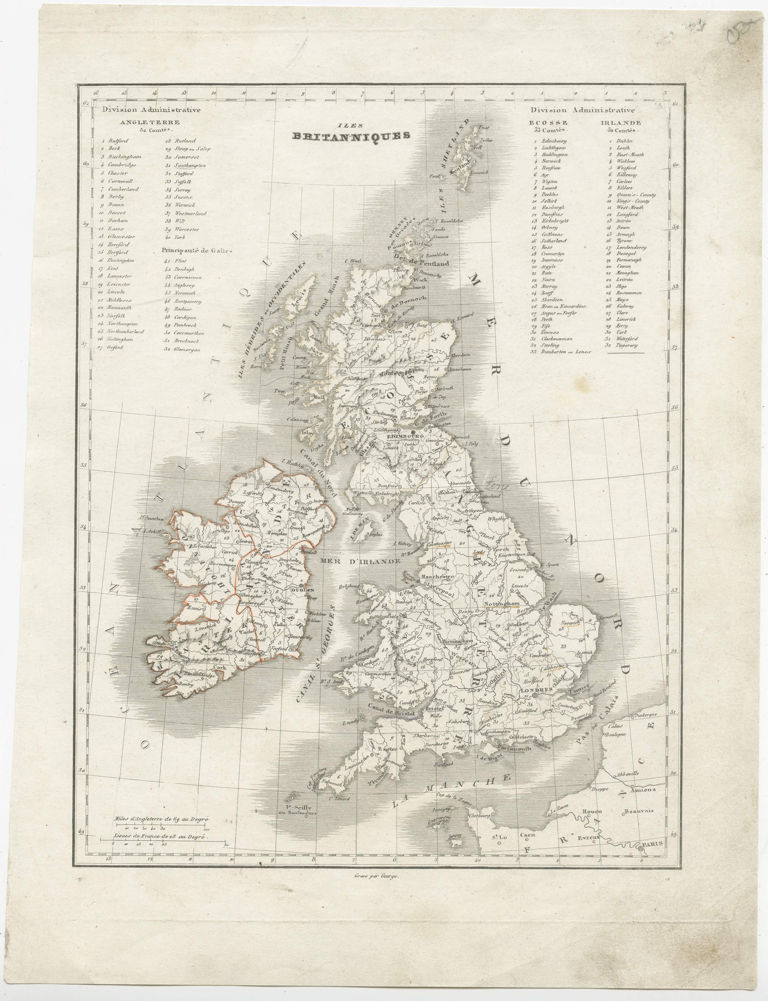
Antique Map of the United Kingdom and Ireland (c.1880)
Sold by Bartele Gallery - The Netherlands, Langweer, FRL, Netherlands
Association Member:
AbeBooks Seller since 8 January 2018
Used
Condition: Fair
Quantity: 1 available
Add to basketSold by Bartele Gallery - The Netherlands, Langweer, FRL, Netherlands
Association Member:
AbeBooks Seller since 8 January 2018
Condition: Fair
Quantity: 1 available
Add to basketAntique map titled 'Isles Britanniques'. Map of the United Kingdom and Ireland. Source unknown, to be determined. Published circa 1880. General age-related toning. Shows wear and soiling, blank verso. Please study image carefully. Overall size: 24 x 32 cm. Image size: 20 x 25 cm. The collection of Bartele Gallery includes over 50,000 authentic antique maps, sea charts, prints and books. Our Abebooks store includes a selection of maps, prints and books for SALE prices. Please visit our other online sales channels to explore our complete collection of original antique maps and prints!
Seller Inventory # BG-13009-111
We guarantee the condition of every item as it's described on the Abebooks websites. Returns can be initiated within 14 days of delivery, please use the Ask bookseller a question link to contact us and we'll respond within 2 business days.
All orders are processed within 1-3 business days. Shipping charges for your order will be calculated and displayed at checkout.