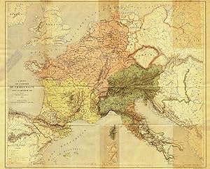
Antique Map-EMPEROR-CHARLEMAGNE-CAROLINGIANS-EMPIRE-Vetault-1877
Sold by ThePrintsCollector, Zeeland, Netherlands
AbeBooks Seller since 3 April 2017
Used
Quantity: 1 available
Add to basketSold by ThePrintsCollector, Zeeland, Netherlands
AbeBooks Seller since 3 April 2017
Quantity: 1 available
Add to basketMap : 'Carte de L empire de Charlemagne apres le partage de 806.' (Map of the empire of Charlemagne after the breaking up of 806). Original colour lithograph on a vellin type paper. Description: This attractive original old antique print / plate originates from: 'Charlemagne' by Alphonse Vetault, published by Alfred Mame et Fils in Tours, France 1877. This map engraved by Erhard.Artists and Engravers: Alphonse Vetault (1843 - 1898), French historian. Condition: Good. General age related toning and minimal staining and/or soiling. Some small tears in the margins and a tear on the left side, backed. Paper slightly browned. Storage location: C156-21 The overall size is ca. 21.1 x 18.1 inch. The image size is ca. 20.1 x 16.7 inch. The overall size is ca. 53.5 x 46 cm. The image size is ca. 51 x 42.5 cm.
Seller Inventory # 27260
Order quantity | 4 to 14 business days | 4 to 14 business days |
---|---|---|
First item | £ 15.62 | £ 15.62 |
Delivery times are set by sellers and vary by carrier and location. Orders passing through Customs may face delays and buyers are responsible for any associated duties or fees. Sellers may contact you regarding additional charges to cover any increased costs to ship your items.