
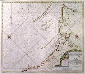
NOUVELLE CARTE MARINE CROISSANTE EN DEGRES D UNE PARTIE DES C�TES MARITIMES DE NORMANDIE, VIMEUX, ET PONTIEU. . Sea chart of the French Channel coast between Dieppe and Le Touquet-Paris-Plage with two compass roses and large decorative cartouche. Published in by
Keulen, G. van.
Published by Gerard van Keulen in Amsterdam ca. 1709
Map
Hardcover
From Garwood & Voigt, Sevenoaks, United Kingdom
Seller rating 5 out of 5 stars
![]()
AbeBooks Seller since 25 November 2013