
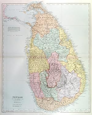
CEYLON . A fine detailed large map of Ceylon with the provinces coloured in separate tints. A railway runs from Matara in the south, via Kalutara, Columbo, Kurunegala, Anuradhapura to Jaffna in the north. A branch line goes off west to Adams Bridge. A proposed Ferry is marked linking Ceylon to the mainland of India.
Edward Stanford.
Published by Edward Stanford ca. 1904
Map
Condition: Fine
From Garwood & Voigt, Sevenoaks, United Kingdom
Seller rating 5 out of 5 stars
![]()
AbeBooks Seller since 25 November 2013
Used -
Price:
� 90
Convert Currency
� 35
shipping from United Kingdom to U.S.A.
Destination, rates & speeds
Quantity: 1 available
Add to basket