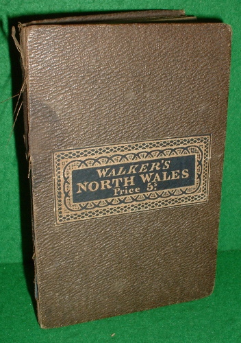

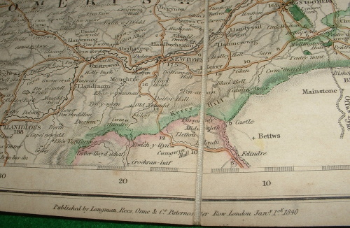

WALKER'S MAP OF NORTH WALES
J & C WALKER
Published by Longman, Rees, Orme & Co., LONDON, 1840
Used
Hard Back
From
booksonlinebrighton, Brighton, United Kingdom
Seller rating 5 out of 5 stars
![]()
AbeBooks Seller since 7 March 2000
This specific copy is no longer available. Here are our closest matches for WALKER'S MAP OF NORTH WALES.
About this Item
Description:
Mounted in section on linen with cloth covered card covers and title label. Hand coloured in outline, 140 X 95mm approx folded, and 650x400mm approx opened.dated 1st Jan 1840. With returns of Parliamentary members, market towns, population market days, dates of Fairs etc. Good (Covers- heavy shelf wear to hinges of boards, face of map a little tanned with general shelf soiling and a previous owner name in ink to reverse of linen). Please see our images of the actual map offered for sale. Seller Inventory # 130378
Bibliographic Details
Title: WALKER'S MAP OF NORTH WALES
Publisher: Longman, Rees, Orme & Co., LONDON
Publication Date: 1840
Binding: Hard Back
Condition: Good
Edition: 1st Edition
Top Search Results from the AbeBooks Marketplace

Walker's Map of North Wales
Used
Soft cover
First Edition
Seller: The Cary Collection, Bristol, CT, U.S.A.
Seller rating 5 out of 5 stars
![]()
Soft cover. Condition: Very Good. No Jacket. 1st Edition. In Original Publisher's Case w/ Label 24 Panel Parchment Map Published by J & A Walker Map: 25.25"H x 31"W Case: 8"H x 4.75"W. Seller Inventory # 37905
Quantity: 1 available