About this Item
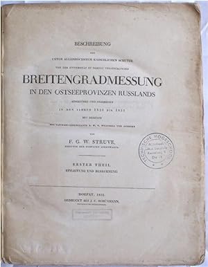
2 volumes in 1. 4to. [8], 360; [8], 424, [3] pp. 13 folding plates; light scattered foxing especially at plates and through p. 20, pages largely un-opened. Original printed wrappers; edges and spine chipped, top spine edges torn, hand-written ink front cover title. Spine and front cover library labels, rubber stamps to front cover and title-page (observatory in Utrecht and a Technical Library in Deft). UNTRIMMED IN ORIGINAL PUBLISHER'S PLAIN WRAPPERS, AS ISSUED. Very good +. FIRST EDITION of Struve's pioneering geodetic work. These measurements represent the initiation of the Struve Geodetic Arc, "a chain of survey triangulations stretching from Hammerfest in Norway to the Black Sea, through ten countries and over 2,820 km, which yielded the first accurate measurement of a meridian" (Wikipedia). "The work carried out under Dr. Struve's supervision in Tartu during 1816-1855 was of considerable importance for determining the shape and size of the Earth and represented an important step in the development of astronomy, geodetics and cartography. The measurement of the arc constituted a rare example of collaboration for a scientific cause between the scientists and rulers of a number of countries" (ER). The plates are mainly diagrams of scientific instruments employed by Struve. / "In 1819, M. Struve, who was then director of the observatory of Dorpat, while engaged in the survey of Livonia, suggested to the University of Dorpat the desirableness of measuring the arc of the meridian included between the island of Hogland in the Gulf of Finland, and the town of Jacobstadt in the province of Courland. The sanction of the emperor having been obtained for the project, the operations were commenced and were finally completed in the year 1827. . . In the same year in which M. Struve brought to a close the operations connected with this arc, General Tenner also completed measurement of the arc of the meridian included between Bristen in Courland, and Belin in the province of Grodno. . . It became desirable to connect trigonometrically the two arcs together. This was effected in 1827-8, by M. Struve and General Tenner, independently of each other, and the results upon being transmitted separately in sealed letters to Bessel, were found to exhibit a most satisfying accordance" (Knight, p. 349). / "From 1828 to 1831 Struve and Tenner had been engaged in joining their respective measurements of meridian arcs. The description of this operation was published in 1832; the full account of Struve's work having appeared in 1831 in the. . .Breitengradmessung" (Abbe, p. 375). / Struve was a Danish-Norwegian astronomer who is best known for his studies of double stars, making micrometric measurements of 2714 of them from 1824-1837, and his work in the field of geodesy. He taught astronomy at the University of Dorpat for many years, before becoming director of the Central Observatory in Pulkova, Russia, in 1839. "In addition to his teaching, Struve's research was also significant in a number of areas, notably observation of double stars; determination of stellar parallaxes and distribution of stars in space; observation of planets, the moon, comets, and auroras; meridian measurements; statistical techniques; and the design and refinement of astronomical and geodetic instruments" (DSB, vol. XIII, p. 109). / "At Pulkova, he determined anew the constant of aberration, but was chiefly occupied in working out the results of former years' work and in the completion of the geodetic operations in which he had been engaged during the greater part of his life. He had commenced them with a survey of Livonia (1816-19), which was followed by the measurement of an arc of meridian of over 34 in the Baltic provinces of Russia" ("Struve," Encyclopaedia Britannica, p. 641). / PROVENANCE: Rubber-stamps of "Technische Hogeschool, Bibliotheek Lab. v. Geodesie, Kanaalweg 4, Delft," a library at Delft University of Technology, and "Sterrewacht Zonnenburg, Utrecht," the Sonn. Seller Inventory # S13208
Contact seller
Report this item
![]()


