Order Total (1 Item Items):
Shipping Destination:

World Mercators Projection (276 results)
Skip to main search results
Search filters
Product Type
- All Product Types
- Books (166)
- Magazines & Periodicals (No further results match this refinement)
- Comics (No further results match this refinement)
- Sheet Music (No further results match this refinement)
- Art, Prints & Posters (13)
- Photographs (No further results match this refinement)
- Maps (97)
- Manuscripts & Paper Collectibles (No further results match this refinement)
Condition Learn more
Binding
Collectible Attributes
- First Edition (18)
- Signed (2)
- Dust Jacket (No further results match this refinement)
- Seller-Supplied Images (227)
- Not Print on Demand (223)
Language (3)
Free Shipping
Seller Location
Seller Rating
-

Map of the World on Mercator's Projection.Showing the World-Wide Distribution of British Territories
Published by Amalgamated Press Ltd., London, 1929
Map
Map, Paper. Condition: VG+. Edition Not Stated. Large, colored map showing the World with British Territories denoted in Pink. Unfolds to 28" by 21". Clean and unmarked. Sound folds no splitting. 'Presented with Part One of The Story of the British Empire'. Weight, 41g. Lettermail may apply. Size: 7" by 10.5" Folded. Map.
-

The World. On Mercator's Projection. Map of the Continents and Oceans with Hand Colored Borders
Published by George Virtue, Publisher, London
Seller: Mare Booksellers ABAA, IOBA, Dover, NH, U.S.A.
Association Member: ABAA ILAB IOBA
Seller rating 5 out of 5 stars

Unbound. Condition: Good. no date, perhaps 1830s, based on publisher's address of Ivy Lane. Single sheet, disbound from a larger work. 11 � by 8 �. Map of the world, showing some settlements, rivers and other natural features. GOOD condition. Heavy creasing, chipping, tearing and curling along the extremities. Minor to moderate soiling, foxing and staining. Light toning to the paper. A worn copy.
-

PAP. Condition: New. New Book. Shipped from UK. Established seller since 2000.
-
hardcover, Condition: Very Good, S.Augustus Mitchell, Phila. 1844. (c.1843), 8vo. 572pp. + 4pp. of U.S.population by county. 1/2 leather, marbled boards, rubbed & scuffed boards, front cover almost detached, contents foxed, ow VG $.
-
An Accompaniment to Mitchell's Map of the World On Mercator's Projection Classic Reprint
Seller: PBShop.store UK, Fairford, GLOS, United Kingdom
Seller rating 5 out of 5 stars
PAP. Condition: New. New Book. Shipped from UK. Established seller since 2000.
-
An Accompaniment To Mitchell's Map Of The World, On Mercator's Projection; Containing An Index To The Various Countries, Cities, Towns, Islands, .
Published by S. Augustus Mitchell, Philadelphia, 1846
Seller: Willis Monie-Books, ABAA, Cooperstown, NY, U.S.A.
Association Member: ABAA ESA ILAB
Seller rating 5 out of 5 stars
Hardcover. Condition: Good. Pages have very slight or slight foxing, light on the title page. Heavier foxing to the last several leaves and to the endpapers. Pages in rear have damp staining to the lower outer corners and adjacent margins. Covers have wear to the corners, edges, and spine ends. ; Companion volume to map with descriptions of places around the world. No maps in this book, or charts of flags.
-

An Accompaniment to Mitchell's Map of the World: On Mercator's Projection; Containing an Index to the Various Countries, Cities, Towns, Islands, &c., ... Five Great Divisions of the Globe, America,
Seller: Ria Christie Collections, Uxbridge, United Kingdom
Seller rating 5 out of 5 stars
� 27.09
� 11.98 shipping
Ships from United Kingdom to U.S.A.Quantity: Over 20 available
Add to basketCondition: New. In.
-
Rand, Mcnally & Co.'s Handy Reference Map Of The World On Mercator's Projection
Published by Rand, McNally & Co., Chicago & New York, 1910
Seller: Willis Monie-Books, ABAA, Cooperstown, NY, U.S.A.
Association Member: ABAA ESA ILAB
Seller rating 5 out of 5 stars
Softcover. Condition: Very Good. Dust Jacket Condition: No Dust Jacket. Folded map. Attached paper covers have light edge creasing. Store ink stamp on front cover.
-
An Accompaniment to Mitchell's Map of the World, on Mercator's Projection; containing An Index to the Various Countries, Cities, Towns, Islands, etc.
Language: English
Published by S. Augustus Mitchell, PHILADELPHIA, 1845
Hardcover. Condition: Good. Marbled boards with green corners and gilt lettering on green spine. 572 pages. Chips to all extremities and spine ends. Bumps and rubs and soiling to cover. A few pencil notes on blank endpaper. Fold-out map in front has been removed. (Scans available upon request.) Size: 8vo - over 7�" - 9�" tall.
-

The British Empire showing the Great Commercial Highways. Map of the World on Mercator's Projection showing all countries of the British Empire
Language: English
Published by The Offices of the Amalgamated Press, London, 1907
Seller: Kilrimund Books, Gateside, FIFE, United Kingdom
Seller rating 5 out of 5 stars
Map First Edition
Soft cover. Condition: Very Good. 1st Edition. Map extract from the Harmsworth Universal Atlas and Gazetteer (circa 1907). Single sheet (measuring 510 mm x 392 mm) with single fold as issued. Clean and crisp condition.
-

An Accompaniment to Mitchell's Map of the World: On Mercator's Projection; Containing an Index to the Various Countries, Cities, Towns, Islands, &c., ... Five Great Divisions of the Globe, America,
Seller: Ria Christie Collections, Uxbridge, United Kingdom
Seller rating 5 out of 5 stars
� 34.26
� 11.98 shipping
Ships from United Kingdom to U.S.A.Quantity: Over 20 available
Add to basketCondition: New. In.
-
An Accompaniment to Mitchell's Map of The World on Mercator's Projection
Published by S. Augustus Mitchell, 1845
Seller: Arader Galleries of Philadelphia, PA, Philadelphia, PA, U.S.A.
Seller rating 4 out of 5 stars

Hardcover. Condition: Very Good. green decorated boards with green leather spine solid and tight.
-
The World - Mercator's Projection Map 1870
Language: English
Published by 1870, 1870
Seller: Manning's Books & Prints, ABAA, Pacifica, CA, U.S.A.
Seller rating 3 out of 5 stars

No Binding. Condition: Fine. 25" X 15�". Mitchell's New General Atlas Hand Colored Map From 1870. Published In Ny. Hand Colored Engraving.
-
The World on Mercator's Projection (map of)
Published by London Printing and Publishing Company, London, 1860
Seller: Victoria Bookshop, BERE ALSTON, DEVON, United Kingdom
Seller rating 4 out of 5 stars
Paperback. Condition: G-. First Thus. Minor creasing and a number of splits/1 long closed tear to tail edge. nick to RH side edge with small loss. this map has been folded. Very minor foxing. Decorative Black & White 19th century map for the Image Size: 350 x 245mm, 13.75 x 9.75" approx. Paper Size: 390 x 285mm, 15.25 x 11.25" approx. John Rapkin (fl. 1835-65) A nineteenth century map maker and engraver, best known for his work on the Illustrated Atlas of the World 1849-53 for John Tallis and Co. noted for their beautifully decorative borders and later re-issued by the London Printing and Publishing Co. London and New York. Book.
-

MAP: "Map of The World on Mercator's Projection" .from Standard Atlas of Outgamie County, Wisconsin
Published by Geo. A. Ogle & Co., Chicago, 1917
Seller: Dorley House Books, Inc., Hagerstown, MD, U.S.A.
Seller rating 4 out of 5 stars
Art / Print / Poster First Edition
Unbound. Condition: Very Good. Handcolored Map (illustrator). 1st. 17.5" x 28.5" handcolored map Size: 17.5" x 28.5".
-
Vintage Cleartype General Map of the World on Mercator's Projection 1940
Language: English
Published by American Map Company, Inc., New York, 1940
Map
Condition: Fair. Stored folded in nonsmoking environment. Many of the folds are separating, but no piece is detached from the whole; normal age discoloration. Large 38" x 50" size. Colorprint Series 9455-D published in 1940. Featuring all Political Divisions, Principal Cities and Shortest Steamship Distances Between Ports. Featuring Flags of the Nations divided into those of the United Nations, Axis Powers, and Neutral Countries. Detailed maps of The Solomon Islands Area, The Philippines Islands, Japan, India, Burma and Adjacent Areas, and Europe Including Mediterranean Area and the Near-East.
-
MAP: THE WORLD ON MERCATORS PROJECTION.
Published by Undated. George Philip & Son. London.
Seller: Black Cat Bookshop P.B.F.A, Leicester, United Kingdom
Association Member: PBFA
Seller rating 5 out of 5 stars
Cloth mounted map of the world, with principal steamer routes marked. Not dated, but shows The British Empire & Japanese Mandate. Also shows countries administered by The League of Nations. All neatly folded and contained in its orginal red linen backed folder. (Spine on folder a touch faded). Generally VG (minor wear to a couple of the folds). Nice & clean.
-
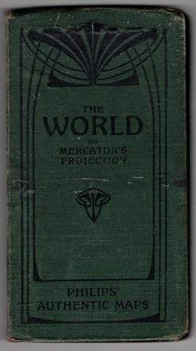
Philips' Authentic Series of Maps: The World on Mercator's Projection
Published by George Philip and Son, London
Hardcover. Condition: Fair. Dust Jacket Condition: No Dust Jacket. No Date. Fold out map in boards. Boards are heavily scuffed and heavily scratched. Rear board has a bend. Front board is warped. Top edge of front board has a horizontal crease. Old bookstore sticker on front pastedown. Tips and spine ends are heavily bumped and heavily rubbed. Edges of boards are rubbed. Front board has several glue bubbles. Rear board has several small surface tears and a small stain. Linen map is still attached to boards and has many pinholes. Top edge border of map has dust staining, not affecting the map itself. Map has several small light creases.
-

Map of the World - Mercator's Projection (1883 Original Antique Colour Print)
Published by George W. Bacon, UK, 1883
Softcover. Condition: Very Good. 1883. A clean and well-presented colour map produced by Bacon in 1883. Central fold line, as originally presented, with some very small nicks at the outer edges repaired and reinforced with conservation tape to prevent wear. No other notable signs of wear. Why on Amazon do most sellers not describe their actual book? Buy with confidence and support a genuine Independent Bricks & Mortar Real Bookshop. We are Maynard & Bradley CAMBO & PBFA(now lapsed) members here in Leicester City Centre. Size: 350 x 505 mm. 1. Item Type: Book. Quantity Available: 1. Shipped Weight: Under 1 kilo. Category: Geography & Maps; Britain/UK; 19th century; Inventory No: 44318.
-
WORLD MAP Mercators Projection 1894 Colour Antique Map
Published by Meyers Konversations
Seller: Artisans-lane Maps & Prints, Sidney, BC, Canada
Seller rating 4 out of 5 stars
Art / Print / Poster
no binding. Condition: very good. This is a historical world map from 1894, printed in color and using the Mercator projection. The map is in excellent condition, with clear and detailed details, and is a book plate map that has been folded. The text on the map is in German. The overall size of the map is approximately 12 inches by 9.5 inches, and the reverse side is blank.
-

c1912 THE WORLD MAP on Mercators Projection Barren Regions Developed areas (BS5)
Seller: Antique Paper Company, ASHFORD, KENT, United Kingdom
Seller rating 2 out of 5 stars

Listing Template 2018 Home About Us View Feedback Contact Us c1912 THE WORLD MAP on Mercators Projection Barren Regions Developed areas (BS5)Click image to enlargeDescriptionc1912An original coloursmall antique maptaken from 'Handy Reference Atlas of the world' titled:THE WORLD on Mercators ProjectionOverall size of thismapis approx 22cm x 18cm with central fold as issued.Published by John Bartholomew Co, Edinburgh.Shipping View Our Categories Decorative Prints World Wide Maps Scotland Maps Architecture Design England Maps Royalty About UsWe specialise in selling all items that can be considered to be Antique Paper. * PRINTS * MAPS * HISTORICAL DOCUMENTS * POSTAL HISTORY * BOOKS * POSTERS * STAMPS * POSTCARDS * EPHEMERA And anything else that is considered Antique and made of Paper. ALL OF OUR ITEMS ARE ORIGINAL ANTIQUES - NOT MODERN COPIES. We are also very keen buyers of anything similar and especially after better collections, original archives, whole libraries and better single items and have and#163;250,000 in cash funds at anyone time to buy the right items. Contact UsIf you have any questions then please do not hesitate to contact us through the eBay messaging system. Feedback We will always help you to have a 100% positive happy buying experience. Contact us if you are unhappy about any aspect of your purchase from us. We only want five star feedback from you so buy with confidence.
-
Paperback. Condition: New. Print on Demand. This book is a comprehensive guide to the geographical and natural features of North America. Focused on presenting an overview of the continent's physical geography, the author discusses mountain ranges, river systems, lakes, plains, and animal life, detailing the geographic location of each and presenting scientific information in accessible language. The book places special emphasis on the unique characteristics of North America's geography and the interplay between the continent's physical features and its development, concluding with the significance of this interplay on the study of geography. This book is a reproduction of an important historical work, digitally reconstructed using state-of-the-art technology to preserve the original format. In rare cases, an imperfection in the original, such as a blemish or missing page, may be replicated in the book. print-on-demand item.
-

An Accompaniment to Mitchell's Map of the World: On Mercator's Projection; Containing an Index to the Various Countries, Cities, Towns, Islands, &c.
Language: English
Published by Creative Media Partners, LLC Jul 2023, 2023
ISBN 10: 1021333735 ISBN 13: 9781021333735
Map
Taschenbuch. Condition: Neu. Neuware - This guide to Mitchell's map of the world offers useful background information and a comprehensive index of the map's features. With detailed descriptions of the countries and regions represented, as well as a discussion of the different geographical regions of the world, this guide is an essential tool for anyone using Mitchell's world map.This work has been selected by scholars as being culturally important, and is part of the knowledge base of civilization as we know it.This work is in the 'public domain in the United States of America, and possibly other nations. Within the United States, you may freely copy and distribute this work, as no entity (individual or corporate) has a copyright on the body of the work.Scholars believe, and we concur, that this work is important enough to be preserved, reproduced, and made generally available to the public. We appreciate your support of the preservation process, and thank you for being an important part of keeping this knowledge alive and relevant.
-
An Accompaniment To Mitchell's Map Of The World, On Mercator's Projection; Containing An Index To The Various Countries, Cities, Towns, Islands.
Language: English
Published by R.L. Barnes, Philadelphia, PA, 1839
Hardcover. Condition: Good. Tight binding, leather spine strip over rubbed marbled boards, "Mitchell's World" in bright gilt lettering to spine strip chipped at spine ends, foxing throughout not affecting readability, otherwise unmarked.
-
Condition: Sehr gut. Zustand: Sehr gut | Seiten: 578 | Sprache: Englisch | Produktart: B�cher | Keine Beschreibung verf�gbar.
-

ca. 27,5 x 20,5 cm. Original-Landkart "The World on Mercators Projection gest. v. W. Hughes, Stahlstich grenzkol., Format 27,5 x 20,5 m sehr guter Zustand, genuine map Sprache: Deutsch Gewicht in Gramm: 350.
-

An Accompaniment to Mitchell's Map of the World: On Mercator's Projection; Containing an Index to the Various Countries, Cities, Towns, Islands, &c.
Language: English
Published by Creative Media Partners, LLC Aug 2024, 2024
ISBN 10: 1019636238 ISBN 13: 9781019636237
Map
Buch. Condition: Neu. Neuware - This guide to Mitchell's map of the world offers useful background information and a comprehensive index of the map's features. With detailed descriptions of the countries and regions represented, as well as a discussion of the different geographical regions of the world, this guide is an essential tool for anyone using Mitchell's world map.
-

Condition: Hervorragend. Zustand: Hervorragend | Seiten: 576 | Sprache: Englisch | Produktart: B�cher | Keine Beschreibung verf�gbar.
-

The World on Mercator's Projection. The Americas sheet.
Published by 1881. 17.25in x 14in (44 x 36cm), 1881
Seller: R.G. Watkins Books and Prints, Ilminster, SOMER, United Kingdom
Seller rating 5 out of 5 stars
Map
No Binding. Condition: Very good. Colour map, from Letts's "Popular Atlas", central fold,
-
COMMERCIAL & POLITICAL MAP OF THE WORLD on Mercator's Projection
Language: English
Published by Geographia Ltd, London, 1920
Seller: THOMAS RARE BOOKS, Yaxley, SUFFOLK, United Kingdom
Seller rating 4 out of 5 stars
First Edition
paperback. Condition: Fine. 1st Edition. FOLDING MAP: Lithographic colour map MOUNTED ON LINEN c1920 measuring 1460x950 mm (37.5 x 57.25 inches). A fine copy of a scarce map. Green board covers, gilt, [spine worn but complete]. A very attractive map of the world and British Empire just after the first world war.