Order Total (1 Item Items):
Shipping Destination:

The Mapping of the World Early Printed World Maps 1472 1700 (23 results)
Feedback
Skip to main search results
Search filters
Product Type
- All Product Types
- Books (23)
- Magazines & Periodicals (No further results match this refinement)
- Comics (No further results match this refinement)
- Sheet Music (No further results match this refinement)
- Art, Prints & Posters (No further results match this refinement)
- Photographs (No further results match this refinement)
- Maps (No further results match this refinement)
- Manuscripts & Paper Collectibles (No further results match this refinement)
Condition Learn more
- New (3)
- As New, Fine or Near Fine (6)
- Very Good or Good (8)
- Fair or Poor (No further results match this refinement)
- As Described (6)
Binding
- All Bindings
- Hardcover (22)
- Softcover (No further results match this refinement)
Collectible Attributes
Language (2)
Price
- Any Price
- Under � 20 (No further results match this refinement)
- � 20 to � 35 (No further results match this refinement)
- Over � 35
Free Shipping
- Free Shipping to U.S.A. (No further results match this refinement)
Seller Location
Seller Rating
-
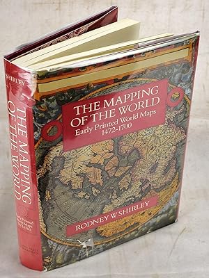
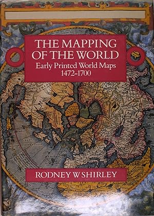
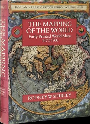
The Mapping of the World: Early Printed World Maps, 1472-1700
Published by Holland Press, London, 1983
Language: English
Seller: Plunder and Salvage, Kill Devil Hills, NC, U.S.A.
Seller rating 4 out of 5 stars

First Edition
Hardcover. Condition: Very Good. Dust Jacket Condition: Good. 1st Edition. Folio; xlvi, [ii], 669pp. Profusely illustrated and over 600 maps described. Very good copy bound in full red cloth with somewhat wrinkled and edge-worn jacket (fair to good). An old ownership sticker has been removed from the front pastedown, where surface lifting of about 1 by 4 inches appears. Binding and contents are else very good, clean and unmarked. A second, revised edition appeared in 1987. ** NOTE SHIPPING COST: This item will incur additional shipping costs. Contact us for a shipping estimate to your location. **.
-

The mapping of the world: Early printed world maps, 1472-1700 (Holland Press cartographica)
Published by London: The Holland Press, 1983., 1983
ISBN 10: 0946323038 ISBN 13: 9780946323036
Language: English
hardcover. Condition: Very Good. Dust Jacket Condition: Good. Hardcover in somewhat rubbed and edgeworn dust jacket. Gently used, no markings.
-

The Mapping of the World: Early Printed World Maps, 1472-1700 (Holland Press Cartographica Series Volume 9)
Published by Holland Press Limited, London, 1983
ISBN 10: 0946323038 ISBN 13: 9780946323036
Language: English
Seller: Blue Whale Books, ABAA, Charlottesville, VA, U.S.A.
Seller rating 4 out of 5 stars
Hardcover. Condition: Very Good. Dust Jacket Condition: very good. Internally clean. Edge of text block slightly foxed. Minor wear to the mylar covered dust jacket. Always securely packed. Professional booksellers since 1994. Satisfaction guaranteed.
-
The mapping of the world: Early printed world maps, 1472-1700 (Holland Press cartographica)
Seller: Arader Galleries of Philadelphia, PA, Philadelphia, PA, U.S.A.
Seller rating 4 out of 5 stars
Hardcover. Condition: New. Dust Jacket Condition: new. 1st Printing. Large Tome book and Dust jacket never used.
-
The Mapping Of The World: Early Printed World Maps 1472-1700
Published by The Holland Press;, London, 1984
ISBN 10: 0946323038 ISBN 13: 9780946323036
Language: English
� 179.49
Convert currency� 17.39 shipping from Germany to U.S.A.Quantity: 1 available
Add to basketHardcover. Condition: Gut bis sehr gut. Grossfolio, englischer Text. Die ersten Weltkarten bibliographisch dargestellt mit vielen Bildern.
-
hardcover. Condition: New. In shrink wrap. Looks like an interesting title!
-
Mapping of the World: Early Printed World Maps, 1472-1700 (Holland Press cartographica)
Seller: Powell's Bookstores Chicago, ABAA, Chicago, IL, U.S.A.
Seller rating 5 out of 5 stars

Condition: Used - Very Good. Cloth, dj. Jacket spine sunned. Top corner of rear panel torn; previous owner affixed scotch tape over it. Light chipping along top edge of front panel. Else fine. A sound copy with clean text and pristine plates. Very Good.
-
The Mapping of the World: Early Printed World Maps 1472-1700
Seller: The Isseido Booksellers, ABAJ, ILAB, Tokyo, Japan
Association Member: ILAB
Seller rating 5 out of 5 stars
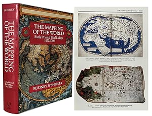
Hardcover. Condition: Very Good. Dust Jacket Condition: Good. Large 4to. xlvi, 669pp. 440 illus., some in color. Original cloth, slightly worn. Dust jacket.
-
The mapping of the world: Early printed world maps, 1472-1700 (Holland Press cartographica)
Published by London: The Holland Press, 1983., 1983
ISBN 10: 0946323038 ISBN 13: 9780946323036
Language: English
Hardcover. Condition: new. Excellent Condition.Excels in customer satisfaction, prompt replies, and quality checks.
-
Mapping of the World: Early Printed World Maps, 1472-1700 (Holland Press cartographica)
Published by Littlehampton Book Services Ltd, 1984
ISBN 10: 0946323038 ISBN 13: 9780946323036
Language: English
Condition: Very Good. Very Good in a Good++ dust jacket; Hardcover; Dust jacket has a couple small edge-tears and one small chip at the top spine corner of jacket, otherwise is clean and intact, and has not been price-clipped (Now fitted with a new, Brodart jacket protector); Light wear to the boards with "straight" edge-corners; Unblemished textblock edges; The endpapers and all text pages are clean and unmarked; The binding is excellent with a straight spine; This book will be shipped in a sturdy cardboard box with foam padding; Extra-Large Format (Folio, 12.75" - 14" tall); Heavy (8.0 lbs); Map illustration to jacket with title in tan lettering on a red backgorund; 1984, Littlehampton Book Services Ltd; 718 pages; "Mapping of the World: Early Printed World Maps, 1472-1700 (Holland Press cartographica)," by Rodney W. Shirley.
-

The Mapping of the World: Early Printed World Maps 1472-1700
Published by New Holland Australia(AU), London, England, 1998
ISBN 10: 1853682713 ISBN 13: 9781853682711
Language: English
Hard cover. Sewn binding. Paper over boards. 720 p. Contains: Illustrations. Audience: General/trade. Very good in very good dust jacket.
-
Mapping of the World: Early Printed World Maps, 1472-1700 (Holland Press cartographica)
Published by Littlehampton Book Services Ltd, 1984
ISBN 10: 0946323038 ISBN 13: 9780946323036
Language: English
Seller: Sequitur Books, Boonsboro, MD, U.S.A.
Association Member: IOBA
Seller rating 5 out of 5 stars
Hardcover. Condition: As New. 2nd. xlvi, 669 p. : ill., maps (some col.) ; 35 cm. Hardcover and dust jacket. Fine binding and cover. Slight sunning to spine. Clean, unmarked pages. Light wear to dust jacket. Original promotional papers included. Illustrated lining papers. Holland press cartographica, vol. 9. This is an oversized or heavy book that requires additional postage for international delivery outside of Canada and the US.
-
The mapping of the world. Early printed world maps 1472-1700.
Seller: Sequitur Books, Boonsboro, MD, U.S.A.
Association Member: IOBA
Seller rating 5 out of 5 stars
Hardcover. Condition: Very Good. 2nd Revised edition. Hardcover and dust jacket. Good binding and cover. Clean, unmarked pages. Wear / tear to dj, in mylar cover. Names on front end pages. Text and binding are excellent. Holland Press cartographica, v. 9. xlvi, 669 pages : illustrations (some color) ; 35 cm. This is an oversized or heavy book, which requires additional postage for international delivery outside the US.
-
The mapping of the world: Early printed world maps, 1472-1700 (Holland Press cartographica)
Seller: Grey Matter Books, Hadley, MA, U.S.A.
Association Member: SNEAB
Seller rating 4 out of 5 stars
Hardcover. Condition: Very Good. Oversized book in red slipcase. Slipcase is in fine condition. Book itself in very good condition. Dj has some light creasing which appears on the bottom spine area and a few other places. Book itself solid and clean. Pages bright, crisp and glossy. Priority/international shipping at cost.
-
Mapping of the World: Early Printed World Maps, 1472-1700 (Holland Press cartographica)
Published by Littlehampton Book Services Ltd, 1984
ISBN 10: 0946323038 ISBN 13: 9780946323036
Language: English
Seller: Vagabond Books, A.B.A.A., PASADENA, CA, U.S.A.
Seller rating 3 out of 5 stars

First Edition
Hardcover. Condition: Fine. Dust Jacket Condition: Fine. FIRST. A FINE FIRST EDITION IN DJ AND SLIPCASE.
-
The Mapping of the World: Early Printed World Maps 1472-1700
Published by Holland Press, London, 1983
ISBN 10: 0946323038 ISBN 13: 9780946323036
Language: English
Seller: Book Grove, RMABA, Glenwood Springs, CO, U.S.A.
Association Member: RMABA
Seller rating 4 out of 5 stars
Hardcover. Condition: Near Fine. Dust Jacket Condition: Near Fine. Minor wear to DJ edges, tips lightly bumped, otherwise very clean, tight and bright.
-
The Mapping of the World. Early Printed World Maps 1472-1700.
Published by London, The Holland Press, 1984. 346 x 250mm (13� x 9� inches)., 1984
Seller: Tooley, Adams & Co., Wallingford, OXON, United Kingdom
Seller rating 5 out of 5 stars
� 180
Convert currency� 37.15 shipping from United Kingdom to U.S.A.Quantity: 1 available
Add to basketFolio, cloth & d/w, slightly faded at spine, illus; pp. xlviii + 670, fully illus. This cartobibliographical study illustrates how the printed world map developed from the earliest years of printing in the 1470s up to the end of the 17th-century.
-
MAPPING OF THE WORLD, EARLY PRINTED WORLD MAPS, 1472-1700
Published by The Holland Press, London, 1983
Seller: Oak Knoll Books, ABAA, ILAB, NEW CASTLE, DE, U.S.A.
Seller rating 5 out of 5 stars
First Edition
Maps (illustrator). thick 4to. cloth, dust jacket, publisher's cloth slipcase. xlviii, 670 pages. First edition. Fine in fine jacket with the scarce publisher's slipcase. Volume Nine in the Holland Press Cartographica Series. Profusely illustrated including a number in full color. Includes as appendices a list of lesser known map makers and a chronological listing and rarity index. Magnificent book. cloth, dust jacket, publisher's cloth slipcase.
-
Mapping of the World: Early Printed World Maps 1472 - 1700.
Published by Holland Press, London, 1983
Seller: Antiquariat Friederichsen, Hamburg, Germany
Association Member: BOEV
Seller rating 5 out of 5 stars
First Edition
� 314.25
Convert currency� 39.23 shipping from Germany to U.S.A.Quantity: 1 available
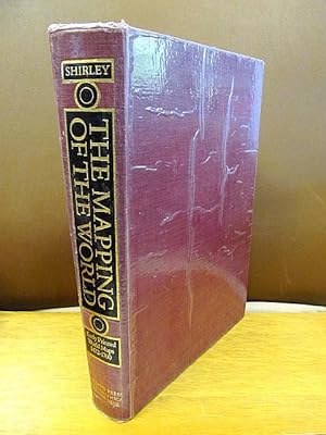
Add to basket( In englischer Sprache, Holland Press Volume Nine First Edition, Erste Ausgabe ) Mit XLVI, 669 Seiten. Mit 440 schwarz-wei�en ( und einigen farbigen ) Abbildungen und Illustrationen, teils auf Tafeln. Roter Original-Leinwand mit goldgepr�gtem schmalen Einbandr�cken, KleinFolio ( 34,5 x 25 cm ). Der Einband ist von privat cellophaniert, Einbandecken und -kanten teils st�rker besto�en, Bindung defekt und stark gelockert, Buchblock fast lose. Innen von guter Erhaltung. ( Gewicht 3400 Gramm ) ( Weitere Bilder auf Anfrage ) Artikel 15208 /// ( In English, Holland Press Volume Nine - First Edition, First Edition ) With XLVI, 669 pages. With 440 black and white ( and some color ) illustrations and illustrations, some on plates. Original red cloth with gilt-stamped narrow spine, small folio ( 34.5 x 25 cm ). The binding is privately cellophane-wrapped, corners and edges of the binding partly heavily bumped, binding defective and heavily loosened, book block almost loose. Inside in good condition. ( weight 3400 gram ) ( more pictures on request ) item 15208.
-
The Mapping of the World Early Printed World Maps 1472-1700
Published by London Holland Press 1983, 1984
Seller: Aquila Books(Cameron Treleaven) ABAC, Calgary, AB, Canada
Association Member: ABAC ILAB PBFA
Seller rating 5 out of 5 stars
� 444.04
Convert currency� 14.11 shipping from Canada to U.S.A.Quantity: 1 available
Add to basketCondition: Near Fine. XLVI, 669 pp. Quarto. Pictorial dust jacket. Cloth bound in burgundy with matching slip case. Gilt/black decoration and information on spine. Decorative end papers. Numerous illustrations and photographs throughout text. 440 colour and B/W Plates. Ex-libris mounted on FFEP. Not price clipped. Minor bumping to spine. Text is clean and binding tight. Both dust jacket and text are in near fine condition. This comprehensive reference illuminates the significant progression of world mapping from the 15th to the 17th century. Shirley, an esteemed map historian, meticulously examines the cultural and technological influences that shaped these early printed maps. His thorough research provides invaluable insights into the pioneers of cartography and their groundbreaking contributions. With detailed analysis and stunning illustrations, this book remains an indispensable resource for scholars and enthusiasts, unraveling the rich history and intricacies of early world mapping.
-
The Mapping of the World: Early Printed World Maps 1472-1700
Published by Holland Press, Ltd., London, 1984
Seller: Xochi's Bookstore & Gallery, Truth or consequences, NM, U.S.A.
Seller rating 2 out of 5 stars

Hardcover. Condition: Fine. 669pp.incl.index; HB burgundy w/blk.&gilt; fine condition w/clean,tight pgs. DJ red w/white-map covers; fine. Slipcase burgundy w/no title; slight rub. "The aim of this work is to show, by cartobibliographical study, how the printed world map developed from the earliest years of printing in the 1470s up to the turn of the seventeenth century." Holland Press Cartographica Volume Nine. 440 plates.
-

THE MAPPING OF THE WORLD: Early Printed World Maps, 1472-1700
Published by Holland Press Limited, (London, 1984
Seller: Bartleby's Books, ABAA, Chevy Chase, MD, U.S.A.
Association Member: ABAA ESA ILAB IOBA
Seller rating 5 out of 5 stars
First Edition Signed
First edition, 1/300 copies (this #4) signed by the author, Holland Press Cartographica Volume Nine. Folio. xlvi, (2), 669 pp. Illustrated from old maps, some full-page or double-page, some in color, portraits, and other artwork, charts. Describes 639 maps. Publisher's green half-morocco and marbled boards, gilt, gilt spine title, illustrated endpapers, publisher's cloth slipcase. Fine.
-
The Mapping of the World Early Printed World Maps 1472-1700 / Rodney W Shirley
Published by Artist: The Holland Press Limited; issued in: London; :, 1983
Seller: Antique Sommer& Sapunaru KG, M�nchen, Germany
Seller rating 5 out of 5 stars
� 484.85
Convert currency� 39.23 shipping from Germany to U.S.A.Quantity: 1 available
Add to basketTechnic: Color print, colorit: black/whitecondition: Slight signs of use, size (in cm): 34 x 25 cm cm; - One of the most important reference books of antique world maps, published from 1472 - 1700. 669 pages, with a colour frontispiece and over 440 plates, 19 of them illustrated in colour.This cartobibliographical study illustrates how the world map developed from the earliest years of printing in the 1470s up to the turn of the seventeenth century.