Order Total (1 Item Items):
Shipping Destination:

Survey London: Maps (315 results)
Feedback
Skip to main search results
Search filters
Product Type
- All Product Types
- Books (4,129)
- Magazines & Periodicals (7)
- Comics (No further results match this refinement)
- Sheet Music (No further results match this refinement)
- Art, Prints & Posters (6)
- Photographs (No further results match this refinement)
- Maps (315)
- Manuscripts & Paper Collectibles (No further results match this refinement)
Condition Learn more
Binding
Collectible Attributes
- First Edition (8)
- Signed (No further results match this refinement)
- Dust Jacket (4)
- Seller-Supplied Images (137)
- Not Print on Demand (315)
Language (2)
Free Shipping
Seller Location
Seller Rating
-

Waterloo & Southwark 1914 (Old Ordnance Survey Maps, London, Sheet 76)
Published by Alan Godfrey Maps, Dunston, 1992
ISBN 10: 0850545234 ISBN 13: 9780850545234
Language: English
Map
Map. Condition: Good. A little scrumpled, but still in good condition.
-

Soft cover. Condition: Very Good. No Jacket. Map, some light wear to edges and corners, no rips or misfolds.
-

Croydon 1895: London Sheet 157.2 (Old Ordnance Survey Maps of London)
Seller: GENERATIONS GONE BY, Manchester, United Kingdom
Seller rating 5 out of 5 stars

Map
Soft cover. Condition: New. No Jacket. Croydon 1895: London Sheet 157.2 (Old Ordnance Survey Maps of London).
-

Hampton and Bushy Park 1934: London Sheet 139.4 (Old Ordnance Survey Maps of London)
Seller: GENERATIONS GONE BY, Manchester, United Kingdom
Seller rating 5 out of 5 stars
Map
Soft cover. Condition: New. No Jacket. Hampton and Bushy Park 1934: London Sheet 139.4 (Old Ordnance Survey Maps of London).
-

Upper Holloway 1894: London Sheet 029.2 (Old Ordnance Survey Maps of London)
Seller: GENERATIONS GONE BY, Manchester, United Kingdom
Seller rating 5 out of 5 stars
Map
Soft cover. Condition: New. No Jacket. Here are the details of maps for Holloway: London 29.1 Upper Holloway 1869 - published 1999; intro by David Mander. ISBN.978-1-84151-100-9 London 29.2 Upper Holloway 1894 - published 1995; intro by David Mander. ISBN.978-0-85054-764-1 London 29.3 Upper Holloway 1914 - published 1986; intro by Jim Connell. ISBN.978-0-85054-138-0 London 29.4 Holloway & Highbury 1937 - published 2019; intro by Pamela Taylor. ISBN.978-1-78721-270-1 We have published four versions of this map, showing how the area developed across the years. The maps each cover the same area, stretching from Holloway Prison eastward to Green Lanes and Highbury New Park, and from Finsbury Park station southward to Aberdeen Park and Holloway station. The GNR main line runs north-south through the map, with many sidings, and part of the Canonbury Branch; Finsbury Park and Holloway stations are included, and the 1914 map has Drayton Park station. Railway information is detailed, with tracks, signal posts, air shafts etc. West of the railway is much of Holloway, including Holloway Road, the prison (left blank), Seven Sisters Road, Hornsey Road, St Mary's Workhouse Schools, West London Union Workhouse. East of the railway is part of Highbury around Highbury House and Highbury Park, while north of this is a detached part of Hornsey, South Hornsey, incl Brownswood Park; the 1869 map has part of the New River here. Gillespie Road and Arsenal football ground are on the later maps. Each map includes a specially written introduction to the history of the area. The map links up with London Sheets 20 Finsbury Park to the north, 28 Gospel Oak to the west, 30 Stoke Newington to the east, 39 Highbury to the south.
-

Highbury and Islington 1914: London Sheet 039.3 (Old Ordnance Survey Maps of London)
Seller: GENERATIONS GONE BY, Manchester, United Kingdom
Seller rating 5 out of 5 stars
Map
Soft cover. Condition: New. No Jacket. Here are the details of maps for Islington & Highbury: London 39.1 Highbury & Islington 1871 - published 1990; intro by David Mander. ISBN.978-0-85054-336-0 London 39.2 Highbury & Islington 1894 - published 1990; intro by Alan Godfgrey. ISBN.978-0-85054-455-8 London 39.3 Highbury & Islington 1914 - published 1985; intro by Jim Connell. ISBN.978-0-85054-029-1 We have published three versions of this map, showing how the area developed across the years. The maps each cover the same area, York Road eastward to Rotherfield Street, and from Cloudsley Square northward to Witherington Road. Highbury & Islington station is near the centre of the map, which covers much of Islington and also southern Highbury. Barnsbury and Canonbury are also included. Major roads running through the map include Upper Street, Essex Road, Liverpool Road and Caledonian Road. These are very busy maps and features include the Kings Cross railway approaches; North London Railway, including Canonbury, Highbury & Islington, Caledonian Road and (at extreme west edge) Maiden Lane stations; Metropolitan Cattle Market, Belle Isle, Thornhill Square, Lonsdale Square, Highbury Fields, Milner Square, Canonbury Square, Islington Town Hall, Peabody Square. The major feature is innumerable streets of housing, Barnsbury area to west, Canonbury to east. The map links up with London Sheets 29 Upper Holloway to the north, 38 Kentish Town to the west, 40 Dalston to the east, 50 Clerkenwell to the south.
-

Dalston 1870: London 40.1 (Old Ordnance Survey Maps of London)
Seller: GENERATIONS GONE BY, Manchester, United Kingdom
Seller rating 5 out of 5 stars
Map
Soft cover. Condition: New. No Jacket. Here are the details of maps for Dalston & Kingsland: London Sheet 40.1 Dalston 1870 - published 1987; intro by David Mander. ISBN.978-0-85054-199-1 London Sheet 40.2 Dalston 1894 - published 1992; intro by Jenny Golden. ISBN.978-0-85054-498-5 London Sheet 40.3 Dalston 1913 - published 1985, 2nd Edition 1995; intro by Isobel Watson. ISBN.978-0-85054-720-7 We have published three versions of this map, showing how the area developed across the years. The maps each cover the same area, stretching from Essex Road eastward to London Fields, and from Shacklewell Lane southward to De Beauvoir Crescent. The maps therefore cover a varied and very busy area, comprising De Beauvoir Town, Kingsland and Balls Pond at the west, Dalston and west Hackney to the east. The North London Railway forms a T-shape across the map, including Dalston Junction and Haggerston stations, while on the later maps the GER line runs down the eastern side, including London Fields and Hackney Downs stations. Kingsland Road and Kingsland High Street runs north-south through the centre of the map. Other features include De Beauvoir Square, Kingsland Basin, Bricklayers Almshouses, Dyers Almshouses, Balls Pond Road, Mildmay Compound, German Hospital, Militia Barracks, and countless streets of housing. The map links up with London Sheets 30 Stoke Newington to the north, 39 Highbury to the west, 41 Hackney to the east, 51 Shoreditch to the south.
-

Creekmouth 1894: London Sheet 068.2 (Old Ordnance Survey Maps of London)
Seller: GENERATIONS GONE BY, Manchester, United Kingdom
Seller rating 5 out of 5 stars
Map
Soft cover. Condition: New. No Jacket. Here are the details of maps for Creekmouth: London Sheet 68.2 Creekmouth 1894 - published 1989; intro by Stephen Pewsey. ISBN.978-0-85054-239-4 London Sheet 68.3 Creekmouth 1914 - published 2000; intro by Tony Clifford. ISBN.978-1-84151-204-4 We have published two versions of this map, showing how the area developed across the years. The maps each cover the same area, which is centred on Barking Creek, where the River Roding meets the Thames. At the time Creekmouth was described as "an isolated hamlet of Barking - seldom visited by ordinary visitors or noticed by historians". Much is marshland. However, the left side of the map does include a significant part of the vast Beckton Gas Works, with its many sidings etc, and Beckton Pier. There is a chemical works east of the Creek and small communities at Creekmouth and Gallions Cottages. By 1894 the Barking fishing fleet had largely disappeared; however, Tony Clifford tells how in 1909 Frederick Handley Page was using Creekmouth for an experimental aircraft factory. The map covers the Thames and the Plumstead Marshes shoreline opposite. There is a bonus with the 1894 map, for on the reverse of this we have included an Inch to the Mile Map, from c.1870. This covers the area east of London, from Plaistow, Wanstad, Woodford, Loughton and Buckhurst Hill eastward to Billericay, and including Barking, Ilford, Romford, Brentwood, Rainham, Dagenham, Orsett, Havering atte Bower, Chigwell, Mountnessing, Hornchurch, Horndon on the Hill. The map links up with London Sheets 67 Beckton to the west, 82 Plumstead Marshes to the south.
-

. ORDANCE SURVEY, SHEET 177 , EAST LONDON , ORDNANCE SURVEY MAP, 1: 50 000
Published by ORDNANCE SURVEY, Southampton
Language: English
Seller: K Books Ltd ABA ILAB, York, YORKS, United Kingdom
Association Member: ABA ILAB PBFA
Seller rating 5 out of 5 stars
Map
Soft cover. Condition: Very Good. No Jacket. Reprint. This is a slightly worn copy of this OS MAP , . Folded with original printed covers as issued. . SOFT COVER, NO JACKET, N0 MARKINGS, EXCELLENT CONDITION, SPLENDID VALUE . ORDNANCE SURVEY, SHEET 177 , EAST LONDON , ORDNANCE SURVEY MAP, 1: 50 000.
-
ORDNANCE SURVEY, SHEET 176 , WEST LONDON AREA , ORDANCE SURVEY MAP, LANDRANGER SERIES, 1: 50 000
Published by ORDNANCE SURVEY, Southampton
Language: English
Seller: K Books Ltd ABA ILAB, York, YORKS, United Kingdom
Association Member: ABA ILAB PBFA
Seller rating 5 out of 5 stars
Map
Soft cover. Condition: Very Good. No Jacket. Reprint. This is a slightly worn copy of this OS MAP , . Folded with original printed covers as issued. . SOFT COVER, NO JACKET, N0 MARKINGS, EXCELLENT CONDITION, SPLENDID VALUE . ORDNANCE SURVEY, SHEET 176 , WEST LONDON AREA , ORDNANCE SURVEY MAP, LANDRANGER SERIES, 1: 50 000.
-
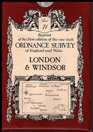
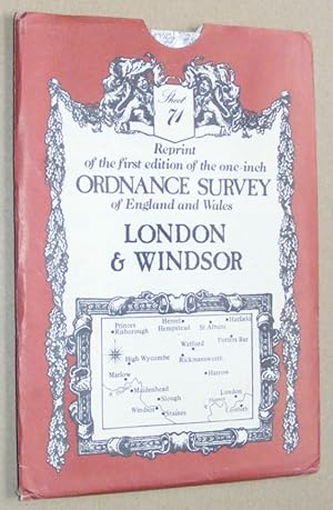
Ordnance Survey Map of LONDON and WINDSOR 1979 Sheet No.71. Reprint of the first edition of the one-inch map of England and Wales
Published by David & Charles, Newton Abbot, Devon, 1979
ISBN 10: 0715346156 ISBN 13: 9780715346150
Language: English
Map
Soft cover. Condition: Fine. ## Ordnance Survey Map of LONDON and WINDSOR 1979 Sheet No.71. Reprint of the first edition of the one-inch map of England and Wales ## ## THIS MAP: Categorised as FINE. The 1979 edition, it was published first in 1970. The paper slipcover has a few marks at the top. The detailing of these early maps is remarkable. PLEASE READ ON for interesting information and details. SEE THE IMAGES. ### ## Ordnance Survey (OS) is the national mapping agency of Great Britain, producing detailed and accurate maps for various purposes. Its origins date back to the 18th century as a military project to survey the Scottish Highlands and the southern coasts of England in response to the Jacobite rebellion and the French Revolution. The name Ordnance Survey reflects its connection to the Board of Ordnance, the defence ministry of the time.## ## One of the pioneers of OS was William Roy, a young engineer who conducted the first small-scale survey of Scotland from 1747 to 1755, using simple instruments such as compasses and chains. He later undertook a more ambitious project to geodetically connect the Royal Observatories of Greenwich and Paris, using a sophisticated theodolite made by Jesse Ramsden. This project, which started in 1784 and lasted until 1790, laid the foundation for the trigonometrical survey of Britain, which aimed to create a network of accurately measured triangles across the country.## ## The trigonometrical survey, also known as the Principal Triangulation, was officially initiated in 1791, marking the birth of OS. It involved measuring baselines on flat ground, such as Hounslow Heath, and then extending the triangles to hills and mountains, where observatories were built to house the theodolites. The surveyors had to deal with various challenges like weather, terrain, visibility, and accuracy. The survey was completed in 1853, covering over 300,000 square kilometres and 5,000 stations.## ## The trigonometrical survey provided the basis for the first accurate map of Britain, which was published by OS in 1801. It was a one-inch-to-the-mile map of Kent, showing roads, rivers, hills, settlements, and land cover. It was followed by maps of other counties and regions, using different scales and symbols. OS also produced maps of overseas British colonies, such as India, Africa, and the Caribbean, under the Directorate of Colonial Surveys and the Directorate of Overseas Surveys.## ##Over the years, OS has evolved and adapted to the changing needs and technologies of mapping. It has introduced new methods and standards of surveying, such as levelling, photogrammetry, aerial photography, and satellite positioning. It has diversified its products and services, such as digital mapping, online platforms, mobile apps, and geospatial data. Today, OS is one of the world's leading mapping agencies, aiming to provide the most up-to-date and comprehensive geospatial information about Great Britain.## ### INTERNATIONAL BUYERS: Please Note. FREE SHIPPING IS UK ONLY. Please get in touch with me for a shipping quotation. ####. No Author signature.
-
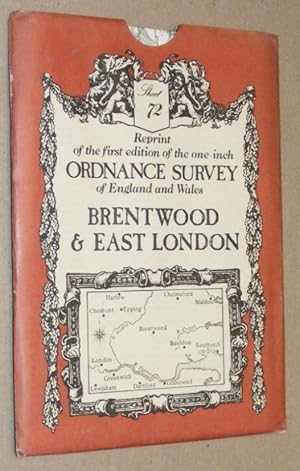
Ordnance Survey Map of BRENTWOOD & East LONDON 1979 Sheet No.72. Reprint of the first edition of the one-inch map of England and Wales
Published by David & Charles, Newton Abbot, Devon, 1983
ISBN 10: 0715346172 ISBN 13: 9780715346174
Language: English
Map
Soft cover. Condition: Fine. ## Ordnance Survey Map of BRENTWOOD & East LONDON 1979 Sheet No.72. Reprint of the first edition of the one-inch map of England and Wales ## ## THIS MAP: Categorised as FINE. The 1979 edition, it was published first in 1970. The paper slipcover has a few marks at the top and minor bumping to the corners. The detailing of these early maps is remarkable. PLEASE READ ON for interesting information and details. SEE THE IMAGES. ### ## Ordnance Survey (OS) is the national mapping agency of Great Britain, producing detailed and accurate maps for various purposes. Its origins date back to the 18th century as a military project to survey the Scottish Highlands and the southern coasts of England in response to the Jacobite rebellion and the French Revolution. The name Ordnance Survey reflects its connection to the Board of Ordnance, the defence ministry of the time.## ## One of the pioneers of OS was William Roy, a young engineer who conducted the first small-scale survey of Scotland from 1747 to 1755, using simple instruments such as compasses and chains. He later undertook a more ambitious project to geodetically connect the Royal Observatories of Greenwich and Paris, using a sophisticated theodolite made by Jesse Ramsden. This project, which started in 1784 and lasted until 1790, laid the foundation for the trigonometrical survey of Britain, which aimed to create a network of accurately measured triangles across the country.## ## The trigonometrical survey, also known as the Principal Triangulation, was officially initiated in 1791, marking the birth of OS. It involved measuring baselines on flat ground, such as Hounslow Heath, and then extending the triangles to hills and mountains, where observatories were built to house the theodolites. The surveyors had to deal with various challenges like weather, terrain, visibility, and accuracy. The survey was completed in 1853, covering over 300,000 square kilometres and 5,000 stations.## ## The trigonometrical survey provided the basis for the first accurate map of Britain, which was published by OS in 1801. It was a one-inch-to-the-mile map of Kent, showing roads, rivers, hills, settlements, and land cover. It was followed by maps of other counties and regions, using different scales and symbols. OS also produced maps of overseas British colonies, such as India, Africa, and the Caribbean, under the Directorate of Colonial Surveys and the Directorate of Overseas Surveys.## ##Over the years, OS has evolved and adapted to the changing needs and technologies of mapping. It has introduced new methods and standards of surveying, such as levelling, photogrammetry, aerial photography, and satellite positioning. It has diversified its products and services, such as digital mapping, online platforms, mobile apps, and geospatial data. Today, OS is one of the world's leading mapping agencies, aiming to provide the most up-to-date and comprehensive geospatial information about Great Britain.## ### INTERNATIONAL BUYERS: Please Note. FREE SHIPPING IS UK ONLY. Please get in touch with me for a shipping quotation. ####.
-
Soft cover. Condition: Fine. ## Ordnance Survey Map of LONDON and WINDSOR 1979 Sheet No.71. Reprint of the first edition of the one-inch map of England and Wales ## ## THIS MAP: Categorised as FINE. The 1979 edition, it was published first in 1970. The paper slipcover has a few marks at the top. The detailing of these early maps is remarkable. PLEASE READ ON for interesting information and details. SEE THE IMAGES. ### ## Ordnance Survey (OS) is the national mapping agency of Great Britain, producing detailed and accurate maps for various purposes. Its origins date back to the 18th century as a military project to survey the Scottish Highlands and the southern coasts of England in response to the Jacobite rebellion and the French Revolution. The name Ordnance Survey reflects its connection to the Board of Ordnance, the defence ministry of the time.## ## One of the pioneers of OS was William Roy, a young engineer who conducted the first small-scale survey of Scotland from 1747 to 1755, using simple instruments such as compasses and chains. He later undertook a more ambitious project to geodetically connect the Royal Observatories of Greenwich and Paris, using a sophisticated theodolite made by Jesse Ramsden. This project, which started in 1784 and lasted until 1790, laid the foundation for the trigonometrical survey of Britain, which aimed to create a network of accurately measured triangles across the country.## ## The trigonometrical survey, also known as the Principal Triangulation, was officially initiated in 1791, marking the birth of OS. It involved measuring baselines on flat ground, such as Hounslow Heath, and then extending the triangles to hills and mountains, where observatories were built to house the theodolites. The surveyors had to deal with various challenges like weather, terrain, visibility, and accuracy. The survey was completed in 1853, covering over 300,000 square kilometres and 5,000 stations.## ## The trigonometrical survey provided the basis for the first accurate map of Britain, which was published by OS in 1801. It was a one-inch-to-the-mile map of Kent, showing roads, rivers, hills, settlements, and land cover. It was followed by maps of other counties and regions, using different scales and symbols. OS also produced maps of overseas British colonies, such as India, Africa, and the Caribbean, under the Directorate of Colonial Surveys and the Directorate of Overseas Surveys.## ##Over the years, OS has evolved and adapted to the changing needs and technologies of mapping. It has introduced new methods and standards of surveying, such as levelling, photogrammetry, aerial photography, and satellite positioning. It has diversified its products and services, such as digital mapping, online platforms, mobile apps, and geospatial data. Today, OS is one of the world's leading mapping agencies, aiming to provide the most up-to-date and comprehensive geospatial information about Great Britain.## ### INTERNATIONAL BUYERS: Please Note. FREE SHIPPING IS UK ONLY. Please get in touch with me for a shipping quotation. ####.
-
London & Windsor: Sheet 71 , reprint of the first edition of the one-inch Ordnance Survey of England and Wales
Published by David & Charles, Newton Abbot, 1979
ISBN 10: 0715346156 ISBN 13: 9780715346150
Language: English
Map
Map. Condition: Very Good. Folded map in very good condition, in an envelope which has some wear and rubbing.
-
Brentwood & East London: Sheet 72, reprint of the first edition of the one-inch Ordnance Survey of England and Wales
Published by David & Charles, Newton Abbot, 1979
ISBN 10: 0715346172 ISBN 13: 9780715346174
Language: English
Map
Map. Condition: Very Good. Folded map in very good condition, card envelope has some wear and rubbing.
-

Swiss Cottage and South Hampstead 1937: London Sheet 37 (Old Ordnance Survey Maps of London)
Seller: GENERATIONS GONE BY, Manchester, United Kingdom
Seller rating 5 out of 5 stars
Map
No Binding. Condition: New. No Jacket. Here are the details of maps for Swiss Cottage & South Hampstead: London 37.1 Swiss Cottage 1866-71 - published 2006; intro by Pamela Taylor. ISBN.978-1-84151-926-5 London 37.2 Swiss Cottage 1894 - published 1986; intro by Susan Palmer. ISBN.978-0-85054-149-6 London 37.4 Swiss Cottage & South Hampstead 1937 - published 2007; intro by Alan Godfrey. ISBN.978-1-84784-047-9 We have published three versions of this map, showing how the area developed across the years. The map is centred on Swiss Cottage, with its underground station, New College (a training college for dissenting ministers), and School for the Blind. The map also covers West Hampstead, and the area of south and west Hampstead developed as part of the Maryon Wilson estate. It also includes part of the Belsize estate. In the NE of the map is a stretch of Haverstock Hill, including Hampstead Vestry Hall; in the SE corner is part of Primrose Hill, while Edgware Road cuts across the SW corner. Several railways emerge from tunnels on the map, including the LNWR at Loudon Road station, and Metropolitan, Midland and Hampstead Junction at the Finchley Road stations. Principal roads include Priory Road, Finchley Road, Fitzjohns Avenue, Eton Avenue, Adelaide Avenue and many more. The 1871 map shows an area which is still largely undeveloped north of Swiss Cottage. This map includes extracts from an early street directory for Adelaide Road, Belsize Road/Square, Finchley New Rd, Loudon Road. The 1937 map, by contrast, shows the area entirely built up. A selection of street directory entries on the reverse includes Belsize Avenue/Crescent/Grove/Lane, Elsworthy Road, Finchley Road, Fitzjohns Avenue, Greencroft Gardens. The map links up with London Sheets 27 Hampstead to the north, 36 Willesden Green to the west, 38 Kentish Town to the east, 48 St Johns Wood to the south.
-

East Ham & Barking 1939: London Sheet 44.4 (Old Ordnance Survey Maps of London)
Seller: GENERATIONS GONE BY, Manchester, United Kingdom
Seller rating 5 out of 5 stars
Map
No Binding. Condition: New. No Jacket. Here are the details of maps for Barking & East Ham: London Sheet 44.1 East Ham & Barking 1894 - published 1996; intro by Stephen Pewsey. ISBN.978-0-85054-373-5 London Sheet 44.2 East Ham & Barking 1915 - published 1999; intro by Tony Clifford. ISBN.978-1-84151-087-3 London Sheet 44.3 East Ham & Barking 1939 - published 2021; intro by Tony Kirby. ISBN.978-1-78721-465-1 We have published three versions of this map, showing how the area developed across the years. The maps each cover the same area, stretching from High Street North at East Ham eastward to Barking station; and from Jersey Road and Manor Park Athletic Grounds southward to Caulfield Road. The River Roding runs north-south through the centre of the map, East Ham to one side, Barking to the other. Features include East Ham and Barking stations, Linton Road, East Street, Uphall chemical works, various works beside the Roding, railway junctions, housing development at East Ham. The 1894 version also includes a large extract of Essex sheet 73.12 to the south, showing more of Barking incl St Margaret's church, White Gate Bridge, also of East Ham incl Wallend. If you are only buying one map we therefore recommend the 1894 version. The map links up with London Sheets 34 Ilford to the north, 43 Forest Gate to the west, and Essex Sheets 86.04 Upney to the east and 86.07 East Ham & Barking South to the south.
-

Highbury and Islington 1871: London Sheet 039.1 (Old Ordnance Survey Maps of London)
Seller: GENERATIONS GONE BY, Manchester, United Kingdom
Seller rating 5 out of 5 stars
Map
No Binding. Condition: New. No Jacket. Here are the details of maps for Islington & Highbury: London 39.1 Highbury & Islington 1871 - published 1990; intro by David Mander. ISBN.978-0-85054-336-0 London 39.2 Highbury & Islington 1894 - published 1990; intro by Alan Godfgrey. ISBN.978-0-85054-455-8 London 39.3 Highbury & Islington 1914 - published 1985; intro by Jim Connell. ISBN.978-0-85054-029-1 We have published three versions of this map, showing how the area developed across the years. The maps each cover the same area, York Road eastward to Rotherfield Street, and from Cloudsley Square northward to Witherington Road. Highbury & Islington station is near the centre of the map, which covers much of Islington and also southern Highbury. Barnsbury and Canonbury are also included. Major roads running through the map include Upper Street, Essex Road, Liverpool Road and Caledonian Road. These are very busy maps and features include the Kings Cross railway approaches; North London Railway, including Canonbury, Highbury & Islington, Caledonian Road and (at extreme west edge) Maiden Lane stations; Metropolitan Cattle Market, Belle Isle, Thornhill Square, Lonsdale Square, Highbury Fields, Milner Square, Canonbury Square, Islington Town Hall, Peabody Square. The major feature is innumerable streets of housing, Barnsbury area to west, Canonbury to east. The map links up with London Sheets 29 Upper Holloway to the north, 38 Kentish Town to the west, 40 Dalston to the east, 50 Clerkenwell to the south.
-

Beckenham (South) 1894: London Sheet 151.2 (Old Ordnance Survey Maps of London)
Seller: GENERATIONS GONE BY, Manchester, United Kingdom
Seller rating 5 out of 5 stars
Map
No Binding. Condition: New. No Jacket. Here are the details of maps for Elmers End: London Sheet 151 Beckenham (South) 1894 - published 2013; intro by Richard Oliver. ISBN.978-1-84784-698-3 This detailed map covers the area south of Beckenham, from Burnhill Road and part of the High Street, southward to South Eden Park and Elmers End. Features include Eden Lodge, Kelsey Park, Kelsey Manor, Eden Park, Beckenham Cottage Hospital, SER Mid Kent line with Elmers End station, part of Crystal Palace District Cemetery, St James church etc. Entries C-K of a 1905 Kent directory of Beckenham are included on the reverse. The map links up with London sheets 146 Beckenham to the north, 150 South Norwood to the west, 152 Shortlands to the east.
-

Teddington & Hampton Hill 1934: London Sheet 131.4 (Old Ordnance Survey Maps of London)
Seller: GENERATIONS GONE BY, Manchester, United Kingdom
Seller rating 5 out of 5 stars
Map
No Binding. Condition: New. No Jacket. Here are the details of maps for Teddington & Hampton: London Sheet 131.2 Teddington & Hampton Hill 1894 - published 1997; intro by John Griffiths. ISBN.978-0-85054-883-9 London Sheet 131.4 Teddington & Hampton Hill 1934 - published 2012; intro by Pamela Taylor. ISBN.978-1-84784-598-6 We have published two versions of this map, showing how the area developed across the years. Each covers the western part of Teddington, including Broad Street, Church Road and Park Road, and the area westward to Hampton Hill, including Windmill Road, High Street, Mill Road. Features include a stretch of Queen's or Cardinal's River, Fulwell & Hampton Hill station, Teddington Cemetery, St Peter & St Paul's church Teddington, St James church Hampton, the northern part of Bushy Park incl Upper Lodge. The introductory essay by John Griffiths for the 1894 edition also includes a section on 'General Roy's Base and the Origins of the Ordnance Survey'; the East End of Roy's base is on the map. The maps also include a selection of directory entries. The map links up with London Sheets 121 West Twickenham to the north, 132 Teddington Lock to the east and 139 Hampton to the south, and with Middlesex 25.02 Hanworth to the west.
-
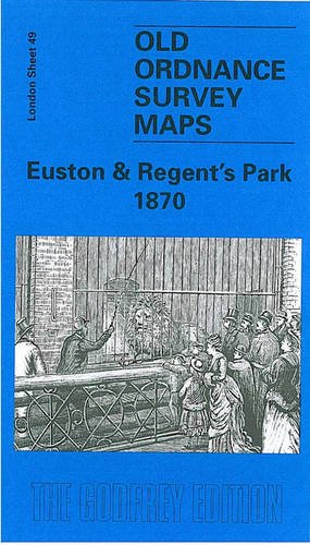
Euston and Regent's Park 1870: London Sheet 049.1 (Old Ordnance Survey Maps of London)
Seller: GENERATIONS GONE BY, Manchester, United Kingdom
Seller rating 5 out of 5 stars
Map
No Binding. Condition: New. No Jacket. Here are the details of maps for Euston: London 49.1 Euston & Regent's Park 1870 - published 2000; intro by Malcolm Holmes. ISBN.978-1-84151-140-5 London 49.2 Euston & Regent's Park 1894 - published 1989; intro by Isobel Watson. ISBN.978-0-85054-254-7 London 49.3 Euston & Regent's Park 1913 - published 1993; intro by Isobel Watson. ISBN.978-0-85054-557-9 We have published three versions of this map, showing how the area developed across the years. The maps each cover the same area, stretching from Baker Street station eastward to Tavistock Square; and from The Zoo southward to Fitzroy Square. The maps therefore cover a fascinating area, including most of Regent's Park, Euston station and its approaches, Somers Town goods station and the St Pancras railway approaches, part of north Bloomsbury, and the area around University College Hospital. Other features include Royal Botanic Gardens, Regents Canal and Regents Park Basin, Cumberland Market, Regents Park Barracks, The Zoo, Albany Street, Clarendon Square, St Pancras Workhouse, St Pancras church, and countless streets. Various street directory extracts are given on the reverse; the 1894 map also has a Plan of the Zoo. The map links up with London Sheets 38 Kentish Town to the north, 48 St Johns Wood to the west, 50 Clerkenwell to the east, 61 West End to the south.
More buying choices from other sellers on AbeBooks
New offers from � 5.75
-

North Hammersmith and Bedford Park 1893: London Sheet 072.2 (Old Ordnance Survey Maps of London)
Seller: GENERATIONS GONE BY, Manchester, United Kingdom
Seller rating 5 out of 5 stars
Map
No Binding. Condition: New. No Jacket. Here are the details of maps for North Hammersmith: London Sheet 72.1 North Hammersmith 1869 - published 2004; intro by Pamela Taylor. ISBN.978-1-84151-626-4 London Sheet 72.2 North Hammersmith & Bedford Park 1893 - published 1996; intro by Alan Godfrey. ISBN.978-0-85054-857-0 London Sheet 72.3 North Hammersmith & Bedford Park 1912 - published 1986; intro by Rosemary Clarkson. ISBN.978-0-85054-061-1 London Sheet 72.4 North Hammersmith & Bedford Park 1935 - published 2007; intro by Pamela Taylor. ISBN.978-1-84784-065-3 We have published four versions of this map, showing how the area developed across the years. The maps all cover the same area, with coverage extending from Acton Lane and Beaconsfield Road eastward to Devonport Road and Tabor Road, and from the Uxbridge Road southward to Hamlet Gardens and the District Line. The 1869 map shows Hammersmith at the edge of suburbia, with many fields, but several brick fields are evidence that building was underway. Features include Starch Green, Acton Vale, Oldfield House, Stamford Brook, Acton Green, Turnham Green station, Ravenscourt Park, Paddenswick Green. By the time of the 1893 map Starch Green has extended south to join Hammersmith, and part of the map is shown as western Shepherds Bush. Bedford Park is being developed. By the time of the 1912 map most of the map has been built on with just a few streets half built, and the 1935 version completes the picture. Other features on these maps include the NSWJR Hammersmith Branch, Stamford Brook Common, Wendell Park, tramways - and all the usual detail of these maps, including individual houses neatly delineated. The 1869 map includes an 1888 LSWR timetable for the Waterloo-Hammersmith-Richmond line on the reverse. The 1893, 1912 and 1935 maps have good selections of street directory entries. The map links up with London Sheets 58 East Acton to the north, 71 South Acton to the west, 73 Holland Park to the east, and 85 Chiswick to the south.
-

Croydon (E) Coombe Park & Addiscombe Road 1895: London Sheet 158.2 (Old Ordnance Survey Maps of London)
Seller: GENERATIONS GONE BY, Manchester, United Kingdom
Seller rating 5 out of 5 stars
Map
No Binding. Condition: New. No Jacket. Here are the details of maps for East Croydon : London Sheet 158 Croydon (E): Coombe Park & Addiscombe Road 1895 - published 2014; intro by Richard Oliver. ISBN.978-1-84784-809-3 This detailed map covers the eastern part of Croydon, from the Addiscombe Road southward to Coombe Park. Features include Shirley House, Addiscombe Farm, Coombe Lane station, Parkhill House, Brickwood House, St Mary Magdalene church, Addiscombe Road etc. Extracts from a 1934 street directory are included on the reverse. The map links up with sheets 155 Croydon NE to the north, 157 Croydon to the west and 160 Addington Hills to the south.
-

Chiswick and West Hammersmith 1935: London Sheet 85 (Old Ordnance Survey Maps of London)
Seller: GENERATIONS GONE BY, Manchester, United Kingdom
Seller rating 5 out of 5 stars
Map
No Binding. Condition: New. No Jacket. Here are the details of maps for Chiswick & Castelnau: London Sheet 85.1 Chiswick 1867 - published 2004; intro by Pamela Taylor. ISBN.978-1-84151-617-2 London Sheet 85.2 Chiswick 1893 - published 1994; intro by Alan Godfrey. ISBN.978-0-85054-657-6 London Sheet 85.4 Chiswick & West Hammersmith 1935 - published 2008; intro by Pamela Taylor. ISBN.978-1-84784-096-7 We have published three versions of this map, showing how the area developed across the years. The maps each cover the same area, Chiswick House and Christ Church (on Turnham Green) eastward to Hammersmith Bridge; and from High Road and King Street southward. However, Please note that the 1935 map (as usual at that period) does not include the area south of the river, which is left blank. Features on the maps include Chiswick House and gardens, Chiswick Cemetery, Chiswick New Town, Devonshire Road, Duke Road, Griffin Brewery, St Nicholas church, West Middlesex Water Works, Royal Horticultural Gardens, Church Wharf, St Peter's Square, The Creek. A portion of Hammersmith (south of King Street) is in the NE corner. The Thames runs through the map, including Chiswick Eyot. Castlenau and Lonsdale Road are in the SE quarter (except 1935 version). Part of Turnham Green is in the NW corner. A list of private residents in 1890 is included, split between the 1867 and 1893 maps. The 1935 map includes a contemporary street directory for Chiswick High Road, Chiswick Lane and Chiswick Mall. The map links up with London Sheets 72 North Hammersmith to the north, 84 Kew to the west, 86 Hammersmith & Fulham to the east, 98 Barnes to the south.
-
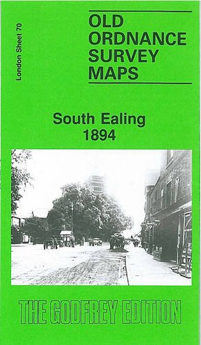
South Ealing 1894: London Sheet 070.2 (Old Ordnance Survey Maps of London)
Seller: GENERATIONS GONE BY, Manchester, United Kingdom
Seller rating 5 out of 5 stars
Map
No Binding. Condition: New. No Jacket. Here are the details of maps for South Ealing: London Sheet 70.2 South Ealing 1894 - published 1994; intro by Alan Godfrey. ISBN.978-0-85054-651-4 London Sheet 70.3 South Ealing 1913 - published 2020; intro by Pamela Taylor. ISBN.978-1-78721-313-5 London Sheet 70.4 South Ealing 1934 - published 2007; intro by Jonathan Oates. ISBN.978-1-84784-090-5 We have published three versions of this map, showing how the area developed across the years. Each covers the same area. Coverage stretches from Elthorne Park eastward to Cedar Grove, and from Rathgar Avenue southward to Darwin Road. In 1894 this was still a largely rural area, and major features are St Mary's church, a stretch of the District line with Boston Road and South Ealing stations, a small stretch of Grand Junction Canal with Osterley Lock; Little Ealing, with Ealing Park convent, Ealing Cemetery, and the beginning of building nearby; Lammas Park and village area around St Mary's church. The later editions show the area becoming increasingly built-up. Selected directory extracts are included on both maps. The map links up with Sheets 56 Ealing to the north, 69 Hanwell to the west, 71 South Acton to the east and 83 Brentford to the south.
-

The West End 1914: London Sheet 061.3 (Old Ordnance Survey Maps of London)
Seller: GENERATIONS GONE BY, Manchester, United Kingdom
Seller rating 5 out of 5 stars
Map
No Binding. Condition: New. No Jacket. Here are the details of maps for The West End, Soho and Mayfair: London Sheet 61.1 The West End 1870 - published 1995; intro by Alan Godfrey. ISBN.978-0-85054-134-2 London Sheet 61.2 The West End 1894 - published 1996; intro by Pamela Taylor. ISBN.978-0-85054-830-3 London Sheet 61.3 The West End 1914 - published 1986; intro by Alan Godfrey. ISBN.978-0-85054-071-0 The three versions of this map show how the area developed across the years. The maps each cover the same area of central London, stretching from Marble Arch eastward to Charing Cross Road, from Devonshire Street and Bedford Square southward to Berkeley Square and Haymarket. Oxford Street runs through the centre of a map which covers most of what we know as The West End. Streets covered include Regent Street, Shaftesbury Avenue, most of Tottenham Court Road, Charing Cross Road, Portland Place, Portman Square, Soho Square, Grosvenor Square, Cavendish Square and many others. Features include Burlington House, the National Gallery, British Museum, many theatres, All Soul's church. However the map is most notable for its closely packed streets, with their houses, shops, offices etc. in remarkable detail. Each map also has selected extracts from directories; for instance, the 1914 map has a directory for Oxford St. The map links up with Sheets 49 Euston to the north, 60 Paddington to the west, 62 Holborn to the east, and 75 Westminster to the south.
More buying choices from other sellers on AbeBooks
New offers from � 5.75
-
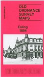
Ealing 1894: London Sheet 056.2 (Old Ordnance Survey Maps of London)
Seller: GENERATIONS GONE BY, Manchester, United Kingdom
Seller rating 5 out of 5 stars
Map
No Binding. Condition: New. No Jacket. Here are the details of maps for Ealing: London Sheet 56.2 Ealing 1894 - published 1991; intro by Peter Hounsell. ISBN.978-0-85054-404-6 London Sheet 56.3 Ealing 1913 - published 2017; intro by Alan Godfrey. ISBN.978-1-78721-057-8 London Sheet 56.4 Ealing 1934 - published 2008; intro by Peter Hounsell. ISBN.978-1-84784-095-0 We have published three versions of this map, showing how the area changed across the years. Each covers the same area, which is an area of a mile by a mile and a half, stretching from Eccleston Road eastward to Ealing Broadway and Windsor Road; from Cleveland Road and Castle Bar southward to Grange Road and Churchfield Road. The map covers central and west Ealing. Features include Ealing Broadway station, Castle Hill & Ealing Dean station, Haven Green, Drayton Green, cemetery, Central London District School. Churches include St Stephen's, St John's Mattock Lane, Christ Church. Streets include The Avenue, Uxbridge Road, High Street, Eaton Rise, Argyle Road etc. The map links up with Sheet 45 Perivale to the north, Sheet 55 Hanwell to the west, Sheet 57 Ealing Common to the east and 70 South Ealing to the south.
-
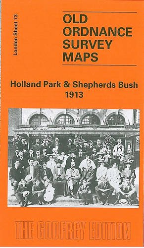
Holland Park and Shepherds Bush 1913: London Sheet 073.3 (Old Ordnance Survey Maps of London)
Seller: GENERATIONS GONE BY, Manchester, United Kingdom
Seller rating 5 out of 5 stars
Map
No Binding. Condition: New. No Jacket. Here are the details of maps for Kensington (W) & Shepherds Bush: London Sheet 73.1 Holland Park & Shepherds Bush 1871 - published 1989; intro by Brian Curle & Pamela Taylor. ISBN.978-0-85054-214-1 London Sheet 73.2 Holland Park & Shepherds Bush 1894 - published 1983, 2nd Edition 1997; intro by Pamela Taylor. ISBN.978-0-85054-917-1 London Sheet 73.3 Holland Park & Shepherds Bush 1913 - published 1996; intro by Pamela Taylor. ISBN.978-0-85054-824-2 We have published three versions of this map, showing how the area developed across the years. The maps each cover the same area, stretching from Iffley Road, Hammersmith eastward to Phillimore Gardens, Kensington; and from Royal Crescent and the Uxbridge Road southward to Pembroke Road. The many features include Olympia, Holland Park, Holland House, Shepherds Bush Common, Brook Green, part of Kensington High Street, Shepherds Bush Road, Addison Road. Several railways cross the map and stations include Uxbridge Road and Addison Road (later Kensington Olympia) on the West London Railway; Shepherds Bush, Goldhawk Road and Hammersmith on the Hammersmith & City; Shepherds Bush and Hammersmith on the LSWR Kensington & Richmond line. The map links up with London Sheets 59 Notting Hill to the north, 72 North Hammersmith to the west, 74 Kensington to the east, 86 Hammersmith & Fulham to the south.
-

Holland Park and Shepherds Bush 1871: London Sheet 073.1 (Old Ordnance Survey Maps of London)
Seller: GENERATIONS GONE BY, Manchester, United Kingdom
Seller rating 5 out of 5 stars
Map
No Binding. Condition: New. No Jacket. Here are the details of maps for Kensington (W) & Shepherds Bush: London Sheet 73.1 Holland Park & Shepherds Bush 1871 - published 1989; intro by Brian Curle & Pamela Taylor. ISBN.978-0-85054-214-1 London Sheet 73.2 Holland Park & Shepherds Bush 1894 - published 1983, 2nd Edition 1997; intro by Pamela Taylor. ISBN.978-0-85054-917-1 London Sheet 73.3 Holland Park & Shepherds Bush 1913 - published 1996; intro by Pamela Taylor. ISBN.978-0-85054-824-2 We have published three versions of this map, showing how the area developed across the years. The maps each cover the same area, stretching from Iffley Road, Hammersmith eastward to Phillimore Gardens, Kensington; and from Royal Crescent and the Uxbridge Road southward to Pembroke Road. The many features include Olympia, Holland Park, Holland House, Shepherds Bush Common, Brook Green, part of Kensington High Street, Shepherds Bush Road, Addison Road. Several railways cross the map and stations include Uxbridge Road and Addison Road (later Kensington Olympia) on the West London Railway; Shepherds Bush, Goldhawk Road and Hammersmith on the Hammersmith & City; Shepherds Bush and Hammersmith on the LSWR Kensington & Richmond line. The map links up with London Sheets 59 Notting Hill to the north, 72 North Hammersmith to the west, 74 Kensington to the east, 86 Hammersmith & Fulham to the south.