Order Total (1 Item Items):
Shipping Destination:

Perrier Motor Map (10 results)
Skip to main search results
Search filters
Product Type
- All Product Types
- Books (5)
- Magazines & Periodicals (No further results match this refinement)
- Comics (No further results match this refinement)
- Sheet Music (No further results match this refinement)
- Art, Prints & Posters (No further results match this refinement)
- Photographs (No further results match this refinement)
- Maps (4)
- Manuscripts & Paper Collectibles (1)
Condition Learn more
- New (No further results match this refinement)
- As New, Fine or Near Fine (2)
- Very Good or Good (6)
- Fair or Poor (No further results match this refinement)
- As Described (2)
Binding
Collectible Attributes
- First Edition (2)
- Signed (No further results match this refinement)
- Dust Jacket (No further results match this refinement)
- Seller-Supplied Images (8)
- Not Print on Demand (10)
Language (2)
Free Shipping
- Free Shipping to U.S.A. (No further results match this refinement)
Seller Location
Seller Rating
-
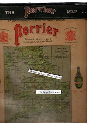
Perrier Motor Map
Language: English
Published by Perrier, 1910
Seller: YattonBookShop PBFA, Yatton, United Kingdom
Association Member: PBFA
Seller rating 5 out of 5 stars

Hardcover. Condition: Good. Undated, c1910. 2 cloth backed maps in a green slipcase with white lettering to front, NORTH and SOUTH. Additional photos are available upon request. When securely packed this item will weigh in the region of 705g. Unless specifically mentioned, all our books are photographed so you can see what you are buying. ABE may, however, display a stock image whilst processing ours. (YBP Ref: 033729:12f) Size: 8vo - over 73/4" - 93/4" Tall Language: ENG 705 G. Book.
-
The Perrier Motor Map of England & Wales
Language: English
Published by George Philip & Son for Perrier, United Kingdom, 1922
Seller: Pendleburys - the bookshop in the hills, Llanwrda, United Kingdom
Seller rating 5 out of 5 stars
Hardcover. Condition: Very Good. No Jacket. a very good set of sectional coloured maps on an 8 miles to the inch scale, in original case, undated but around 1920-1923 as the Road lettering and numbering system (A1, A40 etc) are not here used and earlier than 1920 copies were backed onto linen, fourteen maps, distance card, Index sheet, all printed on card and with linen index taps to top edge (lacking tab for Card Six) Index card with Perrier advertising and reference to Royal Warrant of George V, housed in a very good original wooden sided case lettered silver and red on green cloth, plastic front to case revealing maps behind, two press fasteners to rear flap, a very well preserved set.
-

Soft cover. Condition: Near Fine. Color lithograph map in one section, 38" x 50"; map is near fine; green waterproof case with red lettering has light to moderate wear, overall very good.
-
Soft cover. Condition: Very Good+. Color lithographed map, divided into North and South sections; 47" x 56", linen backed, North section has 13 dots to mark route, South has 4 dots, overall very good+ or better; waterproof green case with red lettering is very good with cloth worn through at bottom corner tips and light wear, overall very good.
-
The Perrier Motor Map (of England and Wales with part of Scotland)
Language: English
Published by George Philip and Son Ltd, 1910
Seller: Morning Mist Books and Maps, Cirencester, United Kingdom
Seller rating 5 out of 5 stars
Map
No Binding. Condition: Good. NOTE: the linen is thinning and fragile with splits along edges and across folds which is aggravated by the weight of the sheets. It is likely that further splitting will occur. Two large sheets, lacking the original slipcase. Large Perrier title and advert, both to the North sheet. Splits to margins and going into the map in some places. Splits beginning, to fold junctions. General toning but still bright with good colour. Sheet sizes: 75cm by116.5cm x2 (approx.). Undated but advert references Edward VII, so unlikely to be much later than 1910 but 'Royal Appointment' marks tend to stay in use for a few years after the monarch's demise. Price takes into account condition and risks. Purchase is on the understanding that this may well occur. Further details available on request. (n616 B P.L.).
-
Perrier Motor Map. England
Published by Perrier [1920], London, 1920
Seller: Barter Books Ltd, Alnwick, NORTH, United Kingdom
Association Member: IOBA
Seller rating 5 out of 5 stars
Map First Edition
Grey hardback cloth case. Condition: Good. First Edition. G : in Good condition. Case rubbed. Previous owner inscription to case. 260mm x 210mm (10" x 8"). 36 linen-backed panels. 2 full colour maps - North and South Sections. 8 miles to 1 inch.
-

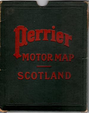
PERRIER MOTOR MAP OF SCOTLAND.
Published by George Philip, London, c. 1910., 1910
Seller: Sainsbury's Books Pty. Ltd., Camberwell, VIC, Australia
Association Member: ANZAAB ILAB
Seller rating 4 out of 5 stars

Large colour printed folding map of Scotland (approx. 950mm x 1250mm) with Perrier advertisement inset to upper left corner, dissected into 25 sections and mounted on linen.
-
'The Perrier Motor Map of England and Wales', complete, sectional maps
Published by George Philip & Son for Perrier, London, 1920
Seller: Rare Books Honolulu, Honolulu, HI, U.S.A.
Association Member: IOBA
Seller rating 5 out of 5 stars
Manuscript / Paper Collectible
'The Perrier Motor Map of England and Wales', complete, with 14 sectional road maps of England and Wales, one index and one distance chart, each 12 x 9.5 inches (24.5 x 30cm), George Philip & Son for Perrier, undated but around 1920-1923 as the maps are without the later introduced road lettering and numbering system. The set of sectional colored maps has an 8 miles to the inch scale. In original case, covered with green faux leather, in good condition, minor shelf wear, minimal ageing to clear plastic front. Cards very good, with numbered tabs, two press fasteners to rear flap, loose sectional maps in solid case.
-
The Perrier Motor Map of England and Wales, complete, sectional maps. Perrier advertising, by Special Appointment to H.M. King George V.
Published by George Philip & Son for Perrier, London, 1920
Map First Edition
Leather rear/edges, Plastic F. Condition: Good. First Edition. c1920, 16 cards, each 24.5 x 30cm (12 x 9.5 inches), i. e. 13 sectional single sided card maps of England and Wales in the original cloth covered card case, interior side/base wood supports with clear plastic front. Condition original cloth covered card case in good condition, minor edge rubbing, with black tape repair to top, minimal ageing to clear plastic front. Cards good, all cards present with numbered tabs top good, a couple with tiny corner tip loss, not affecting content, two press fasteners to rear flap, very good. As "By special appointment to H.M. King George V" reigned 1910-1936, undated , but believed to have been made c1920. Size: 27.5 x 34cm. Aprox. Map.
-
Folded in Slipcase. Condition: Near Fine. Very attractive motor map of Scotland, overall size 38" x 49", folded 4 times horizontally and 4 times vertically to make 25 sections (each 7 5/8" x 9 7/8"), mounted on one piece of dark grey cloth (linen?). Lithographic print in eight colours. The condition of the map is excellent save for a few light stains. Not dated but Perrier is advertised as "by special appointment to H.M. King Edward VII", so 1901-1910. The map goes from latitude 54 degrees 40' in the south to 58 degrees 40' in the north, and includes the islands of Scotland and part of Northern Ireland in the western part of the map and part of northern England in the south east corner. There is a nice ad for Perrier "The Champagne of Table Waters", 7" x 7 1/2" pasted to the top left corner of the map and "Perrier Motor Map" in large bold letters printed directly on the map at the top right corner. The map shows roads, cities, counties and mountain ranges. The slipcase is dark green cloth over cardboard with "Perrier Motor Map - Scotland" stamped in red on one side. The slipcase is worn at corners, is split along edges in places, and is missing one side. Map.