
Order Total (1 Item Items):
Shipping Destination:

Ordnance Survey Half Inch Map (86 results)
Skip to main search results
Search filters
Product Type
- All Product Types
- Books (23)
- Magazines & Periodicals (No further results match this refinement)
- Comics (No further results match this refinement)
- Sheet Music (No further results match this refinement)
- Art, Prints & Posters (No further results match this refinement)
- Photographs (No further results match this refinement)
- Maps (63)
- Manuscripts & Paper Collectibles (No further results match this refinement)
Condition Learn more
- New (No further results match this refinement)
- As New, Fine or Near Fine (2)
- Very Good or Good (62)
- Fair or Poor (7)
- As Described (15)
Binding
Collectible Attributes
- First Edition (11)
- Signed (No further results match this refinement)
- Dust Jacket (2)
- Seller-Supplied Images (72)
- Not Print on Demand (86)
Language (2)
Free Shipping
- Free Shipping to U.S.A. (No further results match this refinement)
Seller Location
Seller Rating
-

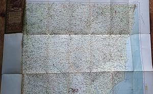
The Cotswolds : An Ordnance Survey District Map on the Half-Inch Scale
Published by Ordnance Survey Office, Southampton, England
Seller: Longhouse, Publishers & Booksellers, Brattleboro, VT, U.S.A.
Seller rating 5 out of 5 stars

Map. Near fine detailed foldout map in color in good illustrated wraps.
-

Ordnance Survey Road Map. Half-inch to One Mile. Worcester and Ludlow. Sheet 22. (Hill-shaded)
Language: English
Published by Ordnance Survey, 1914
Seller: Gwyn Tudur Davies, Aberystwyth, United Kingdom
Seller rating 5 out of 5 stars
Soft cover. Condition: Very Good. 1 folded cloth-backed col. map. A clean unmarked copy in very good condition. [Maps - Worcester - Ludlow - Shropshire - Worcestershire - England] s386.
-
![Seller image for Llandovery [Llanymddyfri] Sheet Sn 73 two and a half inch map. Ordnance Survey for sale by Gwyn Tudur Davies](https://pictures.abebooks.com/inventory/md/md30635716145.jpg)
Llandovery [Llanymddyfri] Sheet Sn 73 two and a half inch map. Ordnance Survey
Published by Ordnance Survey
Seller: Gwyn Tudur Davies, Aberystwyth, United Kingdom
Seller rating 5 out of 5 stars
Map
Soft cover. Condition: Good. No Jacket. 1 folded map. Minor scuffing to top edge of card-cover o/w map itself clean, unmarked and in very good condition. p1044 / m8589.
-
Colchester. Sheet 30, Ordnance Survey of England and Wales Half-inch map (1:126720)
Language: English
Published by Ordnance Survey, 1914
Map
Map. Condition: Good. Folded map, dissected and mounted on cloth, some marking, mainly in one panel (in the North Sea) and on the cloth backing, and a little tanned; card cover (Stanford) is foxed, marked and creased. Reduced from the One-inch map of 1902-4.
-

Ordnance Survey Road Map. Half-inch to One Mile. Chatham, Margate and Hastings. Sheet 40. (Layers)
Published by Ordnance Survey, 1928
Map First Edition
Soft cover. Condition: Very Good. No Jacket. 1st Edition. Published at the Ordnance Survey, Southampton in 1928 by the Director General. Periodical reprints. Imprint no 3039. Cover is clean and unmarked. Cloth map is clean and unmarked. Overall, a nice sheet! Reduced postage for multiple orders.
-

Ordnance Survey Road Map. Half-inch to One Mile. North Devon. Sheet 31. (Layers)
Published by Ordnance Survey, 1925
Map First Edition
Soft cover. Condition: Very Good. No Jacket. 1st Edition. Published at the Ordnance Survey, Southampton in 1925 by the Director General. Corrections up to 1931. Imprint no 3032 336. Cover is clean and unmarked. Cloth map is clean and unmarked. Overall, a nice sheet! Reduced postage for multiple orders.
-

Ordnance Survey Road Map. Half-inch to One Mile. Gloucester, Monmouth and Newport. Sheet 27. (Layers)
Published by Ordnance Survey, 1926
Map First Edition
Soft cover. Condition: Very Good. No Jacket. 1st Edition. Published at the Ordnance Survey, Southampton in 1926 by the Director General. Corrections up to 1932. Imprint no 3250/32. Cover is clean and unmarked. Cloth map is clean and unmarked. Overall, a nice sheet! Reduced postage for multiple orders.
-

Ordnance Survey Road Map. Half-inch to One Mile. Worcester and Ludlow. Sheet 22. (Hill-shaded)
Published by Ordnance Survey, 1914
Map First Edition
Soft cover. Condition: Very Good. Dust Jacket Condition: Very Good. 1st Edition. Published at the Ordnance Survey, Southampton in 1914. Cover is clean and unmarked. Cloth map is clean and unmarked. Overall, a nice sheet! Reduced postage for multiple orders.
-

Ordnance Survey Road Half-Inch to One Mile Map of Lincoln and Grimsby. Sheet 14. (Layers)
Published by Ordnance Survey, 1914
Map First Edition
Soft cover. Condition: Very Good. No Jacket. 1st Edition. Published at the Ordnance Survey, Southampton in 1914 by the Director General. With periodic reprints. Imprint no 25/39. Cover is clean and unmarked. Cloth map is clean and unmarked. Overall, a nice sheet! Reduced postage for multiple orders.
-

Ordnance Survey Road Map, Half-Inch to One Mile. Middlesborough and Richmond. Sheet 6. (Hill-shaded)
Published by Ordnance Survey, 1912
Map First Edition
Soft cover. Condition: Very Good. No Jacket. 1st Edition. Published at the Ordnance Survey, Southampton in 1912 by the Director General. Cover is clean and unmarked. Cloth map is clean and unmarked. Overall, a nice sheet! Reduced postage for multiple orders.
-

Ordnance Survey Half-Inch Map of Brighton. Sheet 39
Published by Ordnance Survey, 1928
Map First Edition
Soft cover. Condition: Very Good. No Jacket. 1st Edition. Published at the Ordnance Survey, Southampton in 1928 by the Director General with periodical corrections. Imprint no 25/37. Bender cover is clean and unmarked. Cloth map is clean and unmarked. A slightly rarer later edition with modified cover title and bender cover. Overall, a nice sheet! Reduced postage for multiple orders.
-

Ordnance Survey Road Map of Colchester (Half-Inch to One Mile), Sheet 30 Hill-Shaded
Published by Ordnance Survey, 1915
Map First Edition
Soft cover. Condition: Very Good. No Jacket. 1st Edition. OS Half-Inch green cover, Sheet 30 Colchester, Hill-shaded. Published at the the Ordnance Survey, Southampton 1915. Cover very good and clean. Linen-backed map - clean and unmarked. Postage will be reduced for multiple orders.
-

Ordnance Survey Snowdonia National Park Half-Inch Map
Language: English
Published by Ordnance Survey
Softcover. Condition: Very Good. Dust Jacket Condition: No Cover.
-

Ordnance Survey Map Of England half Inch to mile Sheet 3 - Newcastle Upon Tyne
Language: English
Published by Ordnance Survey, UK, 1912
Seller: Hanselled Books, Burntisland, FIFE, United Kingdom
Association Member: IOBA
Seller rating 4 out of 5 stars

Soft cover. Condition: Very Good. No Jacket. Linen backed.1/2" to mile, coloured. Opened size 21.5" x 30".
-
Ordnance Survey Map: SNOWDONIA NATIONAL PARK: Half Inch Map: 1976
Published by Ordnance Survey, Southampton, Hampshure, England, 1974
Map
Soft cover. Condition: Fine. No Jacket. ## Ordnance Survey Map: SNOWDONIA NATIONAL PARK: Half Inch Map: 1976 ## ## Please note: The map's condition, not its cover, determines its categorisation. All maps are pre-owned and may show signs of wear if folded incorrectly. The images displayed on our site are of our actual maps in stock, not generic ones. They are allowing you to assess the condition of the cover before purchase. While the cover may exhibit various degrees of creasing, wear and tear, or damage, the maps are generally in good condition and categorised accordingly. Please refer to the provided images for more details.## ## THIS MAP: Categorised as FINE. This 1976 edition was published first in 1976. The paper slipcover has general wear and tear, proportional to its age. The detailing of these early maps is remarkable. PLEASE READ ON for interesting information and details. SEE THE IMAGES. ### ## Ordnance Survey (O.S.) is the national mapping agency of Great Britain, producing detailed and accurate maps for various purposes. Its origins date back to the 18th century as a military project to survey the Scottish Highlands and the southern coasts of England in response to the Jacobite rebellion and the French Revolution. The name Ordnance Survey reflects its connection to the Board of Ordnance, the defence ministry of the time.## ## One of the pioneers of O.S. was William Roy, a young engineer who conducted the first small-scale survey of Scotland from 1747 to 1755, using simple instruments such as compasses and chains. He later undertook a more ambitious project to geodetically connect the Royal Observatories of Greenwich and Paris, using a sophisticated theodolite by Jesse Ramsden. This project, which started in 1784 and lasted until 1790, laid the foundation for the trigonometrical survey of Britain, which aimed to create a network of accurately measured triangles across the country.## ## The trigonometrical survey, also known as the Principal Triangulation, was officially initiated in 1791, marking the birth of O.S. It involved measuring baselines on flat ground, such as Hounslow Heath, and then extending the triangles to hills and mountains, where observatories were built to house the theodolites. The surveyors had to deal with various challenges like weather, terrain, visibility, and accuracy. The survey was completed in 1853, covering over 300,000 square kilometres and 5,000 stations.## ## The trigonometrical survey provided the basis for the first accurate map of Britain, which was published by O.S. in 1801. It was a one-inch-to-the-mile map of Kent, showing roads, rivers, hills, settlements, and land cover. It was followed by maps of other counties and regions, using different scales and symbols. O.S. also produced maps of overseas British colonies, such as India, Africa, and the Caribbean, under the Directorate of Colonial Surveys and the Directorate of Overseas Surveys.## ##Over the years, O.S. has evolved and adapted to the changing needs and technologies of mapping. It has introduced new methods and standards of surveying, such as levelling, photogrammetry, aerial photography, and satellite positioning. It has diversified its products and services, such as digital mapping, online platforms, mobile apps, and geospatial data. Today, O.S. is one of the world's leading mapping agencies, aiming to provide the most up-to-date and comprehensive geospatial information about Great Britain.## ### INTERNATIONAL BUYERS: Please Note. FREE SHIPPING IS FOR THE UK ONLY. Please get in touch with me for a shipping quotation. ####.
-
Ordnance survey Road Map of Derby, Nottingham & Leicester. Half-inch to One Mile.
Published by Ordnance Survey, 1932
Seller: Bentfinger Book Services, Loughborough, United Kingdom
Seller rating 4 out of 5 stars
Map
Slim-fold(19x10.6) PB Green/brown illus card covers-a little creasing some chipping & edge wear but still just good. A little edge repair with archival repair tape to prevent any further deterioration. Internally the map Is v.good.
-

Mynyd Mallaen (Cardiganshire & Carmarthenshire). Sheet SN 74. Two and a half inch map. Ordnance Survey.
Published by Ordnance Survey
Seller: Gwyn Tudur Davies, Aberystwyth, United Kingdom
Seller rating 5 out of 5 stars
Map
No Binding. Condition: Good. No Jacket. 1 folded map. the card cover rather creased and scuffed around edges but map itself in very good condition. [Ceredigion / Caerfyrddin] p1042 / m8587.
-

Ordnance Survey. Sheet SN 75. Llyn Berwyn, Llanddewi Brefi . Scale: 1, 25, 000. Two and a half inch map.
Published by Ordnance Survey
Seller: Gwyn Tudur Davies, Aberystwyth, United Kingdom
Seller rating 5 out of 5 stars
Map
Soft cover. Condition: Very Good. No Jacket. 1 folded map. A clean unmarked copy in very good condition. p634 / m8173.
-
ORDNANCE SURVEY MAP. 1907. Country Round ALDERSHOT (with layers). Scale 1/2 (half) inch to a mile.
Language: English
Published by ORDNANCE SURVEY, Southampton., 1909
Map
Soft cover. Condition: Fair. Cloth backed, Sheet size 31 x 23 inch. Area covered Top Left Wantage, Top Right Hendon, Bottom Left Winchester, Bottom Right Horsham. Includes READING, UXBRIDGE,GUILDFORD, NEWBURY, RICHMOND, DORKING etc. Used but nice clean condition - no deliberate marks, no tears.
-

Ordnance Survey Map: SNOWDONIA NATIONAL PARK: Half Inch Map: 1976
Language: English
Published by Ordnance Survey, 1979
Soft cover. Condition: Good. FREE U.K. Shipping. FAMILY Business. FIRST Class Service. Full refund if not totally satisfied. 1979 MAP in good condition. Many maps in stock.
-
Norwich. Ordnance Survey Half-Inch District Map, 1961.
Published by Ordnance Survey, 1961
Seller: Plurabelle Books Ltd, Cambridge, United Kingdom
Association Member: GIAQ
Seller rating 5 out of 5 stars
Booklet. Condition: Good. Series: Ordnance Survey. Large folded colour map with moss-green card cover, good condition, a little light wear around edges and folds, light pencil marks around some edges of map, very good used copy Language: English.
-
Ordnance Survey Snowdonia National Park Half-inch Map
Published by Ordnance Survey, Southampton, 1966
Soft cover. Condition: Very Good.
-
Ordnance Survey Road Map of Norwich and Great Yarmouth half Inch to one Mile Sheet 19 1914
Published by Ordnance Survey, Southampton, 1921
Seller: Castle Hill Books, Llandrindod Wells, United Kingdom
Seller rating 4 out of 5 stars
Paperback. Condition: Very Good. 1914 edition, half inch to the mile map , linen backed, plain white front , spotted,; Octavo.
-

Ordnance Survey Sheet SO 03. Llandefaelog-fach. Scale: 1 : 25,000. Two and a half inch map.
Seller: Gwyn Tudur Davies, Aberystwyth, United Kingdom
Seller rating 5 out of 5 stars
Map
Soft cover. Condition: Good. No Jacket. 1 folded map. A clean unmarked copy in good condition. p632 / m8171.
-
Reduced Ordnance Survey Map Half Inch. Ballater and Pitlochry. Scotland Sheet 19.
Published by Southampton: Ordnance Survey, 1912
Seller: Richard Roberts Bookseller., KILMARNOCK, United Kingdom
Seller rating 5 out of 5 stars
1st. thus. reduced fom the One Inch map of 1904 - 05. Coloured foldin map with hill shading. Open size:- 70cm. x 53cm. Folded size:- 18cm. x 9cm. Mounted on linen without covers. 1/2" Scotland. Sheet 19. is machine printed on the verso. Light fraying of the edges. Slight wear at some folds. A good plus to near very good copy.
-
Ordnance Survey half-inch District Map of The Cotswolds.
Published by Southampton: Ordnance Survey, 1931, [1934]., 1934
Seller: Cornell Books Limited, Tewkesbury, United Kingdom
Association Member: PBFA
Seller rating 5 out of 5 stars
Map
Condition: Good. First printed in 1931, this copy is a reprint from 1934 (print code 10,000/34). Mounted on cloth and folded in illustrated card covers featuring a painting by Ellis Martin (reference 67 in Map Cover Art). The inside of the front cover is foxed; otherwise, the map and the covers are in very good condition. Covers Oxford, Swindon, Cirencester, Stroud, Gloucester, Cheltenham, Tewkesbury, Malvern, Worcester, Ledbury, Evesham, Stratford on Avon, Banbury, Chipping Norton, Moreton in Marsh and Stow on the Wold.
-
![Seller image for Ordnance Survey Road Map of Sheffield. Sheet 13. Layers. Half-Inch to One Mile. [Ellis Martin cover]. for sale by Island Books](https://pictures.abebooks.com/inventory/md/md1230343760.jpg)
Ordnance Survey Road Map of Sheffield. Sheet 13. Layers. Half-Inch to One Mile. [Ellis Martin cover].
Published by Ordnance Survey, [Southampton,, 1939
Seller: Island Books, Thakeham, West Sussex, United Kingdom
Seller rating 4 out of 5 stars
Map
Folding coloured map on cloth measuring 22 x 30 ins (approx. 55.5 x 76.0 cms) folding in 21 panels to 7.5 x 4.25 ins (approx. 19.0 x 11.0 cms); original pictorial card wrappers, neat contemporary signature on front wrapper, wrappers lightly age-soiled else a very good, bright, clean copy. With the trade ticket of Moyse of Sheffield on rear wrapper. The Half Inch series was first published in 1919 with striking 'motorist' artwork by Ellis Martin. The present copy is the 1939 revision; the covers are the green and brown variant with green sheet name. Browne, 12.2.a.
-
Ordnance Survey Road Map of Wrexham, Shrewsbury and Stoke on Trent: Sheet 16 - Layers (Scale: Half-Inch to One Mile)
Published by Ordnance Survey, Southampton, 1929
Soft cover. Condition: Good ++. Linen backed map. Green cover.
-
Ordnance Survey Road Map of Bury St. Edmunds and Ipswich. Sheet 25. Layers. Half Inch to One Mile
Language: English
Published by Ordnance Survey, Southampton, 1911
Map First Edition
Map. Condition: Good. First Edition Thus. Folding linen backed, colour, map 53 x 77 cm . Covers a little marked and rubbed, map a little tanned with some nicks and edge tears.
-

Ordnance Survey Road Map of Wrexham and Shrewsbury. 1913. Sheet 16. Layers. Scale: Half-Inch to One Mile
Language: English
Published by Ordnance Survey Office, London, 1913
Seller: Talisman Books, Stockport, CHS, United Kingdom
Seller rating 5 out of 5 stars
Soft cover. Condition: Good. Ordnance Survey Road Map of Wrexham and Shrewsbury. Sheet 16. Layers. Scale: Half-Inch to One Mile. 1913. Slight marks to rear. Watermarks ? to part of right margin otherwise good. Ramblers Association stamp to rear of one panel. Not affecting front. See my other maps. Postage reduced for multiple orders.


