Order Total (1 Item Items):
Shipping Destination:

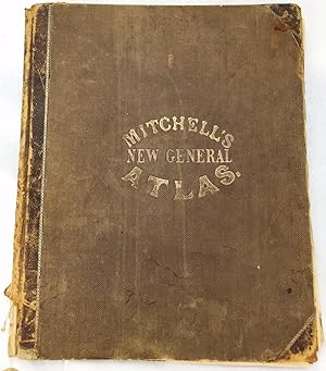
Mitchells New General Atlas by Mitchell Augustus (39 results)
Feedback
Skip to main search results
Search filters
Product Type
- All Product Types
- Books (39)
- Magazines & Periodicals (No further results match this refinement)
- Comics (No further results match this refinement)
- Sheet Music (No further results match this refinement)
- Art, Prints & Posters (No further results match this refinement)
- Photographs (No further results match this refinement)
- Maps (No further results match this refinement)
- Manuscripts & Paper Collectibles (No further results match this refinement)
Condition Learn more
Binding
Collectible Attributes
- First Edition (4)
- Signed (No further results match this refinement)
- Dust Jacket (1)
- Seller-Supplied Images (25)
- Not Print on Demand (32)
Language (2)
Free Shipping
Seller Location
Seller Rating
-

Mitchell's New General Atlas ?containing Maps of the Various Countries of the World; Plans of Cities; Etc. Embraced in Forty?seven Quarto Maps; Forming a Series of Seventy?six Maps and Plans; Together
Seller: Ria Christie Collections, Uxbridge, United Kingdom
Seller rating 5 out of 5 stars

� 12.59
Convert currencyFree shipping within United KingdomQuantity: Over 20 available
Add to basketCondition: New. PRINT ON DEMAND Book; New; Fast Shipping from the UK. No. book.
-

Mitchell's New General Atlas ?containing Maps of the Various Countries of the World; Plans of Cities; Etc. Embraced in Forty?seven Quarto Maps; Forming a Series of Seventy?six Maps and Plans; Together
Seller: Ria Christie Collections, Uxbridge, United Kingdom
Seller rating 5 out of 5 stars
� 22.99
Convert currencyFree shipping within United KingdomQuantity: Over 20 available
Add to basketCondition: New. PRINT ON DEMAND Book; New; Fast Shipping from the UK. No. book.
-
Mitchell's New General Atlas, Containing Maps of the Various Countries of the World, Plans of Cities, Etc. Embraced in Fifty-Three Quarto Maps, Forming a Series of Eighty-four Maps and Plans, Together with valuable Statistical Tables
Published by S. Augustus Mitchell, 1864
Seller: Sequitur Books, Boonsboro, MD, U.S.A.
Association Member: IOBA
Seller rating 5 out of 5 stars
� 304
Convert currency� 24.35 shipping from U.S.A. to United KingdomQuantity: 1 available
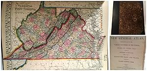
Add to basketHardcover. Condition: Fair. **Collated: Of the 59 full page maps called for 31 are missing**; 40 cm. 30 pages of text. The following hand colored maps are present: Nova Scotia; city of Halifax, Canada East, Environs of Montreal; Canada West;, New Hampshire and Vermont; Massachusetts, Connecticut, and Rhode Island; Plan of Philadelphia; Kentucky and Tennessee; North Carolina, South Carolina, Florida; Louisiana, Mississippi, and Arkansas; Ohio and Indiana; Plan of Cincinnati; South America; Venezuela, New Grenada, Guiana; Equador and Peru; Europe; Russia, Norway, Sweden; France, Spain and Portugal; Scotland; Ireland; Austria, Italy, Turkey in Europe, Greece; Prussia and the German Empire; Oceanica; (21 pages of maps only.) **Lacking maps: The World, The World Mercator, North America, United States, Maine, New York, Plan of New York, Plan of Boston, Pennsylvania, Virginia; Georgia and Alabama; Plan of New Orleans; Texas; Illinois; Missouri; Michigan; Kansas; Oregon; California; Utah; Mexico; Argentina; Brazil; Chili; Denmark; Holland and Belgium; Switzerland; England; Asia; Persia; Hinoostan; Africa.** Publisher's brown boards. Gold lettering on front. Maps loose. Maps generally are good condition. Mitchell's New General Atlas was a classic geographical reference in the late 19th century. Taking over the Mitchell Company business after his father retired in 1860, S. Augustus Mitchell, Jr. revised the existing Mitchell atlas and renamed it the New General Atlas. New editions were published yearly until 1887. The maps were so popular they were used by the public and sometimes other publishers until the beginning of the 1900s. See Ristow, American Maps and Mapmakers.
-

Mitchell's New General Atlas : Containing maps of the various countries of the world, plans of cities, etc, embraced in eighty-three quarto maps : forming a series of one hundred and forty maps and plans : together with valuable statistical tables : also
Published by Philadelphia, Philadelphia, 1867
Seller: High Ridge Books, Inc. - ABAA, South Deerfield, MA, U.S.A.
Association Member: ABAA ESA ILAB SNEAB
Seller rating 5 out of 5 stars
� 1,026
Convert currency� 25.83 shipping from U.S.A. to United KingdomQuantity: 1 available
Add to basket40x33 cm. Original 1/2 leather and cloth, worn and well rubbed, particularly to leather at corners. Internally a very good copy with all maps hand-colored. 90, 27, [4] pp. The maps are dated 1866 or 1867. Generally clean inside, though a small number of maps have light wear and soiling at bottom right corner. The double=page New York State map has damage along the centerfold and the bottom. Imprint on title page includes J. W. Willson, of New York.
-
Mitchell's New General Atlas; containing Maps of the Various Countries of the World, Plans of Cities, etc. Embraced in Ninety-Three Quarto Maps, Forming a series of One Hundred and Forty-Seven Maps and Plans. Together with Valuable Statistical Tables. Also, a list of Post-Offices of the United States and Territories, and also a Census of 1880 for States, Territories and Counties, also of Cities of over 10,000 inhabitants
Published by Philadelphia: Wm. M. Bradley & Bro., 1889, 1889
Seller: Adrian Harrington Ltd, PBFA, ABA, ILAB, Royal Tunbridge Wells, KENT, United Kingdom
Association Member: ABA ILAB PBFA
Seller rating 5 out of 5 stars
[American World Atlas] ORIGINAL COLOURED MAPS. Large quarto (40 x 32cm), with 123 pages of coloured maps, and 46 pages of text at rear. A map of South Africa loosely inserted at rear. Original embossed dark brown cloth over boards, with gilt titles to upper, recently re-backed in brown calf with gilt titles to burgundy morocco label. All edges red. Some gentle spotting to title page, otherwise internally clean. Light general wear to boards, restored to a robust, attractive condition.
-
MITCHELL'S NEW GENERAL ATLAS, CONTAINING MAPS OF THE VARIOUS COUNTRIES OF THE WORLD, PLANS OF CITIES, ETC., EMBRACED IN FIFTY-THREE QUARTO MAPS, FORMING A SERIES OF EIGHTY-FOUR MAPS AND PLANS, TOGETHER WITH VALUABLE STATISTICAL TABLES
Published by S. Augustus Mitchell, Jr., Philadelphia, PA, 1863
Seller: Aardvark Rare Books, ABAA, EUGENE, OR, U.S.A.
Association Member: ABAA CBA ILAB IOBA
Seller rating 5 out of 5 stars
� 1,672
Convert currency� 44.27 shipping from U.S.A. to United KingdomQuantity: 1 available
Add to basketLeather-bound. Condition: Very Good. Folio. 40 cm. 15 3/4 in. x 13 in. Contemporary brown textured cloth. Rebacked (spine and corners) in brown half-morocco, with borders of gilt roll. Original boards somewhat scuffed, rubbed and stained, but the entire refurbishing has yielded a very handsome and serviceable volume with many lovely colored maps. Title embossed to top board, in gilt with copper-tone highlights. Green gold-vein endpapers, probably replacements. Eighty-Four colored maps, including three double maps. Some age-toning to endpapers and map margins -- overall very readable and useable! Maps include many groups of U.S. States and Territories, and plans of U.S. Cities. Also maps of Canada (Nova Scotia, New Brunswick, Cape Breton, and Prince Edward's Islands, Halifax, Montreal;, Mexico, Central America and West Indies, Cuba, Jamaica, Bermuda, Panama Railroad, South America, Proposed Atrato Canal; New Grenada, Venezuela, Guiana; Equador and Peru; Argentine Confederation; Brazil Chili (& Island of Juan Fernandez); Europe; Russia in Europe, Norway and Sweden; Denmark; Holland and Belgium; France, Spain, and Portugal; Switzerland; England and Wales; Scotland (& Shetland Islands); Ireland; Prussia and the German States; Austria, Italy, Turkey in Europe,and Greece; Maltese Islands; Asia; Persia, Turkey in Asia, Afghanistan, and Beloochistan; Palestine, or The Holy Land; Hindoostan, Farther India, China, and Thibet; Oceanica; Sandwich Islands; Africa; Island of St. Helena; Harbors. Also The World - Eastern and Westernb Hemispheres; The World - Mercator's Projection; North America. Statistical Information at rear includes: (Complete) LIST OF POST OFFICES IN THE UNITED STATES; POPULATION OF THE UNITED STATES by the Census of 1850 and 1860; LIST OF SLAVE STATES AND THEIR POPULATIONS IN BOTH 1850 AND 1860; Table of (Foreign) POPULATION AND GOVERNMENTS; TABLE OF DISTANCES (ROUTES TO AND FROM FOREIGN PORTS AND CITIES; LAND ROUTES TO PLACES WITHIN THE UNITED STATES; MOUNTAINS OF THE WORLD; RIVERS OF THE WORLD. A beautiful, restored and VERY sturdy Atlas from 1863.
-
Mitchell's New General Atlas : Containing maps of the various countries of the world, plans of cities, etc, embraced in eighty-three quarto maps : forming a series of one hundred and forty maps and plans : together with valuable statistical tables : also
Published by Philadelphia, Philadelphia, 1869
Seller: High Ridge Books, Inc. - ABAA, South Deerfield, MA, U.S.A.
Association Member: ABAA ESA ILAB SNEAB
Seller rating 5 out of 5 stars
� 760
Convert currency� 25.83 shipping from U.S.A. to United KingdomQuantity: 1 available
Add to basket39x32 cm. Original 1/2 leather in fair to poor condition, leather heavily deteriorated, front board nearly detached. Internally a good to very good copy with all maps hand-colored. United States map is mostly split along the center fold. The Florida and Kansas/Nebraska maps have short mended tears just past the decorative border. The copyright dates on the maps are 1867. This copy contains early states of 1869 maps, ABE Customers: Large heavy volume will require additional shipping charges.
-
Mitchell's New General Atlas : Containing maps of the various countries of the world, plans of cities, etc, embraced in eighty-three quarto maps : forming a series of one hundred and forty maps and plans : together with valuable statistical tables : also
Published by Philadelphia, Philadelphia, 1877
Seller: High Ridge Books, Inc. - ABAA, South Deerfield, MA, U.S.A.
Association Member: ABAA ESA ILAB SNEAB
Seller rating 5 out of 5 stars
� 1,026
Convert currency� 25.83 shipping from U.S.A. to United KingdomQuantity: 1 available
Add to basket38.5x31 cm. Original decorative gilt-stamped cloth with modern leather spine and corners. Internally good to very good with two leaves torn at bottom corners and scattered light stains on some leaves. 122, 34 pp. A restored example of a scarce issue of Mitchell's General Atlas, featuring maps of the United States with other countries of the world largely grouped together on maps. ABE Customers: Large heavy volume will require additional shipping charges.
-
Mitchell's new general atlas : containing maps of the various countries of the world.
Published by S. Augustus Mitchell, Jr, 1860
First Edition
� 1,482
Convert currencyFree shipping from U.S.A. to United KingdomQuantity: 1 available
Add to basketHardcover. Condition: Near Fine. 1st Edition. 1860 FAMED 1ed Mitchell ATLAS Maps America City Plan Asia Texas Caribbean Africa The name Mitchell has long been synonymous with 19th-century maps; in fact, Mitchell maps are often considered the best of atlas maps from the 1800s. In 1860, S Augustus Mitchell Jr took over for his father who had recently retired and published the first edition of the new atlas . Mitchell gained his notoriety with his Universal Atlas decades earlier, but the enormous folio version of Mitchell Jr. has been extremely popular ever sense! This huge atlas contains dozens of hand-colored maps from all over the world! Note that the maps themselves from this atlas have been known to sell for more than $300-$500 each! While the maps are certainly the draw of this work, this 1860 first edition includes 26 pages of text at the end describing various topographical and geographical aspects of North America including post offices, populations, censuses, governments, route distances, ports, rivers, mountains, and more. Item number: #23427 Price: $1950 MITCHELL, S Augustus Mitchell's new general atlas : containing maps of the various countries of the world. Philadelphia : S. Augustus Mitchell, Jr., 1860. First edition of the updated atlas Details: Collation: Complete o [4], 26 o 76 (i.e., 78) maps 2 maps labelled #25, one unnumbered map References: Sabin 39261 Language: English Binding: Leather; tight and secure Size: ~15.75in X 13.25in (40.5cm x 34cm) Exceedingly rare (in this complete form) and ALWAYS very desirable Our Guarantee: Very Fast. Very Safe. Free Shipping Worldwide. Customer satisfaction is our priority! Notify us with 7 days of receiving, and we will offer a full refund without reservation! 23427 Photos available upon request.
-
Mitchell's New General Atlas, Containing Maps of the Various Countries of the World, Plans of Cities, Etc., Embraced in Sixty-Three Quarto Maps, Forming a Series of One Hundred Maps and Plans, Together with Valuable Statistical Tables.
Published by Philadelphia, 1871
Seller: Attic Books (ABAC, ILAB), London, ON, Canada
Seller rating 5 out of 5 stars
� 1,900
Convert currency� 18.45 shipping from Canada to United KingdomQuantity: 1 available
Add to basketHardcover. Condition: Good. 96 hand-coloured maps on 70 sheets, followed by 27, [4] p. 40 cm. Respined. Original cloth with gold lettering, blank impressing, leather corners. Corners bumped, cloth stained and rubbed. Dent in top front edge. Some wear to gold print on new spine label. New endpapers. Pages soiled and thumbed. Tear in map of Mexico, Central America, and the West Indies. Includes full-page city maps of Boston, New York, Philadelphia, Baltimore, Washington, Cincinnati, St Louis and New Orleans. The atlas concentrates on America for Americans but includes highlights from the rest of the world. Being 1871, it includes the Argentine Confederation, Prussia and the German States, Persia, Beloochistan, Hindoostan, Farther India, and the Sandwich Islands. At rear is a reference table, followed by tables of population, governments, distances, mountains, and rivers.
-

Mitchell's New General Atlas, Containing Maps of the Various Countries of the World, Plans of Cities, Etc. Consisting of 72 Quarto Maps, Forming a Series of 103 Maps and Plans.list of Post Offices of the United States and Territories, and Census of 1860 and 1870
Published by S. Augustus Mitchell, Philadelphia, 1873
� 798
Convert currency� 36.86 shipping from U.S.A. to United KingdomQuantity: 1 available
Add to basketHardcover. Condition: Fair. Complete and collated. Black embossed boards, well worn, with leather spine and tips. Tips worn to board, spine split outside, inner hinge broken at title page. Map on #3 & #4, World double fold is chipped at page crease. 12 additional double fold map plates. Mauve endpapers. Maps are in very good condition. S. Augustus Mitchell, Jr. Revised the existing Mitchell atlas and renamed it the New General Atlas. New editions were published yearly until 1887.; Folio 13" - 23" tall.
-
� 987.24
Convert currency� 21.40 shipping from U.S.A. to United KingdomQuantity: 1 available
Add to basketHardcover. Condition: Good. Original 3/4 leather binding. 84 full color maps on 53 sheets. Maps are clean but rear pagers of index, etc. slight damp stain on bottom corner.not affecting text. Printed right in middle of Civil War!
-
Mitchell's New General Atlas, contains maps of the various countries of the world, plans of cities, etc.
Published by S Augustus Mitchell, Jr., 1869
� 760
Convert currency� 33.20 shipping from U.S.A. to United KingdomQuantity: 1 available
Add to basketHardcover. Condition: Good. No Jacket. illustrated (illustrator). Embossed boards w/gilt titling & leather spine covers are well- bound, crack after map list; sunning & soil, a damp stain on rear board, some chipping of spine cover. Pages are tanning at margins, maps are clean & bright. Feel free to ask for pictures.
-
Mitchell's New General Atlas, Containing Maps of the Various Countries of the World, Plans of Cities, Etc. Embraced in Fifty-Three Quarto Maps, Forming a Series of Eighty-four Maps and Plans, Together with valuable Statistical Tables
Published by S. Augustus Mitchell, Jr., Philadelphia, 1864
Seller: Moroccobound Fine Books, IOBA, Lewis Center, OH, U.S.A.
Association Member: IOBA
Seller rating 5 out of 5 stars
� 950
Convert currency� 43.13 shipping from U.S.A. to United KingdomQuantity: 1 available
Add to basketHardcover. Condition: Good. Eighty-four maps, hand colored in outline, and plans on 54 sheets. Hardcover, bound in leather backed gilt embossed cloth. The covers with several stains, including a damp stain at the top corner along the spine edge, which has affected the endpapers, some text leaves, and slightly the margin of several maps.
-
Mitchell's New General Atlas
Published by S. Augustus Mitchell, Philadelphia, 1866
Seller: Oddfellow's Fine Books and Collectables, Topeka, KS, U.S.A.
Association Member: IOBA
Seller rating 5 out of 5 stars
First Edition
� 874
Convert currency� 29.51 shipping from U.S.A. to United KingdomQuantity: 1 available
Add to basketHardcover. Condition: Good+. Dust Jacket Condition: No Dust Jacket. First Edition; 2nd State. Ex-Library with minimal (Kansas State Library) markings limited to a stamp in blue ink and catalog information in pencil on the title page, an additional stamp with penned number on the title page verso, stamp and penned library name on the VA/WV map and a small number line in pencil at the rear end page and in the blank margin of 2 maps; no markings found over any maps other than Virginia/West Virginia. Repaired binding includes archival end pages and a reinforced spine. The map of Pennsylvania has a tape repair to the fore edge (map bottom) that very slightly covers the map boarder. All other maps remain complete and clean though a few pages have small smudges, tears and/or chips in the boarders and at edges. In this edition, the southern point of Nevada is still part of Arizona Territory, the Texas panhandle remains part of Oklahoma Territory and Wyoming, though labeled, is still included within Dacotah Territory. Of the remaining maps, most are from either the 1860 or 1865 editions. Includes all 44 states, U. S. Cities and possessions and world maps.; Folio 13" - 23" tall.
-
Mitchell's New General Atlas.
Published by Philadelphia: S. Augustus Mitchell & New York: J.W.Willson, 1867., 1867
Seller: D & E LAKE LTD. (ABAC/ILAB), Toronto, ON, Canada
Seller rating 3 out of 5 stars

� 1,265.40
Convert currency� 37.63 shipping from Canada to United KingdomQuantity: 1 available
Add to basketfolio. [ff. 17]. 91 hand-coloured lithographed maps & plans with decorative borders on 58 sheets (5 double-page). 1 hand-coloured time-table on verso of double-hemisphere map. original half calf over blind & gilt-stamped cloth (binding worn & calf oxidized, covers detached, the maps themselves in very good condition). Fifty of the maps (3 double-page, 15 inset) are devoted to Canada and the United States. Included are full-page plans of the cities of Boston, New York City, Philadelphia, Baltimore, Washington, New Orleans, Cincinnati & Chicago. cfPhillips, Atlases, 3558.
-

Mitchell's New General Atlas, containing Maps of the Various Countries Of The World, Plans of Cities, Etc.; Embraced in Ninety Three Quarto Maps forming a Series of One Hundred and Forty-seven Maps and Plans
Published by S. Augustus Mitchell, Philadelphia, 1879
Seller: Old Book Shop of Bordentown (ABAA, ILAB), Bordentown, NJ, U.S.A.
Seller rating 3 out of 5 stars
� 912
Convert currency� 35.75 shipping from U.S.A. to United KingdomQuantity: 1 available
Add to basketHardcover. Condition: Very Good. Folio in three quarter dark brown leather over original brown cloth ornately decorated in black and gilt. Complete with all color tinted maps and city plans plus at rear 37 pp. reference table consisting of "Post Offices on The United States and Territories Alphabetically Arranged in States Forming A List of the Cities, Towns And Villages, With Their Locations", "Official Census of Canada--1871", "Population of the United States by the Census of 1860 and 1870", "Table Population, Governmets, &c.", "Table Of Distances" , "Mountains of the World", "Rivers of the World', "Population of the Principal Cities, Towns, and Villages of the United States in 1879", and "Table Showing the Relative Rank of the States in Population during each Decade from 1776 to 1876". A tight example though with front hinge starting. crease to the ffep, wear to the leather tips and running to the spine strip with an aprox 3/4" loss to the foot of the spine. Front hinge starting. Internally clean and unmarked.
-
Mitchell's New General Atlas
Published by S. Augustus Mitchell,, Philadelphia:, 1864
Seller: Nicholas D. Riccio Rare Books, ABAA, Florham Park, NJ, U.S.A.
Seller rating 4 out of 5 stars

� 2,280
Convert currency� 29.51 shipping from U.S.A. to United KingdomQuantity: 1 available
Add to basketFolio, original cloth with leather spine and corners, embossed gilt title on front cover, 49 colored maps. Rubbing and fading to binding, gilt dull, removed label from front cover,wear to extremities, small stain aaffecting preliminaries, occassional margin soiling and a few margin tears; U.S. map has split at the bottom of fold, some minor toning, but contents generally bright and clean. This atlas contains 49 colored maps, twenty-six relate to the U.S. Only for maps are double page. Maps of Texas, California, and South America are particularly attractive.
-
Mitchell's New General Atlas
Published by S. Augustus Mitchell,, Philadelphia:, 1868
Seller: Nicholas D. Riccio Rare Books, ABAA, Florham Park, NJ, U.S.A.
Seller rating 4 out of 5 stars
� 1,520
Convert currency� 29.51 shipping from U.S.A. to United KingdomQuantity: 1 available
Add to basketFolio, original cloth with leather spine and corners, gilt title on front cover, 65 colored maps. Joints and extremities rubbed, but binding is sturdy, and in very good condition, the U.S. map is split at the middle fold, someminor foxing and stains, but maps are generally bright and clean. Five of the 65 maps in this atlas are double page, and 33 realte to the U.S. The maps of the United States, New York, Pennsylvania and Texas are particularly attractive.
-
Mitchell's new general atlas: ninety-three quarto maps, forming a series of one-hundred and forty-seven maps and plans
Published by Philadelphia : Bradley & Co., 1882
Seller: Sequitur Books, Boonsboro, MD, U.S.A.
Association Member: IOBA
Seller rating 5 out of 5 stars
� 874
Convert currency� 24.35 shipping from U.S.A. to United KingdomQuantity: 1 available
Add to basketHardcover. Condition: Good. Folio.120, [6], 46 pages) : 147 maps and plans; 40 x 32 cm. Original boards. Rebacked on modern black leather. New marbled endpapers. Good binding. Old spotting stains to boards. Maringal soiling, occasional spotting. Tears to a few maps, Map of New York almost torn in two. Phillips 892. Mitchell's New General Atlas was a classic geographical reference in the late 19th century. Taking over the Mitchell Company business after his father retired in 1860, S. Augustus Mitchell, Jr. revised the existing Mitchell atlas and renamed it the New General Atlas. New editions were published yearly until 1887. The maps were so popular they were used by the public and sometimes other publishers until the beginning of the 1900s. See Ristow, American Maps and Mapmakers. This is an oversized or heavy book, that requires additional postage for international delivery outside the US.
-
Mitchell's new general atlas, containing maps of the various countries of the world, plans of cities, etc. : embraced in fifty-three quarto maps, forming a series of eighty-four maps and plans, together with valuable statistical tables.
Published by S. Augustus Mitchell, 1863
Seller: Sequitur Books, Boonsboro, MD, U.S.A.
Association Member: IOBA
Seller rating 5 out of 5 stars
� 1,216
Convert currency� 24.35 shipping from U.S.A. to United KingdomQuantity: 1 available
Add to basketHardcover. Condition: Good. Folio. 83 leaves, [28] pages: 84 color maps ; 40 cm. Black leather rebacked spine. Original black cloth. Good binding and cover. Wear to cloth edges, occasional spotting, dampstaining to bottom margin affecting last map and text pages in rear. Includes list of post offices in the United States, population of the United States by the census of 1850 and 1860, table of population, governments, & C., table of distances, mountains of the world, and rivers of the world. Phillips 892. Mitchells New General Atlas was a classic geographical reference in the late 19th century. Taking over the Mitchell Company business after his father retired in 1860, S. Augustus Mitchell, Jr. revised the existing Mitchell atlas and renamed it the New General Atlas. New editions were published yearly until 1887. The maps were so popular they were used by the public and sometimes other publishers until the beginning of the 1900s. See Ristow, American Maps and Mapmakers.
-
Mitchell's New General Atlas, Containing Maps of the Various Countries of the World, Plans of Cities, Etc. Embraced in Fifty-Three Quarto Maps, Forming a Series of Eighty-four Maps and Plans, Together with valuable Statistical Tables
Published by S. Augustus Mitchell, 1864
Seller: Sequitur Books, Boonsboro, MD, U.S.A.
Association Member: IOBA
Seller rating 5 out of 5 stars
� 1,140
Convert currency� 24.35 shipping from U.S.A. to United KingdomQuantity: 1 available
Add to basketHardcover. Condition: Good. Collated, complete. [30] pages, [59] leaves) : 84 color maps ; 40 cm. Publisher's brown boards. Gold lettering on front. Light discoloration to front cover. Contemporary signature of Reo.(sp?) J. L. Jenkins on fep. Maps in good condition. Mitchells New General Atlas was a classic geographical reference in the late 19th century. Taking over the Mitchell Company business after his father retired in 1860, S. Augustus Mitchell, Jr. revised the existing Mitchell atlas and renamed it the New General Atlas. New editions were published yearly until 1887. The maps were so popular they were used by the public and sometimes other publishers until the beginning of the 1900s. See Ristow, American Maps and Mapmakers.
-
Mitchell's new general atlas : containing maps of the various countries of the world, plans of cities, etc., embraced in seventy-two quarto maps ; Forming a series of one hundred and three maps and plans, together with valuable statistical tables ; Also, a list of Post Offices of the United States and territories, and census of 1860 and 1870
Published by S. Augustus Mitchell, 1874
Seller: Sequitur Books, Boonsboro, MD, U.S.A.
Association Member: IOBA
Seller rating 5 out of 5 stars
� 1,026
Convert currency� 24.35 shipping from U.S.A. to United KingdomQuantity: 1 available
Add to basketHardcover. Condition: Very Good. Handsome, clean volume. Collated: 2 leaves, 27, [4] pages, 106 color maps and plans on 72 leaves ; 39 x 32 cm. Original leather spine over publisher's navy blind tooled boards. Gold lettering on front. Internal gutter slightly attenuated at list of maps page. Some rubbing to leather spine/corners lightly bumped. Names on Clement Darlington, West Chester PA, 1874, Carrie D. Speakman, 1880 on end page. Maps are in near-fine condition and free of soiling or foxing. Mitchell's New General Atlas was a classic geographical reference in the late 19th century. Taking over the Mitchell Company business after his father retired in 1860, S. Augustus Mitchell, Jr. revised the existing Mitchell atlas and renamed it the New General Atlas. New editions were published yearly until 1887. The maps were so popular they were used by the public and sometimes other publishers until the 1900s. See Ristow, American Maps and Mapmakers. Phillips 892.
-
Mitchell's new general atlas : containing maps of the various countries of the world, plans of cities, etc, embraced in eighty-three quarto maps : forming a series of one hundred and forty maps and plans : together with valuable statistical tables : also a list of post-offices of the United States and territories, and census of 1860 and 1870.
Published by S. Augustus Mitchell,, 1877
Seller: Sequitur Books, Boonsboro, MD, U.S.A.
Association Member: IOBA
Seller rating 5 out of 5 stars
� 836
Convert currency� 24.35 shipping from U.S.A. to United KingdomQuantity: 1 available
Add to basketHardcover. Condition: Very Good. Collated: 120, 32 pages : (83 color full-page maps, 140 total maps); 39 cm. Publisher's brown boards. Gold lettering on front. Rebacked. Very good binding and cover. Maps are in near-fine condition and free of soiling or foxing. Mitchell's New General Atlas was a classic geographical reference in the late 19th century. Taking over the Mitchell Company business after his father retired in 1860, S. Augustus Mitchell, Jr. revised the existing Mitchell atlas and renamed it the New General Atlas. New editions were published yearly until 1887. The maps were so popular they were used by the public and sometimes other publishers until the beginning of the 1900s. See Ristow, American Maps and Mapmakers.
-
Mitchell's New General Atlas, Containing Maps of the Various Countries of the World, Plans of Cities, Etc. Embraced in Fifty Quarto Maps, Forming a Series of Eighty Maps and Plans, Together with Valuable Statistical Tables
Published by S.A. Mitchell, Philadelphia, 1862
Seller: Between the Covers-Rare Books, Inc. ABAA, Gloucester City, NJ, U.S.A.
Association Member: ABAA ESA ILAB IOBA
Seller rating 5 out of 5 stars
First Edition
� 2,280
Convert currency� 33.20 shipping from U.S.A. to United KingdomQuantity: 1 available
Add to basketHardcover. Condition: Very Good. First edition. Small folio, unpaginated. Original publisher's half calf and gilt-lettered pebbled cloth binding. A very good copy with wear to the leather, the title page and list of maps foxed and with occasional mild soiling to the margins of plates, but strong joints and hinges, with an attractive 19th Century American bookplate. A desirable example of this Civil War-era atlas. Excellent original hand-coloring for all maps. This copy is complete with all 80 maps plus two additional maps not called for: "New Hampshire and Vermont" and "County Map of Massachusetts, Connecticut and Rhode Island." Among the more notable American maps are those detailing Texas, California, New Orleans, the Indian Territory of future Oklahoma, and plans of Baltimore and Washington, DC. The atlas also has three double-page maps. A beautiful example of a mid-19th Century American atlas.
-
Mitchell's New general atlas : containing maps of the various countries of the world
Published by Wm. M. Bradley & Bro., 1885
Seller: Sequitur Books, Boonsboro, MD, U.S.A.
Association Member: IOBA
Seller rating 5 out of 5 stars
� 1,140
Convert currency� 24.35 shipping from U.S.A. to United KingdomQuantity: 1 available
Add to basketHardcover. Condition: Very Good. Hardcover. 1 atlas (126 [i.e. 157], 45 p.) : 93 col. maps ; 40 cm. Publisher's brown boards with gold lettering. Half-leather binding. Restored binding. Some wear to the extremities. Internally very good. Color maps. See photos.
-
Mitchell's New General Atlas, Containing Maps of the Various Countries of the World, Plans of Cities, Etc.
Published by Philadelphia: Wm. M. Bradley & Bro., 1883., 1883
Seller: Arader Galleries - AraderNYC, New York, NY, U.S.A.
Seller rating 5 out of 5 stars
� 1,368
Convert currency� 25.83 shipping from U.S.A. to United KingdomQuantity: 1 available
Add to basketFolio, (15 � x 12 � inches). 93 full- or double-page maps with original hand-color in full, lithographed plate "A Time Table," numerous insets and plans (a few short tears). Original publisher's half brown morocco, brown cloth boards, gilt (corners and spine quite worn with loss, binding shaken and loose but holding). Later revised edition, first published in 1862, bearing the newer copyright date of 1879. After retirement around 1860, the innovative, shrewd, and prolific map publisher, S. Augustus Mitchell turned the business over to his son of the same name. Mitchell, Jr. continued with the classic and popular Mitchell atlas under the title New General Atlas, in a slightly smaller format, as here, and was issued annually until 1887. The maps continued to be used right up to the end of the nineteenth century, sometimes by other publishers. See Ristow, American Maps and Mapmakers, p. 313.
-
Mitchell's New General Atlas, Containing Maps of the Various Countries of the World, Plans of Cities, etc. .
Published by S. Augustus Mitchell, Philadelphia, 1871
First Edition
� 1,900
Convert currency� 18.45 shipping from U.S.A. to United KingdomQuantity: 1 available
Add to basket1/2 leather. Illus. with maps (illustrator). 1st. Folio, unpag., Complete with all hand-colored maps; leather spine and corners rubbed, hinges tight, all plates clean & bright, Full title reads as follows: "Mitchell's New General Atlas, Containing Maps of the Various Countries of the World, Plans of Cities, etc. Embraced in Sixty-Three Quarto Maps, Forming a Series of One Hundred Maps and Plans,Together with Valuable Statistical Tables" Very good copy in the original leather-backed brown cloth.
-
MITCHELL'S NEW GENERAL ATLAS, CONTAINING MAPS OF THE VARIOUS COUNTRIES OF THE WORLD, PLANS OF CITIES, Etc.,
Published by Philadelphia,, 1862
Seller: Quaker Hill Books, Redding, CT, U.S.A.
Seller rating 4 out of 5 stars
� 2,014
Convert currency� 6.64 shipping from U.S.A. to United KingdomQuantity: 1 available
Add to basketRecent Black Cloth. Condition: Excellent. 51 hand colored plates comprising 80 beautiful maps and charts, many are double page and a few are insets. A truly extraordinary copy of one of the best Mitchell's atlases. All the maps are bright and vivid showing only some very light and scattered soiling to the edges and versos. Bound in recent black cloth with gold lettering on the spine.
-
![Seller image for Mitchell's new general atlas ?containing maps of the various countries of the world, plans of cities, etc. Embraced in forty?seven quarto maps, forming a series of seventy?six maps and plans, together with valuable statistical tables. 1861 [LeatherBound] for sale by True World of Books](https://pictures.abebooks.com/inventory/md/md31657377483.jpg)
� 18.23
Convert currencyFree shipping from India to United KingdomQuantity: 18 available
Add to basketLeatherBound. Condition: New. LeatherBound edition. Condition: New. Reprinted from 1861 edition. Leather Binding on Spine and Corners with Golden leaf printing on spine. Bound in genuine leather with Satin ribbon page markers and Spine with raised gilt bands. A perfect gift for your loved ones. Pages: 72 NO changes have been made to the original text. This is NOT a retyped or an ocr'd reprint. Illustrations, Index, if any, are included in black and white. Each page is checked manually before printing. As this print on demand book is reprinted from a very old book, there could be some missing or flawed pages, but we always try to make the book as complete as possible. Fold-outs, if any, are not part of the book. If the original book was published in multiple volumes then this reprint is of only one volume, not the whole set. Sewing binding for longer life, where the book block is actually sewn (smythe sewn/section sewn) with thread before binding which results in a more durable type of binding. Pages: 72 Mitchell, S. Augustus.