Order Total (1 Item Items):
Shipping Destination:

Map State New York Compiled by Mitchell Augustus (4 results)
Skip to main search results
Search filters
Product Type
- All Product Types
- Books (2)
- Magazines & Periodicals (No further results match this refinement)
- Comics (No further results match this refinement)
- Sheet Music (No further results match this refinement)
- Art, Prints & Posters (No further results match this refinement)
- Photographs (No further results match this refinement)
- Maps (2)
- Manuscripts & Paper Collectibles (No further results match this refinement)
Condition Learn more
- New (No further results match this refinement)
- As New, Fine or Near Fine (No further results match this refinement)
- Very Good or Good (No further results match this refinement)
- Fair or Poor (No further results match this refinement)
- As Described (4)
Binding
- All Bindings
- Hardcover (4)
- Softcover (No further results match this refinement)
Collectible Attributes
- First Edition (No further results match this refinement)
- Signed (No further results match this refinement)
- Dust Jacket (No further results match this refinement)
- Seller-Supplied Images (4)
- Not Print on Demand (4)
Language (1)
Price
- Any Price
- Under � 20 (No further results match this refinement)
- � 20 to � 35 (No further results match this refinement)
- Over � 35
Free Shipping
- Free Shipping to U.S.A. (No further results match this refinement)
Seller Location
Seller Rating
-
Map of the State of New York compiled from the Latest Authorities
Published by S. Augustus Mitchell, Philadelphia, 1838
Seller: Antipodean Books, Maps & Prints, ABAA, Garrison, NY, U.S.A.
Association Member: ABAA ANZAAB ESA ILAB
Seller rating 3 out of 5 stars

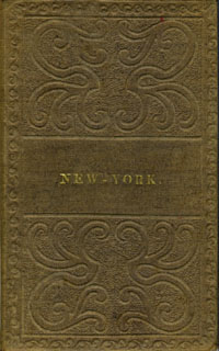
Ephemera. Condition: Otherwise very good condition. Folding pocket map, 17 x 21", with full period color. Bound in 16mo brown gilt & blind stamped cloth boards, stamped "New - York." on the front board. A beautiful colored copy, with county divisions and relief shown pictorially. Inset Vicinity of Rochester, Vicinity of Albany, Vicinity of New York, and Map of the Hudson River from New York to Albany. OCLC: 45669426 cites only the NY Public & NY State Library. Boards in very good condition, the map with a few corner cracks, as onion paper is prone to do.
-
Map of the State of New York Compiled from the Latest Authorities
Published by S. Augustus Mitchell, Philadelphia, 1839
Seller: Donald A. Heald Rare Books (ABAA), New York, NY, U.S.A.
Seller rating 5 out of 5 stars

Map
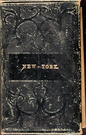
Full period color, (17 x 20 1/2 inches), folding into gilt-stamped brown leather covers. Statistical table laid down inside front cover. Minor repairs, a bit of staining. The fourth Mitchell edition of D.H. Vance's map of New York State. Extensive additions to New York's embryonic railroad system, both on the main and the inset maps. "Sold by Thomas Cowperthwait & Co. No. 253 Market Street." added below neat line. The front covers now stamped "New-York." With five insets: "Map of the Hudson River," "Vicinity of Albany," "Vicinity of New York," "Vicinity of the Falls of Niagara" and "Vicinity of Rochester." This edition not in Rumsey; not in Phillips.
-

Map of the State of New York, Compiled from .
Published by Philadelphia, Philadelphia, 1836
Seller: High Ridge Books, Inc. - ABAA, South Deerfield, MA, U.S.A.
Association Member: ABAA ESA ILAB SNEAB
Seller rating 5 out of 5 stars
Pocket map, lacking front cover of leather folder. Split along one fold and at some fold junctions, otherwise very good. Full color by county. 5 inset maps: Vicinity of Niagara Falls, Vicinity of Rochester, Vicinity of Albany, Vicinity of New York, and the Hudson River.
-
Map of the State of New York Compiled from the Latest Authorities
Published by S. Augustus Mitchell, Philadelphia, 1834
Seller: Donald A. Heald Rare Books (ABAA), New York, NY, U.S.A.
Seller rating 5 out of 5 stars
Map
Full period color, 17 x 20 1/2 inches, folding into gilt-stamped brown leather covers. Statistical table laid down on inside front cover. Five insets (see below). Minor repairs. This is the second pocket map edition of D. H. Vance's map of New York State with the imprint of S. Augustus Mitchell. Mitchell had purchased the plate from Anthony Finley in 1831, removed Vance's name, added a new border, and included it in his edition of the A New American Atlas (1831). The map was first issued as a pocket map by Mitchell in 1832. With the 1832 edition, Mitchell replaced the inset, "Profile of the Erie Canal," with four insets: "Vicinity of Albany," "Vicinity of New York," "Vicinity of the Falls of Niagara" and "Vicinity of Rochester." With this 1834 edition the statistical table at right was replaced by an inset "Map of the Hudson River." Numerous new towns are present throughout, and distances in miles along roads between towns have been added. New York's first railroads are also included for the first time. The title has been moved from the upper left to the lower left corner. This edition is not listed in Rumsey nor in Phillips.