Order Total (1 Item Items):
Shipping Destination:

Map Ontario Counties by Augustus Mitchell (18 results)
Skip to main search results
Search filters
Product Type
- All Product Types
- Books (17)
- Magazines & Periodicals (No further results match this refinement)
- Comics (No further results match this refinement)
- Sheet Music (No further results match this refinement)
- Art, Prints & Posters (No further results match this refinement)
- Photographs (No further results match this refinement)
- Maps (1)
- Manuscripts & Paper Collectibles (No further results match this refinement)
Condition Learn more
- New (No further results match this refinement)
- As New, Fine or Near Fine (1)
- Very Good or Good (1)
- Fair or Poor (No further results match this refinement)
- As Described (16)
Binding
- All Bindings
- Hardcover (No further results match this refinement)
- Softcover (No further results match this refinement)
Collectible Attributes
- First Edition (No further results match this refinement)
- Signed (No further results match this refinement)
- Dust Jacket (No further results match this refinement)
- Seller-Supplied Images (17)
- Not Print on Demand (18)
Language (2)
Free Shipping
Seller Location
Seller Rating
-

1894 Original Handcolor Map: NOVA SCOTIA, NEW BRISNSWICK, CAPE BRETON AND PRINCE EDWARD ISLANDS / ONTARIO COUNTIES
Published by Chicago : John E. Potter & Company, 1894
Map
Map. Condition: Very Good. Short neatedge tear at right edge. Original hand-colored leaf from John E. Potter and Company's, "The New Family Atlas." Please refer to photo for condition. PLEASE NOTE: If two images are shown they represent the obverse and reverse of the same leaf--not two separate leaves. Overall dimensions approx. 13" x 15.25". This item will be shipped flat.
-
County Map of Nova Scotia New Brunswick Cape Breton Id. and Pr. Edward's Id. [with inset] City and Harbor of Halifax [verso with] Map of Ontario in Counties [with inset] Manitoba, Dominion of Canada
Language: English
Published by [W.M. Bradley & Bro.], [Philadelphia], 1886
Seller: Kaaterskill Books, ABAA/ILAB, East Jewett, NY, U.S.A.
Association Member: ABAA ILAB IOBA
Seller rating 5 out of 5 stars

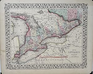
Hand colored map. Plate 7: County Map of Nova Scotia New Brunswick Cape Breton Island and Prince Edward's Island, with inset map of City and Harbor of Halifax. Copyright by S. Augustus Mitchell 1884. 10.5 x 13.5 inches. [On verso] Plate 8: Map of Ontario in Counties, with inset map of Manitoba, Dominion of Canada. Copyright by S. Augustus Mitchell 1884. 13.5 x 10.75 inches. From: Mitchell's New General Atlas, Containing Maps Of The Various Countries Of The World, Plans Of Cities, Etc., Embraced In Ninety-Three Quarto Maps, Forming A Series Of One Hundred and Forty-seven Maps and Plans, Together With Valuable Statistical Tables. Also, A List Of Post-Offices Of The United States And Territories, And Also Census Of 1880 For States, Territories And Counties, Also Of Cities Of Over 10,000 Inhabitants. Philadelphia: Published By Wm. M. Bradley & Bro., No. 1026 Arch Street. 1886. Very good, soiling and toning, tears on the outer edges, one just into image, cropped closely.
-

Map of Ontario in Counties.
Published by Philadelphia:, 1870
Seller: Nicholas D. Riccio Rare Books, ABAA, Florham Park, NJ, U.S.A.
Seller rating 4 out of 5 stars

Unbound, colored engraved map, decorative border, 14" x 11". Slight toning, browning and aging, a little soiling in upper margin, a couple of chips in upper margin; otherwise bright and clean. Maps are wrapped with acid free board, or in rigid sleeves. The Mitchell family started to produce atlases in 1846, and continued into the early 1890s. Around 1860, S. Augustus Mitchell Jr. took over, and the atlas would be called Mitchell's New General Atlas. This is an attractive colorful map of Ontario from the 1870 installment of that atlas. The map provides good county detail, and part of Quebec, New York and Pennsylvania are visible. Extra postage may be required. Ristow 311-13.
-

Map of Ontario in Counties.
Published by Philadelphia:, 1869
Seller: Nicholas D. Riccio Rare Books, ABAA, Florham Park, NJ, U.S.A.
Seller rating 4 out of 5 stars
Unbound, colored engraved map, decorative border, 14" x 11". Slight toning, browning and aging; otherwise bright and clean. Maps are wrapped with acid free board, or in rigid sleeves. The Mitchell family started to produce atlases in 1846, and continued into the early 1890s. Around 1860, S. Augustus Mitchell Jr. took over, and the atlas would be called Mitchell's New General Atlas. This is an attractive colorful map of Ontario from the 1869 installment of that atlas. The map provides good county detail, and part of Quebec, New York and Pennsylvania are visible. Extra postage may be required. Ristow 311-313.
-
Map of Ontario in Counties
Published by S. Augustus Mitchell, Jr., Philadelphia, 1869
Seller: Sandra L. Hoekstra Bookseller, Thomaston, ME, U.S.A.
Association Member: ABAA ILAB IOBA MABA
Seller rating 4 out of 5 stars
Map no binding. Condition: Near fine. [MAP]. Mitchell's New General Atlas. 10 ¾" x 13 1/2", 9 1/8" x 11 7/8"; engraved map showing the Canadian province of Ontario, vining border; hand-colored; light age-toning of paper; near fine. A nicely detailed hand-colored map of Ontario showing Lake Huron to the west, Quebec to the north and east, and bordered by Lake Erie in the southwest and Lake Ontario in the south. New York state, Pennsylvania, and Ohio, all in the U.S. lie to the south of Lakes Erie and Ontario. Michigan lies to the far west. Georgian Bay, Saginaw Bay, Manitoulin Bay and Nottawasaga Bay are identified. Lake Nipissing and Lake St. Clair are labeled.
-

Map of Ontario in Counties
Publication Date: 1885
Seller: Art Source International Inc., Boulder, CO, U.S.A.
Seller rating 5 out of 5 stars
This map was made by S. Augustus Mitchell for "Mitchells New General Atlas" published in 1885, by WM. M. Bradley & Co. The well maintained maps in this atlas feature Mitchell's characteristic pastel coloring and abundant details of geographical features. Details include the names of countries, regions, cities, towns, transportation routes, rivers, lakes, and mountain ranges. Regions are distinguished by color. These 1885 maps offer a fascinating perspective of areas that have since undergone significant growth and change, in addition to their value as great examples of Mitchell's work. This map measures 12 inches by 9 inches.
-

Map of Ontario in Counties
Publication Date: 1887
Seller: Art Source International Inc., Boulder, CO, U.S.A.
Seller rating 5 out of 5 stars
This map was made by S. Augustus Mitchell for "Mitchell's New General Atlas" published in 1887. The well maintained maps in this atlas feature Mitchell's characteristic pastel coloring and abundant details of geographical features. Ontario is illustrated on this map with an inset showing Manitoba. Details include the names of counties, important towns, rivers, mountains, lakes, and railroads. Counties are distinguished by color. These 1887 maps offer a fascinating perspective of areas that have since undergone significant growth and change, in addition to their value as great examples of Mitchell's work. This map measures 13.5 inches by 11 inches.
-

Map of Ontario in Counties
Publication Date: 1872
Seller: Art Source International Inc., Boulder, CO, U.S.A.
Seller rating 5 out of 5 stars
This map of Ontario was made by S. Augustus Mitchell in 1872. The traditional ivy border, and hand coloring make this map beautiful. This map shows transportation routes, railroads, cities, towns and topographic features. Counties are distinguished by various pastel colors. Very Detailed! This map measures 13 inches by 10.5 inches.
-

Map of Ontario in Counties
Publication Date: 1878
Seller: Art Source International Inc., Boulder, CO, U.S.A.
Seller rating 5 out of 5 stars
This map was produced by Augustus Mitchell in 1878 for his New General Atlas. Highlights of this map are Mitchells traditional grapevine border, characteristic pastel coloring and abundant details of geographical features. The territory of Ontario is illustrated on this map. Towns and districts are distinguished by color. This beautiful 1878 map is a great example of Mitchell's classic mapmaking style. This map measures 13.5 inches by 10.75 inches.
-

Map of Ontario in Counties
Publication Date: 1875
Seller: Art Source International Inc., Boulder, CO, U.S.A.
Seller rating 5 out of 5 stars
This map was produced by S. Augustus Mitchell in 1875 for his New General Atlas. This map shows Mitchells traditional grape vine border, characteristic pastel coloring and abundant details of geographical features. Counties are distinguished by different colors. Wagon trails and major routes of transport are also shown. These 1875 maps offer a fascinating perspective of areas that have since undergone significant growth and change, in addition to their value as great examples of Mitchell's work. This map measures 13.5 inches by 10.5 inches.
-

Map of Ontario in Counties
Publication Date: 1877
Seller: Art Source International Inc., Boulder, CO, U.S.A.
Seller rating 5 out of 5 stars
This original hand colored map of Ontario came from Mitchells "New General Atlas", published in 1877. This map details cities and towns, rivers, topography, and existing railroads at the time. Wagon trails and major routes of transport are also shown. This map measures 14 inches by 11 inches.
-

Map of Ontario in Counties
Publication Date: 1867
Seller: Art Source International Inc., Boulder, CO, U.S.A.
Seller rating 5 out of 5 stars
S. Augustus Mitchell Jr. made this hand colored map for "Mitchells New General Atlas" in 1867. Ontario is illustrated on this map. Regions are distinguished by bright pastel colors. Lakes, mountains, rivers, important cities and countries are identified. This map measures 13.5 inches by 10.75 inches.
-

Map of Ontario in Counties
Publication Date: 1883
Seller: Art Source International Inc., Boulder, CO, U.S.A.
Seller rating 5 out of 5 stars
This map came from Mitchells New General Atlas, 1883. The traditional ivy border, and hand coloring make this map beautiful. Very Frameable. Has inset map of Manitoba. This map measures 13.5 inches by 11 inches.
-

Map of Ontario in Counties (with an inset map of Manitoba, Dominion of Canada)
Publication Date: 1888
Seller: Art Source International Inc., Boulder, CO, U.S.A.
Seller rating 5 out of 5 stars
This map of Ontario (with an inset map of Manitoba, Dominion of Canada) was made by S. Augustus Mitchell for "Mitchells New General Atlas" published in 1888, by WM. M. Bradley & Co. The well maintained maps in this atlas feature Mitchell's characteristic pastel coloring and abundant details of geographical features. Details include the names of counties, cities, towns, transportation routes, mountain ranges, rivers and lakes. These 1888 maps offer a fascinating perspective of areas that have since undergone significant growth and change, in addition to their value as great examples of Mitchell's work. This map measures 13.5 inches by 11 inches.
-

Map of Ontario in Counties
Publication Date: 1870
Seller: Art Source International Inc., Boulder, CO, U.S.A.
Seller rating 5 out of 5 stars
S. Augustus Mitchell Jr. made this hand colored map for Mitchells New General Atlas in 1870. Ontario is illustrated on this map. Regions are distinguished by bright pastel colors. Lakes, mountains, rivers, important cities and countries are identified. This map measures 13.5 inches by 10.75 inches.
-

Map of Ontario in Counties
Publication Date: 1881
Seller: Art Source International Inc., Boulder, CO, U.S.A.
Seller rating 5 out of 5 stars
This map came from Mitchells New General Atlas, 1881. This map shows major railroads, water bodies, and towns. Decorative ivy border, and nice colorful detail. Would look nice framed!' This map measures 13.5 inches by 11 inches.
-

Map of Ontario in Counties
Publication Date: 1868
Seller: Art Source International Inc., Boulder, CO, U.S.A.
Seller rating 5 out of 5 stars
This hand colored map was made for "Mitchells New General Atlas" published in 1868 by S. Augustus Mitchell, Jr. Ontario is illustrated on this map.Counties are distinguished by color. Other details include the names of counties, and important cities, railroads, major roads,and rivers. The pastel coloring in this atlas is very beautiful and more muted than typical. This map measures 13.5 inches by 10.75 inches.
-

Map of the Ontario in Counties
Publication Date: 1874
Seller: Art Source International Inc., Boulder, CO, U.S.A.
Seller rating 5 out of 5 stars
This map was produced by S. Augustus Mitchell in 1874 for his New General Atlas. This map shows Mitchell's traditional grape vine border, characteristic pastel coloring and abundant details of geographical features. The Provenance of Ontario is illustrated on this map. Counties are distinguished by color. These 1874 maps offer a fascinating perspective of areas that have since undergone significant growth and change, in addition to their value as great examples of Mitchell's work This map measures 14 inches by 11 inches.

![Seller image for County Map of Nova Scotia New Brunswick Cape Breton Id. and Pr. Edward's Id. [with inset] City and Harbor of Halifax [verso with] Map of Ontario in Counties [with inset] Manitoba, Dominion of Canada for sale by Kaaterskill Books, ABAA/ILAB](https://pictures.abebooks.com/inventory/md/md31156944016.jpg)