Order Total (1 Item Items):
Shipping Destination:

Map Oakland (71 results)
Skip to main search results
Search filters
Product Type
- All Product Types
- Books (35)
- Magazines & Periodicals (No further results match this refinement)
- Comics (No further results match this refinement)
- Sheet Music (No further results match this refinement)
- Art, Prints & Posters (No further results match this refinement)
- Photographs (No further results match this refinement)
- Maps (15)
- Manuscripts & Paper Collectibles (21)
Condition Learn more
- New (2)
- As New, Fine or Near Fine (4)
- Very Good or Good (38)
- Fair or Poor (No further results match this refinement)
- As Described (27)
Binding
Collectible Attributes
- First Edition (10)
- Signed (No further results match this refinement)
- Dust Jacket (1)
- Seller-Supplied Images (48)
- Not Print on Demand (70)
Language (2)
Free Shipping
Seller Location
Seller Rating
-

Map. Condition: Very Good.
-

Oakland Adjacent Cities and Souther Alameda County (MAP)
Published by The H. M. Gousha Company, 1971
Map. Condition: Very Good. Map - VG - Map is clean with only light wear.
-

map. Condition: Very Good. Most of our very good books have only minor imperfections such as shelf wear consistent with a new book that's sat on a bookshop shelf for a year or two. Occasionally we may miss other minor imperfections as we have to grade books at speed. Our books are dispatched from a Yorkshire former cotton mill. We list via barcode/ISBN so please note that the images are stock images and may not be the exact copy you receive, furthermore the details about edition and year might not be accurate as many publishers reuse the same ISBN for multiple editions and as we simply scan a barcode or enter an ISBN we do not check the validity of the edition data when listing. If you're looking for an exact edition please don't order (at least not without checking with us first, although we don't always have time to check). We aim to dispatch prompty, the service used will depend on order value and book size. We can ship to most countries, see our shipping policies. Payment is via Abe only.
-

Oakland Hills and Pleasanton Ridge - Bay Area Trail Map
Published by Redwood Hikes Press, Campbell, CA, 2014
ISBN 10: 1934127264 ISBN 13: 9781934127261
Map
No Binding. Condition: New. New!!!!
-

The Buildings of Oakland. With Oakland Firestorm map laid in. With a Section on Piedmont.
Published by Forest Hill Press., Oakland., 1979
First Edition
Hardcover. First edition. Illustrated. Important reference work. Very scarce in this condition. Fine copy in fine dust jacket (in mylar).
-
Map of Naval Supply Depot, Oakland California Plot Plan
Published by U. S. Navy circa 1947, Oakland California, 1947
Seller: Charles Lewis Best Booksellers, San Diego, CA, U.S.A.
Seller rating 4 out of 5 stars

Condition: In quite good condition. [8 by 10inches]. with 19 item numbered index and list of transportation services.
-
Oakland County, Michigan 1857 Plat Map Transcription by Oakland County Genealogical Society
Published by Oakland County Genealogical Society
Seller: A Squared Books (Don Dewhirst), South Lyon, MI, U.S.A.
Seller rating 5 out of 5 stars

Condition: Good. Birmingham, 1993; white illustrated paper covers; mild edge and corner wear; 4to, 9 3/4" - 12" Tall; Interior clean and unmarked; 193 pages.
-

Condition: good. A copy that has been read, remains in good condition. All pages are intact, and the cover is intact. The spine and cover show signs of wear. Pages can include notes and highlighting and show signs of wear, and the copy can include "From the library of" labels or previous owner inscriptions. 100% GUARANTEE! Shipped with delivery confirmation, if you're not satisfied with purchase please return item! Ships via media mail.
-

paperback. Condition: Very Good.
-

Thomas Bros. Street Map, San Francisco, Oakland, Including Berkeley-Alameda, San Leandro-Piedmont, Albany-Emeryville
Language: English
Published by Thomas Bros., Oakland, Los Angeles
No Binding. Condition: Very Good. In very good condition; small amount of red pencil or china marker linear and single letter notations around and between Potrero Hill and North Beach; faint toning to otherwise clean map; two 1/8-in. tear at crease; short creasing to corners of map cover, with hard rubbing along cover spine and 3/4-in. diagonal tear from bottom of back cover meeting spine. Undated, but possibly prior to 1940 when company relocated to Los Angeles. Cover printed with 337 17th St., Oakland 12, California address and GLencourt 1 telephone number; 2308 Market Street, San Francisco 14 address with UNderhill 3 telephone number. 8 x 4 3/4 in. map cover; 22.5 x 35 in. map, unfolded;
-

Map. Condition: Very Good. 1st Edition. An original map of Rose Township in Oakland County, Michigan measuring approximately 12-1/2 x 15-1/2" at the outer edges. This map is part of the 1872 Atlas of Oakland County Michigan published by F. W. Beers. In very good condition with minor edgewear. Suitable for framing and shipped in protective covering in sturdy cardboard tube. ; MCM00365; Folio 13" - 23" tall.
-

Map. Condition: Very Good. 1st Edition. An original map of Brandon Township in Oakland County, Michigan measuring approximately 12-1/2 x 15-1/2" at the outer edges. This map is part of the 1872 Atlas of Oakland County Michigan published by F. W. Beers. In very good condition with minor edgewear. Suitable for framing and shipped in protective covering in sturdy cardboard tube. ; MCM00364; Folio 13" - 23" tall.
-
MAP OF OAKLAND COUNTY.
Seller: John K King Used & Rare Books, Detroit, MI, U.S.A.
Seller rating 4 out of 5 stars
W. S. McAlpine Map Co.: Birmingham, Mich. 1951. 14 x 12", b/w map, folded, minor edge tears, removal mark on reverse.
-
A NEW MAP Of OAKLAND Alameda & Berkeley: Compliments of Central National Bank - Central Savings Bank
Published by Oakland Blue Print Co, Oakland, 1926
Seller: Tavistock Books, ABAA, Reno, NV, U.S.A.
Association Member: ABAA ESA ILAB IOBA
Seller rating 5 out of 5 stars
1st printing. Broadsheet, folded 5x. Recto: Map, with street index in upper right corner. Verso: Adverts, history blurbs of Oakland & the banks. Exterior panels with image of the bank's Oakland office building, 14th and Broadway. Folded: 8-1/2" x 46-1/8" Map also depicts portions of Albany, Emeryville, Piedmont & San Leandro. At the time of cataloguing, OCLC records just one holding institution for this year: California State Library. Age-toning. Modest wear, with a couple small hole at fold-junctures. Red pencil circling the area NE of Lake Merritt. Very Good. Printed self-wrappers. Now housed in an archival mylar sleeve.
-
![Seller image for Subdivision Map of Gorrill Glen, Brooklyn Twp. [Oakland,] Alameda Co., Cal. for sale by Wittenborn Art Books](https://pictures.abebooks.com/inventory/md/md16146003627.jpg)
Subdivision Map of Gorrill Glen, Brooklyn Twp. [Oakland,] Alameda Co., Cal.
Published by Oakland, CA: 1907, 1907
Seller: Wittenborn Art Books, San Francisco, CA, U.S.A.
Seller rating 5 out of 5 stars
Manuscript / Paper Collectible
Condition: Good. Facsimile of original Subdivision Map for the blocksbounded by Fruitvale Ave. Lincoln Ave.,Pinneo street, Grace Street. Manuscriptannotation with lot prices and text "streetwork complete." 7.5 x 9 inches.
-

Condition: Hervorragend. Zustand: Hervorragend | Sprache: Englisch | Produktart: Bücher | Keine Beschreibung verfügbar.
-
Condition: Sehr gut. Zustand: Sehr gut | Sprache: Englisch | Produktart: Bücher | Keine Beschreibung verfügbar.
-

Condition: Hervorragend. Zustand: Hervorragend | Seiten: 52 | Sprache: Englisch | Produktart: Bücher | Keine Beschreibung verfügbar.
-

Condition: Hervorragend. Zustand: Hervorragend | Seiten: 52 | Sprache: Englisch | Produktart: Bücher | Keine Beschreibung verfügbar.
-

Condition: Hervorragend. Zustand: Hervorragend | Sprache: Englisch | Produktart: Bücher | Keine Beschreibung verfügbar.
-
Condition: Sehr gut. Zustand: Sehr gut | Sprache: Englisch | Produktart: Bücher | Keine Beschreibung verfügbar.
-
Condition: Hervorragend. Zustand: Hervorragend | Sprache: Englisch | Produktart: Bücher | Keine Beschreibung verfügbar.
-
Condition: Hervorragend. Zustand: Hervorragend | Sprache: Englisch | Produktart: Bücher | Keine Beschreibung verfügbar.
-
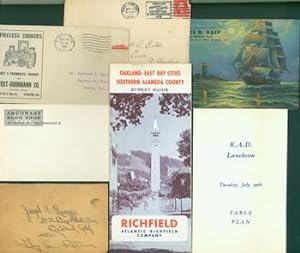
San Francisco Bay Area Miscellania. Oakland-East Bay Cities Map from 1967; blank envelope from Argonaut Book Shop (San Francisco), ca. 1908; Ad vert for Fireless Cookers at Yost-Dohrmann Co. (Stockton, CA), China Hall, 1915; Postmarked Envelope sent from Oakland, 1914 to North Carolina; advertisement for "Your Smiling Associated Dealer.James D. Daly," Berkeley, CA, ca. 1920; Table Plan for R. A. D. Luncheon, Tuesday July 30th (1918?); post card sent to Joseph A. Ruegge, Oakland, CA.
Published by San Francisco, CA: Argonaut Book Shop, et al-1967., 1908
Seller: Wittenborn Art Books, San Francisco, CA, U.S.A.
Seller rating 5 out of 5 stars
Manuscript / Paper Collectible
Condition: Good. Cards, Envelopes, Map. 5" x 9" & smaller, Some Oblong, Very Good with minor staining.
-
Southern California Los Angeles San Francisco Oakland 1908 McNally large map
Publication Date: 1908
Seller: RareMapsandBooks, Dover, NH, U.S.A.
Seller rating 4 out of 5 stars
Map
Condition: good. California.(North America, United States, California, Southern California, Los Angeles, San Francisco, Oakland). Issued 1908, Chicago by Rand Mc Nally. Large, oversized early 20th century color lithographed map. Not to be confused with the much more common smaller maps by this same maker, this one from the much more expensive and scarcer monumental Business Atlas. This size allows for much more detail. Well preserved, nice looking example with pleasing age patina. A couple short edge tears nicely closed on reverse with archival tape and now almost invisible when viewing map. Original center fold as issued. Sheet Measures c. 20 1/2" x 28". Printed Area Measures c. 19" x 27 1/2". Cartographic Reference (s):Tooley's Dictionary of Mapmakers, vol. 4.[R26199].
-
MAP OF OAKLAND
Published by Thomas Bros., n.d. [ca 1939]., N.P., 1939
Seller: BUCKINGHAM BOOKS, ABAA, ILAB, IOBA, GREENCASTLE, PA, U.S.A.
Association Member: ABAA ILAB IOBA RMABA TXBA
Seller rating 4 out of 5 stars
[CALIFORNIA]. 18" x 20" sheet folded to 16 panels. Illustrations. Map. Printed in black and white. 1 cover panel offering a bird's-eye view of Oakland, 4 panels offer information about and pictures of Bekins Storage Company, and 3 panels offer an Index for the 8-panel street map on the opposite side. Near fine.
-
Map of Oakland, Berkeley & Alameda.
Published by Bekins Van & Storage CO.
Pas de couverture. Condition: bon. RO60005134: Sans date. In-4. En feuillets. Bon état, Couv. convenable, Dos satisfaisant, Intérieur frais. Plan en noir & blanc. Quelques endroits coloriés au crayon. Index des rues des 3 villes. . . . Classification Dewey : 420-Langue anglaise. Anglo-saxon.
-
E-Z Guide Map of Oakland and Vicinity with Dial Pointer for Locating Streets Compliments of American Trust Company Oakland, California
Published by Fred B. Bain Inc., San Francisco, California, 1929
Seller: Certain Books, ABAA, Las Cruces, NM, U.S.A.
Association Member: ABAA ESA ILAB
Seller rating 5 out of 5 stars
First Edition
Condition: Good. Folding Map. Folding map in black, blue & white; red boundary-outlines; revolving volvelle pointer at center, secured by metal brad. Inset map of surrounding area; and a list of locations for the American Trust Co. branches. reverse with facts concerning Oakland and a street directory. Approx. 14" x 18" overall size, durably printed on stiff cardstock; a little darkening, soiling to cover panel; 'pointer' arm with a couple of creases and functions easily; in good condition.
-
E-Z Guide Map of Oakland, California with Patent Indicator
Published by Fred B. Bain Inc., San Francisco, California, 1920
Seller: Certain Books, ABAA, Las Cruces, NM, U.S.A.
Association Member: ABAA ESA ILAB
Seller rating 5 out of 5 stars
First Edition
Condition: Good. Folding Map. Folding map in black, green & white; red boundary-outlines; revolving volvelle pointer at center, secured by metal brad. Inset map of surrounding area; reverse with facts concerning Oakland, street directory, cover with illustrations of the First National Bank & First Savings Bank of Oakland. Approx. 14" x 18" overall size, durably printed on stiff cardstock; a little darkening, soiling to cover panel; in good condition.
-
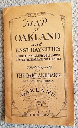
Map of Oakland and East Bay Cities Berkeley, Alameda, Piedmont, Emeryville,San Leandro, Albany.Compiled Especially For The Oakland Bank
Published by Thomas Bros. Maps., Oakland, 1928
Map
Soft cover. Condition: Near Fine. First Thus. Only 2 OCLC locations on this folding map, undated, but with a history of the Oakland Airport which includes 1928 statistics.