Map Gaule by Vaugondy Robert (4 results)

Language: French
Published by Paris 1780
- Map
Seller: Antiquariat Steffen Völkel GmbH, Seubersdorf, GermanyAntiquariat Steffen Völkel GmbH
Contact seller5-star sellerCondition: Used
£ 8.93
£ 26.04 shippingShips from Germany to U.S.A.Quantity: 1 available
Altkolorierte Kupferstich-Karte von Didier Robert de Vaugondy (c.1723-1786) von ca. 1780. -- Blatt-Format: ca. 40 x 29 cm. -- gut erhalten. || Old colored copper engraved map by Didier Robert de Vaugondy (c.1723-1786) from c. 1780. -- in very good condition. || Dies ist ein Original! - Kein Nachdruck! - Keine Kopie! -- This is a…n original! No copy! - No reprint! // Wir, das Antiquariat Steffen Völkel, kaufen und verkaufen alte Bücher, Handschriften, Zeichnungen, Autographen, Grafiken und Fotografien. Wir sind stets am Ankauf von kompletten Bibliotheken, Sammlungen und Nachlässen interessiert. Sprache: Französisch Gewicht in Gramm: 1550.
- Map
Seller: Antique Paper Company, ASHFORD, KENT, United KingdomAntique Paper Company
Contact seller2-star sellerCondition: Used
£ 30.00
£ 6.00 shippingShips from United Kingdom to U.S.A.Quantity: 1 available
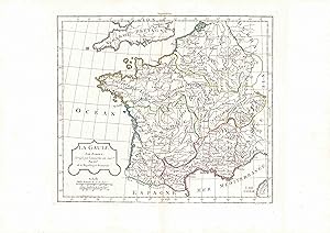
1792 LA GAULE Par Robert. A fine antique map of France. Central fold as issued and original outline hand colour.Gilles Robert de Vaugondy (1688-1766) and his son, Didier Robert De Vaugondy (1723-1786) based a lot of their maps on the work of the Sanson family to whom they were also related. There seems to have been considerable…cross-over in their material, and Gilles maps were often signed with the name: M.Robert, and son Didier signed his Robert de Vaugondy. Perhaps their greatest achievement was perhaps one of the most striking atlases of the 18th century, The Atlas Universal, a large volume that took around fifteen years to complete. They struck two versions: one a large folio that ran for 601 copies and the other a andfrac34; folio that ran for 517 copies. Both were published in Paris in 1757 and are now highly collectable. Despite the general sparsity of decoration on the whole within the maps, considerable time and artistry went into the Vaugondy cartouches. They commissioned a number of engravers to depict decoratively the postal routes within Britain and other countries in western Europe. Perhaps the most renowned of these engravers were the Haussard sisters, but all involved in the compilation of these most gratifying creations were undoubtedly some of the most highly skilled of the age.

Published by Robert de Vaugondy, France 1762
Seller: Terra Firma Books, San Diego, CA, U.S.A.Terra Firma Books
Contact seller5-star sellerCondition: Used - Very good
£ 61.61
£ 4.54 shippingShips within U.S.A.Quantity: 1 available
No Binding. Condition: Very Good. Original antique map (9.5x11"/24x28 cm). Outlines in color. From "Nouvel Atlas Portatif.".
 More images
Published by De Vaugondy, Paris 1778
- Map
Seller: Luis Porretta Fine Arts, Nanaimo RPO Country Club, BC, CanadaLuis Porretta Fine Arts
Contact seller3-star sellerCondition: Used - Very good
£ 89.69
£ 21.20 shippingShips from Canada to U.S.A.Quantity: 1 available
Map. Condition: Very Good. No Dust Jacket. This delightful map by De Vaugondy was published in 1778 and depicts the whole of France in original outline color, it is in very good condition, large full borders as published, plate marks defined, small repair at left lower edge, map size 12" x 10", overall size 11" x 17". A lovely m…ap in the distinct De Vaugondy style. Images available.; 12" x 10".


