Order Total (1 Item Items):
Shipping Destination:

Clan Map of Scotland (48 results)
Feedback
Skip to main search results
Search filters
Product Type
- All Product Types
- Books (44)
- Magazines & Periodicals (No further results match this refinement)
- Comics (No further results match this refinement)
- Sheet Music (No further results match this refinement)
- Art, Prints & Posters (No further results match this refinement)
- Photographs (No further results match this refinement)
- Maps (4)
- Manuscripts & Paper Collectibles (No further results match this refinement)
Condition
Binding
Collectible Attributes
- First Edition (1)
- Signed (No further results match this refinement)
- Dust Jacket (No further results match this refinement)
- Seller-Supplied Images (11)
- Not Print on Demand (48)
Language (3)
Free Shipping
Seller Location
Seller Rating
-

Scotland of Old Clan Names Map
Published by HarperCollins Publishers, United Kingdom, London, 1998
ISBN 10: 0004487753 ISBN 13: 9780004487755
Language: English
Seller: WorldofBooks, Goring-By-Sea, WS, United Kingdom
Seller rating 5 out of 5 stars

� 5.56
Convert currency� 5.60 shipping from United Kingdom to U.S.A.Quantity: 1 available
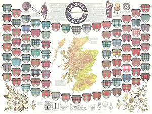
Add to basketPaperback. Condition: Very Good. Colourful pictorial map showing the arms, official insignia of the Scottish clan chiefs, and their crests, which are encircled with each chiefs motto or slogan. The locations are shown of the ancient territories held by the clans and considerable families around the time of King James VI, but taking the history of each family or district as a whole. OTHER TITLES IN THIS SERIES Castles Map of Scotland Clans Map of Scotland Historical Map of Scotland Irish Family Names Map Tartan Map of Scotland Whisky Map of Scotland. The book has been read, but is in excellent condition. Pages are intact and not marred by notes or highlighting. The spine remains undamaged.
More buying choices from other sellers on AbeBooks
Used offers from � 8.38
-
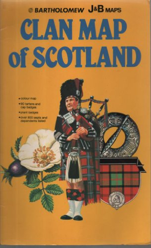
Clan Map of Scotland
Published by HarperCollins Distribution Ser, 1985
ISBN 10: 0702807095 ISBN 13: 9780702807091
Language: English
Seller: WorldofBooks, Goring-By-Sea, WS, United Kingdom
Seller rating 5 out of 5 stars
� 13
Convert currency� 5.60 shipping from United Kingdom to U.S.A.Quantity: 1 available
Add to basketPaperback. Condition: Very Good. The book has been read, but is in excellent condition. Pages are intact and not marred by notes or highlighting. The spine remains undamaged.
-

Condition: New.
More buying choices from other sellers on AbeBooks
New offers from � 15.43
-

Hardcover. Condition: Good. No Jacket. Pages can have notes/highlighting. Spine may show signs of wear. ~ ThriftBooks: Read More, Spend Less 1.01.
More buying choices from other sellers on AbeBooks
Used offers from � 12.48
-

� 3.53
Convert currency� 5.50 shipping from United Kingdom to U.S.A.Quantity: 1 available
Add to basketMap. Condition: Used; Very Good. Dispatched, from the UK, within 48 hours of ordering. Though second-hand, the book is still in very good shape. Minimal signs of usage may include very minor creasing on the cover or on the spine.
More buying choices from other sellers on AbeBooks
Used offers from � 9.03
-

Condition: New. 2024. paperback. . . . . . Books ship from the US and Ireland.
More buying choices from other sellers on AbeBooks
New offers from � 16.74
Used offers from � 27.72
Also find Softcover
-

Bartholomews Clan Map - Scotland of Old
Published by John Bartholomew & Son, 1111
Seller: World of Rare Books, Goring-by-Sea, SXW, United Kingdom
Seller rating 4 out of 5 stars

� 7
Convert currency� 4.82 shipping from United Kingdom to U.S.A.Quantity: 1 available
Add to basketCondition: Fair. No Edition Remarks. Unpaginated. Large fold-out cloth-backed map. Panels have light edge wear with minor creasing and scuffing to folds. Some tape markings to map. Ink staining and two pin pricks to corners. Paper cover has slight edge wear with minor marks and slight creases.
-

Soft cover. Condition: Very Good. 2nd Edition. Map encased in folder with minor external wear. Small stain on map, otherwise Very Good condition. Folded full color map, opens to approximately 39 inches long and 29 inches wide. Shows traditional lands and heraldry of Scottish clans.
-

Clan Map of Scotland
First Edition
No Binding. Condition: Near Fine. 1st Edition. SOFT COVER IN NEAR FINE CONDITION.
-
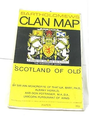
Bartholomews Clan Map 'Scotland of Old'
Published by John Bartholomew & Son Ltd, 1956
ISBN 10: 0851525814 ISBN 13: 9780851525815
Language: English
No Binding. Condition: Very Good. Cloth fold out map in very good condition, Map clean, High School stamps on outside binding 60"x40" Publication date not stated.
-
paperback. Condition: Good. Connecting readers with great books since 1972! Used books may not include companion materials, and may have some shelf wear or limited writing. We ship orders daily and Customer Service is our top priority!
-
Bartholomew's Clan Map Scotland of Old
Published by Bartholomew
Seller: A Squared Books (Don Dewhirst), South Lyon, MI, U.S.A.
Seller rating 5 out of 5 stars
paperback. Condition: Very Good. no published date, circa 1970; fold out map with glossy paper covers; wear and discoloration around edges; corners are lightly rounded; ~40 x 30; interior is clean and unmarked. Previous owner's name on.
-
Bartholomews Clan Map 'Scotland of Old'
Published by John Bartholomew & Sons, Edinburgh
Seller: 4 THE WORLD RESOURCE DISTRIBUTORS, Springfield, MO, U.S.A.
Seller rating 5 out of 5 stars
Condition: Good. Map on Cloth, previously mounted to a wall with pushpins.
-
VG/no dust jacket Paperback folding map,NO highlighting or notes, has very minor wear to edges and corners; otherwise, a tight, clean copy.
-
Condition: Fair. Envoi rapide Etat Correct plan frais couverture aspect assez salie. in8. Sans date. d�pliant. Fair.
-

Condition: good. Book is in good condition and may include underlining highlighting and minimal wear. The book can also include "From the library of" labels. May not contain miscellaneous items toys, dvds, etc. . We offer 100% money back guarantee and 24 7 customer service.
-
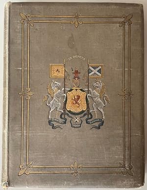
The Tartans of the Clans of Scotland. Also an introductory account of celtic Scotland; Clanship, chiefs, their dress, arms, etc., and with historical notes of each clan. By James Grant. Emblazoned arms of the chiefs, and a map of the districts occupied by the various clans are added.
Published by W. & A. K. Johnston, Edinburgh, London, 1886
Seller: Antiquariat am St. Vith, M�nchengladbach, Germany
Seller rating 5 out of 5 stars
� 351.87
Convert currency� 38.86 shipping from Germany to U.S.A.Quantity: 1 available
Add to basketLeinen. Folio. Illustr. Leinen mit Goldpr�gung und Kopfgoldschnitt. Sprache: Englisch, Mit zahlr. farb. Farbtafeln und farb. Wappenabbildungen. Einband berieben, etwas fleckig und mit kl. L�suren, Innengelenke mit Leinenstreifen verst�rkt, fliegende Vors�tze eingerissen, Titelblatt mit Bib.-Stempel und Nummerneintrag, sonst gutes Exemplar.
-
� 46
Convert currency� 7.50 shipping from United Kingdom to U.S.A.Quantity: 1 available
Add to basketCondition: Good. Clan map of Scotland. Tartans. Family crests. 88x66cm BARTHOLOMEW 1984 old. Folding map; John Bartholomew & Son (1984). 88.0 x 65.5cm, 34.5 x 25.75 inches; this is a folding map. Condition: Good. There is nothing printed on the reverse side, which is plain.
-
Condition: Fine. Size: 2616cm (land map 75100cm).
-
Kingdom of Scotland Decorative Vignettes Clan Shields c. 1950's lg pictorial map
Publication Date: 1950
Seller: RareMapsandBooks, Dover, NH, U.S.A.
Seller rating 5 out of 5 stars
Map
Condition: good. (Travel, Tourism, Europe, United Kingdom, Scotland, Cartoon Pictorial Maps, Souvenir Items, Decorative Maps). Seeing Scotland: Souvenir Map. Published c. 1950's, Edinburgh by W. & A. K. Johnston. Large offset color folding map. Text in English. Publisher's pictorial card stock paper sleeve, large folded map loosely set witihin. Item is old and shows some signs of handling and time. Item is not new or in "new" condition. Paper covers age worn, slight rubbing, remains overall clean and attractive as a fragile survival. Text block paper is toned, signs of handling, small scattered spotting, internally still well preserved, tight, sound. Still attractive on the shelf. The scarce pamphlet displays a pleasing and unique age patina and is in nice antiquarian condition, any age flaws easy to overlook or forgive. Please review photos for more detail and our best attempt to convey how this antique item survives. Covers measures c. 10 1/4" H x 5 3/4" W.[B4442].