Order Total (1 Item Items):
Shipping Destination:

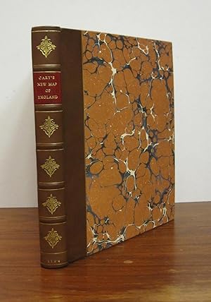
Cary's New Map of England and Wales with Part of Scotland by Cary John (21 results)
Feedback
Skip to main search results
Search filters
Product Type
- All Product Types
- Books (17)
- Magazines & Periodicals (No further results match this refinement)
- Comics (No further results match this refinement)
- Sheet Music (No further results match this refinement)
- Art, Prints & Posters (No further results match this refinement)
- Photographs (No further results match this refinement)
- Maps (4)
- Manuscripts & Paper Collectibles (No further results match this refinement)
Condition
- All Conditions
- New (No further results match this refinement)
- Used (21)
Binding
Collectible Attributes
- First Edition (11)
- Signed (No further results match this refinement)
- Dust Jacket (No further results match this refinement)
- Seller-Supplied Images (18)
- Not Print on Demand (21)
Language (2)
Price
- Any Price
- Under � 20 (No further results match this refinement)
- � 20 to � 35 (No further results match this refinement)
- Over � 35
Free Shipping
- Free Shipping to United Kingdom (No further results match this refinement)
Seller Location
Seller Rating
-
Cary's New Map of England and Wales with Part of Scotland
Published by John Cary, 1794
Language: English
Seller: Morning Mist Books and Maps, Cirencester, United Kingdom
Seller rating 5 out of 5 stars

First Edition
Hardcover. Condition: Fair. 1st Edition. Graded as fair: front board detched. All map pages present apart from 62 (sea blank) and 80 although the latter could be the unnumbered General Map, to front or possibly the title page. The book also lacks the early leaves: 'General Directions for Tracing on This Map The Roads from The Metropolis' (12pp) and also 'Index to the Preceding Roads' (2pp) which were not always present in printings of the first edition. Front board detached, as previously mentioned. Boards and spine worn. General dustmarking and finger marks along with the odd ink mark. Contemporary bookseller label to front board: John Bally of Bath. Blank; title page; dedication; general map; explanations; scale page; map pages; index; list of subscribers; blank. Further details available on request. (Ua1).
-
Cary's New Map of England and Wales with Part of Scotland
Published by John Cary, 1794
Language: English
Seller: Morning Mist Books and Maps, Cirencester, United Kingdom
Seller rating 5 out of 5 stars
First Edition
Hardcover. Condition: Very Good. 1st Edition. A lovely example of this classic work, rebound in 2009 in half-calf, marbled boards and contrasting title label to spine. New endpapers, pastedowns and blanks. Retaining the blank prior to the title, on which is the ownership inscription ?B? Eveleigh's Dec 1804. There are two Eveleigh names in the list of subscribers at the rear: it is possible that this inscription relates in some way. Bound after the title page and dedication are the 'General Directions' (12pp) and 'Index to Preceding Routes' (2pp) which are not always included in the 1794 edition. Map page publication dates: pp1-4,6-9 no date; p5 June 11th 1794 within the map area, not lower margin; 10 onwards, all are dated June 1794 but vary between June 1st and June 11th. List of places to rear: 85pp (not the 87 in later copies) but p62 wrongly numbered as 55 (the list is correct). 3pp of list of subscribers. Whether this the first state or second state is uncertain. Fordham was not clear in that respect nor is there any mention of June 1st publication dates on the map pages. Contents: generally bright with only light spotting / marking other than a 'splash' to the 'Explanations' page. Outline colouring. Further details available on request. Extra postage required for delivery outside the U.K. (Ud2).
-
Cary's New Map of England and Wales with Part of Scotland
Publication Date: 1794
Language: English
Seller: PETER FRY (PBFA), Grange- over -Sands, CUMBR, United Kingdom
Association Member: PBFA
Seller rating 5 out of 5 stars
� 1,774.98
Convert currency� 4.35 shipping within United KingdomQuantity: 1 available
Add to basketHardcover. Condition: Very Good. Cary John. 1794 Cary's New map of England and Wales with Part of Scotland. Eng. title and dedication., hand col. ''General mao'' Explanations and 76 eng. numbered maps (1-81), complete and therefore hand col. in outline, Subcriber's list and index, Quarto. Half Calf, marbled boards. A tight and very good plus copy. Scarce.
-
CARY'S NEW MAP OF ENGLAND AND WALES WITH PART OF SCOTLAND On which are carefully laid down all the direct and principal cross roads, the course of the rivers and navigable canals, cities, market and borough towns, parishes, and most considerable hamlets, parks, forests &c. &c. Delineated from actual surveys and materially assisted from authentic documents liberally supplied by the Post Masters General.
Published by Cary J. Lndon, 1794
First Edition
� 364.36
Convert currency� 27.55 shipping from U.S.A. to United KingdomQuantity: 1 available
Add to basketSoft cover. Condition: Good. No Jacket. 1st Edition. Large 4to volume in original flexible wrap leather binding. Binding is in poor condition as it is dismounted from the page block. Ready for a rebind. Contents complete and in good condition other than some offsetting. Contents not foxed and with outlined colors.
-

CARY'S NEW MAP OF ENGLAND AND WALES With Part of Scotland. On Which are Carefully Laid Down All the direct and Principal Cross Roads, the Course of the Rivers and Navigable Canals, Cities, Market and Borough Towns, Parishes, and most considerable Hamlets, Parks, Forests, &c.&c. Delineated from Actual Surveys: and materially assisted from Authentic Documents Liberally supplied by the Right Honourable the Post Masters General.
Published by London: Publish'd June 11th 1804?, 1794
Seller: Francis Edwards ABA ILAB, Hay on Wye, United Kingdom
Association Member: ABA ILAB PBFA
Seller rating 5 out of 5 stars
4to. 85pp. + [iii] Subscribers. 81 engraved sheets including title page Dedication leaf, hand coloured general map, Explanations, 76 sheets of map hand coloured in outline. Light age toning, contemporary mottled calf boards, some restoration work to corners, rebacked in modern calf with gilt ruling and gilt lettered label to spine. ESTC T149022.The title page and maps are dated 1794 but the 88 page 'List of Places' bound at the rear was apparently only issued in the 2nd edition of 1804 (Fordham pp 44 - 7). US$1327.
-
CARY'S NEW MAP OF ENGLAND AND WALES WITH PART OF SCOTLAND On which are carefully laid down all the direct and principal cross roads, the course of the rivers and navigable canals, cities, market and borough towns, parishes, and most considerable hamlets, parks, forests &c. &c. Delineated from actual surveys and materially assisted from authentic documents liberally supplied by the Post Masters General. WITH ORIGINAL FULL HAND COLOURING
Published by John Cary Engraver & Map Seller No181 Strand, 1794
Seller: Andrew Cox PBFA, Shropshire, United Kingdom
Association Member: PBFA
Seller rating 5 out of 5 stars
First Edition
Hardcover. Condition: Very Good. John Cary (illustrator). 1st Edition. Published in 1794, this is a nice hand coloured example of Cary's Map of England and Wales, with part of Scotland, with original full hand colouring rather than just the outline colouring in many copies, the map covers Eighty One separate Pages, with a general map and a folding distances table, plus 85 pages index and a list of subscribers, pages 62 & 80 are not present as issued, these only covered blank areas of the sea, bound in old leather boards with later leather spine, this example was originally the property of the noted botanist Stanesby Alchorne (1727-1800) of The Tower of London, who worked at the Chelsea Physick Garden, and also at The Royal Mint as an Assay Master, the book has been fitted with new endpapers, some light foxing, the folding distance table has some creasing and edge curling else in nice general condition.
-
Cary's new map of England and Wales, with part of Scotland
Published by publish d June 11th 1794 by J. Cary Engraver & Map-Seller, No. 181 Strand, 1794
Seller: Symonds Rare Books Ltd, London, United Kingdom
Seller rating 3 out of 5 stars

Hardcover. Condition: Fine. CARY, John. Cary s new map of England and Wales, with part of Scotland London, publish d June 11th 1794 by J. Cary Engraver & Map-Seller, No. 181 Strand, [1794]. Folio. [4],85,[3]p., the title-page and dedication are engraved, with explanations, scale and list of subscribers at the end. Initial general map of Great Britain fully hand-coloured and 77 engraved numbered plates of maps (1-81) with original hand-coloured outlines and details. Ex-library book (label of Gateshead Public Library partially glued to recto of upper free endpaper, easily removable, and unitrusive ink stamp on verso of dedication leaf). A clean and crisp copy in original reversed leather over thick boards, blind-tooled along edges, with large gilt red morocco labels on covers and spine. Negligible library number to foot of spine. A fine copy. ESTC T149022.
-
Cary's New Map of England and Wales with Part of Scotland. On which are carefully laid down all the direct and principal Cross Roads, the Course of the Rivers and Navigable Canals, Cities, Market and Borough Towns, Parishes and most considerable hamlets, parks, Forests etc.
Published by 1794,, 1794
Seller: Harteveld Rare Books Ltd., Marly, Switzerland
Association Member: ILAB VEBUKU
Seller rating 4 out of 5 stars

� 828.99
Convert currency� 14.77 shipping from Switzerland to United KingdomQuantity: 1 available
Add to basketin-4to, 2 engraved leaves : title and dedication + 14 p. general directions + 77 maps (1-81) incl. general map + 88 p. List of places, In contemporary soft brown leather covers, worn and bumped on corners and edges. (to be rebound). 81 maps including the colored General Map, 85 pages, index followed by a 3 page list of subscribers. 30x24cm folio. A lovely copy, clean tight and untrimmed! (ESTC T149022) The output of Cary?s cartographic firm was prolific and diverse, ranging through maps, plans, atlases, astronomical and educational works, road-books (including works based on surveys by Aaron Arrowsmith the elder, who probably trained him), guides, and globes. See ODNB. 1794. Author GBPlease notify before visiting to see a book. Prices are excl. VAT/TVA (only Switzerland) & postage.
-
Cary's New Map of England and Wales with part of Scotland.
Published by J. Cary, London, 1794
First Edition
� 581.65
Convert currency� 3.91 shipping from Ireland to United KingdomQuantity: 1 available
Add to basketHardcover. Condition: Very Good. 1st Edition. First printing. a clean unmarked copy in slightly later boards, spine renewed. Small repair to title page and some margins a bit foxed, as it the title page. Short closed tear ot margin of plate 74. Bound without sheets 62 and 80 as usual both of which are blanks. All sheets with original hand colouring.
-
Cary's New Map of England and Wales, with Part of Scotland.
Published by [London]: G. & J. Cary, 1822., 1822
Seller: Arader Galleries - AraderNYC, New York, NY, U.S.A.
Seller rating 5 out of 5 stars
� 536.95
Convert currency� 26.07 shipping from U.S.A. to United KingdomQuantity: 1 available
Add to basket4to., (12 1/8 x 10 1/8 inches). 2-page publisher's Advertisement, engraved title page, Dedication page, and "Explanations" page. Double-page engraved "General Map" giving Greenwich as the meridian, with original hand-color in full, 77 engraved numbered (1-81) maps with original hand-color in outline (occasional spotting). Brown cloth library binding, the smooth spine lettered in gilt (extremities bumped, one or two pale stains). Second edition, first published in 1794. The general map of England and Wales is "is the first map on the meridian of Greenwich instead of London (St. Paul's Cathedral) which had been used on English maps from its introduction by John Seller in 1676" (Wardington sale catalogue). There are in fact four meridians that pass through the Royal Observatory in Greenwich: the first was Flamsteed's, established in 1675 and named for the celebrated Astronomer Royal; the second was established by Edmund Halley in 1725; the third after James Bradley; and the fourth in 1851 by Sir George Airy. This last was designated the Prime Meridian at an international conference in Washington in 1884, even though France continued to use their own meridian in creating maps for several decades to come. "Cary's first known engraved plan is dated 1779. Henceforth, the quality of his engraving established new standards and a new style, with his effective, starkly beautiful, plain design being widely adopted. His firm's cartographic output was prolific and diverse, ranging through maps, plans, atlases, astronomical and educational works, road-books (including works based on surveys by Aaron Arrowsmith the elder, who probably trained him), guides, and globes. Particularly noteworthy are the immensely popular New and Correct English Atlas (editions from 1787), which became the standard county atlas of the period, and the Traveller's Companion (from 1790), the printing plates of both of which had to be replaced having become worn in the effort to meet the huge demand, and the particularly fine New English Atlas (from 1801) and New Universal Atlas (from 1808)" (David Smith for DNB).
-

Cary's New Map of England and Wales with part of Scotland.
Published by London: J. Cary, June 11th, 1794., 1794
Seller: Arader Galleries - AraderNYC, New York, NY, U.S.A.
Seller rating 5 out of 5 stars
First Edition
� 2,301.19
Convert currency� 26.07 shipping from U.S.A. to United KingdomQuantity: 1 available
Add to basket4to., (11 6/8 x 9 3/8 inches). Engraved title-page, dedication leaf, Explanations, and scale. Engraved "General Map" giving Greenwich as the meridian, and 77 engraved numbered maps (1-81) all with original hand-colour in outline (some brownign and offsetting, some minor insect damage to fore-edges of last leaves). Contemporary maroon morocco gilt wallet-style binding (extremities a bit scuffed, some minor insect damage to flap). First edition. The general map of England and Wales is "is the first map on the meridian of Greenwich instead of London (St. Paul's Cathedral) which had been used on English maps from its introduction by John Seller in 1676" (Wardington). There are in fact four meridians that pass through the Royal Observatory in Greenwich: the first was Flamsteed's, established in 1675 and named for the celebrated Astronomer Royal; the second was established by Edmund Halley in 1725; the third after James Bradley; and the fourth in 1851 by Sir George Airy. This last was designated the Prime Meridian at an international conference in Washington in 1884, even though France continued to use their own meridian in creating maps for several decades to come. "Cary's first known engraved plan is dated 1779. Henceforth, the quality of his engraving established new standards and a new style, with his effective, starkly beautiful, plain design being widely adopted. His firm's cartographic output was prolific and diverse, ranging through maps, plans, atlases, astronomical and educational works, road-books (including works based on surveys by Aaron Arrowsmith the elder, who probably trained him), guides, and globes. Particularly noteworthy are the immensely popular New and Correct English Atlas (editions from 1787), which became the standard county atlas of the period, and the Traveller's Companion (from 1790), the printing plates of both of which had to be replaced having become worn in the effort to meet the huge demand, and the particularly fine New English Atlas (from 1801) and New Universal Atlas (from 1808)" (David Smith for DNB). Catalogued by Kate Hunter.
-
Cary's New Map of England and Wales with Part of Scotland
Published by J. Cary, London, 1794
Seller: Argosy Book Store, ABAA, ILAB, New York, NY, U.S.A.
Seller rating 5 out of 5 stars
First Edition
� 1,150.60
Convert currency� 31.28 shipping from U.S.A. to United KingdomQuantity: 1 available
Add to baskethardcover. Condition: near fine. First. 4to, profusely illustrated with hand-colored maps in detailed scale. Rebound brown morocco-backed marbled boards with gilt decorated spines and red leather label. London: J. Cary, 1794. First edition. Light foxing and offsetting, else near fine. Page 62 and 80 are not present, as issued. On Which are Carefully Laid Down All the Direct and Principal Cross Roads, the Course of the Rivers and Navigable Canals, Cities, Market and Borough Towns, Parishes, and Most Considerable Hamlets, Parks, Forests, &c., &c.
-
Cary's New Map of England and Wales with part of Scotland.
Published by London: J. Cary, June 11th, 1794., 1794
Seller: Arader Galleries - AraderNYC, New York, NY, U.S.A.
Seller rating 5 out of 5 stars
First Edition
� 2,454.61
Convert currency� 26.07 shipping from U.S.A. to United KingdomQuantity: 1 available
Add to basket4to., (11 6/8 x 9 3/8 inches). Engraved title-page, dedication leaf, Explanations, and scale. Engraved "General Map" giving Greenwich as the meridian, and 77 engraved numbered maps (1-81) all with original hand-colour in full. Contemporary tree calf, gilt, all edges gilt (rebacked to style). Provenance: from the library of Christopher Henry Beaumont Pease, Lord Wardington (1924-2005), his sale Library of Important Atlases and Geographies, 18th October 2005, lot 94. First edition. The general map of England and Wales is "is the first map on the meridian of Greenwich instead of London (St. Paul's Cathedral) which had been used on English maps from its introduction by John Seller in 1676" (Wardington). There are in fact four meridians that pass through the Royal Observatory in Greenwich: the first was Flamsteed's, established in 1675 and named for the celebrated Astronomer Royal; the second was established by Edmund Halley in 1725; the third after James Bradley; and the fourth in 1851 by Sir George Airy. This last was designated the Prime Meridian at an international conference in Washington in 1884, even though France continued to use their own meridian in creating maps for several decades to come. "Cary's first known engraved plan is dated 1779. Henceforth, the quality of his engraving established new standards and a new style, with his effective, starkly beautiful, plain design being widely adopted. His firm's cartographic output was prolific and diverse, ranging through maps, plans, atlases, astronomical and educational works, road-books (including works based on surveys by Aaron Arrowsmith the elder, who probably trained him), guides, and globes. Particularly noteworthy are the immensely popular New and Correct English Atlas (editions from 1787), which became the standard county atlas of the period, and the Traveller's Companion (from 1790), the printing plates of both of which had to be replaced having become worn in the effort to meet the huge demand, and the particularly fine New English Atlas (from 1801) and New Universal Atlas (from 1808)" (David Smith for DNB). From the distinguished library of Lord Wardington, whose collection of Atlases was unique: "a panoply of the history of cartography and of great mapmakers" (Andrew Phillips "An Appreciation", Sotheby's sale Catalogue). Catalogued by Kate Hunter.
-
Cary's New Six Sheet Map of England and Wales with Part of Scotland
Published by John Cary, 1830
Seller: Morning Mist Books and Maps, Cirencester, United Kingdom
Seller rating 5 out of 5 stars
Map
No Binding. Condition: Good. Extremely large folding map complete on a single sheet, comprising of 48 panels mounted in sections on linen and contained within its original slipcase. Fully coloured according to counties and with a high level of detail, including canals, cross-roads, parks, woodland and hachuring for landscape. Some large patches of ink to the map face, a few on the map but most obvious to sea areas and near title (darker than the accompanying photos show). A few small holes to fold junctions but no tears. General dust-marking. A small patch of surface loss just to the west of Reading. Creasing to lower right hand panels (English Channel by France). Spotting to reverse. Scotland covered as far as Perth. Slipcase still rigid but heavily worn in all respects. Sheet size when open: 104.5cm by 136.3cm approx. More details available on request. (non361o3).
-

Cary's new map of England and Wales with part of Scotland
Published by John Cary, London, 1816
Seller: Cotswold Internet Books, Cheltenham, United Kingdom
Seller rating 5 out of 5 stars
2nd ed. Rebacked retaining original repaired backstrip, with gilt lettering; board edges slightly worn; marbled end papers (hinges repaired); internally generally VG in tight binding. Used - Good. Good (rebacked) hardback in black half-leather.
-
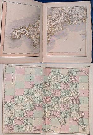
CARY'S NEW MAP OF ENGLAND AND WALES, with part of Scotland: On which are carefully laid down all the direct and principal cross roads, the course of the rivers and navigable canals, cities, market and borough towns, parishes, and most considerable hamlets, parks, forests &c. &c. delineated from actual surveys and materially assisted from authentic documents supplied by the Post Masters General.
Published by Cary 2nd edition corrected to 1832, London, 1832
Seller: Abbey Antiquarian Books, Blockley, GLOS, United Kingdom
Seller rating 3 out of 5 stars
Condition: Good. Hand-coloured maps on 81 leaves incl. General map, dedication, explanations, & distance gauge by Cary. Folio half calf (covers off & lacking spine/tips worn) 81 leaves + 102pp incl. adverts for Atlases. Slight edge dusting to a few leaves and some offsetting where opposite page is mainly sea. One opening has small ink spotting. All roads, boundaries and wooded areas coloured. 1 volume. Hardcover.
-
Cary's New Map of England and Wales with part of Scotland on which are carefully laid down All the Direct and Principal Cross Roads, the Course of the Rivers and Navigable Canals
Published by John Cary, 1794
Seller: Morning Mist Books and Maps, Cirencester, United Kingdom
Seller rating 5 out of 5 stars
Map First Edition
No Binding. Condition: Very Good. 1st Edition. Please note: it is not possible to show the whole map in a single photograph: the accompanying photos show a selection of details. Extremely large folding map divided into nine pieces with each one having part of the overall map divided into (a further nine) sections and mounted on linen. The equivalent outer edges with green silk bordering. To the reverse of each piece is a small index map showing that section, along with and ownership name and number. Each piece measures 59cm by 65cm approx. When the pieces are laid adjacent, the whole map measures 179 by 225cm approx. Area covered: northwards, a line from Colonsay to Crail; all of England and Wales; Isle of Man; Scilly Isles (inset). Detailed title with large calligraphic dedication beneath, followed by a small index map. Previous owner's name just above the title (different to name on reverse). No holes or tears. Periodic light marking to the map face but nothing significant. Light spotting to reverse of pieces other than the top right one with has a little patch of water staining to the reverse but map face unaffected. Outline colouring, along with green for parks and red for major towns. Wales has pronounced hachuring for landscape and gives the map a different look in those areas (coupled with a lack of roads etc). Highly detailed as always with Cary's maps, and with the map subdivided makes it more manageable to handle. Rigid slipcase with labels to side partially lost. Owner's coat of arms to front, again rather worn. Casing very scuffed, with surface loss and splits to some edges but structurally rigid and sound. A lovely example, rarely seen in this form. (Note: the green tint on one of the accompanying photos is an image processing fault and is not a tint on the actual map). Further details available on request. (Ud1).
-
Cary's New Map of England and Wales, with Part of Scotland
Published by London, London, 1794
Seller: High Ridge Books, Inc. - ABAA, South Deerfield, MA, U.S.A.
Association Member: ABAA ESA ILAB SNEAB
Seller rating 5 out of 5 stars
First Edition
� 958.83
Convert currency� 26.07 shipping from U.S.A. to United KingdomQuantity: 1 available
Add to basketFirst edition of this very large 6-part map of England and Wales, dissected and linen-backed, in original slipcase. Maps have labels of William Faden. Full color by county. A very attractive map. Though also issued in book form, this edition was obviously put together at the time at Faden's shop.
-
Cary's New Map of England and Wales with Part of Scotland. On Which are Carefully Laid Down All the Direct and Principle Cross Roads, The Course of the Rivers and Navigable Canals. Cities, Market and Borough Towns. Delineated from Actual Surveys and Materially Assisted from Authentic Documents. FIRST EDITION.
Published by J. Cary. Engraver & Map Seller. London, 1794
Map First Edition
J. Cary. London. 1794. First edition. 4to. Bound in reverse calf with envelope style of flap to protect contents, flap worn and ripped, upper joint very tender. Marbled endpapers with small engraved complete map and scale to front pastedown. Title page, dedication page, two blanks followed by a hand-tinted general map showing the numbers of the pages as a modern road atlas does. All hand-coloured map pages bound in. Map numbers 62, 63, 71, 72 and 80 would be blank pages and are missing. Map numbers 78, 79 and 81 are also blank pages but are present. 85 page index plus 3 pages of subscribers. Ownership signature to verso of front end paper. Occasional foxing and browning otherwise a very complete and clean atlas.
-
Cary's New Map of England and Wales, With Part of Scotland. On which are carefully laid down All the Direct and Principal Cross Roads, the Course of the Rivers and Navigable Canals, Cities, Market and Borough Towns, Parishes and most considerable Hamlets, Prks, Forests &c &c. Second Edition, Corrected to 1820.
Publication Date: 1820
Seller: Altea Antique Maps, London, United Kingdom
Association Member: ABA ILAB PBFA
Seller rating 5 out of 5 stars
Map
London: G. & J. Cary, 1820. Original outline colour. Dissected and laid on linen in three sections, total if joined 2310 x 1830mm, with diced calf slipcase with James Wyld's label inside lid. Light offset, slipcase scuffed. Cary's monumental map of England and Wales, first published in 1794, this example from the second edition of 1816 updated to 1820. The map was published just prior to the age of railways: Britain's first public railway, the Stockton and Darlington Railway, opened only five years later, in 1825.
-
Cary's New map of England and Wales with Part of Scotland on which are carefully laid down all the Principal Cross Roads, the Course of the Rivers and Navigable Canals, Cities &c &c
Seller: Hay-on-Wye Booksellers, Hay-on-Wye, HEREF, United Kingdom
Seller rating 5 out of 5 stars
Condition: Very Good. Rebacked calf spine with minor wear. Glt title. Boards marked & with scuffed corners. Inscription to ffep. 81 maps & 85 pages of index. Contents vg - clean and unmarked, solid binding.