Order Total (1 Item Items):
Shipping Destination:

Bacons Large Print Map London Suburbs by Bacon (10 results)
Feedback
Skip to main search results
Search filters
Product Type
- All Product Types
- Books (7)
- Magazines & Periodicals (No further results match this refinement)
- Comics (No further results match this refinement)
- Sheet Music (No further results match this refinement)
- Art, Prints & Posters (1)
- Photographs (No further results match this refinement)
- Maps (2)
- Manuscripts & Paper Collectibles (No further results match this refinement)
Condition Learn more
- New (No further results match this refinement)
- As New, Fine or Near Fine (No further results match this refinement)
- Very Good or Good (3)
- Fair or Poor (2)
- As Described (5)
Binding
- All Bindings
- Hardcover (7)
- Softcover (No further results match this refinement)
Collectible Attributes
- First Edition (1)
- Signed (No further results match this refinement)
- Dust Jacket (No further results match this refinement)
- Seller-Supplied Images (6)
- Not Print on Demand (10)
Language (1)
Free Shipping
Seller Location
Seller Rating
-

Hardcover. Condition: Fair. No Jacket. Readable copy. Pages may have considerable notes/highlighting. ~ ThriftBooks: Read More, Spend Less 1.01.
-
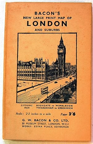
Bacon's New Large Print Map of London and Suburbs, 1948
Published by G. W. Bacon & Co., London, 1948
Hardcover. Condition: Very Good. No Jacket. Hadcover with tan illustrated covers. Some spotting on covers. 40 pages of text with fold out map attached to the book. Some tears to the map, but intact. Book is 7.5x5. Color map folds out to 36x29 inches.
-
Hardcover. Condition: Very Good. No Jacket. circa 1939.
-
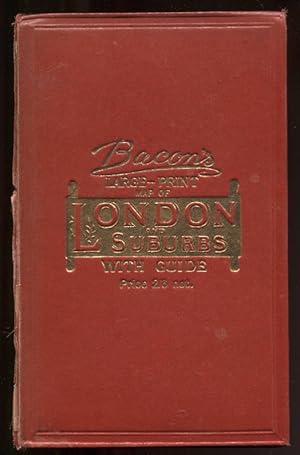
Bacon's new large print map of London and suburbs : extending from Highgate to Wimbledon, Twickenham to Greenwich
Published by G. W. Bacon & Co. Ltd., London, 1948
First Edition
Cloth. Condition: Good to VG+. First Edition. Cover title. Includes "Strangers' guide to London" [40pp] and folded, col.oured map (28 1/2in x 36 in.). With index to streets. Folding map, mounted on linen, is in perfect condition - very bright and, because folded, fresh. Guidebook text is near fine. Red cloth covers, ith Houses of Parl;iament to the front and the London Underground map to the back, show minor edge wear and some discoloration to the lower quarter of the front cover. Spine is sun-faded. Unpacked weight, 162g. Ships via inexpensive Canada Post Lettermail within North America, in card sleeve, $4.00 - $6.00. Images available. Enquire for rates to Worldwide destinations. Size: 19cm. Book.
-
BACON'S LARGE PRINT MAP OF LONDON AND SUBURBS.
Published by Ed. Map & Globe Publishers. Londres, s.a. (c. 1948, 1948
Seller: FARR� Libreria Anticuaria, Barcelona, B, Spain
Seller rating 5 out of 5 stars

). 19 cm. 48 p�g. + mapa a color plegado de 94,5 x 72 cm montado sobre tela. Ilustr. con grabados, en el texto. Enc. en tela. * El mapa se acompa�a de la "Strangers' guide to London", que incluye un apartado de tarifas de taxi, as� como una interesante relaci�n de lugares de inter�s de la ciudad y sus alrededores, como edificios p�blicos, museos, palacios, puentes, teatros, parques o iglesias. Contiene, asimismo, un mapa ampliado del centro urbano y otro de las estaciones y l�neas de metro. - Geograf�a. Mapas. Londres. Geograf�a. Mapas. Londres.
-
Bacon's Large-Print Map of London and Suburbs with Guide Nd C1905 Linen-Backed Map
Published by G. W. Bacon & Co. , Ltd, London, 1905
Seller: Leaf and Stone Books, Toronto, ON, Canada
Association Member: ABAC ILAB IOBA
Seller rating 5 out of 5 stars
Hardcover. Condition: Good. Dust Jacket Condition: No Dust Jacket. [iv], 62 pp. Large folding linen-backed map. Folding red cloth covers with brilliant gilt to front. Inside is a double-page ad for Chas Baker & Co, followed by a double page map of central London (scale 9 inches to a mile) , an ad for Nevill's Turkish Baths ("pronounced to be the Finest In Europe") , then the Strangers' Guide to London, including horse cab fares, an ad for Brand's Savoury meat Lozenges "world-renowned as Life Sustainers", then a number of pages of places of interest, then more ads for John Piggott, Ltd. And the Tranter's Hotel. Across from the guide is the large folding map, cloth backed, measuring 38" x 28". The guide and map are in good condition, some wear and separating at the spine of the red cloth cover but holding together well, bit of rubbing at corners. . The guide and the map are in good condition with some normal age darkening but otherwise clean and unmarked. No date but the ad for Chas Baker has typeface and clothing consistent with the 1905-1910 period. ; 8vo 8" - 9" tall.
-

Bacon's Large-Print Map Of London And Suburbs.
Published by London G.W. Bacon & Co. Ltd. Strand c., 1882
Seller: Robert Frew Ltd. ABA ILAB, London, United Kingdom
Association Member: ABA ILAB PBFA
Seller rating 4 out of 5 stars

Map
� 300
Convert currency� 10 shipping from United Kingdom to U.S.A.Quantity: 1 available
Add to basketOverall dimensions 71 x 93 cm. Colour printed map of London showing the extents fromHighgate down to Upper Norwood and West Ham across to Ealing with inset map of Hamptopn Court and surrounds. The plan backed onto thin cloth, foldsingbetween red cloth covers (18 x 13 cm.), gilt decorated to upper board, advertisement for Chas. Baker Stores to front paste down (Wthout the "Guide"). (Hyde. 191).
-
BACON'S LARGE- PRINT MAP OF LONDON AND SUBURBS. Title of Guide insert: GEM POCKET-MAP OF LONDON AND SUBURBS. WITH VISITORS' GUIDE. Cover title: BACON'S GEM-MAP OF LONDON AND SUBURBS.
Published by G. W. Bacon and Co. Ltd Strand [No date but c.1897], London, 1897
Seller: Marrins Bookshop, Folkestone, KENT, United Kingdom
Association Member: ABA ILAB PBFA
Seller rating 4 out of 5 stars
� 200
Convert currency� 25.35 shipping from United Kingdom to U.S.A.Quantity: 1 available
Add to basketCondition: Hyde, 191 (2). Coloured folding map. 35 x 27 inches. With inset sewn visitor's guide, small 8vo. [1] + 4-16 pp. + [1] + [1] pp. advertisement. Map folded into brown cloth boards with blind stamped decoration. Advetisement on front pastedown. Extremities a little worn and some foxing but otherwise good condition. The map is coloured to show the postal district boundaries. It was first issued about 1882, and this edition not only shows the Inner Circle complete, but also depicts the line of the Blackwall Tunnel (constructed 1892-97) and also the Tate Gallery (opened 1897). It is therefore a later version of the 1884 edition, the last quoted by Hyde. TOPOGRAPHY LONDON FOLDING MAPS TOPOGRAPHY LONDON 19TH CENTURY TOPOGRAPHY.
-
Bacon's Large Print Map of London and suburbs.
Published by [ca. 1920], 1920
Seller: Maggs Bros. Ltd ABA, ILAB, PBFA, London, United Kingdom
Association Member: ABA ILAB PBFA
Seller rating 5 out of 5 stars
Art / Print / Poster
� 216
Convert currency� 27 shipping from United Kingdom to U.S.A.Quantity: 1 available
Add to basketLithograph printed in colours, 700 x 885 mm, folding into the original paper covers, with printed title 'Bacon's New Large Print Map of London and suburbs', with index booklet, 'Stranger's Guide to London', pasted in. Short tear�to one fold. London: G.W. Bacon & Co., Detailed plan of London bounded by Highgate in the north, Crystal Palace in the south and from Richmond and Teddington in the west to Greenwich in the east.
-
![Seller image for Bacon's new large print map of London and suburbs [cover title] for sale by Zamboni & Huntington](https://pictures.abebooks.com/inventory/md/md31525304250.jpg)
Map. Condition: Fair only. London: G. W. Bacon & Co., [188-, inscription dated "1889" on inside front cover]. 28 x 36 3/4". Tipped into original cloth folder (7 1/4 x 4 5/8"), large printed paper label on front cover. 5 1/4" closed tear along one fold with loss of small piece of detail map of Hampton Court, a few small closed tears at fold corners. LACKS index to streets and illustrated guide. Fair condition.