Air Navigation Chart Mercator Projection (2 results)
FeedbackSearch filters
Product Type
- All Product Types
- Books (2)
- Magazines & Periodicals (No further results match this refinement)
- Comics (No further results match this refinement)
- Sheet Music (No further results match this refinement)
- Art, Prints & Posters (No further results match this refinement)
- Photographs (No further results match this refinement)
- Maps (No further results match this refinement)
- Manuscripts & Paper Collectibles (No further results match this refinement)
Condition
- All Conditions
- New (No further results match this refinement)
- Used (2)
Binding
- All Bindings
- Hardcover (1)
- Softcover (No further results match this refinement)
Collectible Attributes
- First Edition (No further results match this refinement)
- Signed (No further results match this refinement)
- Dust Jacket (No further results match this refinement)
- Seller-Supplied Images (2)
- Not Print on Demand (2)
Language (2)
Price
- Any Price
- Under £ 20 (No further results match this refinement)
- £ 20 to £ 35 (No further results match this refinement)
- Over £ 35
Free Shipping
- Free Shipping to United Kingdom (No further results match this refinement)
Seller Location
Seller Rating
-
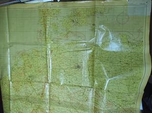
USAF Air Navigation Chart - North Central Europe Mercator Projection - AN 131.
Published by Aeronautical Chart Service, US Air Force, Washington. 5th Ed. 1953., 1953
Language: English
£ 50.88
Convert currency£ 7.80 shipping from Germany to United KingdomQuantity: 1 available
Add to basketHardcover. Ca. 2,42 x 1,34 m. Folierte Original-Karte. Die obere rechte Ecke (ca. 10,5 x 13,5 cm) nicht foliert. Die Karte im Maßstab 1 : 1.000.000 zeigt Deutschland sowie die angrenzenden Länder (Dänemark, Italien, Teile Frankreichs, Polen, Tschechoslowakei, Nordfrika.). Sperrgebiete und Gefahrenzonen sind in rot gekennzeichnet. Eine Legende mit Zeichenerklärungen am unteren Rand. Die Karte war in zwei Teile getrennt und wurde rückseitig mit durchsichtigem Klebeband zusammengefügt. Die Karte leicht gebräunt und rückseitig fleckig. Der nicht laminierte Teil mit kleinen Randläsionen, der restliche Teil teils mit kleinen Knicken aber in altersgemäß ganz gutem Zustand. // Original map (Germany, Italy, parts of France.) 1: 1.000000, almost complete foiled (except one corner 10,5 x 13,5 cm) with danger zones and restricted areas. Map was cut in two pieces and stuck together on the back with duct tape. Parts of the map with traces of use and fold, backside is stained a bit. -- Bitte Portokosten außerhalb EU erfragen! / Please ask for postage costs outside EU! / S ' il vous plait demander des frais de port en dehors de l ' UE! // Bitte beachten Sie auch unsere Fotos! / Please also note our photos! / Veuillez noter nos photos -- Genießen Sie ein gutes Buch auf einer Sommerwiese oder im kühlen Schatten bei einem erfrischenden Getränk. K02301.
-
Air Navigation Chart. Mercator Projection. No. V-30-40. Restricted.
Published by Washington, D.C., Hydrographic Office, 1943., 1943
Seller: Antiquariat INLIBRIS Gilhofer Nfg. GmbH, Vienna, A, Austria
£ 4,017.12
Convert currency£ 26 shipping from Austria to United KingdomQuantity: 1 available
Add to basketColour-printed map, 910 x 1370 mm. Scale 1:2,188,800. Reprinted July 1943. Large WWII U.S. Navy map used for air navigation above the Arabian Gulf, the Gulf of Oman, and the Arabian Sea. Before the widespread use of more sophisticated navigation tools, Navy pilots were reliant on air navigation light beacons (carefully noted on the map), the occasional radio facility, and visual flight rules, compasses, and navigation maps. This particularly detailed example carefully depicts coastlines and river systems from Bahrain to Bombay, and notes "landplane" bases and airports both military and civilian, including facilities in Manama, Doha, Abu Dhabi, Sharjah, and Ras Al Khaimah, as well as numerous others. Many of these early military bases would later become the major commercial airports of the Arabian Peninsula and Indian subcontinent in the postwar years. - Light wear, minor discoloration, otherwise in good condition.


